August 24, 2015
Current Situation: 9,600 acres
40% Containment
241 Personnel
3 Crews
2 Dozers
2 Helicopters
8 Water Tenders
8 Engines
Yesterday, crews finished burning along the south containment lines, creating a fuel break from the Big Craggies to the 1376 road system. Firefighters will secure the fire’s edge by extinguishing burning vegetation along the completed containment lines. A helicopter equipped with an aerial ignition device will add depth to the burnout by dropping small incendiary spheres to remove interior pockets of unburned fuel. Other helicopters will be available for waters drops to cool hot spots and limit fire growth.
Firefighters will continue to patrol and secure containment lines on the west flank. Chipping and brushing operations will progress north from FR 3318 to the Illinois River to remove fuel along this alternate line. Crews and equipment will repair damage from fire suppression activities on alternate lines that are no longer needed.
The fire continues to slowly spread to the east in the Kalmiopsis Wilderness, but has not crossed the Illinois River. Natural barriers with sparse vegetation are limiting fire growth in that direction. Helicopters may also be utilized to slow the fire from spreading eastward.
Burnout operations play an important role in securing the southern containment line by preventing the fire from spread into Mislatnah Creek and the Chetco River watershed. Current water sources in the vicinity have been adequate to support the needs of the burnout. To date, there has been no water withdrawal from the Chetco River, and none are anticipated. If absolutely necessary, however, the following measures will be taken: (1) tenders will be filled before leaving Gold Beach, (2) fish screens will be used in coho critical habitat, (3) no helicopters will dip from the Chetco, and (4) no more than 12,000 gallons per day would be removed – an impact of 0.03% of the overall daily flow.
Steep terrain, an abundance of snags and the potential for the fire to re-burn previously burned areas presents challenges to firefighter safety. Smoke may be visible throughout the remainder of the fire season. For information on closures on the Rogue River-Siskiyou National Forest, please see the Facebook page or the Inciweb page listed above.
Businesses along the south coast and Rogue River remain open and welcome visitors.
Residents and visitors to Gold Beach, Brookings and nearby communities are encouraged to drive carefully as firefighter traffic has increased in the area. With extreme drought conditions in southwestern Oregon, the public is encouraged to use caution outdoors. Any type of spark or flame may ignite a wildfire. Please follow local fire restrictions and remain mindful of fire prevention.
August 22, 2015
 |
|
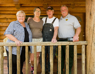
Residents of Upper Cow Creek Rd with IMT 2 Steve Bowen.
|
Southern Oregon is wildfire country. In the last five years about one-third of the 325,000-acre Tiller Ranger District has been blackened by wildfire. This year, the Stouts Creek Fire has already burned over 25,000 and was 82 percent contained on August 22, 2015. Locals here know about living with wildfire. They have learned that adapting to wildfire means getting to know your neighbors and that potlucks are the perfect place talk about being a fire-adapted community.
When the Stouts Creek Fire was threatening homes east of the community of Azalea, fire managers were pleased to learn that Milo, Tiller, and Upper Cow Creek Road were designated FireWise Communities. Being Firewise means homeowners have taken significant steps to make their homes defensible from a wildfire. After several years of hard work, 14 homes and several roads including Upper Cow Creek Rd have defensible space and have joined the dozen other recognized FireWise communities in Douglas County.
The maxim of many hands makes light work applies. Grant resources, program support and technical assistance came from the Douglas Forest Protective Association, the Umpqua National Forest, Douglas County Public Works, the Phoenix Charter School and others. At the grassroots level, neighbors did not just come together on their own. There was a spark, a catalyst, someone who overcame the inertia and fostered change. That person was Kathy Staley of Upper Cow Creek Rd.
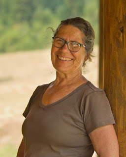 |
| Kathy Staley, community sparkplug. |
“The Umpqua National Forest is part of our community,” said Kathy Staley. “Donna Owens, Tiller District Ranger, made it easy for us. We hold regular potlucks and Donna and her staff began attending. As we got to know one another we naturally broadened our circle of care to include those who work for the Forest Service,” she explained.
“Prior to these gatherings, the relationship with the Umpqua NF was often adversarial. It helped that Ranger Owens was willing to say the tough but honest things,” Staley said. “That built trust in the eyes of the community members.”
Clearly motivated, Kathy explained that her career as an engineering inspector gave her a sharp and critical eye.
“I saw a need,” she explained. “I’m relatively new to the community. We learned that there were grants available to help pay for removing the brush and small trees to make our homes safer from wildfire,” she said. The grant funds and other monies helped pay for road crews removing roadside brush.
“Red Apple Road used to be tight with brush,” explained Kathy Pack of Upper Cow Creek Road. “It made me nervous thinking about driving it during a wildfire. Getting the roads and houses cleared of brush out really gave me piece of mind,” she said.
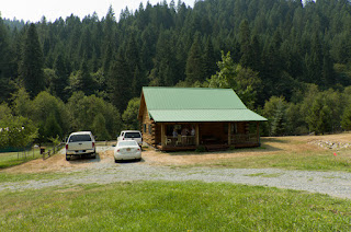 |
| Defensible space around the home of Jim and Kathy Pack. |
Once the neighbors learned that they could meet their commitment by contributing their time, the idea spread like creamy peanut butter. Using the county’s road crew and students from the Phoenix Charter School, they were able conduct defensible space activities at more than a dozen homes—removing brush and small trees and pruning up the branches on larger trees to make the homes safer from wildfire.
“We’ve owned this piece of land for 30 years,” said Jim Pack. “I planted all the trees myself and each one has a name. This place is a dream come true for me. Making it safer from wildfire was just something we had to do. We have too much at stake to live with the risk of it burning.”
Just as local residents gave their time, staff from the Tiller Ranger District understood they had to do the same. “The relationship building just took time,” said Terry Brown, Fire Management Officer, Tiller Ranger District. “The relationships we have with the community are the most valuable results from this process.”
The Douglas Forest Protective Association formed the third leg of the FireWise stool. FireWise Coordinator Dennis Sifford advises communities on becoming FireWise.
“The program helps make homeowners aware of the risks and teaches them about the little things they can do to help their homes survive a wildfire,” said Dennis.
Wildfire is a frequent visit
or to southern Oregon. Building resilience and adapting to wildfire depends on knowing your neighbors, widening the circle of care and finding the catalysts in the community who can make things happen. In these Firewise communities, these grass roots efforts have clearly paid off.
“When I learned that the residents of Upper Cow Creek Road were designated FireWise, I was more confident that we could protect the homes and that our firefighters would come home safely,” explained Steve Bowen, Structural Liason for the Stouts Creek Fire.
By: Stouts Creek Fire Information Team
Helpful Links:
http://www.dfpa.net
http://www.firewise.org
http://www.fs.usda.gov/umpqua
August 21, 2015
After three weeks of hard dangerous work, crews now have the Stouts Creek Fire fully encircled with a blackline—when the fire’s edge has burnt to a road or other fireline and is secure. Last night, fire crews completed burn out operations on the last piece of the 51-mile fire perimeter. Reaching this milestone has been the fire crews’ focus for the past week.
“I feel really good about where we are at,” said John Pellisier Operations Section Chief. “I was able to sleep easy last night knowing that we have this thing cinched up.”
While the mood at morning briefing was upbeat, fire managers reminded crews to be vigilant and stay focused on the work ahead. “Yes, we have a blackline around this fire. That’s great. And we still have lots of work to do,” said Incident Commander Chris Cline. “We need to stay focused and make sure our lines hold as the weather heats back up in coming days.”
The day shift will focus on burning interior patches of unburnt fuels near the southern tip of the fire. These operations will produce smoke for at least a couple more days. Once the burnout is secured, the evacuation level on Upper Cow Creek Road will be reduced. Until then, the evacuation levels remain unchanged.
A Level 2 Evacuation notice (Get Set) remains in place for residents on Upper Cow Creek Road east of Devils Flat to the end of the road. This precautionary measure is because of high temperatures and low humidities that might cause increased fire behavior. The Stouts Creek Fire has blackened 26,188 acres and is 80% contained and still has the potential for rapid growth. A contingency plan to protect structures on Upper Cow Creek is in place and will be activated if needed. Evacuation levels for all other areas remain at Level 1 (Get Ready).
The Stouts Creek Fire has been managed under unified command by Oregon Department of Forestry Team 2 Incident Commander Chris Cline and Forest Service Incident Commander Mike Wilde, since August 13.
There are 764 personnel assigned to the fire with 11 crews, 19 engines, 25 water tenders, 13 bulldozers and six helicopters. To date, the Stout Creek Fire has cost $33.3 million.
The Incident Management Team is protecting lands that are about 46% on state protected lands, which include BLM and private lands and 54% on the Umpqua National Forest.
August 21, 2015
Location: Rogue River-Siskiyou National Forest, 18 miles east of Gold Beach
Incident Commander: Doug Johnson
Information Center: 541-247-4447
Inciweb: http://inciweb.nwcg.gov/incident/4461Email: collierbuttefire@gmail.com
Facebook: U.S. Forest Service-Rogue River – Siskiyou National Forest
Oregon Smoke Information: http://oregonsmoke.blogspot.com/
The Curry County Fairgrounds in Gold Beach will host the Fair August 27-30 as planned. The Collier Butte Fire incident command post will be moving to the Gold Beach High School Saturday to make room for the Fair set-up.
Current Situation:
9,000 acres
30% Containment
415 Personnel
5 Crews
5 Dozers
2 Helicopters
8 Water Tenders
11 Engines
With firelines in place on the north, west and south flanks, firefighters will focus on securing containment lines by burning fuel along the fire’s edge and interior pockets within the fire perimeter. Burnout operations will also focus on the containment line between Big Craggies and the Collier Butte vicinities, and will begin only if favorable weather conditions exist. A helicopter equipped with an aerial ignition device is available to assist ground personnel by burning areas that are difficult to access.
Helicopters will shuttle crews into the Wilderness to assist in containing burnout operations. Portable water pumps and hoses remain in place to provide water support, and two heavy lift helicopters stationed in Agness will be available to drop water.
Crews and engines will continue mop up operations to extinguish burning and smoldering vegetation along the fire edge. Firefighters will improve secondary and contingency lines by falling hazard trees and removing excess fuels. These precautionary lines extend north from Forest Road 3318 to the Illinois River and south along Forest Road 1376 to the Chetco River. The fire continues spreading east into remote, inaccessible land in the Kalmiopsis Wilderness, yet remains west of the Illinois River.
Nationally, the wildfire situation remains at a critical level. All available firefighting resources are being called upon to assist, resulting in a shortage of fire crews, helicopters and support personnel. Firefighters are being reassigned to more-critical incidents to protect lives, homes and infrastructure. On the Collier Butte Fire, managers are strategically positioning available resources to focus on holding and securing containment lines, and coordinating aircraft use with other fires in southwest Oregon.
Rugged, steep terrain and an abundance of snags present challenges to firefighter safety. Due to a shortage of firefighting resources and limited wilderness access, management of this wildfire is likely to continue for an extended period. Smoke from the fire may be visible at the times throughout the remainder of the fire season.
Businesses along the south coast and Rogue River remain open and welcome visitors. Residents and visitors to Gold Beach, Brookings and nearby communities are encouraged to drive carefully as firefighter traffic has increased in the area. The public is encouraged to use caution outdoors, as extreme drought conditions persist. Fuels are receptive to any type of spark or flame. For information on closures on the Rogue River-Siskiyou National Forest, please see the Facebook page or the Inciweb page listed above.
August 20, 2015
The Oregon Department of Forestry’s Southwest Oregon District imposed a complete shutdown August 1 on public use of power-driven machinery. This shutdown includes any equipment that uses a petroleum fuel-powered, spark-emitting engine. The list of equipment this restriction affects is long, but it includes chain saws, brush cutters, mowers and generators.
This restriction does not apply to cutting irrigated green grass, or to machinery used for the commercial culture or harvest of agricultural crops. It also does not apply to industrial activities, which are currently regulated under Industrial Fire Precaution Level III (three).
The Oregon Department of Forestry’s Southwest Oregon District protects 1.8 million acres of state, private, county, and Bureau of Land Management lands in Jackson and Josephine counties. Fire season regulations also apply in county, state and BLM day-use areas and campgrounds.
For more information about the Oregon Department of Forestry’s fire season regulations, please call or visit the Southwest Oregon District unit office nearest to you:
- Medford Unit, 5286 Table Rock Rd., Central Point. (541) 664-3328
- Grants Pass Unit, 5375 Monument Dr., Grants Pass. (541) 474-3152


