Update for Sept. 16, 2020, morning
Northwest Incident Management Team 9 (Incident Commander Brian Goff)
Email: 2020.archiecreek@firenet.gov
Phone: 971-334-7674 Hours: 7am-8pm
InciWeb: https://inciweb.nwcg.gov/incident/7176/
Facebook: https://www.facebook.com/Archie-Creek-Fire-Information-120244459815292/
Evacuations, shelter areas: The Douglas County Sheriff announced that Idleyld residents will be allowed to visit homes Thursday, Sept. 17 from noon until 7:00 pm. Fire managers and the Sheriff’s Office urge residents returning to their homes to drive cautiously and watch for falling hazards such as trees and debris.
An interactive evacuation map from the Douglas County Sheriff’s Office can be found online at www.dcso.com/evacuations.
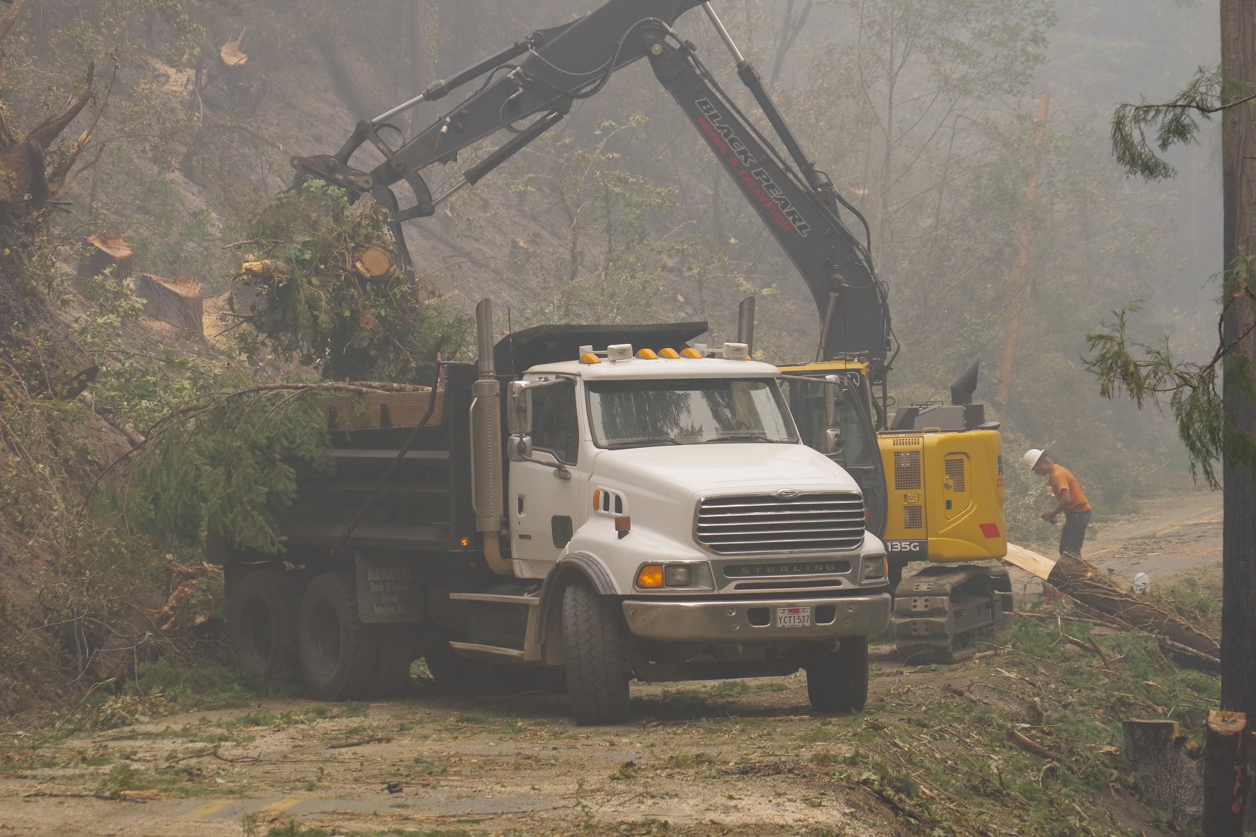
Equipment clearing roads on the Archie Creek Fire. Credit: DFPA
Fire summary:
Firefighters continue to work in the Little River area with heavy machinery, engines and crews, to construct and hold containment lines. Structure protection resources remain in place along Little River Road. On the far eastern portion of the fire, crews are allowing the fire to slowly back down the hillside to Panther Creek where crews have prepared roads to hold the fire. Heading north from Highway 138E, firefighters are scouting and constructing both primary and secondary containment lines from the Canton Creek area into the Upper Rock Creek area. Containment lines from South Calapooya Creek down to Glide continue to hold.
Suppression efforts on the Archie Creek Fire were boosted yesterday by an additional 125 personnel from the Oregon National Guard. These soldiers are working to hold containment lines around the perimeter of the fire and mop-up hot spots near structures. Total personnel assigned to the incident is now 773 people.
Air resources were grounded again yesterday due to safety concerns because of the thick smoke. Four helicopters and two Single Engine Air Tankers (SEATs) remain available in the area for use when the smoke clears.
Winds today are likely to push the smoke from west to east, providing some relief to residents and firefighters. When smoke lifts, temperatures will rise and humidity will decrease leading to increased fire activity.
Highway 138E remains closed to non-fire traffic from Milepost 21 through Milepost 83. Crews from the Oregon Department of Transportation, Douglas County Public Works Department, Pacific Power and their contractors continue to work along Highway 138E, Rock Creek Road and other county-maintained roads within the footprint of the Archie Creek Fire.
The Archie Creek Fire has burned 125,498 acres and is 20% contained. The breakdown of acres by ownership include:
- 62,623 acres of private lands
- 38,536 acres of Bureau of Land Management (BLM) lands
- 24,300 acres of US Forest Service (USFS) lands
- 39 acres of State of Oregon lands
Archie Creek Fire Donations: At this time, the Archie Creek Fire management team does not need donations. To help firefighters and their families, contact the Wildland Firefighters Foundation at www.wwf.org or 208-336-2996.
Glide Helping Hands: Distribution center for food and clothing. Call 541-733-6860 to leave a message and let them know how you would like to help.To support the community, the following agencies and organizations are looking for donations and volunteers to help those who were affected by this fire.
- Greater Douglas United Way: Accepting monetary donations. https://gduway.org/campaigns/fire-relief-fund/
- Roseburg Rotary: Accepting monetary donations to purchase items for firefighters and evacuees. https://www.paypal.com/cgi-bin/webscr?cmd=_s-xclick&hosted_button_id=3D2BEGT2AJBRS&source=url.
- Douglas Timber Operators / Umpqua Fisheries Enhancement Derby: Provide direct relief to the communities and individuals affected by the Archie Creek Fire, including financial assistance, food, supplies, etc. https://donorbox.org/2020-archie-creek-fire-relief-fund
- Saving Grace: To make a monetary donation please visit savinggrace.info and click donate. To volunteer, show up around 9 am Mon-Sat. For more info, call 672-3907.
- Red Cross: Located at the Douglas County Fairgrounds. Check for current needs.
- DHS: Check for current needs. Food items will not be accepted. Donations can be dropped off this week at Roseburg DHS building 738 W Harvard, Roseburg OR M-F, 9am-4pm through 9/18/20
For further information:
Inciweb https://inciweb.nwcg.gov/incident/closures/7176/
Douglas County Sheriff website www.dcso.com/evacuations and Facebook page at https://www.facebook.com/DouglasCoSO
Air quality: The Oregon Department of Environmental Quality at http://www.oregon.gov/deq
Road closures: Monitor www.tripcheck.com for updates on the highway closures.
Bureau of Land Management (BLM): all lands east of Interstate 5, within the Swiftwater Resource Area are closed.
Umpqua National Forest: Maps and closure orders can be found on Inciweb at: https://inciweb.nwcg.gov/incident/closures/7176/. Additional information on the Forest Service closures are available at: https://www.fs.usda.gov/alerts/umpqua/alerts-notices managed lands east of Interstate 5, within the Swiftwater Resource Area are closed.