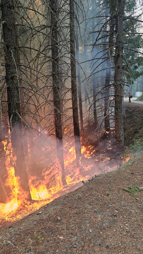
LOWER ROGUE RIVER CORRIDOR, Ore. (Sept. 6, 2025) – Firefighters continued to engage aggressively on the Kelsey Peak and Marial fires burning along the Lower Rogue River Corridor last night, located roughly 26 miles northwest of Grants Pass. These fires are two of 10 that started as a result of lightning on ODF Southwest Oregon District-protected land following thunderstorms on Wednesday. Overnight, resources were able to finish work on the Marial Fire, stopping it at a half-acre and mopping up 100% of the incident. This leaves the Kelsey Peak Fire as the only active incident of 10 fires affecting Bureau of Land Management (BLM) land. While the other nine are in patrol status, they continue to be monitored for signs of heat and any lingering hot spots found are immediately extinguished.
Fire behavior remained active on the Kelsey Fire overnight, but resources were able to put in line with bulldozers, connecting to the work that was completed yesterday along BLM Road 32-9-14 on the north end of the fire. They were also able to reinforce those lines along the road itself and hold the fire there despite embers that threatened to spread beyond established control lines.
Today, this work will continue. Resources assigned to the fire for Saturday include 11 20-person crews, two 10-person crews, 14 engines, two sets of fallers, five bulldozers, and seven water tenders, along with three Type 1, three Type 2 and two Type 3 helicopters; in all, 326 personnel are working on the fire today. Smoky conditions didn’t allow for the use of aircraft yesterday, however clearer skies this morning may mean work from the sky can continue safely today. Additional resources like air tankers will be ordered as needed.
Overnight, an infrared (IR) flight was able to be conducted over the Kelsey Peak Fire, and through more arcuate mapping, the fire was determined to be 506 acres. This jump in acreage is partly due to strategic firing operations that were conducted yesterday to protect the BLM Road 32-9-14.2, which serves as the only exit for communities further west of the fire. ODF, BLM and firefighters on the ground remain committed to keeping this fire as small as possible and extinguishing it quickly, but safely. Challenges on this fire include incredibly steep terrain, limited road access, dense brush, large hazardous trees, rolling debris and snakes.
Due to the threatened road, the BLM Grants Pass Field Office has temporarily closed a portion of the Grave Creek to Marial Backcountry Byway (BLM Road 32-9-14.2) and Sheriff John Ward of the Curry County Sheriff’s Office issued a Level 3, GO NOW, evacuation order for the area of Rogue River Ranch, Tucker Flat Campground and the nearby area of Marial. The public is strongly encouraged to avoid the entire Byway to facilitate safe firefighter access on the steep, narrow, windy road. Members of the public may not enter closed areas, and all uses—including hiking, hunting and dispersed camping—are prohibited. The closure order encompasses BLM Road 32-9-14.2 along the Grave Creek to Marial Backcountry Byway. Please see the map for full closure information on the BLM website: https://www.blm.gov/programs/public-safety-and-fire/fire-and-aviation/regional-info/oregon-washington/fire-restrictions
The following is a complete list of fires on ODF-protected land from Wednesday’s thunderstorm:
| Fire | Size (Acres) | Status |
| August Knob Fire | 1/100 | 100% lined, 100% mopped up |
| Bald Ridge Fire | — | Unable to locate (UTL) |
| Bald Ridge Fire #2 | 1/4 | 100% lined, 100% mopped up |
| Big Meadow Fire | 1/10 | 100% lined, 100% mopped up |
| Cold Springs Fire | 1/10 | 100% lined, 100% mopped up |
| Ditch Creek Fire | 1/10 | 100% lined, 100% mopped up |
| Hewitt Creek Fire | 1/10 | Turned over to USFS |
| Jeep Ridge Fire | 1/100 | 100% lined, 100% mopped up |
| Kelsey Peak Fire | 506 | 25% lined, 0% mopped up |
| Marial Fire | 1/2 | 100% lined, 100% mopped up |
| Mule Creek Fire | 2 | 100% lined, 100% mopped up |
| Quail Creek Fire | 1/10 | 100% lined, 100% mopped up |
Thunderstorms remain in the forecast, but the risk has been heightened today. As a result, the National Weather Service Medford Office has issued a Red Flag Warning from 2 – 11 p.m. across all of Jackson and Josephine counties, and the most western portion of Curry County where the Kelsey Peak Fire is located. The designation is due to the potential for abundant lightning on dry fuel with gusty, erratic winds up to 35 miles per hour. While storms could bring rain, windy conditions can prompt fire growth and lightning can bring new fire starts. Firefighters across the district remain ready to respond to new reports of fire and detection flights over existing or new lightning strikes will be conducted as needed.
Additional fires burning downriver near the Paradise and Half Moon Bar Lodges are on ground protected by our partners at the U.S. Forest Service Rogue River-Siskiyou National Forest and the Coos Forest Protective Association; please follow their pages for additional fire updates.
Help firefighters by following all current regulations during Extreme fire danger:

