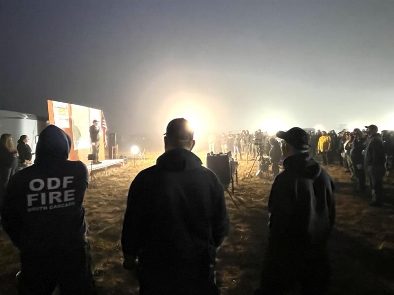
LOWER ROGUE RIVER CORRIDOR, Ore. – Firefighters on the Kelsey Peak Fire continue to push forward on strengthening lines and overall mop-up operations across the incident. The fire, located approximately 15 miles west of Glendale, is now 32% contained. This number is a direct reflection of the work firefighters have completed along the perimeter, extinguishing hotspots and bolstering the lines built to stop the fire’s growth.
From the west side of the fire to the northeast flank, crews have mopped up 70-100 feet into the interior of the fireline. On the east and south sides, a mix between bulldozer and hand-dug line is being strengthened. This work continued overnight and will again be the focus for Saturday. Infrared (IR) technology continues to be used to find areas still holding heat; with these locations mapped, firefighters can work more safely and efficiently to extinguish vegetation and roots that could flare up in warmer, windy conditions.
A Type 1 helicopter was also used yesterday to help extinguish hotspots. While aircraft can be helpful in remote locations, water bucket drops on the steep terrain can loosen trees and rocks and create a hazard for firefighters working on the line below. For that reason, aircraft have been used strategically, and sometimes sparingly, as the majority of work that needs to be completed requires firefighters on the ground.
Weather conditions are expected to heat up into the 80s once again on Saturday, giving firefighters an opportunity to see how their lines are holding. The heat will also help to naturally expose lingering hotspots that may begin smoking again in warmer temperatures. Tonight, a slight chance of rain and thunderstorms is possible, with storm chances holding through Sunday and warmer weather expected again next week.
Oregon Department of Forestry (ODF) Complex Incident Management Team 1, assigned to the Kelsey Peak Fire since last Monday, is working in coordination with the Great Basin Complex Incident Management Team 5 on the Moon Complex, approximately eight miles to the west. Due to closer proximity and easier road access, ODF Team 1 has been providing structure protection to the Zane Grey Cabin, the Rogue River Ranch and the area of Marial. Firefighters are also scouting for contingency lines in the event the Moon Complex fires move further east toward these areas. For more information on the Moon Complex, visit https://www.facebook.com/SWORFireInfo
Rogue River Access: Fire activity can drastically alter the river environment. Mitigation measures may be in place. It’s an evolving situation and updates will be shared as soon as possible. Permitted boaters can contact the BLM Smullin Visitor Center at 541-618-2408 or BLM_OR_MD_Rogue_River_Mail@blm.gov with questions about the status of the river.
Closures: The Rogue River Trail is closed from Horseshoe Bend to Flora Dell. A temporary closure of a portion of the Grave Creek to Marial Backcountry Byway (BLM Road 32-9-14.2) has been implemented by the BLM Grants Pass Field Office. The public is strongly encouraged to avoid the entire Byway to facilitate safe firefighter access on the steep, narrow, windy road. Unauthorized individuals may not enter closed areas, and all uses—including hiking, hunting and dispersed camping—are prohibited. Please see the map for full closure information on the BLM website: https://www.blm.gov/programs/public-safety-and-fire/fire-and-aviation/regional-info/oregon-washington/fire-restrictions
Evacuations: The Curry County Sheriff’s Office decreased the Level 3 – GO NOW evacuation order for the area of Rogue River Ranch, Tucker Flat Campground and the nearby area of Marial to a Level 2 – BE SET. The Josephine County Sheriff’s Office and Emergency Management has a Level 1 – BE READY evacuation notice for Zone JCU-801 in place. More info: https://tinyurl.com/KelseyPeakEvacs
Temporary Flight Restriction (TFR): A “TFR” is in place at an altitude from the surface up to and including 7,000 feet, daily (24 hours) until further notice. Complete information is available at https://tfr.faa.gov/tfr3/?page=detail_5_8274. Flying a drone near or around a wildfire compromises the safety of pilots and interferes with firefighting efforts.
Information for the Moon Complex is available here: https://tinyurl.com/MoonComplexInciweb.

