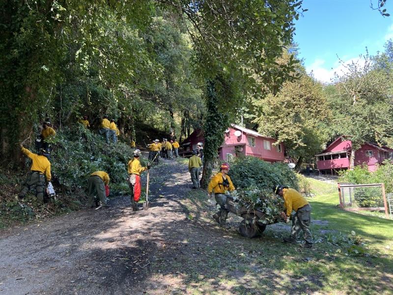
LOWER ROGUE RIVER CORRIDOR, Ore. – As mop-up on the Kelsey Peak Fire nears completion, firefighters are checking each piece of fireline for second and third times, ensuring no heat or flame remains near the perimeter. The fire, located 15 miles west of Glendale along the Lower Rogue River Corridor, has been burning since September 3rd in steep, rugged country with difficult access. Crews have worked hard to secure the fire and minimize impacts to the Wild and Scenic Rogue River. The fire is 1,039 acres with containment rising today to 85%. Curry County Sheriff’s Office has reduced the evacuation order for Rogue River Ranch, Tucker Flat Campground and Marial to Level 1 – BE READY in response to increased containment.
Mop-up depth along the control lines is nearing 300 feet in most areas. Yesterday, a Type 1 helicopter was used to drop water and cool some hot spots in the interior of the fire on the southern end. This area is very steep and rocky with limited access.
Helicopters remain available to support ground operations, including picking up equipment and hose which is no longer needed on the fireline. Using helicopters for backhaul makes the process quicker and reduces fatigue on firefighters who would have been hauling the equipment on their backs up the steep hill.
Weather this week transitions to a warm dry trend with higher temperatures, lower humidities and windy conditions. This weather may fan smoldering embers in the interior of the fire, increasing visible smoke. Firefighters will be looking for these signs of fire and heat near the perimeter, extinguishing them in the mop-up process. Resources from the incident, including aircraft, are available to support local agencies in initial attack response to emerging fires.
Some resources have shifted their focus to repair work related to suppression activities, installing water-bars on control lines to divert run-off during rainy periods, mitigating soil erosion and impacts to water quality. Bulldozers are being used to flatten berms from fireline construction and eliminate areas where water can pool. These repair actions will reduce sediment delivery to the Rogue River and its tributaries.
Oregon Department of Forestry (ODF) Complex Incident Management Team 1 is coordinating with Great Basin Complex Incident Management Team 5 on the Moon Complex, approximately eight miles to the west. ODF Team 1 resources are re-opening old firelines used during past fires as contingency lines for the east flank of the Moon Complex and mitigating fuels around structures in the Rogue River Ranch, Tucker Flats, and Marial areas to support Great Basin Team 5 objectives. For more information on the Moon Complex, visit https://www.facebook.com/SWORFireInfo
Rogue River Access: Fire activity can drastically alter the river environment. Please follow https://www.facebook.com/R6RRSNF and https://www.facebook.com/SWORFireInfo for updates regarding river access and impacts. Be aware of changing conditions and follow the direction of River Rangers and Firefighting personnel along the river. Permitted boaters can contact the BLM Smullin Visitor Center at 541-618-2408 or BLM_OR_MD_Rogue_River_Mail@blm.gov with questions.
Closures: The Rogue River Trail is closed from Horseshoe Bend to Flora Dell. A temporary closure of a portion of the Grave Creek to Marial Backcountry Byway (BLM Road 32-9-14.2) has been implemented by the BLM Grants Pass Field Office. The public is strongly encouraged to avoid the entire Byway to facilitate safe firefighter access on the steep, narrow, windy road. Unauthorized individuals may not enter closed areas, and all uses—including hiking, hunting and dispersed camping—are prohibited. Please see the map for full closure information on the BLM website: https://www.blm.gov/programs/public-safety-and-fire/fire-and-aviation/regional-info/oregon-washington/fire-restrictions
Evacuations: The Curry County Sheriff’s Office issued a Level 2 – BE SET evacuation order for the area of Rogue River Ranch, Tucker Flat Campground and the nearby area of Marial. The Josephine County Sheriff’s Office and Emergency Management has a Level 1 – BE READY evacuation notice for Zone JCU-801 in place. More info: https://tinyurl.com/KelseyPeakEvacs
Temporary Flight Restriction (TFR): A “TFR” is in place at an altitude from the surface up to and including 7,000 feet, daily (24 hours) until further notice. Complete information is available at https://tfr.faa.gov/tfr3/?page=detail_5_8274. Flying a drone near or around a wildfire compromises the safety of pilots and interferes with firefighting efforts.

