
MediaRelDailyUpdate_PM_20260814_final
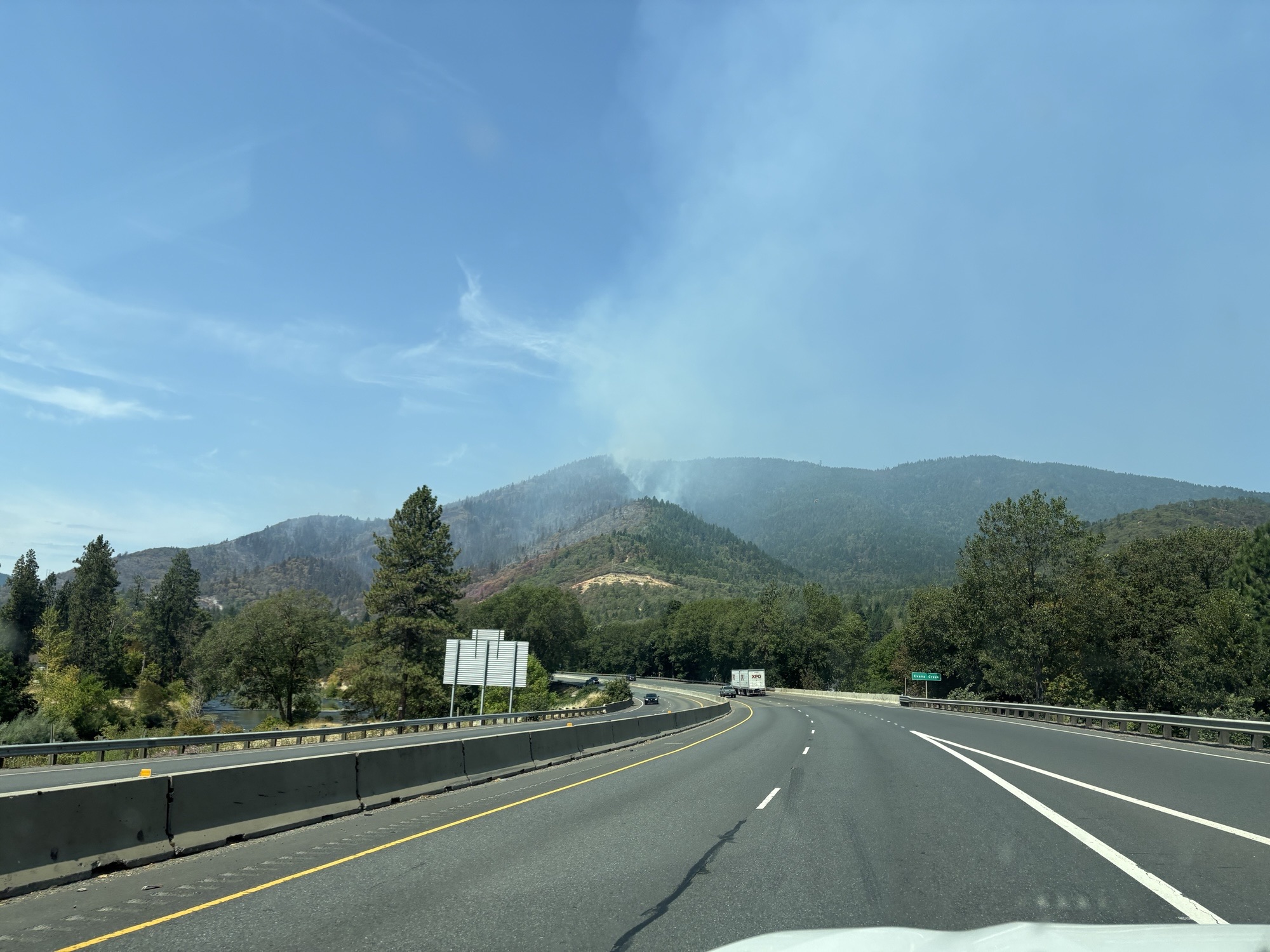
ROGUE RIVER, Ore. – Firefighters continue an aggressive attack on the Fielder Mountain Fire, located just west of Rogue River, making progress across the incident on Friday. Within 24 hours, resources have secured 75% of the fire’s edge with control line, bringing containment up to 7%. The fire is still estimated to be 550 acres; an infrared (IR) flight has been ordered for this evening to determine the exact acreage with more accurate mapping.
Firefighters continued to hold and improve established control line along the southern and northern flanks of the fire today. Dayshift resources were able to connect these lines along some of the western portion, tying in areas where fire tried to cross the line. On the northwestern side, rocky terrain has prevented bulldozers from operating, so fire crews are digging line by hand in these areas. Resources will continue this work overnight.
Oregon Department of Forestry (ODF) Complex Incident Management Team (CIMT) 1 was in-briefed by the local ODF Southwest Oregon District at noon, and has assumed command of the incident as of 6 p.m. The team has been tasked with keeping the fire to the smallest size possible and extinguishing it quickly. The team brings additional resources to the fire and allows local firefighters to rest and return to normal operations, including initial attack readiness for potential new fire starts.
The safety of nearby communities and firefighters is a top priority on this incident; numerous challenges have been identified on the fire, including steep terrain with the potential for falling and rolling debris. Poison oak is also a concern, as well as hazardous trees. Resources are aware of these factors and will mitigate hazards where possible.
Weather in the coming days will continue to be hot and windy, with the potential for thunderstorms across the area through Tuesday. Lightning strikes have been recorded on the ODF Southwest District tonight with severe thunderstorm warnings. Lightning on dry vegetation can naturally start fires, and resources on the district, as well as the team, are ready to respond to any new reports.
While lightning-caused fires can’t be prevented, many others can; Extreme fire danger is in effect on ODF-protected land in Jackson and Josephine counties. Following fire regulations can and does prevent human-caused fires from starting. All local regulations are available https://swofire.com/public-fire-restrictions/ and https://www.blm.gov/programs/fire/regional-info/oregon-washington/fire-restrictions.
Firefighters and aircraft will continue to work near Interstate 5; please be aware of fire personnel when driving through the area and slow down when necessary.
Evacuations: There are evacuations in place in Jackson and Josephine counties, issued by the county Sheriff’s Offices and Emergency Management. Up-to-date evacuations are available here: https://readyjacksonco.com/Emergency/emergency-information-hub-fielder-mountain-fire-aka-i-5-mile-marker-51-fire
Find your evacuation zone here: https://protect.genasys.com/en
Shelter: A shelter for people and pets evacuated from the fire is open at North Middle School in Grants Pass at 1725 NW Highland Avenue. Individuals looking to shelter who need extra medical care and/or assistance can call (541) 776-7206. A small domestic pet shelter is also open at North Middle School. Livestock can be taken to the Jackson County Expo at 21 Peninger Road in Central Point. Call (541) 864-0546 for livestock assistance.
Road/Land Closures: Foothill Boulevard is closed from Rogue River city limits to the Josephine County line, please use an alternate route. Road closure information is available on https://tripcheck.com/
Smoke Impacts: Smoke from the Fielder Mountain Fire may settle into valleys and other low-lying areas, reducing visibility and impacting air quality in nearby communities. Individuals sensitive to smoke should take appropriate precautions. For current air quality information and smoke forecasts, visit: https://fire.airnow.gov/.
Temporary Flight Restriction (TFR): A “TFR” is in place for the fire area daily (24 hours) until further notice. Complete information is available at https://tfr.faa.gov/tfr3/?page=detail_6_5072.
Flying a drone near or around a wildfire is illegal, compromises the safety of both pilots and firefighters, and interferes with firefighting efforts.
Cause: The fire started on Thursday, August 13 shortly after 3 p.m. Initial reports indicated tires on a semi-truck were on fire and flames had spread to nearby vegetation; the official cause remains under investigation.