July 22, 2018
GARNER COMPLEX
#UPDATEEvening Update 7-22-18 – 11:00pm
QUICK FACTS:
Size: 11,564 acres
Change in last 24 hrs. +3,605 acres
Containment: 14%
Start Date/Time: 7/15/2018 9:00a.m.
Expected Containment Date: 8/7/18
Location: Josephine County
Cause: Lightning
Est. Cost: $8.873 million
Personnel: 2162
Assigned Resources:
Handcrews: 70
Engines: 100
Dozers: 25
Water Tenders: 38
Assigned Aircraft: 26
Structure Task Forces: 9
Public Meetings: Plans are set for two public meetings for the local communities that are being most effected by the Garner Complex fires. The first meeting will be Monday July 23, 2018 at 6:00 P.M. at the North Valley High School, 6741 Monument Drive, Grant Pass, OR. Another meeting is set for Wimer on Tuesday July 24, 2018 at 6:00 P.M. at Evans Valley Education and Community Center, 8205 East Evans Creek.
Today 50 Oregon National Guard personnel arrived to staff ten road blocks around the clock. Supporting traffic control check points help the public avoid entering active fire areas.
Construction of direct and indirect control lines continues on the Graves fires. Much of the fire is holding within the lines on the north and west flanks, and hoselays are in place in these areas. Crews worked down each side of the fire tying in reopened roads, hand and dozer lines. Much of the focus on the Grave Fire was to create a fire line across the southern edge to tie in line between the Ditch Fire and the Pleasant Creek fire. The Spencer Fires are subdued with few visible smokes. On the Taylor Fire, because of challenging fire behavior and topography, indirect control line is being built around the much of the fire, by a combination of hand crews and dozers. Some existing roads and old firelines from previous fires will also be utilized. The smoke inversion kept aircraft grounded most of the day.
OSFM Structure Taskforces were busy today doing triage, assessment, and protection of homes in the evacuation areas.
For most current evacuation information, please contact the Joint Information Center at 541-474-5305 (8 AM—8 PM). A Red Cross Shelter is set up at the Grants Pass High School at 830 NE 9th Street in Grants Pass. 541-474-5710.
###
July 22, 2018
INCIDENT: Current Fire Evac Levels and Road Blocks in Josephine County
INCIDENT DATE AND TIME: 7/22/18 @ 10:00 pm
REPORTING DEPUTY: C. Krauss
Current evacuation levels:
Level 3 – West Pickett Creek Road
Level 3 – Upper end of Shan Creek Road
Level 3 – Upper end of Limpy creek Road
Level 3 – Oak Flat community at the end of Illinois River Road
Level 2 – Lower end of Shan Creek Road
Level 2 – Lower end of Limpy Creek Road
Level 2 – Pickett Creek Road, including secondary roads
Level 2 – Dutcher Creek Road, including secondary roads
Level 1 – Riverbanks Road between Limpy Creek Road and Pickett Creek Road including all secondary roads and streets
Due to the Taylor Creek wildfire, road blocks have been established to prevent non-essential vehicle traffic from interfering with residents attempting to evacuate and emergency services vehicles engaged in firefighting activities.
Current road block locations:
West Pickett Creek Rd at Pickett Creek Rd
Shan Creek Rd at Riverbanks Rd
Limpy Creek Rd at Riverbanks Rd
Riverbanks Rd at US Hwy 199
Lower River Rd at Robertson Bridge Rd
We would like to ask non-residents of Riverbanks Rd, including secondary streets and drives off of Riverbanks Rd, to please avoid the area. We would also like to remind residents of the area to carry proof of residence to re-enter the area if they leave and return. Proof of residence includes a driver’s license, utility bill with address, photo ID, etc.
If you have not signed up for Josephine County Citizen Alert, Josephine County’s emergency notification system, you can sign up on line at www.rvem.org.
The Red Cross evacuation shelter remains active at Grants Pass High School, 830 NE 9th St, Grants Pass, OR 97526.
The Fire Information Center can be reached at 541-474-5305 and is staffed from 8:00am to 8:00pm each day.
An animal evacuation center is currently being set up and will be open tomorrow at 10:00am. More information will be released separately about these details tomorrow morning.
These evacuation notices are based on fire activity from the Taylor Creek and Klondike Fires in Josephine County.
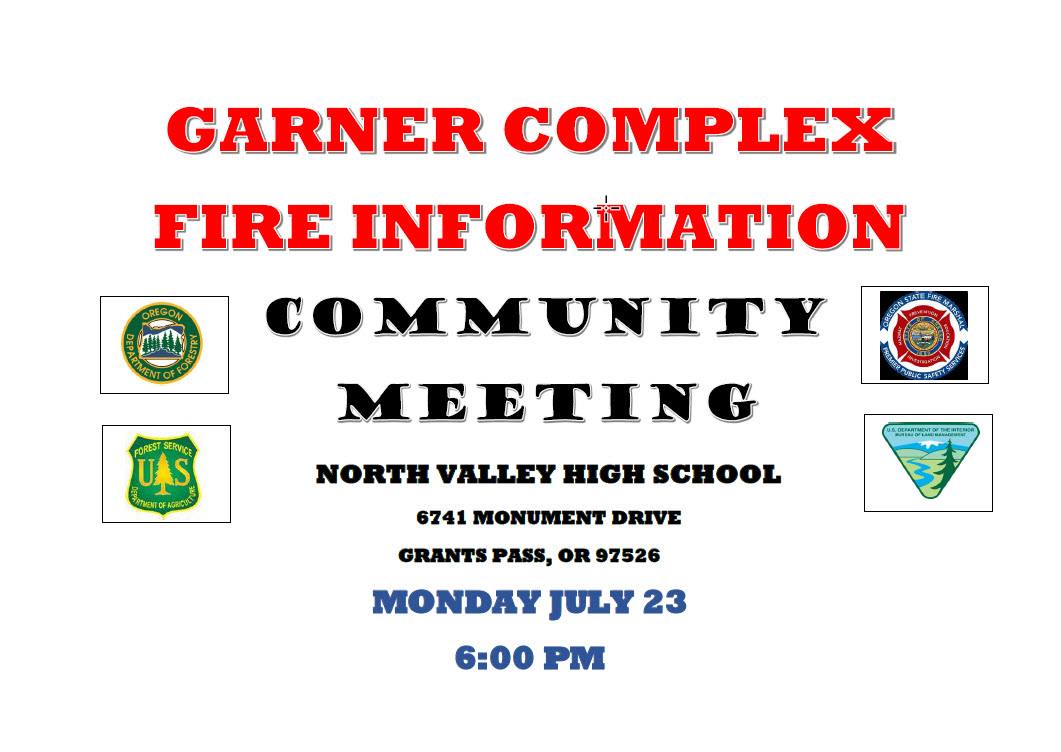
July 22, 2018
Garner Complex Community Meeting
There will be a community meeting held at the North Valley High School tomorrow
Monday 7/23/18 at 6P.M.
6741 Monument Dr.
Grants Pass, OR 97526
July 22, 2018
Additional Resources Arrive at Garner Complex:
In the last 24 hours additional resources have arrived to help in the efforts on the Garner Complex.
Troops from the National Guard arrived this morning to help with security at roadblocks in active fire areas and evacuation zones. A total of 50 personnel are expected to assist in the effort.
The Oregon State Fire Marshall will be adding three more task forces to the Garner Complex. This brings the total to nine task forces. The task forces will be working in the Grave Fire, Pleasant Creek Fire and Taylor Creek Fire areas. Their mission is to assess and protect homes and structures near the fires.
Two DC-10 VLATs (Very Large Air Tanker) began work on the fires yesterday. One 747 VLAT was used on the Garner Fire and is planned to be used on the Taylor Fire today. These three aircraft bring the total of four VLATs available to the Complex. An additional Type-2 helicopter arrives today.
July 22, 2018
#GarnerComplex AM #Update
Sunday, July 22, 2018 at 8:00 A.M.
Oregon Department of Forestry IMT 2
Chris Cline, Incident Commander
Information Center: 541-474-5305 (8 AM—9 PM)
Media Information Line: 541-660-7634
https://inciweb.nwcg.gov/incident/5935/ email: garnercomplexinformation@gmail.com
QUICK FACTS
Size: 7,949 acres
Change in last 24 hours: +1,567 acres
Containment: 10%
Start Date/Time: 7/15/2018 9:00a.m.
Expected Containment Date: 8/7/18
Location: Josephine County
Cause: Lightning
 Est. Cost: $6.3 Million
Personnel: 1834
Assigned Resources
Hand Crews: 59
Engines: 52
Dozers: 14
Water Tenders: 26
Assigned Aircraft: 30
Structure Task Forces: 6
Structures Threatened: 393
Structures Damaged: 0
Structures Destroyed: 0
Evacuations: Levels 2 and 3
Closures: Road Closure at intersection of West Pickett and Pickett.
Road closure at Pickett Cr. Rd and Riverbanks Rd, except
for residents.
—
Last night crews continued to tighten and secure control lines. They continue to evaluate where to place containment lines around the Grave Creek and Taylor Creek fires.
The Grave Creek fire continued to spread towards the Pleasant Creek Rd. The State Fire Marshall’s Team was in place working to triage and surface prep around houses to support the wildland firefighters. Overnight the Taylor Creek Fire continued to spread as crews work to tighten direct fire lines when possible and work on contingency lines. The fire has spread on the south side onto Forest Service ground. Overnight the State Fire Marshall’s had three Task Forces in place working to assess and surface prep near homes.
The three Spencer Creek Fires, King Mountain Fire, and Swamp Creek Fire have been lined, plumbed and are in mop-up. The Pleasant Creek Fire and Ditch Cr. Fire are still having control lines secured by hand and equipment. Today there will be 30 aircraft working on the fires including three airtankers. The
aircraft time follows strict federal aviation laws regarding the amount they can fly everyday. Equipment either for fire camp such as tables and chairs or fire line equipment necessary
for fighting fires on order from the Incident Management Team is in short supply due to all of the fires in the region. We continue to place orders with Redmond Cache, who have to prioritize for all regional fires to fill orders.
DEFINITIONS: Control lines: A term used for all constructed or natural fire barriers used to control a fire.
Containment: When firefighters or other resources stop the
forward progress of a fire with secured control lines.
CURRENT EVACUATION ORDERS:
Level 2 Limpy Cr. Rd, Level 1 for Riverbanks Rd.,
Dutcher Creek Rd. and all secondary roads and streets from Limpy Cr to Pickett Cr.
Pleasant Creek Rd: Levels 2 and 3.
Grave Cr. Rd is Level 3 north of intersection with Ditch Cr. Rd. Pickett Cr. Rd and all cross roads are Level 2
West Picket Cr. Rd. is Level 3.
A Red Cross Shelter is set up at the Grants Pass High School at 830 NE 9th Street in Grants Pass. 541-474-5710.
(Photo: Sunset on the Taylor Creek Fire)