
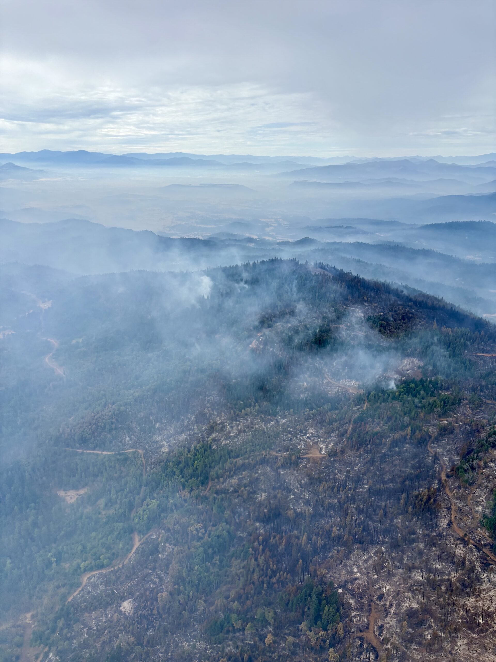
Mop-up operations continue on the East Evans Creek Fire, resources shifting due to progress across incident
Firefighting resources assigned to the East Evans Creek Fire continued mop-up operations across the incident overnight, extinguishing hotspots and adding to overall containment. Following multiple shifts of this aggressive work, the fire is now 26% contained and is being held by resources at 15,705 acres with no new overnight growth reported by fire personnel.
Night shift crews made progress mopping up along the perimeter on the main fire and all spots. Firefighters used handheld infrared (IR) tools to locate residual heat around the Hull Mountain spot fire and along the main fire from the southern control line to the northeast corner. This information is now recorded for dayshift resources to extinguish today.
On the Board Mountain spot fire, mop-up continues along the entire perimeter, with a focus on the northeast portion; additional hazardous trees in this area need to be removed for firefighters to work more safely. In other areas, mop-up efforts are reaching 100-150 feet deep into the fire. On the Canyon Creek spot fire to the east, remaining hotspots are also being extinguished.
Thanks to the effectiveness of coordinated suppression efforts, the threat to structures has been significantly reduced on the East Evans Creek Fire. As a result, the Oregon State Fire Marshal (OSFM) has strategically reduced the number of structural task forces assigned to the incident.
Today, remaining structural resources will continue to support firefighting operations by strengthening mop-up around homes, conducting patrols, and maintaining a presence in neighborhoods surrounding the fire area. Firefighters will continue to monitor conditions closely and provide structure protection wherever it remains necessary.
A portion of wildland resources that have been working overnight on the incident are transitioning to day shift today, adding to firefighters on the line during peak weather times. This shift is due to the progress that has been made so far across the fire, and a strategic move ahead of incoming storms.
Weather could bring numerous challenges across the fire area today; a Red Flag Warning has been issued by the National Weather Service (NWS) for abundant lightning on dry fuels from 11 a.m. to 11 p.m. This designation covers the majority of Jackson County, including the fire. If thunderstorms materialize, winds are expected to be 20 miles per hour, with erratic gusts up to 45. These conditions will test the strength of established firelines; firefighters will continue to monitor for spot fires and will respond aggressively if fire threatens the line or crosses it.
Storms may bring heavy rain, and while this can be somewhat beneficial on the fire, it can also create hazardous conditions for firefighters to work and drive in. Flash flood warnings are not in effect, but resources will remain aware of these potential safety concerns. Excessive precipitation on a burned area can cause debris flows of water, mud, rocks and branches that can pose significant risk to firefighters on the line.
Lightning with minimal or no rain is a possibility today, which could ignite new fire starts across the area. Specific resources across the fire have been designated to rapidly assist the local ODF district in responding to new reports of fire if needed. Firefighters left on the line will continue building progress on mop-up operations. Aircraft will be available and used where needed on the fire throughout the day.
Shelter Update: As evacuation levels continue to decrease, the American Red Cross shelter at Eagle Point Middle School is no longer accepting new evacuees. The Red Cross will continue working with current shelter residents to support their transition. Residents needing sheltering assistance should contact Non-Emergency Dispatch at 541-776-7206.
Evacuations: There are evacuations in place in Jackson County, issued by the Sheriff’s Office and Emergency Management. Up-to-date evacuations are available here: https://readyjacksonco.com/Emergency/emergency-information-hub-east-evans-creek-road-fire
Find your evacuation zone here: https://tinyurl.com/EastEvansCreekFireEvacMap
Road/Land Closures: Traffic is closed to the public on East Evans Creek Road at Meadows Road. The BLM has issued a road closure for West Fork Evans Creek Road and Rock Creek Road. Please avoid the fire area to allow firefighters and heavy equipment to operate safely. Road closure information is available on https://tripcheck.com/
A closure order for BLM-administered lands near the East Evans Creek Fire is in place. Public entry, including hunting, hiking, and camping, is prohibited. More information about the closure, including a map, is available online at www.blm.gov/orwafire.
Smoke Impacts: Smoke from the East Evans Creek Fire may settle into valleys and other low-lying areas, reducing visibility and impacting air quality in nearby communities. Smoke conditions can change throughout the day as winds shift. Individuals sensitive to smoke should take appropriate precautions. For current air quality information and smoke forecasts, visit: https://fire.airnow.gov/.
Temporary Flight Restriction (TFR): A “TFR” is in place for the fire area daily (24 hours) until further notice. Complete information is available at https://tfr.faa.gov/tfr3/?page=detail_6_4915
Flying a drone near or around a wildfire is illegal, compromises the safety of both pilots and firefighters, and interferes with firefighting efforts.
Cause: The fire started on Friday, July 10th at 2:41 p.m. after a car crashed into a power pole, sparking dry vegetation in the area. The Jackson County Sheriff’s Office is currently investigating the cause of the crash.
SmokeOutlook_SW-Oregon-EastEvansCreek_20260722 MediaRelDailyUpdate_20260722_Draft