
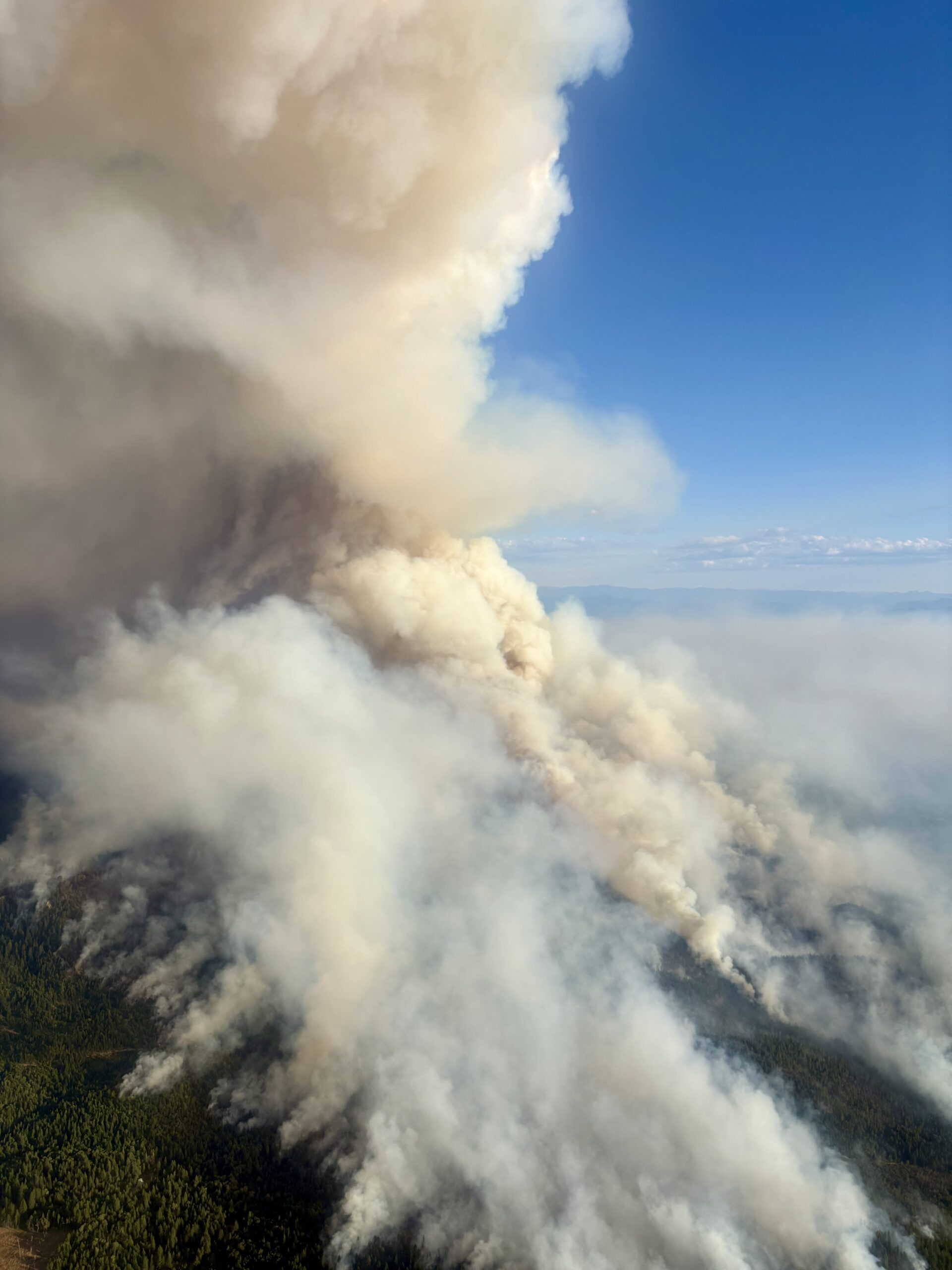
SAMS VALLEY, Ore. (July 15, 2026) – Fire activity continued to increase this afternoon across the East Evans Creek Fire, with the fire becoming more active in several areas of the incident. Firefighters remain vigilant and adapt suppression tactics, strengthen existing control lines, and strategically position additional resources to meet rapidly changing conditions.
Spot fires have challenged firefighters throughout the day, with the Board Mountain spot being the largest, estimated at approximately 1,000 acres. Crews have held containment lines on the north side of the Board Mountain spot fire and limited further spread to the north. A new spot fire located east of Board Mountain was detected this afternoon, and crews are working diligently to limit its growth. Resources are also actively engaged on multiple spot fires in the northeastern portion of the incident that were detected late Monday night. On the southeast side of the main fire, firefighters continue to hold existing containment lines while expanding mop-up operations to 50 feet to reduce residual heat along the fire’s edge and around homes.
On the west side of the incident, crews are improving control line options by identifying safe opportunities to connect natural and constructed features, strengthening long‑term containment. Portions of the southwest areas of the fire have increased in fire activity, with the fire backing downhill. Crews are prepping the line to hold it at the West Fork Evans Creek Road.
Protecting homes remains a top priority for all agencies on the fire. Oregon State Fire Marshal (OSFM) resources continue working alongside Oregon Department of Forestry (ODF) firefighters throughout the Evans Creek corridor and surrounding communities. Crews are improving defensible space, conducting structure triage, monitoring spot fires, and supporting mop-up operations in areas where fire activity has occurred near homes.
As operational needs shifted east in response to new spot fires, an additional structure protection division was established beyond the eastern flank of the largest spot fire. Crews immediately began assessing homes, evaluating access, and developing structure protection plans. To support these expanded operations through the overnight period, two additional structural task forces from Marion and Clackamas counties arrived this afternoon, increasing structural firefighting capacity across the incident.
Today visibility has limited the use of air tankers due to increased smoke in the fire area. Helicopters and ground resources worked in coordination throughout the day to slow the fire’s spread, cool active areas, and support crews constructing and improving the fire line. Additional firefighters and equipment continue to arrive and are strategically positioned where they can be most effective.
Winds are expected to increase through this evening, which could contribute to more active fire behavior tonight. While weather conditions are forecast to moderate overnight with cooler temperatures, higher humidity, and a stronger inversion, resources remain prepared for changing conditions.
Tonight, firefighters will continue to hold existing fire line and construct containment lines around all areas of the spot fires, as well as on the main fire towards the southwestern edge, where fire activity is more active. Crews are thoroughly watching for additional spot fires, expanding mop-up, and reinforcing containment wherever possible.
The Bureau of Land Management has issued a closure order for BLM-administered lands near the East Evans Creek Fire. Public entry, including hunting, hiking, and camping, is prohibited. More information about the closure, including a map, is available online at www.blm.gov/orwafire.
Smoke Impacts: Smoke from the East Evans Creek Fire may settle into valleys and other low-lying areas, reducing visibility and impacting air quality in nearby communities. Smoke conditions can change throughout the day as winds shift. Individuals sensitive to smoke should take appropriate precautions. For current air quality information and smoke forecasts, visit: https://fire.airnow.gov/
Evacuations: The Jackson County Sheriff’s Office and Emergency Management have issued the following evacuations by level:
Evacuation Level 3 Go Now: UPGRADE Zone JAC-109, JAC-126, JAC-149B, JCSO has upgraded Zone JAC-109, JAC-126, and JAC-149B from Level 2 to Evacuation LEVEL 3: GO NOW! JCSO deputies are in the area giving door-to-door notifications.
Evacuation Level 2 Be Set: JCSO has upgraded eight zones, JAC-111 / JAC-112 / JAC-127 / JAC-131 / JAC-132 / JAC-133 / JAC-134 / JAC-149
Evacuation Level 1 Be Ready: JCSO has upgraded the city of Shady Cove to Level 1: Be Ready. This includes Zones SHC-151 / SHC-152 / SHC-153 / SHC-154 / SHC-156 / SHC-157 / SHC-158
The evacuation shelter for residents and domestic pets has been moved to Eagle Point Middle School, 477 Reese Creek Road, Eagle Point. Horses can be taken to the Expo at 21 Penninger Road, Central Point, OR. For more information on evacuation levels or to find your evacuation zone, visit https://tinyurl.com/EastEvansCreekFireEvacMap. Expo staff and volunteers are prepared to receive horses; however, please call 541-776-7206 first to confirm space is available, as additional shelter locations may be activated. Owners should bring feed, water containers, and any necessary medications when possible. For livestock sheltering assistance, call 541-776-7206.
Road Closures: Traffic is closed to the public on East Evans Creek Road at Meadows Road. Please avoid the fire area to allow firefighters and heavy equipment to operate safely.
Temporary Flight Restriction (TFR): A “TFR” is in place for the fire area daily (24 hours) until further notice. Complete information is available at https://tfr.faa.gov/tfr3/?page=detail_6_4915. Flying a drone near or around a wildfire is illegal and compromises the safety of both pilots and firefighters and interferes with firefighting efforts.
The fire started on Friday, July 10th at 2:41 p.m. after a car crashed into a power pole, sparking dry vegetation in the area. The Jackson County Sheriff’s Office is currently investigating the cause of the crash.