
SAMS VALLEY, Ore.– Firefighters on the East Evans Creek Fire faced another afternoon of windy conditions, with gusts reaching up to 30 miles per hour. For the last couple of days on the incident, winds have fueled fire growth, but with cooler temperatures today, resources were able to hold the fire within its current footprint and even add new line around the fire’s perimeter to stop further growth. Work on all spot fires continued as well, with progress being made across the board. Winds are expected to continue into the evening, and firefighters will monitor for any changes on the line. The fire, including all spot fires, is currently 11,551 acres total and remains 5% contained.
Priority areas on the fire remain where homes and structures are located; today on the Canyon Creek spot fire closest to Shady Cove and Trail, firefighters made progress on both the wildland and structural side. On the spot fire itself, approximately 250 acres in size, wildland resources including four 20-person crews, two bulldozers, and two helicopters were able to completely line the perimeter directly at the fire’s edge. Crews will continue this work overnight to push forward on progress, strengthening the lines built today to keep the spot fire corralled.
Meanwhile, structural resources worked proactively on the outskirts of Shady Cove and Trail, preparing homes in the event of the fire approaching. Crews continued structure protection operations around homes, hardening properties and improving defensible space in neighborhoods impacted by the nearby spot fire. Additional strike teams also conducted structure triage in the Ramsey Creek area and preparation to enhance protection efforts. Crews will continue working overnight to strengthen the fire line, and structural engines will monitor areas around homes for signs of fire.
Firefighters also focused on the western edge of the main fire and the newest spot fire to the southwest, where homes are also nearby. Structural resources provided the same services to these homes, preparing where possible in the event the fire were to spread. Wildland firefighters were successful in lining this spot fire today as well, approximately 50 acres total, and continue to build line around the main fire in this area. Resources on tonight’s overnight shift will pick up where dayshift left off, working to hold and strengthen these established lines.
Across the rest of the fire, resources on the northern flank are holding the completed line, despite windy conditions. The spot fire on Board Mountain is currently lined on the northern section and along both sides; firefighters will continue to build line to halt any new progression on this spot fire. On the southern edge of the fire, mop-up operations continue. As these lines are connected and strengthened across the incident, overall containment will increase.
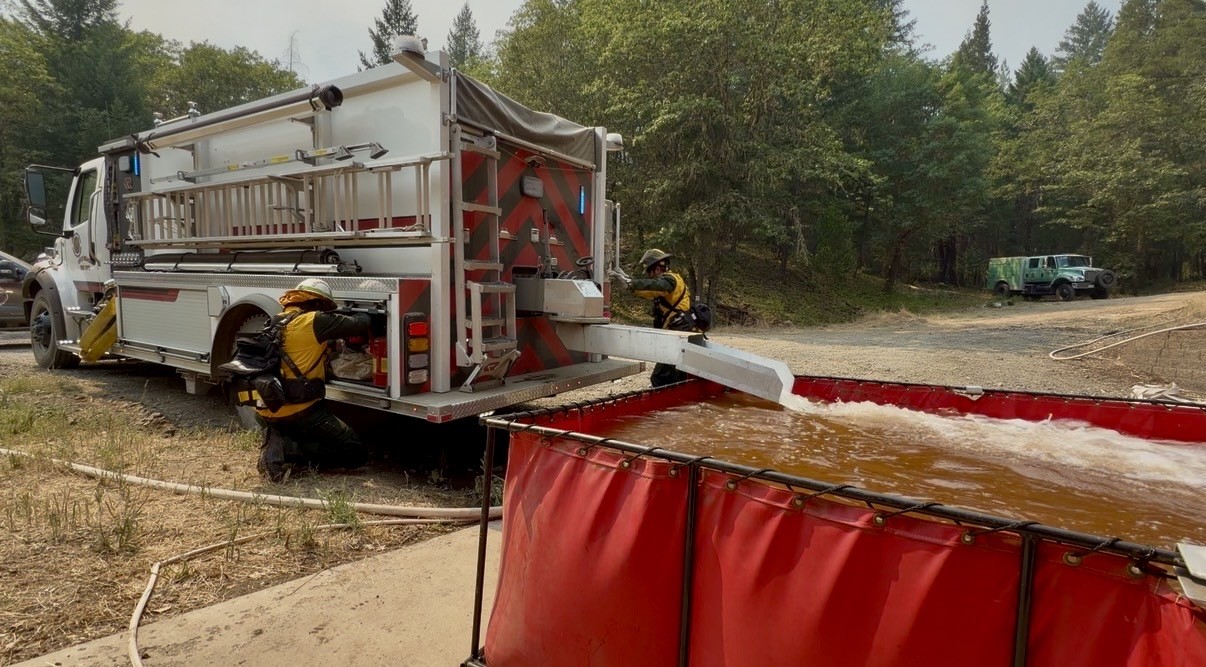
In coordination with wildland firefighters, structural engines supported operations by providing high-pressure pump systems to help improve water availability for crews using hoses on steep terrain. Structural protection plans have been coordinated across divisions to ensure an effective response to fire activity.
Tonight, temperatures are expected to cool down into the low- to mid-50s and relative humidity should increase, but winds will likely persist overnight. These conditions should help to moderate fire behavior, allowing firefighters to progress in their work to line the fire and minimize any new growth.
Evacuations: There are evacuations in place in both Jackson and Douglas counties, issued by both counties’ Sheriff’s Offices and Emergency Management. Up-to-date evacuations are available here: https://readyjacksonco.com/Emergency/emergency-information-hub-east-evans-creek-road-fire
Find your evacuation zone here: https://tinyurl.com/EastEvansCreekFireEvacMap
Road/Land Closures: The Tiller-Trail Highway is closed at the county border in Jackson County to Highway 62. Traffic is closed to the public on East Evans Creek Road at Meadows Road. The BLM has issued a road closure for West Fork Evans Creek Road and Rock Creek Road. Please avoid the fire area to allow firefighters and heavy equipment to operate safely. Road closure information is available on https://tripcheck.com/
A closure order for BLM-administered lands near the East Evans Creek Fire is in place. Public entry, including hunting, hiking, and camping, is prohibited. More information about the closure, including a map, is available online at www.blm.gov/orwafire.
Smoke Impacts: Smoke from the East Evans Creek Fire may settle into valleys and other low-lying areas, reducing visibility and impacting air quality in nearby communities. Smoke conditions can change throughout the day as winds shift. Individuals sensitive to smoke should take appropriate precautions. For current air quality information and smoke forecasts, visit: https://fire.airnow.gov/.
Temporary Flight Restriction (TFR): A “TFR” is in place for the fire area daily (24 hours) until further notice. Complete information is available at https://tfr.faa.gov/tfr3/?page=detail_6_4915
Flying a drone near or around a wildfire is illegal and compromises the safety of both pilots and firefighters and interferes with firefighting efforts.
Cause: The fire started on Friday, July 10th at 2:41 p.m. after a car crashed into a power pole, sparking dry vegetation in the area. The Jackson County Sheriff’s Office is currently investigating the cause of the crash.