
East Evans Creek Fire remains within control lines despite heat and winds; containment increases to 33%
SAMS VALLEY, Ore. – Firefighters continue strengthening control lines across the East Evans Creek Fire while maintaining steady focus on mop-up into the interior of the fire. Many resources are shifting to day operations as containment increases and work moves further into the burned area. Overnight work included mopping up deeper into the interior and identifying hot spots with infrared cameras. Following multiple shifts of sustained effort, containment has reached 33%; the fire has remained in its footprint for multiple shifts at 15,705 acres with no overnight growth.
After several days of challenging weather, established control lines have been held, contributing to increased containment on the East Evans Creek Fire. Wildland firefighters continue strengthening protection around homes as part of ongoing suppression efforts, while local fire agencies remain available to respond to any changes in fire activity. As suppression efforts continue to reduce the threat to homes and other structures, Oregon State Fire Marshal (OSFM) resources are returning to their home agencies this morning and ODF CIMT remains in place. Resources that are no longer needed on the fire are being released to mobilize to other incidents around the state
Crews are using handheld infrared cameras and Unmanned Aircraft Systems (UAS) equipped with infrared technology to locate residual heat around the Board Mountain spot fire and along the main fire edge. This information continues to guide mop-up and support crew safety by identifying areas where the fire may be burning underground with no visible smoke. Firefighters are falling hazard trees to reduce overhead risks along the fireline and protect personnel.
Yesterday, thunderstorms with 30–35 mph wind gusts passed over the fire area. These increased winds fanned areas of heat, increasing visible smoke for firefighters to extinguish with water. Pockets of heat remain on the ground, and fuels are still receptive outside the fire line. Crews focused on these areas throughout the evening; similar winds are expected today.
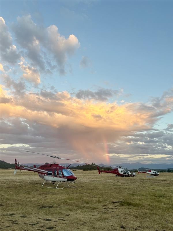
Today, crews remain focused on protecting the community and firefighter safety by strengthening the established containment lines and further securing the perimeter, 63 miles of fireline have been constructed around the fire. Air assets continue to support the incident with aerial observation for ground crew intel and water drops to cool areas of heat. Interior parts of the fire are still smoldering with dry fuel.
Shelter Update: As evacuation levels continue to decrease, the American Red Cross shelter at Eagle Point Middle School will be closing today. The Red Cross will continue working with residents to support their transition as they return home. Residents needing sheltering assistance should contact Non-Emergency Dispatch at 541-776-7206.
Evacuations: There are evacuations in place in Jackson County, issued by the Sheriff’s Office and Emergency Management. Up-to-date evacuations are available here: https://readyjacksonco.com/Emergency/emergency-information-hub-east-evans-creek-road-fire
Find your evacuation zone here: https://tinyurl.com/EastEvansCreekFireEvacMap
Road/Land Closures: Traffic is closed to the public on East Evans Creek Road at Meadows Road. The BLM has issued a road closure for West Fork Evans Creek Road and Rock Creek Road. Please avoid the fire area to allow firefighters and heavy equipment to operate safely. Road closure information is available on https://tripcheck.com/
A closure order for BLM-administered lands near the East Evans Creek Fire is in place. Public entry, including hunting, hiking, and camping, is prohibited. More information about the closure, including a map, is available online at www.blm.gov/orwafire.
Smoke Impacts: Smoke from the East Evans Creek Fire may settle into valleys and other low-lying areas, reducing visibility and impacting air quality in nearby communities. Smoke conditions can change throughout the day as winds shift. Individuals sensitive to smoke should take appropriate precautions. For current air quality information and smoke forecasts, visit: https://fire.airnow.gov/.
Temporary Flight Restriction (TFR): A “TFR” is in place for the fire area daily (24 hours) until further notice. Complete information is available at https://tfr.faa.gov/tfr3/?page=detail_6_4915
Flying a drone near or around a wildfire is illegal, compromises the safety of both pilots and firefighters, and interferes with firefighting efforts.
Cause: The fire started on Friday, July 10th at 2:41 p.m. after a car crashed into a power pole, sparking dry vegetation in the area. The Jackson County Sheriff’s Office is currently investigating the cause of the crash.