July 15, 2026
SAMS VALLEY, Ore. (July 15, 2026) – Fire activity continued to increase this afternoon across the East Evans Creek Fire, with the fire becoming more active in several areas of the incident. Firefighters remain vigilant and adapt suppression tactics, strengthen existing control lines, and strategically position additional resources to meet rapidly changing conditions.
Spot fires have challenged firefighters throughout the day, with the Board Mountain spot being the largest, estimated at approximately 1,000 acres. Crews have held containment lines on the north side of the Board Mountain spot fire and limited further spread to the north. A new spot fire located east of Board Mountain was detected this afternoon, and crews are working diligently to limit its growth. Resources are also actively engaged on multiple spot fires in the northeastern portion of the incident that were detected late Monday night. On the southeast side of the main fire, firefighters continue to hold existing containment lines while expanding mop-up operations to 50 feet to reduce residual heat along the fire’s edge and around homes.
On the west side of the incident, crews are improving control line options by identifying safe opportunities to connect natural and constructed features, strengthening long‑term containment. Portions of the southwest areas of the fire have increased in fire activity, with the fire backing downhill. Crews are prepping the line to hold it at the West Fork Evans Creek Road.
Protecting homes remains a top priority for all agencies on the fire. Oregon State Fire Marshal (OSFM) resources continue working alongside Oregon Department of Forestry (ODF) firefighters throughout the Evans Creek corridor and surrounding communities. Crews are improving defensible space, conducting structure triage, monitoring spot fires, and supporting mop-up operations in areas where fire activity has occurred near homes.
As operational needs shifted east in response to new spot fires, an additional structure protection division was established beyond the eastern flank of the largest spot fire. Crews immediately began assessing homes, evaluating access, and developing structure protection plans. To support these expanded operations through the overnight period, two additional structural task forces from Marion and Clackamas counties arrived this afternoon, increasing structural firefighting capacity across the incident.
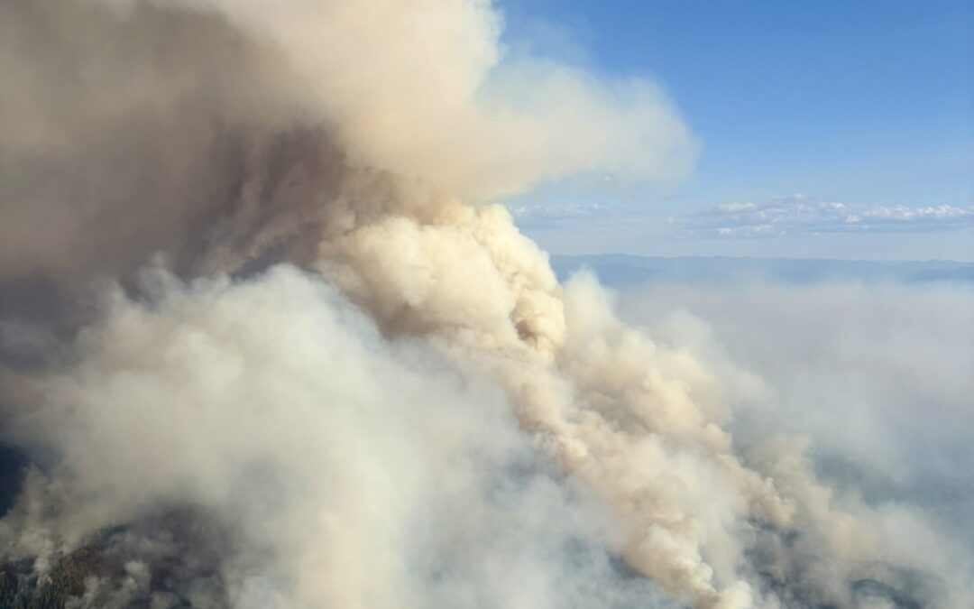
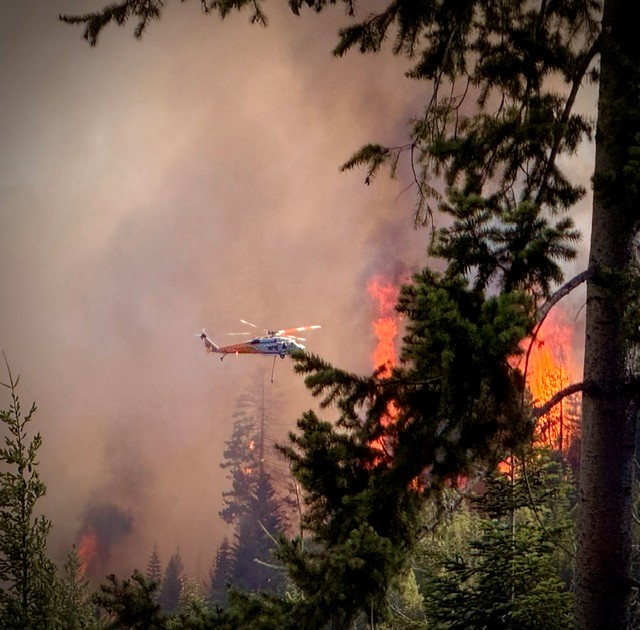
Today visibility has limited the use of air tankers due to increased smoke in the fire area. Helicopters and ground resources worked in coordination throughout the day to slow the fire’s spread, cool active areas, and support crews constructing and improving the fire line. Additional firefighters and equipment continue to arrive and are strategically positioned where they can be most effective.
Winds are expected to increase through this evening, which could contribute to more active fire behavior tonight. While weather conditions are forecast to moderate overnight with cooler temperatures, higher humidity, and a stronger inversion, resources remain prepared for changing conditions.
Tonight, firefighters will continue to hold existing fire line and construct containment lines around all areas of the spot fires, as well as on the main fire towards the southwestern edge, where fire activity is more active. Crews are thoroughly watching for additional spot fires, expanding mop-up, and reinforcing containment wherever possible.
The Bureau of Land Management has issued a closure order for BLM-administered lands near the East Evans Creek Fire. Public entry, including hunting, hiking, and camping, is prohibited. More information about the closure, including a map, is available online at www.blm.gov/orwafire.
Smoke Impacts: Smoke from the East Evans Creek Fire may settle into valleys and other low-lying areas, reducing visibility and impacting air quality in nearby communities. Smoke conditions can change throughout the day as winds shift. Individuals sensitive to smoke should take appropriate precautions. For current air quality information and smoke forecasts, visit: https://fire.airnow.gov/
Evacuations: The Jackson County Sheriff’s Office and Emergency Management have issued the following evacuations by level:
Evacuation Level 3 Go Now: UPGRADE Zone JAC-109, JAC-126, JAC-149B, JCSO has upgraded Zone JAC-109, JAC-126, and JAC-149B from Level 2 to Evacuation LEVEL 3: GO NOW! JCSO deputies are in the area giving door-to-door notifications.
Evacuation Level 2 Be Set: JCSO has upgraded eight zones, JAC-111 / JAC-112 / JAC-127 / JAC-131 / JAC-132 / JAC-133 / JAC-134 / JAC-149
Evacuation Level 1 Be Ready: JCSO has upgraded the city of Shady Cove to Level 1: Be Ready. This includes Zones SHC-151 / SHC-152 / SHC-153 / SHC-154 / SHC-156 / SHC-157 / SHC-158
The evacuation shelter for residents and domestic pets has been moved to Eagle Point Middle School, 477 Reese Creek Road, Eagle Point. Horses can be taken to the Expo at 21 Penninger Road, Central Point, OR. For more information on evacuation levels or to find your evacuation zone, visit https://tinyurl.com/EastEvansCreekFireEvacMap. Expo staff and volunteers are prepared to receive horses; however, please call 541-776-7206 first to confirm space is available, as additional shelter locations may be activated. Owners should bring feed, water containers, and any necessary medications when possible. For livestock sheltering assistance, call 541-776-7206.
Road Closures: Traffic is closed to the public on East Evans Creek Road at Meadows Road. Please avoid the fire area to allow firefighters and heavy equipment to operate safely.
Temporary Flight Restriction (TFR): A “TFR” is in place for the fire area daily (24 hours) until further notice. Complete information is available at https://tfr.faa.gov/tfr3/?page=detail_6_4915. Flying a drone near or around a wildfire is illegal and compromises the safety of both pilots and firefighters and interferes with firefighting efforts.
The fire started on Friday, July 10th at 2:41 p.m. after a car crashed into a power pole, sparking dry vegetation in the area. The Jackson County Sheriff’s Office is currently investigating the cause of the crash.
MediaRelDailyUpdate_PM_20260715_final

July 15, 2026
Fire Danger Level Increases to Extreme in Jackson and Josephine Counties
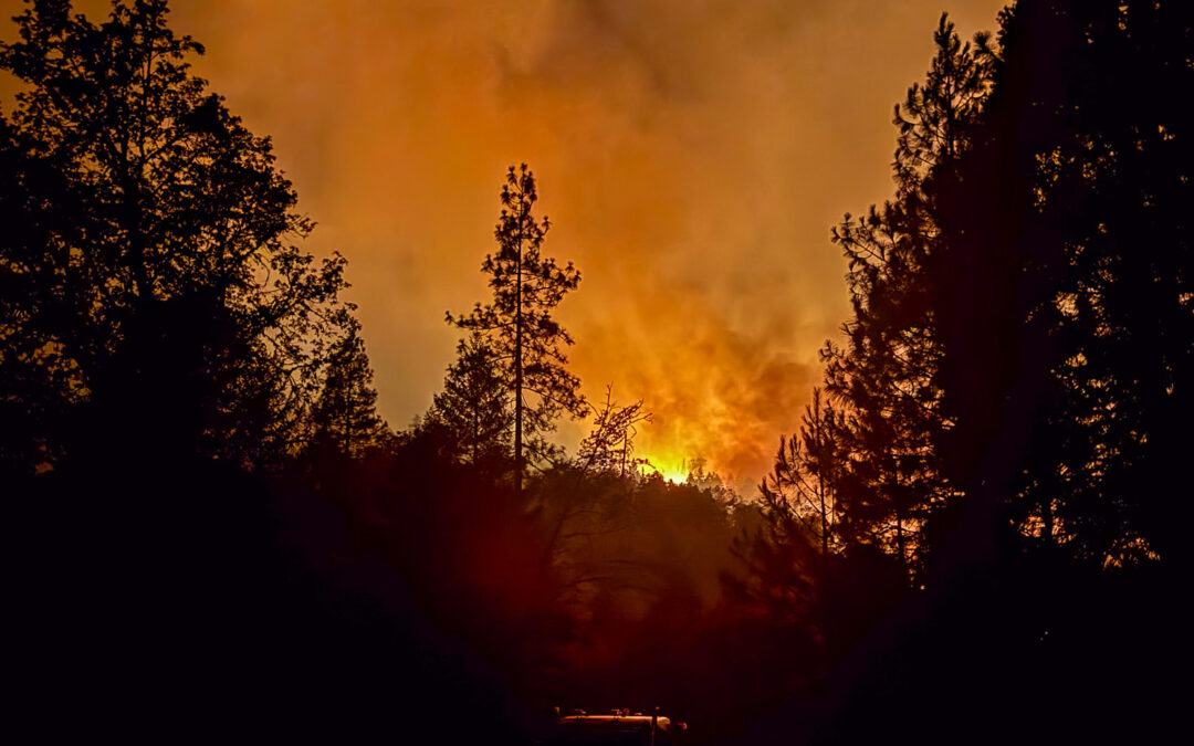
JACKSON & JOSEPHINE COUNTIES, Ore. (July 14, 2026) – Due to continued hot weather with temperatures above 90 degrees, critically dry vegetation, and increasingly active fire behavior across southwest Oregon, the fire danger level on lands protected by the Oregon Department of Forestry in Jackson and Josephine counties will increase to Extreme (Red) at 12:01 a.m. on Friday, July 17, 2026. These regulations impact approximately 1.8 million acres of state, private, county, city and Bureau of Land Management lands protected by ODF’s Southwest Oregon District. The Industrial Fire Precaution Level (IFPL) will remain at Level 2.
Current fuel conditions across southwest Oregon are critically dry and supporting extreme fire behavior. The East Evans Creek Fire, now more than 5,000 acres, has demonstrated how quickly fires can grow under these conditions, with firefighters encountering rapid rates of spread, long-range spotting, and active fire behavior. With continued hot weather, critically dry fuels, and the potential for thunderstorms this week, any new wildfire has the potential to spread quickly, making it critical for everyone to do their part to prevent new fire starts.
Beginning Friday, July 17, at 12:01 a.m., the following Extreme (Red) public use restrictions will take effect:
• The use of power saws, including battery and electric-powered chainsaws, is prohibited.
• The cutting, grinding and welding of metal is prohibited.
• The mowing of dried or cured grass is prohibited. This includes lawnmowers and string trimmers. The mowing of green, irrigated lawns and the culture and harvest of agricultural crops are exempt from restrictions.
• The operation of any other spark-emitting internal combustion engine not specifically mentioned above is prohibited.
The following fire prevention regulations are currently in effect and will remain in effect until fire danger levels are reduced:
• Debris burning, including burn piles and burn barrels, is prohibited.
• Campfires, charcoal fires, cooking fires and warming fires are only allowed in designated campgrounds. Portable cooking stoves and fire pits using liquefied or bottled fuels are allowed in cleared areas with the landowner’s permission. Charcoal and pellet barbecues and smokers are also allowed at fully developed residential homesites when used in a cleared area with a shovel and water source immediately available.
• Smoking is prohibited while traveling, except in vehicles on improved roads, in boats on the water, and other designated locations.
• Fireworks are prohibited on or within one-eighth mile of ODF-protected land.
• The use of tracer ammunition and exploding targets is prohibited.
• Motor vehicles, including motorcycles and all-terrain vehicles, may only be operated on improved roads free of flammable vegetation, except for the culture and harvest of agricultural crops. Fully electric bicycles and motorcycles are exempt from these restrictions.
• Electric fence controllers must be listed by a nationally recognized testing laboratory or certified by the Department of Consumer and Business Services and operated in accordance with the manufacturer’s instructions.
• Fuel-powered generators may only be operated at residential homesites in a cleared area free of flammable vegetation with a charged garden hose or one 2.5-pound or larger fire extinguisher immediately available. Battery- and solar-powered generators are exempt from restrictions.
• While traveling off state highways, county roads and driveways, possession of one shovel and either one gallon of water or one 2.5-pound or larger fire extinguisher is required. All-terrain vehicles and motorcycles must carry at least one 2.5-pound or larger fire extinguisher.
The National Weather Service continues to forecast hot temperatures across southwest Oregon through the coming days. Combined with critically dry fuels and the potential for thunderstorms, these conditions create an environment where fires can spread rapidly and become difficult to contain.
ODF urges everyone to follow current fire restrictions, use extra caution with any activity that could spark a wildfire, and report fires immediately by calling 9-1-1.
For additional information about current fire season regulations and designated campground locations, visit
www.swofire.com
July 15, 2026
There is a community meeting planned for today, Wednesday, July 15, 2026, at 6:30 p.m. to provide an update for the fire.
In-Person: Shady Cove School Gym, 100 Cleveland St, Shady Cove, OR 97539
Hosted streaming site: Jackson County District 1, 5474 N River Rd, Gold Hill, OR 97525
Stream online via: Facebook.com/ODFSouthwest
SAMS VALLEY, Ore. (July 15, 2026) – The East Evans Creek Fire remained active throughout the night, firefighters worked aggressively on spot fires that established outside the primary fire perimeter during yesterday’s active burning conditions. Resources remained focused on the fire’s northeast of the main incident, where crews made progress through the night while continuing suppression efforts on the main fire.
One of the larger spot fires, located on Board Mountain, is estimated at approximately 1,000 acres. Additional crews, engines, and heavy equipment were shifted to that area and are actively engaged to limit further spread and establish containment opportunities. As conditions rapidly change, wildland and structure resources continue to be strategically placed. Additional resources continue to arrive to bolster suppression efforts.
Overnight, firefighters conducted a small-scale tactical firing operation on the western portion of the fire to minimize impacts from the main fire that progressed uphill towards already established containment features. Firefighters and heavy equipment constructed direct fireline where terrain and conditions allowed, strengthening control lines along the fire’s edge on the Board Mountain spot fire. Wildland and structural resources will continue to work collaboratively around the clock with dozers, hand crews, engines operations on the northeastern and eastern portions of the incident, providing point protection for homes threatened by the fire.
Today, firefighters will continue taking a direct approach where conditions allow while remaining focused on firefighter safety. Aircraft and ground resources will work together to slow fire spread, cool active areas, support crews constructing fireline, and quickly engage any new spot fires that develop. The Oregon State Fire Marshal (OSFM) structure engines along the eastern portion of the fire will continue protecting homes and critical infrastructure. On the southwest edge, crews will be improving defensible space around structures and installing temporary water supply sources to support wildland operations.
Elevated fire behavior is expected to return this afternoon as hot, dry weather combines with local wind patterns, steep terrain, and receptive fuels. These conditions may contribute to increased fire intensity, rapid rates of spread, and additional spotting during the hottest part of the day. Firefighters will continue adapting tactics as conditions change while taking advantage of opportunities to safely engage the fire.
The Bureau of Land Management has issued a closure order for BLM-administered lands near the East Evans Creek Fire. Public entry, including hunting, hiking and camping, is prohibited. More information about the closure, including a map, is available online at www.blm.gov/orwafire.
Smoke Impacts: Smoke from the East Evans Creek Fire may settle into valleys and other low-lying areas, reducing visibility and impacting air quality in nearby communities. Smoke conditions can change throughout the day as winds shift. Individuals sensitive to smoke should take appropriate precautions. For current air quality information and smoke forecasts, visit: https://fire.airnow.gov/
Evacuations: The Jackson County Sheriff’s Office and Emergency Management have issued the following evacuations by level:
Evacuation Level 3 Go Now: JAC-124 – 22705 to 24100 block of E. Evans Creek Road.
Evacuation Level 2 Be Set: JAC-016 / JAC-017 / JAC-126 / JAC-147 / JAC-148 / JAC-149B
Evacuation Level 1 Be Ready: JAC-003 / JAC-004 / JAC-014 / JAC-026 / JAC-036 / JAC-109 / JAC-127 / JAC-131 / JAC-149A / JAC-158
An evacuation shelter for residents and domestic pets located at Hanby Middle School, 806 6th Avenue, Gold Hill. Horses can be taken to the Expo at 21 Penninger Road, Central Point, OR. For more information on evacuation levels or to find your evacuation zone, visit https://tinyurl.com/EastEvansCreekFireEvacMap. Expo staff and volunteers are prepared to receive horses; however, please call 541-776-7206 first to confirm space is available, as additional shelter locations may be activated. Owners should bring feed, water containers, and any necessary medications when possible. For livestock sheltering assistance, call 541-776-7206.
Road Closures: Traffic is closed to the public on East Evans Creek Road at Meadows Road. Please avoid the fire area to allow firefighters and heavy equipment to operate safely.
Temporary Flight Restriction (TFR): A “TFR” is in place for the fire area daily (24 hours) until further notice. Complete information is available at https://tfr.faa.gov/tfr3/?page=detail_6_4915. Flying a drone near or around a wildfire is illegal and compromises the safety of both pilots and firefighters, and interferes with firefighting efforts.
The fire started on Friday afternoon at 2:41 p.m. after a car crashed into a power pole, sparking dry vegetation in the area. The Jackson County Sheriff’s Office is currently investigating the cause of the crash.
MediaRelDailyUpdate_AM_20260715_final
July 15, 2026
There is a community meeting planned for tomorrow, Wednesday, July 15, 2026, at 6:30 p.m. to provide an update for the fire.
In-Person: Shady Cove School Gym, 100 Cleveland St, Shady Cove, OR 97539 – Stream online via: Facebook.com/ODFSouthwest
SAMS VALLEY, Ore. (July 14, 2026) – Firefighters on the East Evans Creek Fire took advantage of cooler conditions during the morning hours to make steady progress, establishing, strengthening, and tying sections of line together, improving access, and coordinating suppression efforts with numerous aircraft. This work allowed crews to gain ground ahead of challenging afternoon conditions.
As temperatures climbed, relative humidity dropped, the atmosphere became increasingly unstable, and fire behavior intensified. The thunderstorms predicted for the area remained well south and east of the fire; however, the absence of the forecasted monsoonal moisture contributed to lower relative humidity throughout the day, allowing fuels to remain critically dry and increasing the potential for heightened fire activity. In the late afternoon, conditions became more unstable, resulting in rapid changes in fire intensity.
Two of the spot fires identified during last night’s infrared flight have been mostly lined; however, one remains challenging due to difficult access and rugged terrain. This evening, a new spot fire east of the main fire perimeter prompted additional evacuations, with the latest evacuation information provided below. Crews are using both aircraft and heavy equipment to support suppression efforts in the area while continuing to improve access and strengthen control lines.
This evening, divisions along the northern half of the fire are experiencing extreme fire behavior, including running, torching, and spotting, which is expected to continue into the early morning hours. This remains a terrain- and fuel-driven fire, with steep slopes and heavy fuels continuing to challenge suppression efforts. Firefighters will continue working through the night to cool and slow fire growth, aggressively engaging with the fire when possible, and taking advantage of opportunities to establish and expand fireline.
Oregon State Fire Marshal (OSFM) structural resources remain in place, working alongside wildland firefighters to protect homes and critical infrastructure. OSFM crews are completing full structure preparation in threatened areas, improving the defensibility of homes and buildings by removing combustible materials, identifying hazards, developing structural protection plans, and installing hose lays to support these efforts.
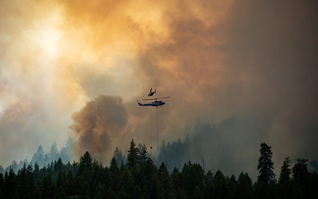
Aviation resources continued to play a critical role throughout the day and into the evening, supporting ground operations by cooling active fire areas, slowing fire spread, suppressing spot fires, and assisting crews working in difficult terrain. Additional resources continue to arrive on the fire and are being rapidly integrated into the response, strengthening suppression efforts in priority areas of the fire.
Tomorrow, firefighters will continue working to tie existing control lines together and strengthen containment. Although temperatures are expected to be slightly cooler, the area remains critically dry, and any new fire starts have the potential to experience rapid growth under current fuel conditions.
The Bureau of Land Management has issued a closure order for BLM-administered lands near the East Evans Creek Fire. Public entry, including hunting, hiking and camping, is prohibited. More information about the closure, including a map, is available online at www.blm.gov/orwafire.
Smoke Impacts: Smoke from the East Evans Creek Fire may settle into valleys and other low-lying areas, reducing visibility and impacting air quality in nearby communities. Smoke conditions can change throughout the day as winds shift. Individuals sensitive to smoke should take appropriate precautions. For current air quality information and smoke forecasts, visit: https://fire.airnow.gov/
Evacuations: The Jackson County Sheriff’s Office and Emergency Management have issued the following evacuations by level:
Evacuation Level 3 Go Now: JAC-124
Evacuation Level 2 Be Set: JAC-016 / JAC-126 / JAC-147 / JAC-148 / JAC-149B
The Jackson County Sheriff’s Office has upgraded JAC-126 and JAC-149B to Evacuation Level 2 Be Set. JAC-148A has been downgraded to Evacuation Level 2 Be Set. All residences located adjacent to E. Evans Creek Road, from address 19385 through 21899, as well as residences located at 21612 Antioch Road and 21615 Antioch Road are included. Zone 148 is no longer split into A and B sections. The entirety of Zone JAC-148 is at a Level 2.
Evacuation Level 1 Be Ready: JAC-003 / JAC-004 / JAC-017 / JAC-026 / JAC-036 / JAC-109 / JAC-127 / JAC-131 / JAC-149A / JAC-158
JAC-127, JAC-131, JAC-149A, and JAC-158 have been upgraded to Level 1 Be Ready.
An evacuation shelter for residents and domestic pets has been established at Hanby Middle School, 806 6th Avenue, Gold Hill. Horses can be taken to the Expo at 21 Penninger Road, Central Point, OR. For more information on evacuation levels or to find your evacuation zone, visit https://tinyurl.com/EastEvansCreekFireEvacMap. Expo staff and volunteers are prepared to receive horses; however, please call 541-776-7206 first to confirm space is available, as additional shelter locations may be activated. Owners should bring feed, water containers, and any necessary medications when possible. For livestock sheltering assistance, call 541-776-7206.
Road Closures: Traffic is closed to the public on East Evans Creek Road at Meadows Road. Please avoid the fire area to allow firefighters and heavy equipment to operate safely.
Temporary Flight Restriction (TFR): A “TFR” is in place for the fire area daily (24 hours) until further notice. Complete information is available at https://tfr.faa.gov/tfr3/?page=detail_6_4915. Flying a drone near or around a wildfire is illegal and compromises the safety of both pilots and firefighters, and interferes with firefighting efforts.
The fire started on Friday afternoon at 2:41 p.m. after a car crashed into a power pole, sparking dry vegetation in the area. The Jackson County Sheriff’s Office is currently investigating the cause of the crash.
MediaRelDailyUpdate_PM_20260714_final
July 14, 2026
SAMS VALLEY, Ore. (July 14, 2026) – Firefighters are preparing for another demanding day on the East Evans Creek Fire as hot, dry conditions combine with the potential for gusty, erratic winds and isolated thunderstorms. Additional resources arrived overnight and will continue arriving throughout the day, increasing suppression capacity and ensuring firefighters are positioned to respond quickly as conditions change.
The fire remained active through the evening, with extreme fire behavior and spotting creating challenging conditions across the north, northwest, and northeast areas of the incident. Working alongside wildland firefighters, Oregon State Fire Marshal (OSFM) structural resources provided point protection where fire activity threatened homes along East Evans Creek Road and Morrison Creek as the fire advanced to the edge of several properties. Crews quickly suppressed spot fires, extinguished ember-caused ignitions, and successfully defended these structures.
As fire activity moderated overnight, firefighters took advantage of improved conditions to cool hot areas, slow fire growth, and strengthen suppression efforts. Crews aggressively engaged multiple spot fires while heavy equipment improved access and constructed fireline. Aviation resources supported suppression well into the evening, assisting ground crews by cooling active fire and utilizing retardant to assist the firefight where possible.
An overnight infrared flight reflected growth of 1,742 acres, bringing the total acreage of the fire to 5,370, providing critical intelligence for today’s operations. Multiple spot fires were identified outside the fire’s northeastern perimeter. Crews are actively working to access and address those areas.
Today, poor overnight humidity recovery, high temperatures, isolated dry thunderstorms, and gusty, erratic outflow winds are expected to contribute to active fire behavior and the potential for another well-developed smoke column. Firefighters will continue engaging the fire aggressively where conditions allow while adapting tactics to steep terrain, limited access, and rapidly changing weather. Aircraft will support suppression efforts by slowing fire spread, cooling active areas, and reinforcing containment lines. Structural resources will continue working alongside wildland firefighters to assess and protect homes, monitor for ember casts, and rapidly suppress any new spot fires that threaten structures.
The arrival of additional hand crews, engines, heavy equipment, overhead personnel, and aviation resources ordered by the Oregon Department of Forestry (ODF) and Oregon State Fire Marshal (OSFM) reflects the increasing complexity of the incident and the commitment to keeping pressure on the fire. Every available resource is being strategically assigned to areas where they can have the greatest impact, whether strengthening containment lines, improving access, protecting homes, or responding to new fire activity.
Firefighter and public safety remain the highest priorities. As weather conditions become more unstable, suppression tactics may shift throughout the day to ensure crews can continue operating safely while taking advantage of opportunities to contain the fire.
Community members should expect to see increased fire resources throughout the area today as they arrive and are assigned. Residents are encouraged to monitor official updates and continue giving firefighters the space they need to work safely. Avoid entering closed areas or stopping along roadways near the fire, as heavy equipment and emergency vehicles will be operating throughout the incident.
The fire started on Friday afternoon at 2:41 p.m. after a car crashed into a power pole, sparking dry vegetation in the area. The Jackson County Sheriff’s Office is currently investigating the cause of the crash.
Smoke Impacts: Smoke from the East Evans Creek Fire may settle into valleys and other low-lying areas, reducing visibility and impacting air quality in nearby communities. Smoke conditions can change throughout the day as winds shift. Individuals sensitive to smoke should take appropriate precautions. For current air quality information and smoke forecasts, visit: https://fire.airnow.gov/
Evacuations: The Jackson County Sheriff’s Office and Emergency Management have issued the following evacuations by level:
Evacuation Level 3 Go Now: The Jackson County Sheriff’s Office and Emergency Management have upgraded JAC-124 to a Level 3 evacuation zone. JAC-148A All residences located adjacent to E. Evans Creek Road, from address 19385 through 21899, are included in the evacuation area. Additionally, residences located at 21612 Antioch Road and 21615 Antioch Road are included.
Evacuation Level 2 Be Set: JAC-016 / JAC-147 / JAC-148B
Evacuation Level 1 Be Ready: JAC-003 / JAC-004 / JAC-017 / JAC-026 / JAC-036 / JAC-109 / JAC-126 / JAC-149B
An evacuation shelter for residents and domestic pets has been established at Hanby Middle School, 806 6th Avenue, Gold Hill. Horses can be taken to the Expo at 21 Penninger Road, Central Point, OR. For more information on evacuation levels or to find your evacuation zone, visit https://tinyurl.com/EastEvansCreekFireEvacMap. Expo staff and volunteers are prepared to receive horses; however, please call 541-776-7206 first to confirm space is available, as additional shelter locations may be activated. Owners should bring feed, water containers, and any necessary medications when possible.
For livestock sheltering assistance, call 541-776-7206.
Road Closures: Traffic is closed to the public on East Evans Creek Road at Meadows Road. Please avoid the fire area to allow firefighters and heavy equipment to operate safely.
Temporary Flight Restriction (TFR): A “TFR” is in place for the fire area daily (24 hours) until further notice. Complete information is available at https://tfr.faa.gov/tfr3/?page=detail_6_4915. Flying a drone near or around a wildfire is illegal and compromises the safety of both pilots and firefighters, and interferes with firefighting efforts.
pio_8x11_land_20260714_0530_EastEvansCreek_OR711S000039_0714day
July 12, 2026
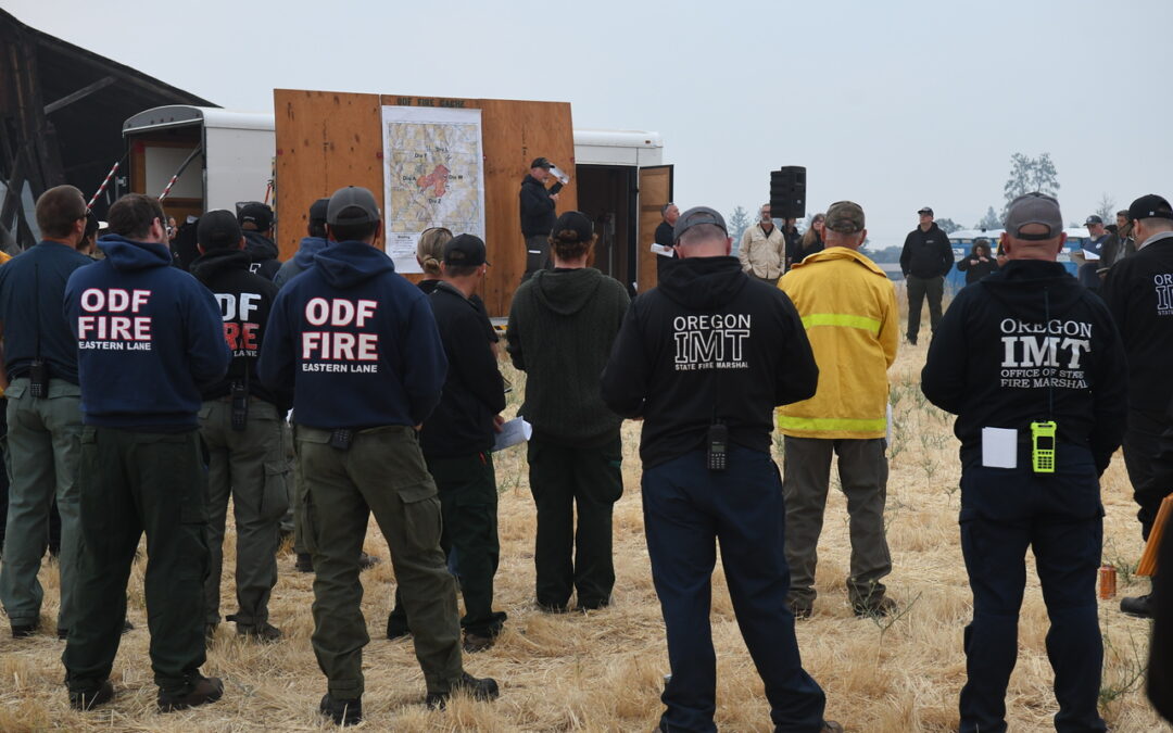
Predicted windy conditions will test East Evans Creek Fire line, firefighters push forward on progress
SAMS VALLEY, Ore. (July 12, 2026) – Firefighters assigned to the East Evans Creek Fire, located approximately seven miles west of Shady Cove, continued making progress overnight. Crews worked to reinforce established lines on the southern portion of the fire, and structural resources remained in place to protect threatened residences. With the most recent mapping completed on foot, the fire remains an estimated 2,656 acres at this time. Updated acreage from infrared (IR) flights will be provided once available.
Yesterday evening, fire activity increased as gusty winds, dry fuels, and steep terrain contributed to increased active fire behavior. Despite these challenging conditions, coordinated ground and aerial suppression efforts were successful in limiting any significant fire growth. Aircraft, including air tankers, were used extensively to slow the fire’s spread, while numerous helicopters provided water drops to cool hotspots and support firefighters working in difficult terrain.
This morning, crews are taking advantage of more favorable conditions created by an inversion and moderate overnight relative humidity recovery. Firefighters are working to strengthen containment ahead of critical fire weather expected from today into early next week. This afternoon, winds are expected to gust up to 30 miles per hour, which could create more challenging conditions on the fire line. Elevated fire weather concerns will continue through the weekend, with the potential for thunderstorms on Monday.
Structural firefighters remain focused on protecting homes, critical infrastructure, and improving defensible space around threatened properties. Wildland firefighters are continuing to engage directly at the fire’s edge as much as possible. In areas of extreme and steep terrain, alternate lines from previous fires are also being opened up as a precaution in case direct line against the fire’s edge isn’t possible.
Aerial suppression operations will be limited this morning by the inversion but remain available and will be utilized as visibility improves and conditions allow.
Firefighters will continue adapting to changing conditions while focusing on strengthening containment, protecting communities, and limiting opportunities for fire growth. Although steep terrain, dense vegetation, and active fire behavior continue to present challenges, crews are building on the progress made and remain committed to keeping the fire footprint as small as possible.
The fire started on Friday afternoon at 2:41 p.m. after a car crashed into a power pole, sparking dry vegetation in the area. The Jackson County Sheriff’s Office is currently investigating the cause of the crash.
The Jackson County Sheriff’s Office and Emergency Management have issued Level 3 – GO NOW, Level 2 – BE SET, and Level 1 – BE READY evacuation notices for areas surrounding the fire. An evacuation shelter for residents and domestic pets has been established at Hanby Middle School, 806 6th Avenue, Gold Hill.
Evacuations: The Jackson County Sheriff’s Office and Emergency Management have issued the following evacuations by level:
Evacuation Level 3 Go Now: JAC-148A All residences located adjacent to E. Evans Creek Road, from address 19385 through 21899, are included in the evacuation area. Additionally, residences located at 21612 Antioch Road and 21615 Antioch Road are included.
Evacuation Level 2 Be Set:
JAC-016 / JAC-124 / JAC-147 / JAC-148B
Evacuation Level 1 Be Ready:
JAC-003 / JAC-004 / JAC-017 / JAC-026 / JAC-036 / JAC-109 / JAC-126 / JAC-149B
An evacuation shelter for residents and domestic pets has been established at Hanby Middle School, 806 6th Avenue, Gold Hill. Horses can be taken to the Expo at 21 Penninger Road, Central Point, OR. For more information on evacuation levels or to find your evacuation zone, visit
https://tinyurl.com/EastEvansCreekFireEvacMap. Expo staff and volunteers are prepared to receive horses; however,
please call 541‑776‑7206 first to confirm space is available, as additional shelter locations may be activated. Owners should bring feed, water containers, and any necessary medications when possible.
Josephine County Fairgrounds can take pigs, goats, and smaller animals at 1451 Fairgrounds Rd, Grants Pass, OR 97527.
For livestock sheltering assistance, call 541‑776‑7206.
Road Closures: Traffic is closed to the public on East Evans Creek Road at Meadows Road. Please avoid the fire area to allow firefighters and heavy equipment to operate safely.
Temporary Flight Restriction (TFR): A “TFR” is in place for the fire area daily (24 hours) until further notice. Complete information is available at
https://tfr.faa.gov/tfr3/?page=detail_6_4915. Flying a drone near or around a wildfire is illegal and compromises the safety of both pilots and firefighters, and interferes with firefighting efforts.
July 12, 2026
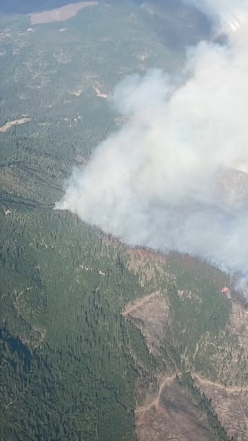
East Evans Creek Fire lines holding strong, state incident management teams take command of fire
SAMS VALLEY, Ore. (July 11, 2026) – Wildland and structural firefighters working on the East Evans Creek Fire, located approximately seven miles west of Shady Cove, continue to make progress, building line around the perimeter and protecting homes and structures near the fire’s edge. Containment lines built overnight have held, and firefighters continue to build on that progress. The fire is currently estimated to be 2,656 acres; an infrared (IR) flight is planned for this evening to confirm the fire’s current footprint and acreage.
Due to the complexities of the incident, including steep terrain, extreme fire behavior and the threat of lightning in the forecast, the Oregon Department of Forestry (ODF) Southwest Oregon District, Bureau of Land Management (BLM) Medford District and the U.S. Wildland Fire Service (USWFS) ordered ODF Complex Incident Management Team 1. Governor Tina Kotek’s invocation of the Emergency Conflagration Act mobilized the Oregon State Fire Marshal (OSFM) Blue Incident Management Team to protect structures near the fire. Together, these teams were in-briefed by local resources at noon on Saturday, and took unified command of the incident at 6 p.m. These teams bring experience, as well as additional resources, to the incident and allow local firefighters to rest and return to their regular duties, including responding to any new reports of fire.
Throughout the day on Saturday, firefighters were able to minimize growth on the fire, however a few small spot fires were found. Resources included numerous helicopters, air tankers, engines, crews, and bulldozers. Retardant drops are helping to create temporary fire line. Focus remains on the southern portion where the majority of homes and structures are located, along with uncontained edges to the north and east.
On the structural side, four structural task forces from Marion, Lincoln, and Linn counties and the southern Oregon coast were mobilized by OSFM today. The conflagration declaration allows OSFM to deploy statewide structural firefighting resources when a wildfire threatens life and property beyond the capabilities of local agencies. These newly arriving resources joined a Douglas County strike team and a Klamath County task force that responded yesterday through an Immediate Response request to provide structure protection. Crews focused on providing structural protection to homes and critical infrastructure and securing fire line around homes.
Firefighters are preparing for several days of critical fire weather, including high temperatures, gusty winds and the potential for lightning. Resources will continue to monitor conditions closely and make plans accordingly. Firefighters are directed to put the fire out as quickly as possible and keep the fire footprint as small as possible, but face numerous challenges on this incident, including steep terrain, active fire behavior and poison oak. The safety of the public and firefighters is the top priority on this incident, along with protecting property and critical infrastructure.
The fire started on Friday afternoon at 2:41 p.m. after a car crashed into a power pole, sparking dry vegetation in the area. The Jackson County Sheriff’s Office is currently investigating the cause of the crash.
The Jackson County Sheriff’s Office and Emergency Management have issued Level 3 – GO NOW, Level 2 – BE SET, and Level 1 – BE READY evacuation notices for areas surrounding the fire. An evacuation shelter for residents and domestic pets has been established at Hanby Middle School, 806 6th Avenue, Gold Hill.
Evacuations: The Jackson County Sheriff’s Office and Emergency Management have issued the following evacuations by level:
Evacuation Level 3 Go Now: JAC-148A All residences located adjacent to E. Evans Creek Road, from address 19385 through 21899, are included in the evacuation area. Additionally, residences located at 21612 Antioch Road and 21615 Antioch Road are included.
Evacuation Level 2 Be Set:
JAC-016 / JAC-124 / JAC-147 / JAC-148B
Evacuation Level 1 Be Ready:
JAC-003 / JAC-004 / JAC-017 / JAC-026 / JAC-036 / JAC-109 / JAC-126 / JAC-149B
An evacuation shelter for residents and domestic pets has been established at Hanby Middle School, 806 6th Avenue, Gold Hill. Horses can be taken to the Expo at 21 Penninger Road, Central Point, OR. For more information on evacuation levels or to find your evacuation zone, visit
https://tinyurl.com/EastEvansCreekFireEvacMap. Expo staff and volunteers are prepared to receive horses; however,
please call 541‑776‑7206 first to confirm space is available, as additional shelter locations may be activated. Owners should bring feed, water containers, and any necessary medications when possible.
Josephine County Fairgrounds can take pigs, goats, and smaller animals at 1451 Fairgrounds Rd, Grants Pass, OR 97527.
For livestock sheltering assistance, call 541‑776‑7206.
Road Closures: Traffic is closed to the public on East Evans Creek Road at Meadows Road. Please avoid the fire area to allow firefighters and heavy equipment to operate safely.
Temporary Flight Restriction (TFR): A “TFR” is in place for the fire area daily (24 hours) until further notice. Complete information is available at
https://tfr.faa.gov/tfr3/?page=detail_6_4915. Flying a drone near or around a wildfire is illegal and compromises the safety of both pilots and firefighters, and interferes with firefighting efforts.
July 11, 2026
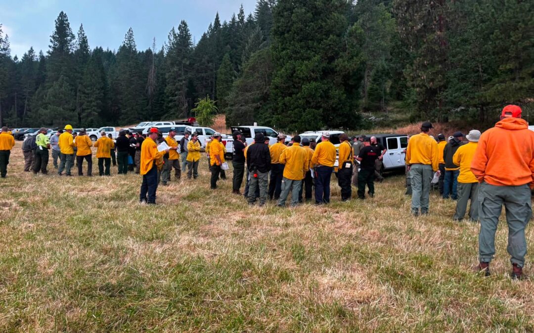
ROGUE RIVER, Ore. (July 11, 2026) – Firefighters assigned to the East Evans Creek Fire, burning on private and Bureau of Land Management (BLM) lands approximately 26 miles northeast of Medford near the 18000 block of East Evans Creek Road, are preparing for another day of intense fire weather as they continue suppression efforts.
The fire was reported Friday afternoon just after 2:40 p.m. when dispatch received a report of a car crash involving a power pole and a downed power line. Upon arrival, firefighters found fire burning in nearby vegetation. The Oregon Department of Forestry and the Jackson County Sheriff’s Office are conducting a further investigation into the incident. Firefighters worked through the night strengthening fire line, reinforcing wet line and mitigating hazardous snags across the incident. As of Saturday morning, the fire is estimated at approximately 2,000 acres.
Warm, dry and breezy conditions are expected to continue across southwest Oregon today, creating another challenging day for firefighters and increasing the potential for active fire behavior and spotting. More than 400 personnel are assigned to the incident today, including 20-person hand crews, engines, dozers, water tenders, heavy equipment, aviation resources and structural task forces. Aviation resources include one Type 3 helicopter with Air Attack, three Type 2 helicopters and two Type 1 helicopters, providing heavy aerial support as conditions allow. Additional structural task forces are expected to arrive today as firefighters continue structure protection efforts where multiple structures remain threatened.
Today’s objectives include reinforcing and strengthening existing fire line, extending hose lays along East Evans Creek Road and improving access for firefighters working throughout the incident. Firefighters continue working in steep terrain, across an old burn scar and around numerous hazard trees. Combined with dry fuels and the potential for spotting, these conditions will continue to present challenges for firefighters throughout today’s operations.
Due to the size and complexity of the East Evans Creek Fire, along with the need to maintain initial attack capability across southwest Oregon, the Oregon Department of Forestry has ordered ODF Incident Management Team 1, which will assume command of the incident this evening. The team will bring additional personnel, equipment and operational support to the incident while allowing local resources to remain available to respond to new wildfire starts across Jackson and Josephine counties.
The Jackson County Sheriff’s Office has issued Level 3 – GO NOW, Level 2 -BE SET and Level 1 -BE READY evacuation notices for areas surrounding the fire. An evacuation shelter for residents and domestic pets has been established at Hanby Middle School, 806 6th Avenue, Gold Hill. Traffic is blocked on East Evans Creek Road at Meadows Road. Firefighters continue working throughout the area, and residents will be allowed through the closure when it is safe to do so.
The public is asked to avoid the area if possible to allow firefighters and heavy equipment to operate safely. For more information on evacuation levels, visit Wildfire Oregon Evacuation Information. To determine your evacuation zone, visit Genasys Protect. Updates on the East Evans Creek Fire will be provided each morning and evening, with additional updates shared throughout the day as significant information becomes available.
East Evans Creek Fire crews prepare for another day of challenging fire weather; ODF Incident Management Team 1 mobilizing For additional fire information, current fire regulations and incident updates, follow @ODFSouthwest on Facebook or visit the ODF Southwest Oregon District website www.swofire.com.

June 15, 2026
JACKSON & JOSEPHINE COUNTIES, Ore. (June 15, 2026) – The fire danger level on lands protected by the Oregon Department of Forestry (ODF) Southwest Oregon District will increase to “high” (yellow) and the Industrial Fire Precaution Level (IFPL) will increase to Level 2 (two) on Wednesday, June 17, 2026 at 12:01 a.m.
This increase is due to persistent hot temperatures and vegetation that continues to dry across Southwest Oregon. ODF Southwest responded to multiple fires in recent days, with the largest being the Spencer Gulch Fire roughly 4 miles south of Ruch. Firefighters were able to stop the forward spread at approximately 75 acres, and crews remain on scene working to fully secure and mop up the fire. This change affects 1.8 million acres of state, private, county and Bureau of Land Management lands in Jackson and Josephine counties.
The primary difference between current fire prevention restrictions and those beginning on Thursday affects the public use of power‑driven equipment, such as chainsaws, mowers, weed eaters, and more. The use of power‑driven equipment, grinding, cutting of metal, and other spark‑emitting equipment, such as wood splitters and generators, will be prohibited between the hours of 10 a.m. and 8 p.m. daily. This does not apply to mowing green lawns.
Other fire prevention regulations which will remain in effect, include:
- No debris burning, including piles and debris burned in burn barrels
- No fireworks on or within 1/8th of a mile of ODF-protected land. Fireworks are prohibited on all BLM land
- Exploding targets and tracer ammunition, or any bullet with a pyrotechnic charge in its base, are prohibited
- Campfires are allowed only in designated campgrounds. Portable stoves or fire pits using liquefied or bottled fuels may be used in other locations that are clear of dry vegetation at all times
- Motorized vehicles, including motorcycles and all-terrain, are allowed only on improved roads; one shovel and one gallon of water, or one 2.5 pound or larger fire extinguisher, is required while traveling
- Smoking while traveling will only be allowed in enclosed vehicles on improved roads, in boats on the water and other specifically designated locations
- Chainsaws may not be used between 10:00 a.m. and 8:00 p.m. during high fire danger. During hours outside of this time frame, chainsaws may be used but require that the operator have one shovel and one 8-oz or larger fire extinguisher at the work site. A fire watch is also required for one hour after each chainsaw use
- Cutting, grinding, and welding of metal is not allowed between 10:00 a.m. and 8:00 p.m. during high fire danger. These activities will be allowed during hours outside of this time frame only if the work site is cleared of potentially flammable vegetation and other materials, and a water supply is at the job site
- The mowing of dead or dried grass with power-driven equipment is not allowed between 10:00 a.m. and 8:00 p.m. during high fire danger, including equipment powered by gas, electricity or batteries. This restriction does not include mowing of green lawns, or equipment used for the commercial culture and harvest of agricultural crops
- Any other spark-emitting internal combustion engine-use not specifically mentioned is not allowed between 10:00 a.m. and 8:00 p.m. during high fire danger. Use of any spark-emitting internal combustion engine is allowed outside of this time frame only if the work site is cleared of potentially flammable vegetation and other materials, and a water supply is at the job site
- Any electric fence controllers must be approved by a nationally recognized testing laboratory, such as Underwriters Laboratories Inc., or be certified by the Department of Consumer and Business Services, and be installed and used in compliance with the fence controller’s instructions for fire safe operation
For industrial operations, under IFPL II (Two) – limited shutdown, which is entirely separate from all public fire restrictions, the following may operate after 8 p.m. and up until 1 p.m. daily:
- Power saws, except at loading sites
- Feller-bunchers with rotary head saws
- Cable yarding
- Blasting
- Welding, cutting, or grinding of metal
For more information about the Oregon Department of Forestry’s fire season restrictions, please call or visit the Southwest Oregon District unit office nearest to you:
- Medford Unit, 5286 Table Rock Rd., Central Point. (541) 664-3328
- Grants Pass Unit, 5375 Monument Dr., Grants Pass. (541) 474-3152

June 9, 2026
JACKSON & JOSEPHINE COUNTIES, Ore. (June 11, 2026) – Fire danger on Oregon Department of Forestry (ODF) Southwest Oregon District-protected land will increase to moderate (blue) on Thursday, June 11, 2026 at 12:01 a.m. Lands affected by this declaration include 1.8 million acres of state, private, county, city and Bureau of Land Management (BLM) forestlands in Jackson and Josephine counties. The Industrial Fire Precaution Level (IFPL) will remain at one.
Although the region has seen a brief stretch of cooler days, vegetation continues to dry, and the increasing heat this week will accelerate that drying as temperatures climb toward the 100 degree mark. This combination of ongoing drying and rising heat is increasing fire danger and prompting the shift to moderate on Thursday.
Beginning Thursday at 12:01 a.m., the following new public fire restrictions will take effect:
- Open fires are prohibited, which includes campfires, charcoal fires, cooking fires and warming fires, except at locations deemed a designated campground. Portable cooking stoves or firepits using liquefied or bottled fuels are still allowed in areas clear of flammable vegetation;
- Chainsaws may not be used between 1:00 p.m. and 8:00 p.m. during moderate fire danger. During hours outside of this time frame, chainsaws may be used but require that the operator have one shovel and one 8 ounce or larger fire extinguisher at the work site. A fire watch is also required for one hour after each chainsaw use;
- Cutting, grinding and welding of metal is not allowed between 1:00 p.m. and 8:00 p.m. during moderate fire danger. These activities will be allowed during hours outside of this time frame only if the work site is a cleared area and a charged garden hose or one 2½ pound or larger fire extinguisher is at the job site;
- The mowing of dead or dried grass with power-driven equipment is not allowed between 1:00 p.m. and 8:00 p.m. This restriction does not include mowing of green lawns, or equipment used for the commercial culture and harvest of agricultural crops;
- Motorized vehicles, including motorcycles and all-terrain vehicles, will be allowed only on improved roads free of flammable vegetation. One shovel and one gallon of water, or one 2½ pound or larger fire extinguisher, is required while traveling. All-terrain vehicles and motorcycles must be equipped with one 2½ pound or larger fire extinguisher;
- Possession of the following firefighting equipment is required while traveling, except on state highways, county roads and driveways: one shovel and one gallon of water or one 2½ pound or larger fire extinguisher. As noted above, all-terrain vehicles and motorcycles must be equipped with one 2½ pound or larger fire extinguisher;
- Any other spark-emitting internal combustion engine use not specifically mentioned is not allowed between 1:00 p.m. and 8:00 p.m. during moderate fire danger. Use of any spark-emitting internal combustion engine is allowed outside of this time frame only if the work site is a cleared area and a charged garden hose or one 2½ pound or larger fire extinguisher is at the job site;
Public fire restrictions currently in effect, which will remain in effect, include:
• No debris burning, including piles and debris burned in burn barrels.
• No fireworks on or within one eighth of a mile of ODF-protected land.
• Exploding targets and tracer ammunition, or any bullet with a pyrotechnic charge in its base, are prohibited.
• Smoking while traveling will only be allowed in enclosed vehicles on improved roads, in boats on the water and other specifically designated locations.
• Any electric fence controllers must be approved by a nationally recognized testing laboratory or be certified by the Department of Consumer and Business Services and be installed and used in compliance with the fence controller’s instructions for fire safe operation.
Following fire season regulations helps to decrease the number of human-caused fires, as these activities are known to create sparks and start fires. For more information about the Oregon Department of Forestry’s Fire Season regulations, visit our Facebook page, @ODFSouthwest or our website, www.swofire.com. You can also call or visit the Southwest Oregon District unit office nearest to you:
Medford Unit, 5286 Table Rock Rd., Central Point – (541) 664-3328 Grants Pass Unit, 5375 Monument Dr., Grants Pass – (541) 474-3152

May 12, 2026
This declaration affects 1.8 million acres of Oregon Department of Forestry Southwest Oregon District-protected lands
JACKSON & JOSEPHINE COUNTIES, Ore. (May 12, 2026) – The Oregon Department of Forestry (ODF) Southwest Oregon District will officially declare the start of fire season on Friday, May 15, 2026, at 12:01 a.m. The fire danger level will be “Low” (green) and the Industrial Fire Precaution Level (IFPL) will be I (one). Lands affected by this declaration include 1.8 million acres of state, private, county, city and Bureau of Land Management (BLM) forestlands in Jackson and Josephine counties.
While winter and spring rains are on track for a slightly below normal water year, snowpack across the state and local landscape is minimal, and drought conditions across both counties are contributing to dry vegetation and an increased risk for fires to start and spread earlier in the year. As conditions continue to trend toward warmer summer-like weather, fire risk and behavior will naturally increase.
The beginning of fire season and Low fire danger brings regulations; these activities are known to cause fires and will be prohibited with the start of fire season:
- No debris burning, including piles and debris burned in burn
- No fireworks on or within 1/8 of a mile of ODF-protected
- Exploding targets and tracer ammunition, or any bullet with a pyrotechnic charge in its base, are prohibited.
- Campfires are allowed in designated campgrounds, on BLM land, and on private land with the landowner’s permission. Designated campgrounds are available online at swofire.com/maps. The following are required where open fires and appliances are allowed: one shovel and one gallon of water or 2½ pound fire extinguisher.
- The use of portable appliances such as camp stoves and fire pits using liquified or bottled fuels are allowed anytime in clear areas* free of flammable vegetation.
- Charcoal and pellet barbecues/smokers are allowed at residential home sites that are fully developed, landscaped, and maintained when used in a cleared area* that is free from flammable vegetation. A charged garden hose or one 2½ pound fire extinguisher must be immediately available.
- Smoking while traveling will only be allowed in enclosed vehicles on improved roads, in boats on the water and other specifically designated locations.
- Any electric fence controllers must be approved by a nationally recognized testing laboratory, such as Underwriters Laboratories , or be certified by the Department of Consumer and Business Services and be installed and used in compliance with the fence controller’s instructions for fire safe operation.
*Cleared Area Definition: Free of flammable vegetation for 50 feet in all directions.
The start of fire season also means regulations on industrial activities. Under IFPL I (one), fire season requirements are in effect, in addition to the following:
- A Firewatch is required at this and all higher levels unless otherwise waived.
For more information about the Oregon Department of Forestry’s Fire Season regulations, please call or visit the Southwest Oregon District unit office nearest to you:
Medford Unit, 5286 Table Rock Rd., Central Point – (541) 664-3328
Grants Pass Unit, 5375 Monument Dr., Grants Pass – (541) 474-3152

November 7, 2025
JACKSON & JOSEPHINE COUNTIES, Ore. (Nov. 7, 2025) – A persistent weather pattern of cooler temperatures and consistent rain has prompted a decrease in restrictions for industrial slash burning, effective Monday, November 10, 2025 at 12:01 a.m. As a result, prescribed fire and industrial slash burning may increase in high-elevation, remote areas throughout Jackson and Josephine Counties. Additional information can be found here: https://www.oregon.gov/odf/fire/Pages/burn.aspx
These restrictions are specifically for industrial use and are separate from general public debris burning regulations. Before a debris or barrel burn, members of the public should first contact their local fire district for any needed permits, and on the day of the debris burn, contact the appropriate county burn line to confirm it is a burn day:
- Jackson County: 541-776-7007
- Josephine County: (541) 476-9663
Even though the fire season is officially over, please continue to practice fire prevention when burning debris by ensuring a burn pile is never left un-attended and using caution when using machinery that could cause a spark. Please be aware that fires can still spread during dry periods in fall and winter conditions. This region is extremely prone to wildfire, and for that reason, fire knows no season.
Fire prevention tips and information from the ODF Southwest Oregon District is available online on our website, www.swofire.com, our Facebook page, @ODFSouthwest and our X account, @swofire.

October 13, 2025
JACKSON & JOSEPHINE COUNTIES, Ore. (Oct. 13, 2025) – After 135 days, the Oregon Department of Forestry (ODF) Southwest Oregon District is officially declaring an end to the 2025 fire season in Jackson and Josephine Counties, taking effect Tuesday, October 14, 2025 at 12:01 a.m. Multiple days of widespread rain across the district and a shift to consistent fall weather has allowed for all fire season regulations and Industrial Fire Precaution Levels (IFPL) to be lifted this week. This declaration affects 1.8 million acres protected by ODF across Jackson and Josephine counties. At this time, industrial slash burning still remains prohibited.
Since fire season was declared on June 1, ODF firefighters responded to 281 fires across Jackson and Josephine counties, totaling 3,558 acres affected. The first large fire of the season was the Upper Applegate Fire on June 18, located along the 2000-block of Upper Applegate Road. This fire occurred two days ahead of the anniversary of the 2024 Upper Applegate Fire. Both fires were located in the same general area, with similar weather and vegetation moisture levels, however this year’s fire started roughly three hours earlier in the day. Additionally, on both days, ODF was responding to a second fire during initial attack. While there are slight nuances to the data, these events are similar in nature across the board. Despite these similarities, fire managers attribute bringing ODF initial attack firefighters on earlier to the faster response, quicker containment and smaller acres achieved on this year’s incident.
Consistent thunderstorms throughout the season created numerous challenging weeks for the district, with the July 7 storm igniting nearly 40 fires across ODF-protected land in Jackson and Josephine counties at once. The Grizzly and Eastside Lightning Complexes were the result of this storm, totaling 22 and 17 fires respectively, and burning 1,060 acres total. The largest of these fires included the Neil Creek Road Fire along Interstate 5 south of Ashland caught at 257 acres, and the Deming Gulch Fire in the Applegate caught at 250 acres. ODF Incident Management Team 3 was ordered to relieve the district of some of these incidents, allowing local firefighters to extinguish the rest and return to a stronger state of readiness for initial attack on new fire starts, which occurred following additional thunderstorms. These 39 fires across the district were all fully extinguished within a month of their natural ignition.
In early September, thunderstorms produced numerous fires in the Lower Rogue River Corridor, an area of southern Oregon notorious for large fires due to the limited road access, extremely steep terrain and numerous hazards to responding firefighters. Twelve fires were started by the September 3 storm, with all but one immediately caught at two acres or less. The Kelsey Peak Fire created the largest number of challenges for firefighters and grew to over 100 acres in the following days due to hot, windy conditions, steep slopes and no road access. Weather conditions and terrain continued to fuel fire growth, and by the week’s end, the district ordered ODF Incident Management Team 1 to take command of the fire and allow local resources to return to their normal response readiness. The Kesely Peak Fire ultimately became the largest fire of the season on the district, caught at 1,039 acres in approximately three weeks. Additionally, the district was engaged on the Moon Complex six miles to the east during this time, providing resources for precautionary structure protection and contingency lines to the IMTs serving our partners at the U.S. Forest Service Rogue River-Siskiyou National Forest and the Bureau of Land Management Medford District.
Fall-like weather arrived in southern Oregon in early October, prompting decreases in fire danger levels and a shift toward the end of the season. With cooler weather and rain consistently in the forecast, the declared fire season is ending.
ODF has an annual goal of putting out 98% of fires at 10 acres or less. Despite numerous thunderstorms throughout the season igniting multiple lightning-caused fires at once, 258 fires were caught at this standard, nearly meeting this metric at 92%. The overall success on the district locally is largely due to a fast and aggressive response to fires and collaboration with our local and federal partners.
The largest fires of the season on the district are listed below:
| Fire Name |
Date |
Location |
Acres |
Cause |
|
| Kelsey Peak Fire |
Sept. 3 |
15 miles west of Glendale |
1,039 |
Lightning |
| Grizzly Lightning Complex |
July 7 |
Jackson and Josephine co. lightning fires |
887 |
Lightning |
| Upper Applegate Fire |
June 18 |
2000-block of Upper Applegate Rd., Jackson County |
470 |
Under Investigation |
| Board Shanty Fire |
July 17 |
2000-block of Board Shanty Rd., Josephine County |
469 |
Under Investigation |
| Eastside Lightning Complex |
July 7 |
Jackson County lightning fires |
173 |
Lightning |
| Hammel Road Fire |
July 10 |
Dodge Bridge County Park, Jackson County |
12.5 |
Under Investigation |
| E. Trail Creek Road Fire |
July 1 |
Highway 227 north of Trail |
11.5 |
Lightning |
| Colestin Fire |
July 7 |
One mile north of OR-CA border, Colestin |
10.5 |
Under Investigation |
The termination of fire season removes fire prevention regulations on equipment use and the use of fire for debris burning. This applies to the public and industrial operations on forestlands, however, industrial slash burning is still prohibited. Many structural fire agencies require permits for residential debris burning; please check with your local fire department to obtain any necessary permits before burning and ensure it’s a burn day designated by the county you reside in:
- Jackson County Burn Line: (541) 776-7007
- Josephine County Burn Line: (541) 476-9663
Even though the fire season is officially over, please continue to practice fire prevention when burning debris by ensuring a burn pile is never left unattended and using caution when using machinery that could cause a spark. While the heightened risk of fires has passed with the ending of the declared fire season, fires can still start and spread in fall and winter conditions. ODF firefighters will continue to be available to respond to fires throughout the year; partner with ODF and area fire agencies in fire prevention by following the debris burning guidelines put in place by your local fire department.
Fire prevention tips and information from the ODF Southwest Oregon District is available online at our Facebook page, @ODFSouthwest and our website, www.swofire.com.

October 9, 2025
JACKSON & JOSEPHINE COUNTIES, Ore. (Oct. 9, 2025) – Recent fall-like weather and multiple days of widespread rain in the forecast has made it possible to ease off on some public fire prevention regulations on lands protected by the Oregon Department of Forestry Southwest Oregon District. Effective Saturday, October 11, 2025 at 12:01 a.m., the public fire danger level will decrease to “low” (green) on ODF-protected lands in Jackson and Josephine counties. The Industrial Fire Precaution Level (IFPL) will remain at I (one).
In low fire danger, fire prevention regulations that remain in effect, include:
- No debris burning, including piles and debris burned in burn barrels.
- No fireworks on or within 1/8 of a mile of ODF-protected land.
- Exploding targets and tracer ammunition, or any bullet with a pyrotechnic charge in its base, are prohibited.
- Smoking while traveling will only be allowed in enclosed vehicles on improved roads, in boats on the water and other specifically designated locations.
- Any electric fence controllers must be approved by a nationally recognized testing laboratory, or be certified by the Department of Consumer and Business Services and be installed and used in compliance with the fence controller’s instructions for fire safe operation.
For more information about the Oregon Department of Forestry’s Fire Season regulations, please call or visit the Southwest Oregon District unit office nearest to you:
- Medford Unit, 5286 Table Rock Rd., Central Point – (541) 664-3328
- Grants Pass Unit, 5375 Monument Dr., Grants Pass – (541) 474-3152
Additional information about fire season is also available online on our website, www.swofire.com, our Facebook page, @ODFSouthwest and our X account, @swofire.

September 29, 2025
JACKSON & JOSEPHINE COUNTIES, Ore. (Sept. 29, 2025) – Widespread rain and more in the forecast has made it possible to ease off on some public and industrial fire prevention regulations on lands protected by the Oregon Department of Forestry Southwest Oregon District. Effective Tuesday, September 30, 2025 at 12:01 a.m., the public fire danger level will decrease to “moderate” (blue), and the industrial fire precaution level (IFPL) will decrease to I (one) on ODF-protected land in Jackson and Josephine Counties.
For public use, restrictions on chain saws, brush cutters and other power-driven or spark-emitting machinery are being further relaxed, allowing the use of equipment near dry vegetation until 1:00 p.m. and after 8 p.m. daily.
Other fire prevention regulations which will remain in effect, include:
- No debris burning, including piles and debris burned in burn barrels.
- No fireworks on or within 1/8 of a mile of forestlands.
- Exploding targets and tracer ammunition, or any bullet with a pyrotechnic charge in its base, are prohibited.
- Campfires are allowed only in designated campgrounds. Portable stoves or firepits using liquefied or bottled fuels may be used in other locations clear of vegetation.
- Motorized vehicles are allowed only on improved roads; one shovel and one gallon of water, or one 2.5 pound or larger fire extinguisher, is required while traveling.
- Smoking while traveling will only be allowed in enclosed vehicles on improved roads, in boats on the water and other specifically designated locations.
- Chainsaws may not be used between 1:00 p.m. and 8:00 p.m. during moderate fire danger, excluding electric chainsaws. During hours outside of this time frame, chainsaws may be used but require that the operator have one shovel and one 8-oz or larger fire extinguisher at the work site. A fire watch is also required for one hour after each chainsaw use.
- Cutting, grinding, and welding of metal is not allowed between 1:00 p.m. and 8:00 p.m. during moderate fire danger. These activities will be allowed during hours outside of this time frame only if the work site is cleared of potentially flammable vegetation and other materials, and a water supply is at the job site.
- The mowing of dead or dried grass with power-driven equipment is not allowed between 1:00 p.m. and 8:00 p.m. during moderate danger. This restriction includes battery, electric or gas-powered mowers, weed eaters and all other types of lawncare equipment when used on dry grass. This regulation does not include the mowing of green lawns, or equipment used for the commercial culture and harvest of agricultural crops, which is allowed at any time.
- Any other spark-emitting internal combustion engine-use not specifically mentioned is not allowed between 1:00 p.m. and 8:00 p.m. during moderate fire danger. Use of any spark-emitting internal combustion engine is allowed outside of this time frame only if the work site is cleared of potentially flammable vegetation and other materials, and a water supply is at the job site.
- Any electric fence controllers must be approved by a nationally recognized testing laboratory, such as Underwriters Laboratories Inc., or be certified by the Department of Consumer and Business Services, and be installed and used in compliance with the fence controller’s instructions for fire safe operation.
Under IFPL I (one) – fire season requirements are in effect. In addition to the following:
- A Firewatch is required at this and all higher levels unless otherwise waived.
For more information about the Oregon Department of Forestry’s Fire Season regulations, please call or visit the Southwest Oregon District unit office nearest to you:
- Medford Unit, 5286 Table Rock Rd., Central Point – (541) 664-3328
- Grants Pass Unit, 5375 Monument Dr., Grants Pass – (541) 474-3152
Additional information about fire season is also available online on our Facebook page, @ODFSouthwest and our X account, @swofire.
September 18, 2025
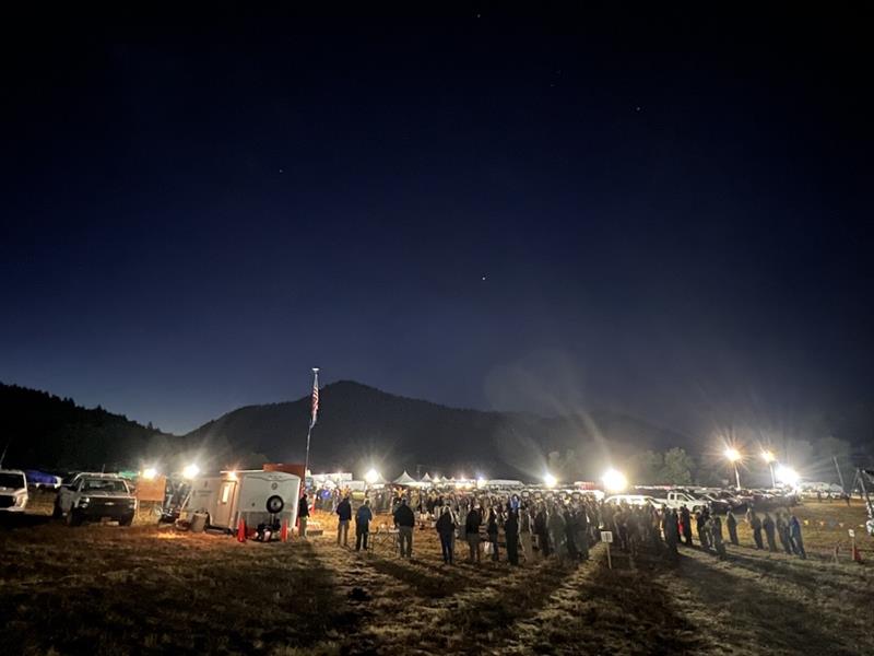
LOWER ROGUE RIVER CORRIDOR, Ore. – Firefighters engaged on the Kelsey Peak Fire are continuing to finish mop-up operations and repairs, as well as hauling unneeded equipment off of the incident. The fire, now 95% contained as of Thursday morning, is located approximately 15 miles west of Glendale and was started by lightning on September 3.
Oregon Department of Forestry (ODF) Incident Management Team 1 has been assigned to the fire since September 8, and after 12 days, will be completing their final shift today. Despite steep terrain, dense brush, hazardous trees and rolling debris, firefighters were able to quickly build a control line around this fire and hold it at a final size of 1,039 acres during this timeframe.
On Wednesday, a local Type 3 team made up of ODF, Bureau of Land Management (BLM) Medford District and U.S. Forest Service Rogue River-Siskiyou National Forest resources was in-briefed on the current status of the fire and have been shadowing members of ODF Team 1 since. They will officially take command of the incident at 6 p.m. tonight to complete the final mop-up and repair work.
In response to the current status and containment of the fire, the Josephine County Sheriff’s Office and Emergency Management has canceled the Level 1 – BE READY evacuation notice for Zone JCU-801. A Level 1 – BE READY evacuation notice issued by the Curry County Sheriff’s Office remains in effect for Rogue River Ranch, Tucker Flat Campground and Marial due to the proximity of the Moon Complex.
Local resources will continue to coordinate with Great Basin Complex Incident Management Team (IMT) 5 on the Moon Complex, as well as the incoming Northwest IMT 13, which will take command of the Moon Complex on Saturday morning. Work to re-open old fire lines used during past fires as contingency lines for the east flank of the Moon Complex and mitigating fuels around structures in the Rogue River Ranch, Tucker Flats, and Marial areas will continue as needed to support the Moon Complex teams. For more information on the Moon Complex, visit https://www.facebook.com/SWORFireInfo
Rogue River Access: Fire activity can drastically alter the river environment. Please follow https://www.facebook.com/R6RRSNF and https://www.facebook.com/SWORFireInfo for updates regarding river access and impacts. Be aware of changing conditions and follow the direction of River Rangers and firefighting personnel along the river. Permitted boaters can contact the BLM Smullin Visitor Center at 541-618-2408 or BLM_OR_MD_Rogue_River_Mail@blm.gov with questions.
Closures: The Rogue River Trail is closed from Horseshoe Bend to Flora Dell. A temporary closure of a portion of the Grave Creek to Marial Backcountry Byway (BLM Road 32-9-14.2) has been implemented by the BLM Grants Pass Field Office. The public is strongly encouraged to avoid the entire Byway to facilitate safe firefighter access on the steep, narrow, windy road. Unauthorized individuals may not enter closed areas, and all uses—including hiking, hunting and dispersed camping—are prohibited. Please see the map for full closure information and updates on the BLM website: https://www.blm.gov/programs/public-safety-and-fire/fire-and-aviation/regional-info/oregon-washington/fire-restrictions
Evacuations: A Level 1 – BE READY evacuation notice from the Curry County Sheriff’s Office remains in effect for Rogue River Ranch, Tucker Flat Campground and Marial.
Temporary Flight Restriction (TFR): A “TFR” is in place at an altitude from the surface up to and including 7,000 feet, daily (24 hours) until further notice. Complete information is available at https://tfr.faa.gov/tfr3/?page=detail_5_8274. Flying a drone near or around a wildfire compromises the safety of pilots and interferes with firefighting efforts.
September 17, 2025
LOWER ROGUE RIVER CORRIDOR, Ore. – Firefighters on the Kelsey Peak Fire are rounding the corner on mop-up operations, extinguishing hotspots 300 feet into the fire’s perimeter on all sides. This work creates a strong barrier around the incident, located approximately 15 miles west of Glendale, preventing any future spread of fire in warm, windy conditions. Due to this tremendous progress firefighters have made, containment has risen to 90%, and the fire remains 1,039 acres in size.
Today, resources will continue to finish mopping up, as well as pulling unneeded equipment off the fire line. Helicopters will be working again to support ground crews, hauling equipment off the incident and saving firefighters from hiking it back out themselves on the steep terrain. The equipment will then be readied to be deployed for the next fire.
Additionally, repair work along fire lines is ongoing, as firefighters work to restore the disturbed landscape to a more natural state. Water bars will also be added on steep terrain to prevent soil erosion when consistent rain returns this fall and winter. Fire lines along ridges will be left open for potential future fire blocks if needed.
This afternoon, a local Type 3 Incident Management Team made up of Oregon Department of Forestry (ODF), Bureau of Land Management (BLM) and U.S. Forest Service Rogue River Siskiyou National Forest resources will be in-briefing with ODF Team 1 to get a current overview of the incident. These incoming resources will then spend Thursday shadowing the current team before taking command of the incident at 6 p.m. tomorrow evening.
Oregon Department of Forestry (ODF) Complex Incident Management Team 1 is coordinating with Great Basin Complex Incident Management Team 5 on the Moon Complex, approximately eight miles to the west. ODF Team 1 resources are re-opening old fire lines used during past fires as contingency lines for the east flank of the Moon Complex and mitigating fuels around structures in the Rogue River Ranch, Tucker Flats, and Marial areas to support Great Basin Team 5 objectives. For more information on the Moon Complex, visit https://www.facebook.com/SWORFireInfo
Rogue River Access: Fire activity can drastically alter the river environment. Please follow https://www.facebook.com/R6RRSNF and https://www.facebook.com/SWORFireInfo for updates regarding river access and impacts. Be aware of changing conditions and follow the direction of River Rangers and Firefighting personnel along the river. Permitted boaters can contact the BLM Smullin Visitor Center at 541-618-2408 or BLM_OR_MD_Rogue_River_Mail@blm.gov with questions.
Closures: The Rogue River Trail is closed from Horseshoe Bend to Flora Dell. A temporary closure of a portion of the Grave Creek to Marial Backcountry Byway (BLM Road 32-9-14.2) has been implemented by the BLM Grants Pass Field Office. The public is strongly encouraged to avoid the entire Byway to facilitate safe firefighter access on the steep, narrow, windy road. Unauthorized individuals may not enter closed areas, and all uses—including hiking, hunting and dispersed camping—are prohibited. Please see the map for full closure information on the BLM website: https://www.blm.gov/programs/public-safety-and-fire/fire-and-aviation/regional-info/oregon-washington/fire-restrictions
Evacuations: The Curry County Sheriff’s Office has reduced the evacuation order for Rogue River Ranch, Tucker Flat Campground and Marial to Level 1 – BE READY in response to increased containment. The Josephine County Sheriff’s Office and Emergency Management has a Level 1 – BE READY evacuation notice for Zone JCU-801 in place. More info: https://tinyurl.com/KelseyPeakEvacs
Temporary Flight Restriction (TFR): A “TFR” is in place at an altitude from the surface up to and including 7,000 feet, daily (24 hours) until further notice. Complete information is available at https://tfr.faa.gov/tfr3/?page=detail_5_8274. Flying a drone near or around a wildfire compromises the safety of pilots and interferes with firefighting efforts.
September 16, 2025
LOWER ROGUE RIVER CORRIDOR, Ore. – As mop-up on the Kelsey Peak Fire nears completion, firefighters are checking each piece of fireline for second and third times, ensuring no heat or flame remains near the perimeter. The fire, located 15 miles west of Glendale along the Lower Rogue River Corridor, has been burning since September 3rd in steep, rugged country with difficult access. Crews have worked hard to secure the fire and minimize impacts to the Wild and Scenic Rogue River. The fire is 1,039 acres with containment rising today to 85%. Curry County Sheriff’s Office has reduced the evacuation order for Rogue River Ranch, Tucker Flat Campground and Marial to Level 1 – BE READY in response to increased containment.
Mop-up depth along the control lines is nearing 300 feet in most areas. Yesterday, a Type 1 helicopter was used to drop water and cool some hot spots in the interior of the fire on the southern end. This area is very steep and rocky with limited access.
Helicopters remain available to support ground operations, including picking up equipment and hose which is no longer needed on the fireline. Using helicopters for backhaul makes the process quicker and reduces fatigue on firefighters who would have been hauling the equipment on their backs up the steep hill.
Weather this week transitions to a warm dry trend with higher temperatures, lower humidities and windy conditions. This weather may fan smoldering embers in the interior of the fire, increasing visible smoke. Firefighters will be looking for these signs of fire and heat near the perimeter, extinguishing them in the mop-up process. Resources from the incident, including aircraft, are available to support local agencies in initial attack response to emerging fires.
Some resources have shifted their focus to repair work related to suppression activities, installing water-bars on control lines to divert run-off during rainy periods, mitigating soil erosion and impacts to water quality. Bulldozers are being used to flatten berms from fireline construction and eliminate areas where water can pool. These repair actions will reduce sediment delivery to the Rogue River and its tributaries.
Oregon Department of Forestry (ODF) Complex Incident Management Team 1 is coordinating with Great Basin Complex Incident Management Team 5 on the Moon Complex, approximately eight miles to the west. ODF Team 1 resources are re-opening old firelines used during past fires as contingency lines for the east flank of the Moon Complex and mitigating fuels around structures in the Rogue River Ranch, Tucker Flats, and Marial areas to support Great Basin Team 5 objectives. For more information on the Moon Complex, visit https://www.facebook.com/SWORFireInfo
Rogue River Access: Fire activity can drastically alter the river environment. Please follow https://www.facebook.com/R6RRSNF and https://www.facebook.com/SWORFireInfo for updates regarding river access and impacts. Be aware of changing conditions and follow the direction of River Rangers and Firefighting personnel along the river. Permitted boaters can contact the BLM Smullin Visitor Center at 541-618-2408 or BLM_OR_MD_Rogue_River_Mail@blm.gov with questions.
Closures: The Rogue River Trail is closed from Horseshoe Bend to Flora Dell. A temporary closure of a portion of the Grave Creek to Marial Backcountry Byway (BLM Road 32-9-14.2) has been implemented by the BLM Grants Pass Field Office. The public is strongly encouraged to avoid the entire Byway to facilitate safe firefighter access on the steep, narrow, windy road. Unauthorized individuals may not enter closed areas, and all uses—including hiking, hunting and dispersed camping—are prohibited. Please see the map for full closure information on the BLM website: https://www.blm.gov/programs/public-safety-and-fire/fire-and-aviation/regional-info/oregon-washington/fire-restrictions
Evacuations: The Curry County Sheriff’s Office issued a Level 2 – BE SET evacuation order for the area of Rogue River Ranch, Tucker Flat Campground and the nearby area of Marial. The Josephine County Sheriff’s Office and Emergency Management has a Level 1 – BE READY evacuation notice for Zone JCU-801 in place. More info: https://tinyurl.com/KelseyPeakEvacs
Temporary Flight Restriction (TFR): A “TFR” is in place at an altitude from the surface up to and including 7,000 feet, daily (24 hours) until further notice. Complete information is available at https://tfr.faa.gov/tfr3/?page=detail_5_8274. Flying a drone near or around a wildfire compromises the safety of pilots and interferes with firefighting efforts.
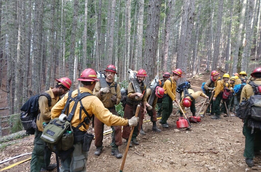
September 15, 2025
LOWER ROGUE RIVER CORRIDOR, Ore. – All control lines remain strong on the Kelsey Peak Fire as firefighters continue to push into the perimeter, extinguishing hot spots to build depth on the line. This work ultimately adds to overall containment, which has now reached 68%. The fire, located approximately 15 miles west of Glendale, is still being held by resources at 1,039 acres.
Rain was felt across the Kelsey Peak Fire early Sunday morning, continuing intermittently into the early afternoon. Rain totals varied from a quarter to four-tenths of an inch on the fire. This small weather system naturally aided resources during mop-up efforts but created slippery conditions on the steep slopes. Safety remains a top priority as work continues on tough terrain with numerous hazards. Hazardous trees that threaten firefighter safety are still being removed near the Kelsey Creek drainage on the east side of the fire. Firefighters also collected unneeded equipment in this area and brought it back to fire camp to be readied for the next incident.
Today, firefighters will continue mopping up across the fire; on the western and northern portions of line, resources have built between 200 and 250 feet of depth inside the perimeter. This work is tedious, requiring firefighters to methodically grid through areas looking for signs of heat or smoke. Smoldering vegetation can remain dormant until warm, windy weather causes it to flare up. With those exact conditions in the forecast later this week, this work is critical to retain control of the fire and continue to move forward in extinguishing it.
This upcoming shift in the weather is predicted to bring warmer temperatures, winds and lower relative humidity, starting today and worsening Tuesday. This combination can naturally fuel fire activity, and firefighters will be watching this week for any increase in fire behavior.
Oregon Department of Forestry (ODF) Complex Incident Management Team 1, assigned to the Kelsey Peak Fire since last Monday, is coordinating with the Great Basin Complex Incident Management Team 5 on the Moon Complex, approximately eight miles to the west. ODF Team 1 resources are re-opening old firelines used during past fires as contingency lines for the east flank of the Moon Complex and mitigating fuels around structures in the Rogue River Ranch, Tucker Flats, and Marial areas to support Great Basin Team 5 objectives. For more information on the Moon Complex, visit https://www.facebook.com/SWORFireInfo
Rogue River Access: Fire activity can drastically alter the river environment. Mitigation measures may be in place. It’s an evolving situation and updates will be shared as soon as possible. Permitted boaters can contact the BLM Smullin Visitor Center at 541-618-2408 or BLM_OR_MD_Rogue_River_Mail@blm.gov with questions about the status of the river.
Closures: The Rogue River Trail is closed from Horseshoe Bend to Flora Dell. A temporary closure of a portion of the Grave Creek to Marial Backcountry Byway (BLM Road 32-9-14.2) has been implemented by the BLM Grants Pass Field Office. The public is strongly encouraged to avoid the entire Byway to facilitate safe firefighter access on the steep, narrow, windy road. Unauthorized individuals may not enter closed areas, and all uses—including hiking, hunting and dispersed camping—are prohibited. Please see the map for full closure information on the BLM website: https://www.blm.gov/programs/public-safety-and-fire/fire-and-aviation/regional-info/oregon-washington/fire-restrictions
Evacuations: The Curry County Sheriff’s Office issued a Level 2 – BE SET evacuation order for the area of Rogue River Ranch, Tucker Flat Campground and the nearby area of Marial. The Josephine County Sheriff’s Office and Emergency Management has a Level 1 – BE READY evacuation notice for Zone JCU-801 in place. More info: https://tinyurl.com/KelseyPeakEvacs
Temporary Flight Restriction (TFR): A “TFR” is in place at an altitude from the surface up to and including 7,000 feet, daily (24 hours) until further notice. Complete information is available at https://tfr.faa.gov/tfr3/?page=detail_5_8274. Flying a drone near or around a wildfire compromises the safety of pilots and interferes with firefighting efforts.
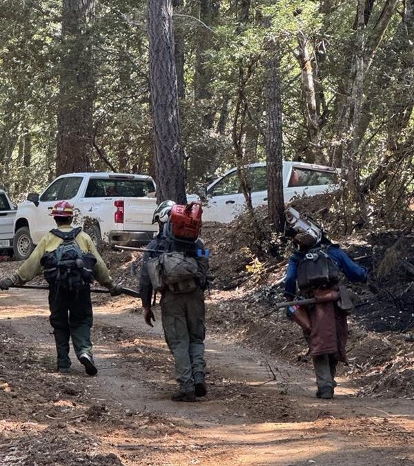
September 14, 2025
LOWER ROGUE RIVER CORRIDOR, Ore. – Containment on the Kelsey Peak Fire increased to 44% as crews continue mop-up work around the perimeter. The lightning-sparked fire, located 15 miles west of Glendale in the Lower Rogue River Corridor, burned 1,039 acres in steep rugged terrain along the Kelsey Creek drainage.
Crews have constructed fireline around the perimeter of the fire and continue to strengthen the line, working into the interior of the fire nearly 200 feet in some areas. Unmanned Aircraft, equipped with infrared (IR) technology is being used to focus gridding on specific areas around the fire’s edge. Falling modules are working with crews and fire engines to mitigate overhead hazards as they move deeper into the interior of the fire looking for areas of heat and flame.
As containment increases for the fire and the perimeter is secured, hose and pumps that are no longer needed for containment efforts are being backhauled off the fireline to clean and prepare for use on the next incident. Overnight, resources focused on mopping up and patrolling the fire to ensure the fire remains within the current footprint.
Rain showers should diminish this morning, with partly sunny conditions expected today. This will begin a warming and drying trend for the next several days. As winds pick up later today, they may fan smoldering embers, increasing visible smoke and flames, aiding firefighters in identifying hot spots to extinguish.
Oregon Department of Forestry (ODF) Complex Incident Management Team 1, assigned to the Kelsey Peak Fire since last Monday, is coordinating with the Great Basin Complex Incident Management Team 5 on the Moon Complex, approximately eight miles to the west. ODF Team 1 resources are re-opening old firelines used during past fires as contingency lines for the east flank of the Moon Complex and mitigating fuels around structures in the Rogue River Ranch, Tucker Flats, and Marial areas to support Great Basin Team 5 objectives. For more information on the Moon Complex, visit https://www.facebook.com/SWORFireInfo
Rogue River Access: Fire activity can drastically alter the river environment. Mitigation measures may be in place. It’s an evolving situation and updates will be shared as soon as possible. Permitted boaters can contact the BLM Smullin Visitor Center at 541-618-2408 or BLM_OR_MD_Rogue_River_Mail@blm.gov with questions about the status of the river.
Closures: The Rogue River Trail is closed from Horseshoe Bend to Flora Dell. A temporary closure of a portion of the Grave Creek to Marial Backcountry Byway (BLM Road 32-9-14.2) has been implemented by the BLM Grants Pass Field Office. The public is strongly encouraged to avoid the entire Byway to facilitate safe firefighter access on the steep, narrow, windy road. Unauthorized individuals may not enter closed areas, and all uses—including hiking, hunting and dispersed camping—are prohibited. Please see the map for full closure information on the BLM website: https://www.blm.gov/programs/public-safety-and-fire/fire-and-aviation/regional-info/oregon-washington/fire-restrictions
Evacuations: The Curry County Sheriff’s Office decreased the Level 3 – GO NOW evacuation order for the area of Rogue River Ranch, Tucker Flat Campground and the nearby area of Marial to a Level 2 – BE SET. The Josephine County Sheriff’s Office and Emergency Management has a Level 1 – BE READY evacuation notice for Zone JCU-801 in place. More info: https://tinyurl.com/KelseyPeakEvacs
Temporary Flight Restriction (TFR): A “TFR” is in place at an altitude from the surface up to and including 7,000 feet, daily (24 hours) until further notice. Complete information is available at https://tfr.faa.gov/tfr3/?page=detail_5_8274. Flying a drone near or around a wildfire compromises the safety of pilots and interferes with firefighting efforts.