July 18, 2018
GARNER COMPLEX
#UPDATEMorning Update 7-18-18 – 8:30am
QUICK FACTS:
Size: 960 acres
Change in last 24 hrs. +700 acres
Containment: 2%
Start Date/Time: 7/15/2018 9:00a.m.
Expected Containment Date: unknown
Location: Josephine County
Cause: Lightning
Est. Cost: $750,000
Personnel: 542
Assigned Resources:
Handcrews: 18
Engines: 9
Dozers: 7
Water Tenders: 2
Assigned Aircraft: 8 helicopters
Yesterday afternoon and through the night fire crews scouted the 12 fires that make up the Garner complex. The crews are working to prioritize these fires. The plan is to fully contain the smaller fires, construct fireline around the larger ones, while continually looking for new unaccounted for fires.
The objectives today for the Grave Creek branch will be to keep the fires east of Grave Creek, north of Pease Springs and Buck Springs. For the Pleasant Creek fire, keep the fire west of Pleasant Creek and south of the 33-4-22 road. The objectives for the Spencer Creek branch are to keep fires east of 37-6-36 road, north of China Creek road, west of Water Gap road and south of 38-6-6 road.
John Pellissier, the day Operations Chief, said at the morning briefing to the fire crews “it is great to see you and we are still waiting for more help”. More fire fighters and equipment have been ordered and will be arriving to aid in the suppression efforts. With six incident management teams de-ployed to the region, resources (fire crews, air support & equipment) are scarce.
Weather forecasters predict hot and dry weather again today with gusty winds tonight. These conditions, along with low relative humidity, can cause very active fire behavior.
The Incident Command Post and fire camp is set up at the BLM Sprague Seed Orchard located at 1980 Russell Rd in Merlin.
There are several other fires in Jackson and Josephine Counties that we are working diligently to knock down and contain. Our air attack platform will be performing reconnaissance flights the entire day. As always, keeping our community safe is our priority.
Evacuations: No evacuations are currently in place.
Closures: Intersection of Murphy Cr. and Spencer Cr. Rd. The end of the County Maintenance at Upper Powell Cr. Rd. and Cedar Flat Rd.
Cooperating Agencies: Oregon Department of Forestry, Bureau of Land Management, Rogue Valley Fire Chiefs Association, U.S. Forest Service Rogue River-Siskiyou, Umpqua National Forest
To learn more about wildfire preparedness & fire restrictions please visit:
www.swofire.com
July 18, 2018
(CLARIFICATION — This is not the fire burning near Wagner Butte, but fires on ODF protected lands in Jackson and Josephine counties.)
Date: 7/18/2018 Time: 9:25 a.m.
OREGON DEPARTMENT OF FORESTRY
Incident Start Date: 7/15/2018
Incident Start Time: Approx. 9:00 a.m.
Incident Location: Jackson & Josephine counties
Land Threat: Private, BLM, Industrial
Wagner Creek Complex Sized: Approx. 250 acres Containment: 30%
Expected Full Containment: N/A
Lightning Strikes: Approx. 1,000 across the District Confirmed Wildfires on ODF SWO District: 75
Garner Complex Fire Information in Josephine County will be released separately by the Oregon Department of Forestry Incident Management Team 2. The fires within the complex include: the Spencer Creek Fires, the Grave Creek Fires, and the Pleasant Creek Fire. The updates will still be shared on our @ODFSouthwest Facebook page and www.swofire.com.
Additional fires in Josephine County:
Swamp Creek: 16 miles north of Rogue River. Estimated at 5 acres. This fire is now part of the Grave Creek Series within the Garner Complex. Please see the Garner Complex update for additional information.
Little Grayback: 8 miles east of Cave Junction. The fire is 100% contained. This will be the last update of this fire; however, a new fire was located just to the south of the Little Grayback Fire. (Please see below).
Nelson: roughly 8 miles east of Cave Junction. Estimated at 3 acres. Firefighters are working on hand line construction. The perimeter line is currently 90% complete. We will be using resources today to knock down and eliminate interior heat. No structures are threatened.
Taylor Creek: 7 miles west of Merlin. Firefighters have been aggressively fighting this fire for more than 24 hours; however, it is still posing challenges due to difficult terrain, unfavorable weather conditions, and limited resources. The fire is estimated to be approximately 40 acres. Dozers, crews, and engines will be engaged building fire line today, alongside aerial resources. While there is one remote structure approximately one mile from the fire’s edge; no additional structures are threatened at this time, as the next nearest structures are miles away.
Fielder: North of MP 53 on I-5. 100% contained. This will be the final update of this fire.
Iron Mountain: Southwest to west of Murphy. Firefighters picked up two additional fires off Iron Mountain, the largest being approximately one acre. Both fires are 100% lined, and mop up will be continuing today. No structures are threatened.
Wagner Creek Complex in Jackson County:
Green Top Mountain: 5 miles northeast of Eagle Point. Still holding at 125 acres. Containment remains at 55%. Overnight, firefighters continued to mop up heavy timber, and will continue making more progress with knock down and mop up today. No structures are threatened.
Sterling Creek: 7 miles south of Jacksonville. Continue progress is being made, and the 32 acre fire is now 45% contained. Please note, smoke will be visible on the interior of the fire as suppression efforts and mop up continues over the next 48 hours. No structures threatened.
Trail Creek & Elk Creek Drainage: Multiple fires are burning in the area surrounding Cleveland Ridge, Elk Creek, and the Trail Creek area which is roughly 5.5 miles north to northwest of Shady Cove. There are approximately 12 confirmed fires on ODF-protected land within the drainage. The largest fire in this area is the 13-acre West Fork Trail Fire, which is now 80% contained Several additional fires continue to burn in the area, but all are being attacked aggressively and safely. All others are an acre or less in size. No structures threatened.
Railroad Gap: Mutual aid to Umpqua National Forest. Overnight, firefighters were able to wrap a hand line around the fire, and mapped it at 33 acres. Today firefighters will continue knocking down the interior. Smoke will be present. No structures are threatened.
There are several other fires in Jackson and Josephine Counties that we are working diligently to knock down and contain. Our air attack platform will be performing reconnaissance flights the entire day. As always, keeping our community safe is our priority.
Evacuations: No evacuations are currently in place.
Cooperating Agencies: Oregon Department of Forestry, Bureau of Land Management, Rogue Valley Fire Chiefs Association, U.S. Forest Service Rogue River-Siskiyou, Umpqua National Forest
To learn more about wildfire preparedness & fire restrictions please visit: www.swofire.com
July 17, 2018
QUICK FACTS
Incident Start Date: 7/15/2018
Incident Start Time: Approx. 9:00 a.m.
Incident Type: Wildfire
Cause: Lightning
Incident Location: Jackson & Josephine counties
Land Threat: Private, BLM, Industrial
Command Agency: ODF
Wagner Creek Complex Sized: 200 acres
Containment: 30%
Expected Full Containment: N/A
Civilian Injuries: 0
Firefighter Injuries: 0
Lightning Strikes: Approx. 1,000 across the District Confirmed Wildfires on ODF SWO District: 75
Structures Threatened: 0
Structures Destroyed: 0 Structures Damaged: 0
CURRENT SITUATION
#GarnerComplex Fire Information in Josephine County will be released separately by the Oregon Department of Forestry Incident Management Team 2. The fires within the complex include: the Spencer Creek Fires, the Grave Creek Fires, and the Pleasant Creek Fire. The updates will still be shared on our @ODFSouthwest Facebook page and
www.swofire.com.Additional fires in Josephine County:

Swamp Creek: 16 miles north of Rogue River. Estimated at 5 acres. The fire is 50% contained. No structures threatened. Progress continues to be made on this fire. Overnight, crews will continue mop up operations.
Little Grayback: 8 miles east of Cave Junction. Holding at 2 acres. The fire has a control line around the perimeter, and is estimated to be 40% contained. Smoke will continue to be present as crews work on additional suppression efforts. No structures are threatened.
Fielder: North of MP 53 on I-5. Approximately 7 acres. Firefighters strengthened and secured the perimeter last night, and will be mopping up today. Smoke will be present. No structures threatened.
Wagner Creek Complex in Jackson County:
Green Top Mountain: 5 miles northeast of Eagle Point. Still holding at 125 acres. Firefighters completed the control line around the perimeter of the fire last night. Containment is now at 55%. Overnight, firefighters will be working to knock down remaining interior heat. No structures are threatened.
Sterling Creek: 7 miles south of Jacksonville. The fire was accurately mapped today; the final fire size is 32 acres. It is 40% contained. Please note, smoke will be visible on the interior of the fire as suppression efforts and mop up continues over the next 48 hours. No structures threatened.
Trail Creek & Elk Creek Drainage: Multiple fires are burning in the area surrounding Cleveland Ridge, Elk Creek, and the Trail Creek area which is roughly 5.5 miles north to northwest of Shady Cove. There are approximately 12 confirmed fires on ODF-protected land within the drainage. The largest fire in this area is the West Fork Trail Fire which was originally believed to be 20 acres; however, the fire is now 100% lined, and 70% contained. An accurate GPS of the fire shows that it is actually 13 acres in size. Several additional fires continue to burn in the area, but all are being attacked aggressively and safely. We are also working in partnership with Umpqua National Forest on a few small fires near Railroad Gap. We will continue to prioritize the initial attack of the remaining active fires tonight. No structures are threatened.
There are several other fires in Jackson and Josephine Counties that we are working diligently to knock down and contain. Our air attack platform will be performing reconnaissance flights the entire day. As always, keeping our community safe is our priority.
Evacuations: No evacuations are currently in place.
ASSIGNED RESOURCES
Engines: 25
Water Tenders: 6
Helicopters: 9 (shared)
Hand Crews: 18
Dozers: 4
Total Personnel: 400
Air Tankers: 5 (shared)
Cooperating Agencies: Oregon Department of Forestry, Bureau of Land Management, Rogue Valley Fire Chiefs Association, U.S. Forest Service Rogue River-Siskiyou, Umpqua National Forest
To learn more about wildfire preparedness & fire restrictions please visit:
www.swofire.comJuly 17, 2018
Date: 7/17/2018 Time: 9:15 a.m.
OREGON DEPARTMENT OF FORESTRY
QUICK FACTS
Incident Start Date: 7/15/2018 Incident Start Time: Approx. 9:00 a.m.
Incident Type: Wildfire
Cause: Lightning
Incident Location: Jackson & Josephine counties
Land Threat: Private, BLM, Industrial
Command Agency: ODF
Complexes Sized: 565 acres
Containment: 30%
Expected Full Containment: N/A
Civilian Injuries: 0
Firefighter Injuries: 0
Lightning Strikes: Approx. 1,000 across the District Confirmed Wildfires: 68
Structures Threatened: 0
Structures Destroyed: 0 Structures Damaged: 0
CURRENT SITUATION
Garner Complex in Josephine County
Swamp Creek: 16 miles north of Rogue River. Estimated at 5 acres. While the fire does have a control line around the perimeter, interior mop up will remain a challenge today. The fire is 30% contained. No structures threatened. ***

Little Grayback: 8 miles east of Cave Junction. Holding at 2 acres. The fire has a control line around the perimeter. Smoke will continue to be present as crews work on additional suppression efforts. No structures are threatened.
Spencer Creek Fires: 1-3 Highly visible from Grants Pass, Applegate, Williams, Illinois Valley, and I-5. 12 miles south of Grants Pass. Approximately 3 fires in the area. Total fires estimated at 105 acres. Spencer Creek #1 and #2 were lined overnight. However, Spencer Creek #3 continues to push firefighters to their limits. No structures threatened.
Grave Creek Fires: 1-4 Series of fires off Upper Grave Creek Road, visible from Wimer. Approximately 17 miles north of Rogue River. 6-7 fires in the area. Total of all fires estimated at 115 acres. Grave Creek #3 is the fire within the series that has the most potential to make runs today; therefore, it is the current priority for the district. Winds along ridgelines will also test current control lines in place. Today, aerial and ground resources will continue to aggressively attack these fires striving to lengthen the current control lines along the flanks. No structures threatened.
Pleasant Creek Fire: 15 miles north of Rogue River. Estimated at 60 acres. Ground resources are working on line construction today, while aerial resources will work on cooling off the head of the fire in order to stop the further rate of spread. No structures threatened.
Tennessee Mountain: 3 miles northwest of Cave Junction. Approximately 7 acres. Last night, firefighters wrapped a control line around the fire. Firefighters will continue mopping up today. No structures threatened.
Fielder: North of MP 53 on I-5. Approximately 7 acres. Firefighters strengthened and secured the perimeter last night, and will be mopping up today. Smoke will be present. No structures threatened.
The Oregon Department of Forestry Incident Management Team 2, led by Incident Commander Chris Cline, will be taking command of a series of fires within the Garner Complex, including Spencer Creek Fires, Grave Creek Fires, and the Pleasant Creek Fire. The local district, ODF Southwest, will remain command of the Wagner Creek Complex, as well as all other fires throughout Jackson and Josephine Counties.
Wagner Creek Complex in Jackson County
Green Top Mountain: 5 miles northeast of Eagle Point. Holding at 125 acres. Firefighters completed the control line around the perimeter of the fire last night. Containment is now at 45%. Today, multiple ground and aerial resources will continue to knock down the interior heat of the fire. No structures are threatened.
Sterling Creek: 7 miles south of Jacksonville. Holding at approximately 100 acres. The fire is 30% contained. Ground and aerial resources will continue to knock down the interior perimeter of this fire today.
Trail Creek & Elk Creek Drainage: Multiple fires are burning in the area surrounding Cleveland Ridge, Elk Creek, and the Trail Creek area which is roughly 5.5 miles north to northwest of Shady Cove. There are approximately 10 confirmed fires on ODF-protected land within the drainage. The largest fire in this area is estimated at 20 acres. Several fires within this drainage were lined yesterday, including an 18 acre fire, and several others sized at one acre or less. This series is 50% contained. Crews will continue to prioritize the initial attack of the remaining active fires today. No structures are threatened.
There are several other fires in Jackson and Josephine Counties that we are working diligently to knock down and contain. Our air attack platform will be performing reconnaissance flights the entire day. As always, keeping our community safe is our priority.
Evacuations: No evacuations currently in place.
ASSIGNED RESOURCES
Engines: 25
Water Tenders: 6
Helicopters: 9
Hand Crews: 35
Dozers: 10
Total Personnel: 1,000 +
Air Tankers: 5
Cooperating Agencies: Oregon Department of Forestry, Bureau of Land Management, Rogue Valley Fire Chiefs Association, U.S. Forest Service Rogue River-Siskiyou
To learn more about wildfire preparedness & fire restrictions please visit:
www.swofire.comJuly 16, 2018
QUICK FACTS
Incident Start Date: 7/15/2018
Incident Start Time: Approx. 9:00 a.m.
Incident Type: Wildfire
Cause: Lightning
Incident Location: Jackson & Josephine counties
Land Threat: Private, BLM, Industrial
Command Agency: ODF
Complex Size: 460 acres
Containment: 30%
Expected Full Containment: N/A
Civilian Injuries: 0
Firefighter Injuries: 0
Lightning Strikes: Approx. 1,000 across the District
Confirmed Wildfires: 65
Structures Threatened: 0
Structures Destroyed: 0
Structures Damaged: 0
CURRENT SITUATION
Garner Complex in Josephine County
Swamp Creek: 16 miles north of Rogue River. Estimated at 5 acres. Ground resources were able to complete a control line around the fire; however, snags are threatening the line. The fire is 20% contained. No structures threatened.
Little Grayback: 8 miles east of Cave Junction. Holding at 2 acres. Several ground resources were engaged today securing the perimeter. Smoke will continue to be present overnight and into tomorrow due to continued suppression efforts. No structures are threatened.
Spencer Creek Fires: Highly visible from Grants Pass, Applegate, Williams, Illinois Valley, and I-5. 12 miles south of Grants Pass. Approximately 3-5 fires in the area. Total fires estimated at 80 acres. Firefighters worked tirelessly on this series of fires. By the peak heat of the day, one of the fires made a significant push to the ridgetop. Overnight, several firefighters and heavy equipment will be focusing on securing the perimeter. No structures threatened.
Grave Creek Fires: Series of fires off Upper Grave Creek Road, visible from Wimer. Approximately 17 miles north of Rogue River. 6-7 fires in the area. Total fires estimated at 100 acres. Countless aerial resources were dedicated to this incident until sundown. The fire rapidly grew toward the end of shift near peak burning hours in triple digit temperatures. Overnight, crews will continue flanking the fire, working to achieve a controlled perimeter. No structures threatened.
Tennessee Mountain: 3 miles northwest of Cave Junction. Approximately 7 acres. Crews are close to completing control line around the fire. No structures threatened.
Fielder: North of MP 53 on I-5. Approximately 7 acres. Firefighters established a hose lay around the fire’s perimeter today. Overnight, firefighters will work on strengthening and securing the perimeter. No structures threatened.
The Oregon Department of Forestry Incident Management Team 2, led by Incident Commander Chris Cline, will be arriving tomorrow to take command of a series of fires within the Garner Complex. The local district, ODF Southwest, will remain command of the Wagner Creek Complex, as well as other additional fires as they pop up this week.
Wagner Creek Complex in Jackson County
Green Top Mountain: 5 miles northeast of Eagle Point. Holding at 125 acres. Roughly 90% of the perimeter control line is complete as the landscape has posed several challenges; however, the containment has boosted to 40%. Ground and aerial resources continued to fight this fire aggressively today, and are working on completing the perimeter’s control line overnight. No structures are threatened.
Sterling Creek: 7 miles south of Jacksonville. Holding at approximately 100 acres. Firefighters completed a control line around the entire perimeter of the fire today. The fire is 20% contained. Ground and aerial resources worked the fire all day. Level 3 “Go!” evacuations have been reduced to a Level 1 “Be Ready” evacuation notice. Rogue Valley structural units played an integral role involving home protection and defense. Fire crews will continue to knock down the interior perimeter of this fire overnight.
 Trail Creek & Elk Creek Drainage: Multiple fires are burning in the area surrounding Cleveland Ridge, Elk Creek, and the Trail Creek area which is roughly 5.5 miles north to northwest of Shady Cove. There are approximately 8 confirmed fires on ODF-protected land within the drainage. The largest fire in this area is estimated at 12 acres. Ground and aerial resources were engaged the entirety of today. Night shift ground resources will continue to knock down and work on control lines overnight. No structures are threatened.
There are several other fires in Jackson and Josephine Counties that we are working diligently to knock down and contain. Our air attack platform will be performing reconnaissance flights the entire day. Please know that all other ODF fires are an acre or less at this time, and are posing no threat to our communities.
Evacuations: No evacuations currently in place.
ASSIGNED RESOURCES
Engines: 25
Water Tenders: 6
Helicopters: 9
Hand Crews: 35
Dozers: 10
Total Personnel: 1,000 +
Air Tankers: 5
Cooperating Agencies: Oregon Department of Forestry, Bureau of Land Management, Rogue Valley Fire Chiefs Association, U.S. Forest Service Rogue River-Siskiyou
To learn more about wildfire preparedness & fire restrictions please visit: www.swofire.com
July 16, 2018
July 16, 2018
North Klamathon Update
Monday, July 16, 2018
Russell Wilstead, Incident Commander
|
Location: Approx. 4 mi. S of Greensprings, OR
Total Size Including Klamathon: 38,008 acres
Percent Contained: 95%
|
Start Date: July 5, 2018.
Cause: Under Investigation
Cost to Date Including Klamathon: $31,034,000
|
|
|
Type 1 Hand Crews
|
Type 2 Hand Crews
|
Engines
|
Type 1 Helicopters
|
Type 2 Helicopters
|
Type 3 Helicopters
|
Dozers
|
Total Personnel
|
|
0
|
3
|
10
|
0
|
0
|
1
|
1
|
156
|
To facilitate safe travel and provide close operational supervision, the portion of the Klamathon Fire in Oregon is now being managed as a separate fire. The Incident Command Post for the North Klamathon fire is at the Ashland Middle School in Ashland, Oregon.
Yesterday’s mission to retrieve equipment and repair fire lines was delayed because of widespread lightning that moved through southwest Oregon. Many resources assigned to the North Klamathon Fire including firefighters, engines, and helicopters were assigned to initial attack on multiple new starts. The resources remaining on the North Klamathon fire continued to patrol and mop-up along fire lines. The projected containment date has been extended one day, with full containment expected today.
Today seven engines, a water tender and three hand crews will remain available for initial attack on new fires resulting from yesterday’s lightning. Three engines, one water tender, one dozer, two excavators, and three hand crews remain assigned to equipment retrieval and fire suppression repair on the North Klamathon fire. Fire suppression repair is a series of immediate post-fire actions taken to repair impacts to the land and minimize the potential for soil erosion and other issues that might arise from fire line construction. Fire suppression repair is ongoing on the fire’s southern perimeters and is beginning on the Oregon side in the Cascade-Siskiyou National Monument and the Soda Mountain Wilderness.
Today’s weather forecast calls for the beginning of a hotter, drier trend lasting into mid-week.
Trails and roads that connect to the Medford District Bureau of Land Management closure order area continue to be patrolled by law enforcement agencies. Road closures are in place near Pilot Rock, on the Buckhorn Springs Road, Soda Mountain Road, Baldy Creek Road, and Mill Creek Road. The Pacific Crest Trail is closed between Highway 99 and Highway 66.
Information about the North Klamathon Fire is available at 503-475-8009.
July 16, 2018
WAGNER CREEK & GARNER COMPLEX UPDATE
@swofire
@ODFSouthwest
QUICK FACTS
Incident Start Date: 7/15/2018
Incident Start Time: Approx. 9:00 a.m.
Incident Type: Wildfire
Cause: Lightning
Incident Location: Jackson & Josephine counties
Land Threat: Private, BLM
Command Agency: ODF
Complex Size: 275 acres
Containment: 30%
Expected Full Containment:
Civilian Injuries: 0
Firefighter Injuries: 0
Lightning Strikes: Approx. 1,000 across the District
Confirmed Wildfires: 55
Structures Threatened: 20+
Structures Destroyed: 0
Structures Damaged: 0
CURRENT SITUATION
Situation Summary:
Date: 7/16/2018 Time: 10:00 a.m.
Garner Complex in Josephine County
Swamp Creek: 16 miles north of Rogue River. Estimated at 3 acres. Ground and aerial resources are enagaged. No structures threatened.
Little Grayback: 8 miles east of Cave Junction. Estimated at 2 acres. Several ground resources engaged, securing the perimeter. Smoke will be present. No structures threatened.
Spencer Creek #3: Highly visible from Grants Pass – Illinois Valley, 12 miles south of Grants Pass. Estimated at
10 acres. Ground and aerial resources are engaged. No structures threatened.
Wagner Creek Complex in Jackson County
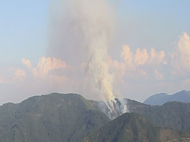
Green Top Mountain: 5 miles northeast of Eagle Point. Estimated at 125 acres. Roughly 90% of the perimeter control line is complete, 5% contained. There was a roughly 4 acre spot fire this morning that has already been knocked down and brought back into the main body of the fire. Ground and aerial resources
are engaged. No structures are threatened.
Sterling Creek: 7 miles south of Jacksonville. Estimated at 100 acres. Roughly 55% of the perimeter control line is complete. Ground and aerial resources engaged. Level 3 “Go!” evacuations are in place impacting the even number addresses only off the 7400-9400 blocks of Sterling Creek Road. Rogue Valley structural units
are working on home protection and defense.
Wagner Creek Area: Highly visible off I-5. Please contact U.S. Forest Service, Rogue River-Siskiyou National Forest for additional details as it is burning on federal land; ODF is not engaged.
Trail Creek & Elk Creek Drainage: Multiple fires are burning in the area surrounding Cleveland Ridge, Elk Creek, and the Trail Creek area which is roughly 5.5 miles north to northwest of Shady Cove. The largest fire in this area is estimated at 10 acres. Ground and aerial resources are engaged. No structures are threatened.
There are several other fires in Jackson and Josephine Counties that we are working diligently to knock down and contain. Our air attack platform will be performing reconnaissance flights the entire day. Please know that all other ODF fires are an acre or less at this time, and are posing no threat to our communities.
July 15, 2018
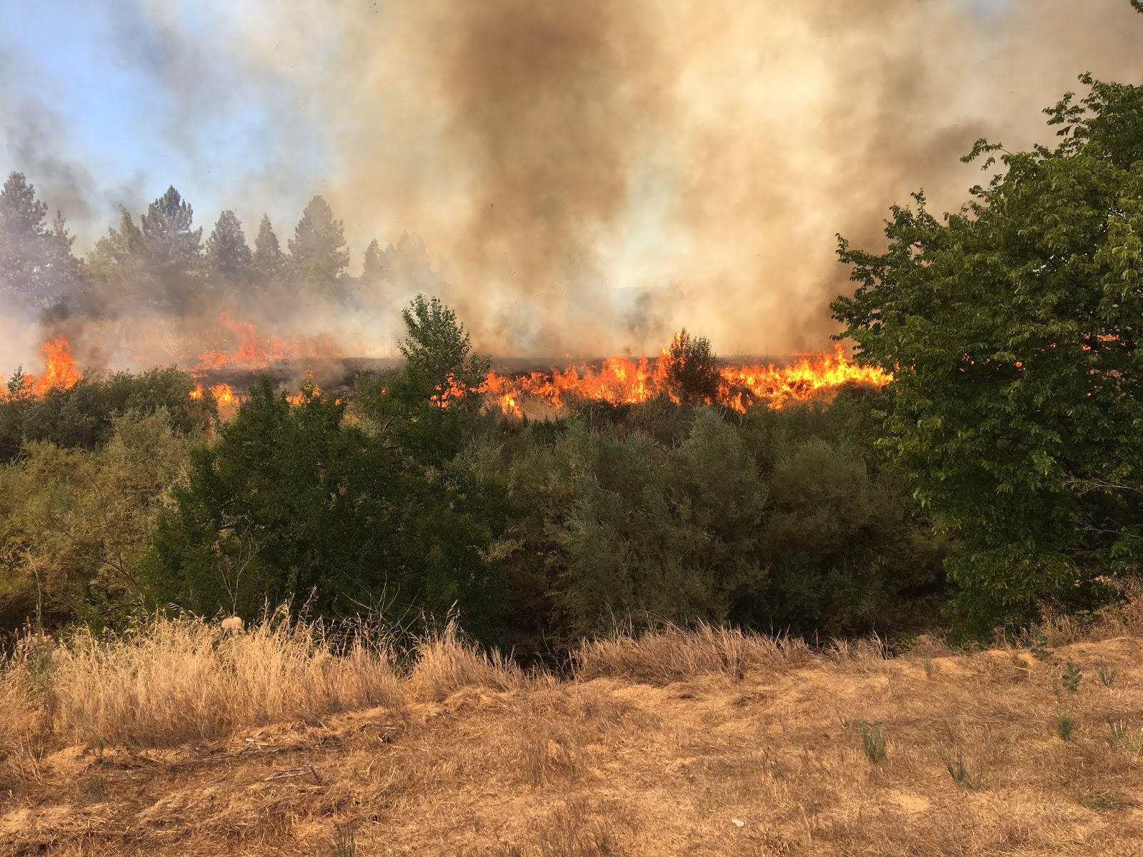
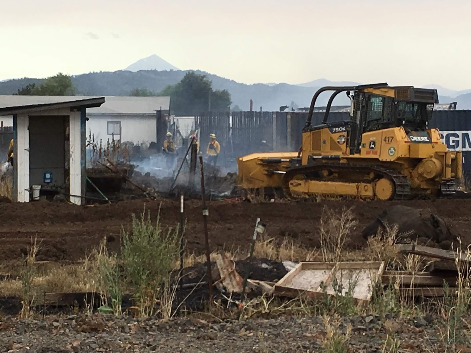
ODF Southwest Oregon District crews started rolling before 9:00 a.m. today on more than two dozen lightning-caused fires. Most of the fires have been contained at less than 1/10th of an acre. The largest fire is a 30-acre blaze on Green Top Mountain, approximately 5 miles northeast of Eagle Point. Crews, bulldozers, helicopters and air tankers have been ordered to fight that fire.
This morning’s lightning storms hit many parts of Jackson County, starting small fires in the following areas: Anderson Butte, Wagner Butte, Hells Peak, Kane Creek, Hyatt Prairie, Burnt Peak, Sterling Creek Road, Cleveland Ridge and several other areas.
Dispatchers expect to have more smokes reported this afternoon. Mountain-top cameras and aircraft are watching for fires across the Siskiyou Mountains in Jackson and Josephine counties, as well as the west slope of the Cascade Range.
[ Update 4:10 p.m. ]
More than a dozen lightning-caused fires have also been discovered in Josephine County by ODF’s Grants Pass Unit crews. The largest fire is approximately 5 acres on Little Grayback Peak, east of Cave Junction.
In Jackson County on ODF’s Medford Unit, crews and aircraft are working on the Sterling Creek Fire, approximately 15 acres and the Hells Peak Fire, approximately 10 acres. The largest fire on the district, Green Top, continues to grow and is estimated at 45 acres. Air Tanker 62 and other aircraft have been ordered to drop retardant and water on this fire.
July 10, 2018
Yesterday, was the first of many challenging days we anticipate on ODF Southwest Oregon District. While all of yesterday’s starts are still under investigation, they have all been deemed human-caused. Therefore, we are urging every member of our community to use extra caution when outdoors. It is going to take all of us working together to reduce the amount of wildfires this season.
In addition, the anticipated forecast for the end of this week is priming the District to enter into an Extreme (Red) Fire Danger Level. While there is no date set in stone currently, it is important for everyone to be aware of the upcoming changes and stay informed. If you are not already, please monitor are public
Facebook page for the most up-to-date information. We, at ODF Southwest, want to take every step necessary to keep you, your families, and our firefighters safe.
Here is a quick recap of what our firefighters across Jackson and Josephine counties faced yesterday:
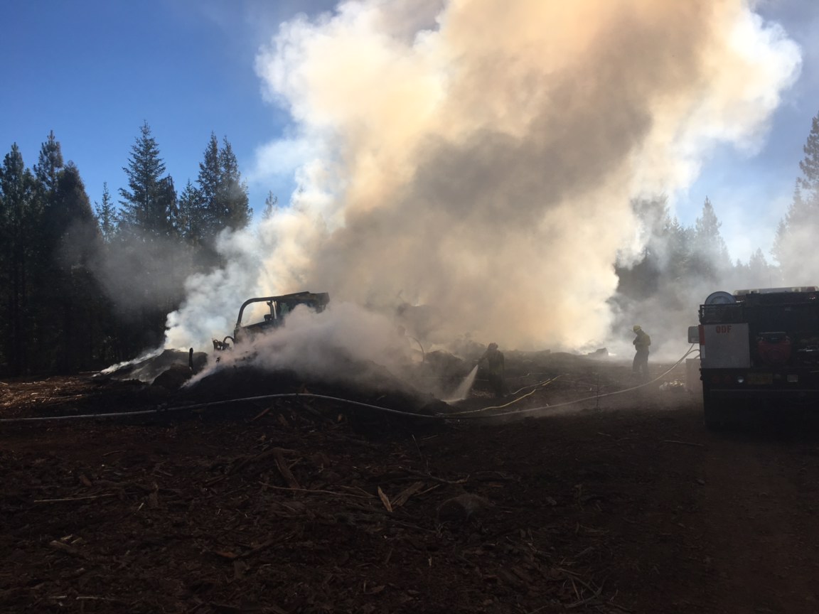
The Truck Road 399 Fire was discovered in the early morning hours July 9 near Butte Falls. Firefighters were able to knock down the fire at roughly a 0.5 acre; however, the heavy timber made mop up a lengthy process. This kept crews tied to the fire for several hours.
Later that morning, firefighters were able to make another amazing catch. The Beacon Hill Fire near I-5 milepost 55 was called in around 10:30 a.m. ODF Southwest and several mutual aid resources were able to make a quick stop on this 0.37 acre fire a mere 20 minutes later. This is a testament of our coordinated firefighting system we have throughout Jackson and Josephine Counties.
Just after 1:00 p.m., ODF Southwest assisted our partners, U.S. Forest Service Rogue River-Siskiyou National Forest, on a fire up near Butcherknife Creek NE of Selma. Although the terrain proved to be difficult, the teamwork thrived. The fire was wrapped up at approximately 10 acres.
By the afternoon, the Red Flag Warning issued by our local National Weather Service came to fruition on the fire line. Another report of a grass fire came in just after 4:30 p.m. roughly seven miles west of Grants Pass. The gusty winds and dry conditions posed a challenge to the several firefighters on the ground from ODF Southwest, Rural Metro Fire, and Grants Pass Fire. However, the collaboration of firefighting efforts on the ground and in the air paid off. The final fire size of the Riverbanks Road Fire is 7.9 acres.
In addition to these fires, we also provided mutual aid to several of our partner agencies including Medford Fire-Rescue (Chevy Way Fire – pictured below) and Illinois Valley Fire District (Redwood Highway Fire – details @IVFD), and other smaller incidents.
Thank you, as always, to our outstanding partners and their diligent work to keep our communities safe this Fire Season.
July 6, 2018
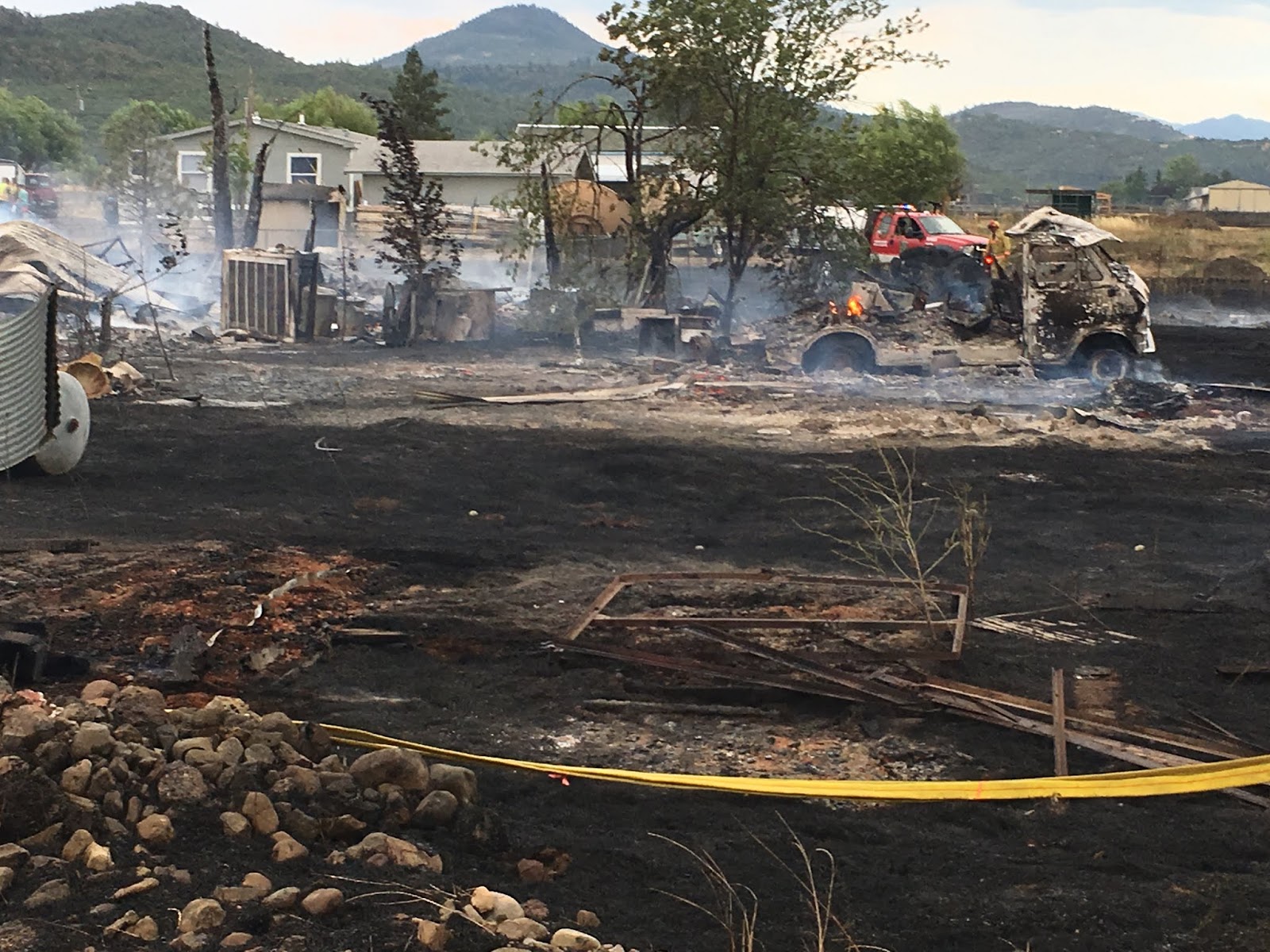
Crews have completed a fire line around the Atlantic Avenue Fire in White City, halting the potential for further spread in the area. A more accurate measurement of the fire was released this morning putting it at 115 acres. Crews from both Fire District 3 and the Oregon Department of Forestry Southwest Oregon District will continue working on the interior mop up of the fire today.
 Firefighters conducted a damage assessment late last night once the fire activity settled down. Multiple vehicles including two RVs, one bus, and six boats; four outbuildings; and one vacant residential structure have been deemed a total loss. There have been no public, firefighter, or animal/pet injuries reported. Crews will continue working with the community in the upcoming days to assess any further damage on personal properties.
 After a thorough investigation by Fire District 3, ODF Southwest, and Jackson County Sheriff’s Office, a 14-year-old girl lighting fireworks was found to be the cause of the fire. Deputies will refer the case to the Jackson County District Attorney’s Office for adjudication.
The Atlantic Avenue Fire was first reported just after 4 p.m. Thursday, July 5. The wind-driven fire grew rapidly reaching 100 acres within an hour of ignition. In addition to ODF Southwest and Fire District 3 engines, one of our Rogue Valley Structural Strike Teams was activated bringing additional assistance from Medford Fire-Rescue, Jackson County Fire District 5, Illinois Valley Fire District, Applegate Valley Fire District, and Lake Creek Rural. Highway 140 and Kershaw Road, along with private, residential roadways were temporarily closed for fire traffic and public safety by our law enforcement partners including Oregon State Police, Jackson County Sheriff’s Office, Medford Police, and Eagle Point Police. By 8:30 p.m., a majority of the fire’s spread was stopped, and all lanes of traffic were reopened. Firefighters worked overnight to complete the perimeter fire line and begin mop up operations.
 We are continuously thankful for our partnerships with our city, county, private and state agencies throughout our region, not to mention the countless community members willing to help their neighbors. Yesterday’s conditions were ripe for a wildfire that could have spread to even greater lengths. Due to the speedy and superb partnership, this fire was deemed “controlled” by nightfall.
 We would like to remind everyone that the fire danger level on Oregon Department of Forestry protected lands in Jackson and Josephine counties will remain at “high” (yellow) for the time being. This means that our shut down time for several power-driven tools is from 10:00 a.m. to 8:00 p.m. Please do your part to eliminate any activities that may produce a spark within our community. For a full list of the public fire restrictions currently in place, visit the ODF Southwest Facebook page, or www.swofire.com. For additional fire information within the Fire District 3 coverage area, please visit the Fire District 3 Facebook page.
 ###
July 5, 2018
Increased fire danger on forestlands protected by the Oregon Department of Forestry’s Southwest Oregon District has made it necessary to increase the fire prevention measures on industrial operations, such as logging sites and other commercial operations. The industrial fire restrictions are separate from the general public. For the public, the “high” (yellow) fire danger level remains in place which was put into effect on July 3.
Industrial Fire Precaution Level II (two) takes effect at 12:01 a.m. on Saturday, July 7. This is considered a limited shutdown which includes the following restrictions:
· The use of fire in any form will be prohibited.
· The use of power saws will be prohibited, except at loading sites, between 1:00 p.m. and 8:00 p.m.
· The use of a feller-buncher with rotary head saws will be prohibited between 1:00 p.m. and 8:00 p.m.
· The use of cable yarders will be prohibited between 1:00 p.m. and 8:00 p.m.
· Blasting will be prohibited between 1:00 p.m. and 8:00 p.m.
· Welding, grinding or cutting of metal will be prohibited between 1:00 p.m. and 8:00 p.m.
Additionally, commercial operators on forestlands are required to have fire suppression equipment on site and provide watchman service.
These regulations affect all state, county, private and Bureau of Land Management lands in Jackson and Josephine counties. The regulated use zones affected by this proclamation include SW-1, SW-2, SW-3, SW-4, SK-3, RR-1, RR-2 and RR-3, and all forestland within one-eighth of a mile of these zones.
For more information about the Oregon Department of Forestry’s fire season public and industrial restrictions, please call or visit the Southwest Oregon District unit office nearest to you:
· Medford Unit, 5286 Table Rock Rd., Central Point. (541) 664-3328
· Grants Pass Unit, 5375 Monument Dr., Grants Pass. (541) 474-3152
Fire season information is also available online at our Facebook page: @ODFSouthwest and our website: www.swofire.com.
July 2, 2018
The fire danger level on Oregon Department of Forestry-protected lands in Jackson and Josephine counties will increase to “high” (yellow) tomorrow, July 3, 2018 at 12:01 a.m. The Industrial Fire Precaution Level will remain at level 1 (one).
These restrictions impact 1.8 million acres of state, private, county, city and Bureau of Land Management lands protected by ODF’s Southwest Oregon District.
Restrictions on the public use of chain saws, brush cutters and other power-driven or spark-emitting machinery will be the biggest change, with a mandatory shutdown time between 10:00 a.m. – 8:00 p.m.
The following fire prevention restrictions that will go into effect tomorrow, until further notice, are the following:
· No debris burning, including piles and debris burned in burn barrels;
· No fireworks on forestlands;
· Exploding targets and tracer ammunition, or any bullet with a pyrotechnic charge in its base, are prohibited.
· Smoking while traveling will only be allowed in enclosed vehicles on improved roads, in boats on the water and other specifically designated locations;
· Open fires are prohibited which includes campfires, charcoal fires, cooking fires and warming fires, except at locations deemed a designated campground. Portable cooking stoves using liquefied or bottled fuels are still allowed;
· Chain saws may not be used between 10:00 a.m. and 8:00 p.m. during high fire danger. During hours outside of this time frame, chain saws may be used but require that the operator have one shovel and one 8-oz or larger fire extinguisher at the work site. A fire watch is also required for one hour after each chainsaw use;
· Cutting, grinding and welding of metal is not allowed between 10:00 a.m. and 8:00 p.m. during high fire danger.These activities will be allowed during hours outside
of this time frame only if the work site is cleared of potentially flammable vegetation and other materials, and a water supply is at the job site;
· The mowing of dead or dried grass with power-driven equipment is not allowed between 10:00 a.m. and 8:00 p.m. during high fire danger. This restriction does not include mowing of green lawns, or equipment used for the commercial culture and harvest of agricultural crops;
· Motorized vehicles, including motorcycles and all-terrain vehicles, will be allowed only on improved roads free of flammable vegetation. One shovel and one gallon of water, or one 2.5 pound or larger fire extinguisher, is required while traveling.
· Any other spark-emitting internal combustion engine use not specifically mentioned is not allowed between 10:00 a.m. and 8:00 p.m. during high fire danger. Use of any spark-emitting internal combustion engine is allowed outside of this time frame only if the work site is cleared of potentially flammable vegetation and other materials, and a water supply is at the job site;
· Any electric fence controllers must be approved by a nationally recognized testing laboratory, such as Underwriters Laboratories Inc., or be certified by the Department of Consumer and Business Services, and be installed and used in compliance with the fence controller’s instructions for fire safe operation.
For more information about the Oregon Department of Forestry’s fire season public restrictions, please call or visit the Southwest Oregon District unit office nearest to you:
· Medford Unit, 5286 Table Rock Rd., Central Point. (541) 664-3328
· Grants Pass Unit, 5375 Monument Dr., Grants Pass. (541) 474-3152
Fire season information is also available online at our Facebook page: @ODFSouthwest and our website: www.swofire.com.
###
June 21, 2018
The fire danger level on Oregon Department of Forestry protected lands in Jackson and Josephine counties will increase to “moderate” (blue) on Saturday, June 23 at 12:01 a.m. Please be aware that this level change means that additional fire restrictions for the public will be in effect. The Industrial Fire Precaution Level will remain at Level I (one).
These regulations impact 1.8 million acres of state, private, county, city and Bureau of Land Management lands protected by ODF’s Southwest Oregon District.
Public fire restrictions currently in effect, which will remain in effect, include:
· No debris burning, including piles and debris burned in burn barrels;
· No fireworks on forestlands;
· Exploding targets and tracer ammunition, or any bullet with a pyrotechnic charge in its base, are prohibited.
Beginning Saturday at 12:01 a.m., the following public fire restrictions will take effect:
· Smoking while traveling will only be allowed in enclosed vehicles on improved roads, in boats on the water and other specifically designated locations;
· Open fires are prohibited which includes campfires, charcoal fires, cooking fires and warming fires, except at locations deemed a designated campground. Portable cooking stoves using liquefied or bottled fuels are still allowed;
· Chain saws may not be used between 1:00 p.m. and 8:00 p.m. during moderate fire danger. During hours outside of this time frame, chain saws may be used but require that the operator have one shovel and one 8-oz or larger fire extinguisher at the work site. A fire watch is also required for one hour after each chainsaw use;
· Cutting, grinding and welding of metal is not allowed between 1:00 p.m. and 8:00 p.m. during moderate fire danger. These activities will be allowed during hours outside of this time frame only if the work site is cleared of potentially flammable vegetation and other materials, and a water supply is at the job site;
· The mowing of dead or dried grasswith power-driven equipment is not allowed between 1:00 p.m. and 8:00 p.m. during moderate fire danger.
This restriction does not include mowing of green lawns, or equipment used for the commercial culture and harvest of agricultural crops;
· Motorized vehicles, including motorcycles and all-terrain vehicles, will be allowed only on improved roads free of flammable vegetation. One shovel and one gallon of water, or one 2.5 pound or larger fire extinguisher, is required while traveling.
· Possession of the following firefighting equipment is required while traveling, except on state highways, county roads and driveways: one shovel and one gallon of water or one 2½ pound or larger fire extinguisher. As noted above, all-terrain vehicles and motorcycles must be equipped with one 2½ pound or larger fire extinguisher.
· Any other spark-emitting internal combustion engine use not specifically mentioned is not allowed between 1:00 p.m. and 8:00 p.m. during moderate fire danger. Use of any spark-emitting internal combustion engine is allowed outside of this time frame only if the work site is cleared of potentially flammable vegetation and other materials, and a water supply is at the job site;
· Any electric fence controllers must be approved by a nationally recognized testing laboratory, such as Underwriters Laboratories Inc., or be certified by the Department of Consumer and Business Services, and be installed and used in compliance with the fence controller’s instructions for fire safe operation.
For more information about the Oregon Department of Forestry Southwest Oregon District’s fire season public restrictions, please call or visit the Southwest Oregon District unit office nearest to you:
· Medford Unit, 5286 Table Rock Rd., Central Point. (541) 664-3328
· Grants Pass Unit, 5375 Monument Dr., Grants Pass. (541) 474-3152
Fire season information is also available online at our Facebook page: @ODFSouthwest and our website: www.swofire.com.
###
June 4, 2018
A report of smoke was called into our
ODF Southwest Medford headquarters yesterday afternoon around 1:30 p.m. When our first dispatched engine arrived to the area, it was confirmed to be a wildfire.
The
#AbbottPrairieFire was first estimated to be 5-10 acres, burning in a combination of light and heavy fuels roughly ten miles north of Lost Creek Lake. Seven engines, a water tender, and dozer from ODF, as well as a hand crew from the
U.S. Forest Service- Rogue River-Siskiyou National Forest battled the wind-driven fire. By 6:00 p.m., it was 100 percent lined at a final fire size of 12.5 acres. The cause of the fire is under investigation.
The footprint of the fire will continue to be mopped up today and tomorrow. Smoke may be present during mop up operations.
As always, if you see smoke in your area, or suspect that someone may be illegally burning, please do not hesitate to call 9-1-1 or our Medford and Grants Pass unit offices at (541) 664-3328 and (541) 474-3152.
May 24, 2018
Fire season begins Friday, June 1, at 12:01 a.m. on lands protected by the Oregon Department of Forestry’s Southwest Oregon District. Lands affected by this declaration include state, private, county, city, and Bureau of Land Management (BLM) forestlands in Jackson and Josephine counties.
“Rainfall across southwest Oregon is below average, and the above normal temperatures this May are causing our grasses to cure rapidly in the lower elevations,” said Dave Larson, Southwest Oregon District Forester, “In order to help curb the number of human-caused fires, especially escaped backyard debris burns, the conditions are ripe to declare fire season.”
The fire danger level for the public will be “low” (green) and the Industrial Fire Precaution Level will be I (one).
This means beginning June 1, the following public restrictions will be taking effect on ODF-protected lands in Jackson and Josephine counties:
o No burning of debris piles, or burning debris in burn barrels
o No fireworks
o No tracer ammunition
o No exploding targets
Last year, fire season started on June 4 and ended October 20 lasting a total of 138 days. A total of 350 fires blackened just over 1,000 acres. According to the 10-year average of fires on the District, 230 fires may burn more than 5,600 acres during fire season. Therefore, last year was quite successful for the District. We will continue to keep a safe, yet aggressive initial attack as one of our top priorities entering this season.
Under Industrial Fire Precaution Level I on ODF-protected lands, commercial operations, such as timber harvesting conducted on forestlands, will be required to have fire suppression equipment on the job site at all times. A Firewatch must also be provided.
For additional information about the Oregon Department of Forestry’s fire season regulations, please call or visit the Southwest Oregon District unit office nearest to you:
Medford Unit, 5286 Table Rock Rd., Central Point. (541) 664-3328
Grants Pass Unit, 5375 Monument Dr., Grants Pass. (541) 474-3152
###
October 20, 2017
After 138 days of being ramped up and ready to fight wildland fires, the 2017 fire season ends today, Friday, October 20, at 9:00 a.m. on lands protected by the Oregon Department of Forestry’s Southwest Oregon District. Lands affected by this declaration include state, private, county, city, and Bureau of Land Management forestlands in Jackson and Josephine counties.
 Fire season proved to be particularly challenging throughout the District due to the abundance of abutted lightning storms. The preliminary totals for the season show ODF firefighters tackling 335 wildland fires totaling roughly 930 acres. Of those fires, 127 are directly linked to lightning. This total fire count does not even include the number of alarms firefighters responded to related to fire restriction violations, assisting our local partners, and smoke chases throughout Jackson and Josephine Counties. Overall, 97 percent of all ODF Southwest fires were held at ten acres or less. We accredit this not only to our aggressive initial attack and well-trained team, but our countless partners throughout our region that have helped to make this season a success.
The termination of fire season removes fire prevention regulations on equipment use and the use of fire for debris burning. This applies to the public and industrial operations on forestlands. However, many structural fire agencies require permits for debris burning; please check with your local fire department to obtain any necessary permits before burning.
This is a great reminder; while fire season is over; fire prevention must continue. Please be vigilant while burning debris making sure that a burn pile is never left unattended. Also, please use caution while using machinery that could produce a spark. While there is precipitation throughout our region today, fall weather in southern Oregon varies greatly. Regardless, we are here to help.
Fire prevention tips and additional information is available online at www.swofire.com, our Facebook page: @ODFSouthwest, or you can call/visit the Southwest Oregon District office nearest to you:
· Medford Unit, 5286 Table Rock Rd., Central Point. (541) 664-3328
· Grants Pass Unit, 5375 Monument Dr., Grants Pass. (541) 474-3152
###
October 5, 2017
Firefighters halted the Little Applegate Fire at 9.5 acres around 1:30 p.m. today. The initial report came in just after 12:30 p.m. with an estimated size of one-acre. Within minutes, the fire began spreading and spotting upslope near two homes off the intersection of Upper Applegate and Little Applegate Roads near the Applegate. While the two homes were initially threatened by the fire, no homes were lost or damaged by this incident; however, an outbuilding has been deemed a total loss.
There are still several firefighters on site investigating the cause of the fire, as well as mopping up hot spots along the hillside. At this time, the fire is 100 percent lined and 40 percent mopped up. Please use caution when driving through this area for the remainder of the afternoon as fire traffic will still be present.
Crews from the Oregon Department of Forestry’s Southwest Oregon District, Applegate Valley Fire District, Jacksonville Fire, U.S. Forest Service Rogue River-Siskiyou National Forest, and the Rogue Valley 2 Strike Team assisted in the suppression of this fire. A special thanks to the Forest Service for lending their two Type 2 helicopters that were on-hand at the Miller Complex. As always, we would like to thank our partners for the continued quick and efficient responses to wildfires throughout our region. For video of our firefighting efforts in action, visit our Facebook page: @ODFSouthwest.
This is a great reminder; fire season is not over yet. Please know the fire restrictions in your area before recreating outdoors this weekend. For additional information about the Oregon Department of Forestry, please visit us at www.swofire.com or call/visit the Southwest Oregon District office nearest to you:
· Medford Unit, 5286 Table Rock Rd., Central Point. (541) 664-3328
· Grants Pass Unit, 5375 Monument Dr., Grants Pass. (541) 474-3152
###
September 29, 2017
Continued cool temperatures, precipitation and overnight relative humidity recoveries have prompted the Oregon Department of Forestry’s Southwest Oregon District to drop the public fire danger level to “Low” (green) and the Industrial Fire Precaution Level (IFPL) to I (one) tomorrow, Saturday, September 30, 2017 at 12:01 a.m.
Some of the public restriction changes include allowing ‘all-day use’ of power saws, and equipment for mowing dry, dead grass.
These regulations affect 1.8 million acres of state, private, county, city and Bureau of Land Management lands protected by ODF’s Southwest Oregon District.
Precipitation has lent a helping hand in reducing the chance for difficult wildfires; however, the uncertainty of consistent rainfall could still pose a risk. Fire managers will reevaluate the upcoming conditions after the weekend in order to determine if fire season can be terminated soon.
As a reminder, public fire restrictions which will remain in effect, include:
· No debris burning, including piles and debris burned in burn barrels.
· No fireworks on forestlands.
· Exploding targets and tracer ammunition, or any bullet with a pyrotechnic charge in its base, are prohibited.
· Campfires are allowed only in designated campgrounds. Portable stoves using liquefied or bottled fuels may be used in other locations.
· Motorized vehicles are allowed only on improved roads; one shovel and one gallon of water, or one 2.5 pound or larger fire extinguisher, is required while traveling.
· Smoking while traveling will only be allowed in enclosed vehicles on improved roads, in boats on the water and other specifically designated locations.
· Any electric fence controllers must be approved by a nationally recognized testing laboratory, such as Underwriters Laboratories Inc., or be certified by the Department of Consumer and Business Services, and be installed and used in compliance with the fence controller’s instructions for fire safe operation.
Under IFPL I (One) – fire season requirements are in effect. In addition to the following:
· A Firewatch is required at this and all higher levels unless otherwise waived.
For more information about the Oregon Department of Forestry’s fire season public restrictions, please call or visit the Southwest Oregon District unit office nearest to you:
Medford Unit, 5286 Table Rock Rd., Central Point. (541) 664-3328
Grants Pass Unit, 5375 Monument Dr., Grants Pass. (541) 474-3152
Fire season information is also available online at our Facebook page: @ODFSouthwest and our website: www.swofire.com.
###
September 18, 2017
The recent rain and cooler temperatures have made it possible to decrease fire restrictions across southwest Oregon. Effective immediately, the fire danger level on Oregon Department of Forestry protected lands in Jackson and Josephine counties will lower to “moderate” (blue). In addition, fire prevention measures for logging, non-logging industrial operations, and all other commercial operations will lessen. Industrial Fire Precaution Level II (two) takes effect today.
These regulations affect 1.8 million acres of state, private, county, city and Bureau of Land Management lands protected by ODF’s Southwest Oregon District.
As a reminder, public fire restrictions which will remain in effect, include:
· No debris burning, including piles and debris burned in burn barrels.
· No fireworks on forestlands.
· Exploding targets and tracer ammunition, or any bullet with a pyrotechnic charge in its base, are prohibited.
· Campfires are allowed only in designated campgrounds. Portable stoves using liquefied or bottled fuels may be used in other locations.
· Motorized vehicles are allowed only on improved roads; one shovel and one gallon of water, or one 2.5 pound or larger fire extinguisher, is required while traveling.
· Smoking while traveling will only be allowed in enclosed vehicles on improved roads, in boats on the water and other specifically designated locations.
· Chain saws may not be used between 1:00 p.m. and 8:00 p.m. during moderate fire danger. During hours outside of this time frame, chain saws may be used but require that the operator have one shovel and one 8-oz or larger fire extinguisher at the work site. A fire watch is also required for one hour after each chainsaw use.
· Cutting, grinding, and welding of metal is not allowed between 1:00 p.m. and 8:00 p.m. during moderate fire danger. These activities will be allowed during hours outside of this time frame only if the work site is cleared of potentially flammable vegetation and other materials, and a water supply is at the job site.
· The mowing of dead or dried grass with power-driven equipment is not allowed between 1:00 p.m. and 8:00 p.m. during moderate fire danger. This restriction does not include mowing of green lawns, or equipment used for the commercial culture and harvest of agricultural crops.
· Any other spark-emitting internal combustion engine-use not specifically mentioned is not allowed between 1:00 p.m. and 8:00 p.m. during moderate fire danger. Use of any spark-emitting internal combustion engine is allowed outside of this time frame only if the work site is cleared of potentially flammable vegetation and other materials, and a water supply is at the job site.
· Any electric fence controllers must be approved by a nationally recognized testing laboratory, such as Underwriters Laboratories Inc., or be certified by the Department of Consumer and Business Services, and be installed and used in compliance with the fence controller’s instructions for fire safe operation.
Under IFPL II (Two) – limited shutdown, which is entirely separate from all public fire restrictions, the following may operate after 8 p.m. and up until 1 p.m. daily:
· Power saws, except at loading sites.
· Feller-bunchers with rotary head saws.
· Cable yarding.
· Blasting.
· Welding, cutting, or grinding of metal.
For more information about the Oregon Department of Forestry’s fire season public restrictions, please call or visit the Southwest Oregon District unit office nearest to you:
Medford Unit, 5286 Table Rock Rd., Central Point. (541) 664-3328
Grants Pass Unit, 5375 Monument Dr., Grants Pass. (541) 474-3152
Fire season information is also available online at our Facebook page: @ODFSouthwest and our website: www.swofire.com.
###