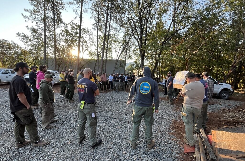
July 24, 2025
GRANTS PASS, Ore. (July 24, 2025) – The 469-acre Board Shanty Fire, south of Grants Pass, continues to be mopped up by firefighters around the clock. Resources on both Wednesday’s day and overnight shifts pushed forward on progress, bringing containment up to 37% by Thursday morning.
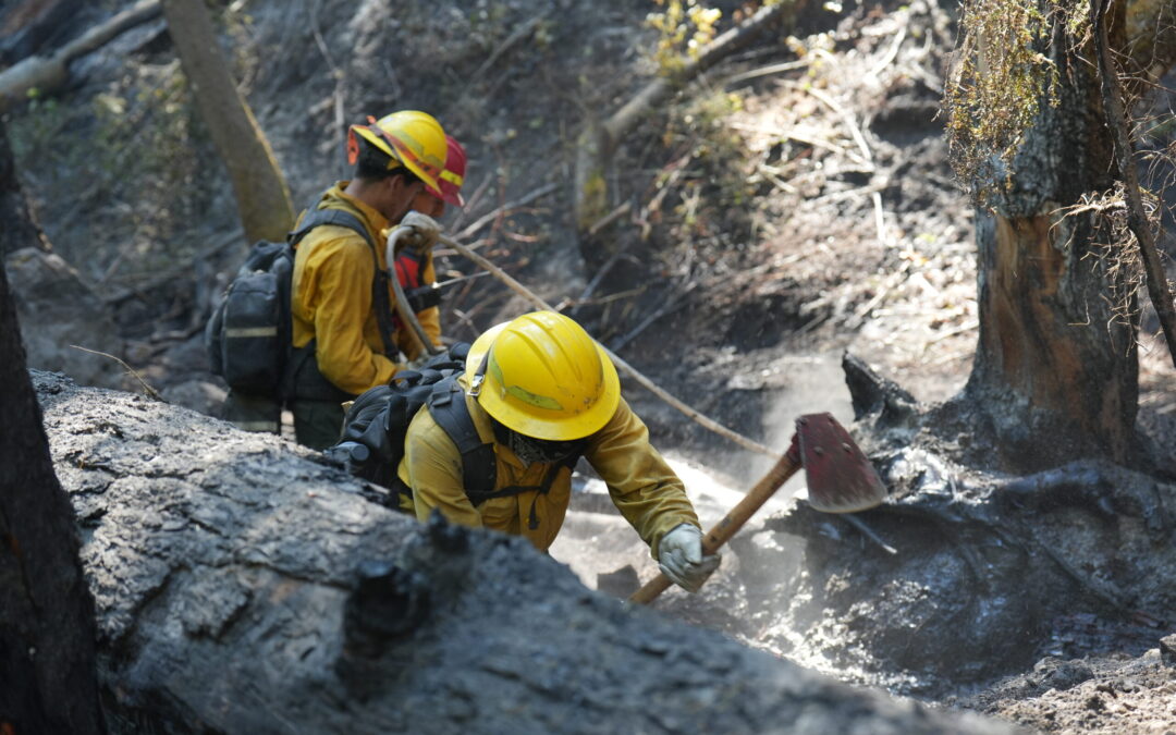
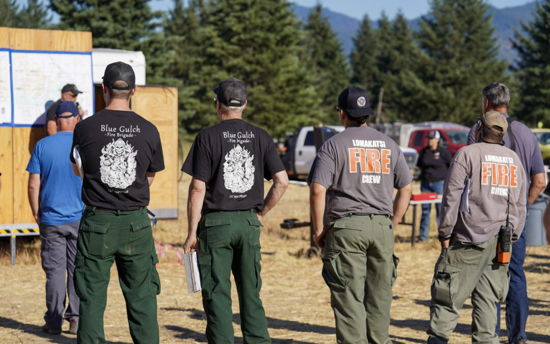
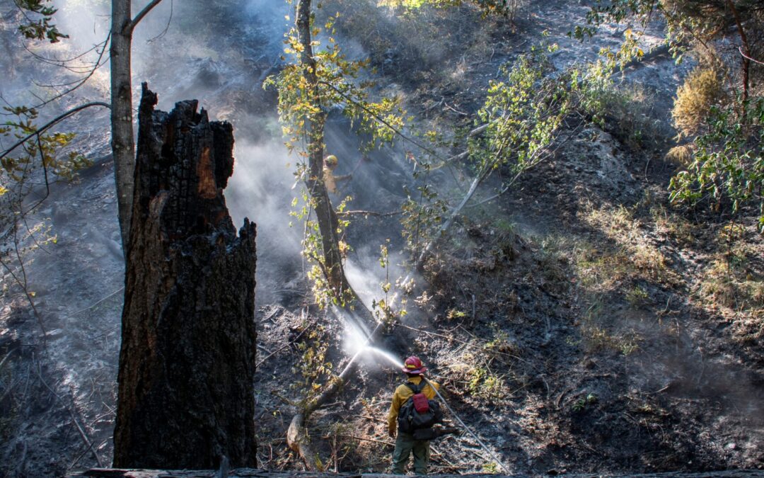
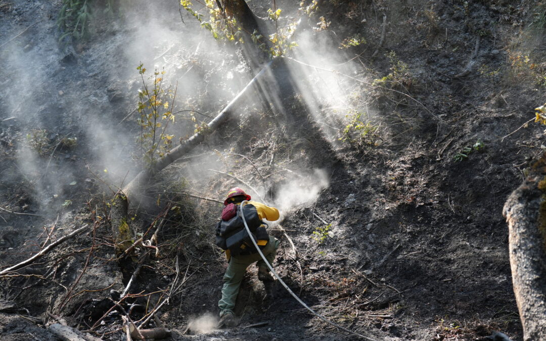
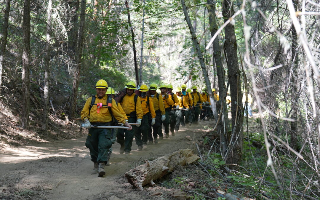
Today, firefighters will continue this work, with 204 personnel assigned to Thursday’s day shift, including eight 20-person crews, two engines, five water tenders, a set of fallers and various overhead. Resources will spend the day searching for hotspots, or areas with remaining heat or embers that could flare up again in hot conditions and reignite the fire. By methodically extinguishing these areas, the overall line built around the fire is strengthened and containment increases. In most areas, the fire has been mopped up 200 feet from the line into the interior of the fire; these areas will continue to be checked, and further progress into the fire continues to be a goal. Tonight, 105 personnel will be assigned to the fire to continue mopping up. This includes four 20-person crews, two engines, two water tenders and overhead.
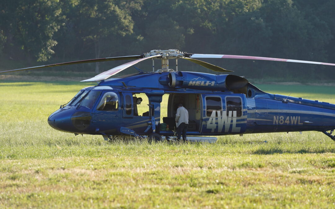
Aircraft is available today if needed, however the majority of the work remaining must be done by firefighters on the ground. A Temporary Flight Restriction (TFR) is in place over the fire area to create a safe airspace for fire-related aircraft when needed. As a reminder, flying drones over or near a fire is illegal and incredibly dangerous to aircraft working the fire and the firefighters on the ground below. All drone use will be reported to law enforcement.
The Josephine County Sheriff’s Office and Emergency Management have issued a Level 1 – Be Ready evacuation notice for Zones JCU-436, JCU-437 and JCU-448-A. For the latest updates on evacuations, visit: https://protect.genasys.com.
Help prevent new human-caused fires from sparking by following all regulations currently in place:
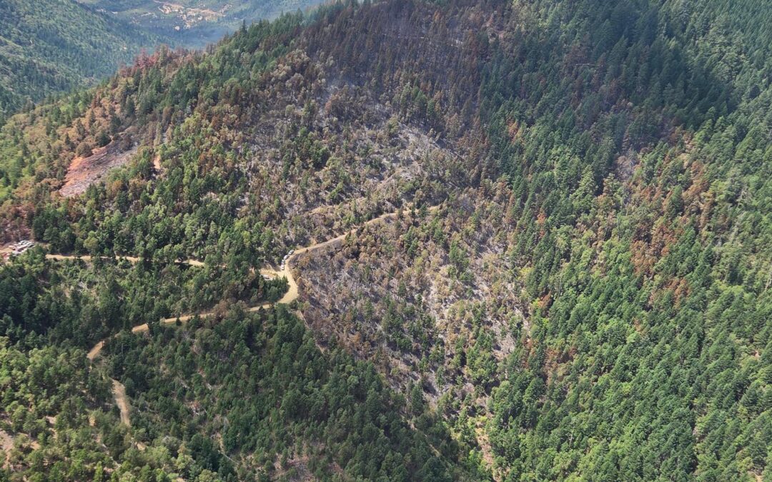
July 23, 2025
GRANTS PASS, Ore. (July 23, 2025) – Firefighters continued to mop up the Board Shanty Fire overnight, located south of Grants Pass, making steady progress bolstering lines and extinguishing hot spots. Resources are holding the fire within its perimeter lines at 469 acres and have not seen any growth or threat to the lines. Currently, firefighters have mopped up 200-feet from the line into the interior of the fire, bringing containment up to 30% this morning. A local Type 3 team is now managing the fire, transferred over from the Oregon Department of Forestry (ODF) Complex Incident Management Team 3 (CIMT 3).
“ODF CIMT 3 made fast work on this fire, and got us to a solid place in mop-up,” said Incident Commander Jake Kurzyniec. “We’re going to continue to push forward on that progress and extinguish it as quickly and safely as possible.”
Today, 204 personnel are assigned to the fire, including eight 20-person crews, two engines, five water tenders, a set of tree fallers and various overhead. Aircraft are also available if needed, and a reconnaissance flight is planned for 2 p.m. to survey the fire. All resources will continue with mop-up operations today with a goal of furthering these efforts an additional 50-feet into the fire’s interior on all sides. Safety remains a top priority for firefighters, as steep slopes, hazardous trees and rolling debris continue to pose risks and challenges.
The Josephine County Sheriff’s Office and Emergency Management have issued a Level 1 – Be Ready evacuation notice for Zones JCU-436, JCU-437 and JCU-448-A. For the latest updates on evacuations, visit: https://protect.genasys.com.
Help prevent new human-caused fires from sparking by following all regulations currently in place:
For fire information anytime, visit our Facebook page, @ODFSouthwest or our website, www.swofire.com.

July 22, 2025
GRANTS PASS, Ore. (July 22, 2025)—Firefighters working the 469-acre Board Shanty Fire, south of Grants Pass, pushed containment to 20% and cooled the perimeter 200-feet into the incident from the fire’s edge. Today, crews will continue mop-up operations along all sides of the fire as they push deeper into the interior and cool hot spots.
This morning, members from a local ODF type-three incident management team will shadow Oregon Department of Forestry’s (ODF) Complex Incident Management Team 3 (CIMT-3) and take command of the incident tomorrow.
“The Grants Pass community is in great hands with the incoming ODF incident management team,” said Deputy Incident Commander Eric Perkins. “We work closely with these folks every summer. They know the terrain and the community, and there isn’t a better team to take over this fire.”
Firefighters continue to push further towards the interior of the fire, bolstering the strength of the lines. Today, crews will extinguish hotspots identified and flagged by nightshift crews using handheld infrared cameras to detect heat.
“We’re really thankful for all the hard work that ODF Team 3 put into this fire to protect the community and keep it as small as possible,” said Jake Kurzyniec, Incident Commander of the incoming ODF IMT. “We’re in a good place to wrap this up quickly.”
While mop up continues, there still may be visible smoke from burning material on the interior of the fire. Perimeter lines are secure, and crews remain vigilant watching for burning rolling material on steep slopes.
Evacuations: Josephine County Zones JCU-436, JCU-437 and JCU-448-A are now under a Level 1- BE READY. The Jackson County Sheriff’s Office and Emergency Management have removed all evacuation notices. For the latest updates on evacuations, visit: https://protect.genasys.com.
Aviation assets assigned to the nearby Grizzly Complex will remain on station for initial attack. As a reminder, drone use near fires is both illegal and extremely dangerous to pilots working on incidents. If you fly, we can’t. All illegal drone use will be reported to law enforcement.
Resources from ODF Southwest Oregon District, Grants Pass Fire, Rural Metro Fire, Rogue Valley fire agencies and ODF CIMT 3 responded to the Board Shanty Fire Thursday, July 17. ODF CIMT 3 took command of the fire on July 18. For more fire information, visit the district’s Facebook page, @ODFSouthwest or www.swofire.com.
ODF fire regulations: https://swofire.com/public-fire-restrictions/.
BLM fire regulations: https://www.blm.gov/orwafire.
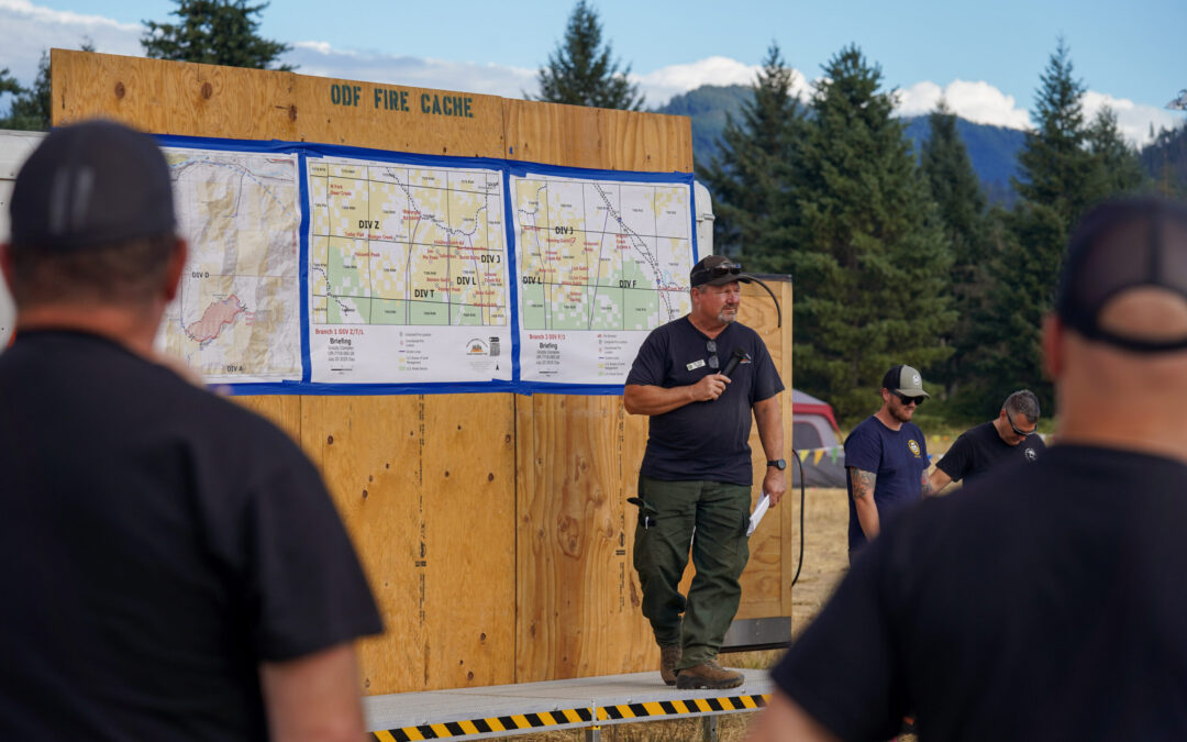
July 21, 2025
GRANTS PASS, Ore. (July 21, 2025)—Crews on the 469-acre Board Shanty Fire, south of Grants Pass, continue mop-up operations along all sides of the fire as they work to cool the perimeter with water until heat is removed. Containment remains at 14%.
Today, officials with Oregon Department of Forestry’s (ODF) Complex Incident Management Team 3 (CIMT-3) began to in brief members from a local, ODF type-three incident management team. Tomorrow, the new team will shadow ODF CIMT 3 and take command of the incident on the morning of Wednesday, July 23.
Today, crews mopped up 100 feet towards the interior of the fire around the entire fire line, and up to 200 feet in some areas. Work continues to push further towards the interior of the fire, bolstering the strength of the lines.
While mop up continues, there still may be visible smoke from burning material in the interior of the fire. Perimeter lines are secure, and crews remain vigilant watching for burning rolling material on steep slopes and spot fires.
Evacuations: Josephine County Zones JCU-436, JCU-437 and JCU-448-A are now under a Level 1- BE READY. The Jackson County Sheriff’s Office and Emergency Management have removed all evacuation notices. For the latest updates on evacuations, visit: https://protect.genasys.com.
Today, aviation assets helped extinguish hot spots within the fire and remain on station for initial attack. As a reminder, drone use near fires is both illegal and extremely dangerous to pilots working on incidents. If you fly, we can’t. All illegal drone use will be reported to law enforcement.
Resources from ODF Southwest Oregon District, Grants Pass Fire, Rural Metro Fire, Rogue Valley fire agencies and ODF CIMT 3 responded to the Board Shanty Fire Thursday, July 17. ODF CIMT 3 took command of the fire on Friday, July 18. For more fire information, visit the district’s Facebook page, @ODFSouthwest or www.swofire.com.
ODF fire regulations: https://swofire.com/public-fire-restrictions/.
BLM fire regulations: https://www.blm.gov/programs/public-safety-and-fire/fire-and-aviation/regional-info/oregon-washington/fire-restrictions.
This will be the last evening update unless conditions change significantly.
Morning updates will continue.
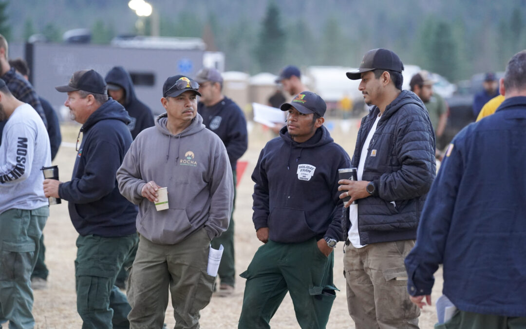
July 21, 2025
GRANTS PASS, Ore. (July 21, 2025)—Crews on the Board Shanty Fire, south of Grants Pass, continue mop-up operations along all sides of the fire as they work to cool the perimeter with water until heat is removed. Containment remains at 14% on the 469-acre fire.
Crews have mopped up towards the interior of the fire between 50-100 feet around the entire fire line, and up to 200 feet in some areas. Work continues to push further towards the interior of the fire, bolstering the strength of the lines built.
With the Board Shanty Fire 100% lined, and mop up progressing, the Josephine County Sheriff’s Office and Emergency Management announced reduced evacuation levels. Josephine County Zones JCU-436, JCU-437 and JCU-448-A are now under a Level 1- BE READY. The Jackson County Sheriff’s Office and Emergency Management have removed all evacuation notices. For the latest updates on evacuations, visit: https://protect.genasys.com.
“We’re glad to see progress on mop up to the point where evacuation levels are reduced,” said ODF CIMT3 Incident Commander Tyler McCarty. “Community and firefighter safety is always the first priority for our teams.”
While mop up continues, there still may be visible smoke from burning material on the interior of the fire. Perimeter lines are secure, and crews remain vigilant watching for burning rolling material on steep slopes.
Aviation assets are still available today to help extinguish hot spots within the fire and remain on station for initial attack. As a reminder, drone use near fires is both illegal and extremely dangerous to pilots working on incidents. If you fly, we can’t. All illegal drone use will be reported to law enforcement.
Resources from Oregon Department of Forestry’s (ODF) Southwest Oregon District, Grants Pass Fire, Rural Metro Fire, Rogue Valley fire agencies and ODF Complex Incident Management Team 3 (CIMT-3) responded to the Board Shanty Fire Thursday, July 17. ODF CIMT 3 took command of the fire on Friday, July 18. For more fire information, visit the district’s Facebook page, @ODFSouthwest or www.swofire.com.
ODF fire regulations: https://swofire.com/public-fire-restrictions/.
BLM fire regulations: https://www.blm.gov/programs/public-safety-and-fire/fire-and-aviation/regional-info/oregon-washington/fire-restrictions.
July 20, 2025
GRANTS PASS, Ore. (July 20, 2025)—Crews on the Board Shanty Fire, south of Grants Pass, continue mop-up operations along all sides of the fire as they work to cool the perimeter with water until heat is removed. Containment remains at 9% on the 469-acre fire.
Today, crews mopped up to 50-100 feet into the interior of the fire on the northeast flank, and 30-50 feet on the southern area, even up to 75-100 feet in several areas. Crews continue to improve control lines and add additional water supplies around the fire to bolster mop up.
“Mop up is 90% of wildland firefighting,” said ODF CIMT3 Incident Commander Tyler McCarty. “Our mission now is to ensure that this fire is dead out to keep it from reheating when the temperatures rise again this summer. It’s difficult. It’s arduous. And it’s absolutely imperative. Our firefighters are diligent and putting in the work.”
Along the next ridge south of the fire, bulldozers are nearly finished clearing a contingency line, as the extreme slopes continue to pose a hazard for burning rolling debris that may cross fire lines. Firefighters remain vigilant in assessing hazards and patrolling for spot fires in the area.
Aviation assets were used today to help extinguish hot spots within the fire and remain on station for initial attack. As a reminder, drone use near fires is both illegal and extremely dangerous to pilots working on incidents. If you fly, we can’t. All illegal drone use will be reported to law enforcement.
Due to the Board Shanty Fire south of Grants Pass, the Josephine County Sheriff’s Office and Emergency Management placed Zones JCU-436, JCU-437 and JCU-448-A under a Level 2 – Be Set to evacuate notice and a Level 1 – BE READY for JCU-448-B. Additionally, the Jackson County Sheriff’s Office and Emergency Management have placed Zone JAC-068 under a Level 1 – Be Ready evacuation notice. For the latest updates on evacuations, visit: https://protect.genasys.com.
Resources from Oregon Department of Forestry’s (ODF) Southwest Oregon District, Grants Pass Fire, Rural Metro Fire, Rogue Valley fire agencies and ODF Complex Incident Management Team 3 (CIMT-3) responded to the Board Shanty Fire Thursday, July 17. ODF CIMT 3 took command of the fire on Friday, July 18. For more fire information, visit the district’s Facebook page, @ODFSouthwest or www.swofire.com.
ODF fire regulations: https://swofire.com/public-fire-restrictions/.
BLM fire regulations: https://www.blm.gov/programs/public-safety-and-fire/fire-and-aviation/regional-info/oregon-washington/fire-restrictions.
July 20, 2025
GRANTS PASS, Ore. (July 19, 2025)—Last night’s cooler temperatures allowed crews working on the Board Shanty Fire, south of Grants Pass, to hold control lines and finish installing hose lays around the full perimeter, recently mapped with infrared at 469 acres. Containment this morning sits at 9%.
Today, firefighters will continue mop-up on all flanks of the fire. Mopping up is the arduous process of digging around the burnt edge of fire lines and cooling the area with water until all heat is removed.
Last night, crews mopped up to 30 feet into the interior of the fire on the northeast flank, and nearly 50 feet from the northwest to southwest portion of the fire. Water has been plumbed on the southern edge, inside the north bank of Shanty Creek, allowing mop up to begin there.
“It was important to us to keep the fire from the community’s emergency response radio tower near the top of the ridge and firefighters made sure that happened. It was a great save to allow emergency communications to continue uninterrupted for the local communities,” said ODF CIMT3 Deputy Incident Commander Eric Perkins.
Extreme slopes continue to pose a hazard for burning rolling debris that may cross fire lines. Firefighters remain vigilant in assessing hazards and patrolling for spot fires in the area.
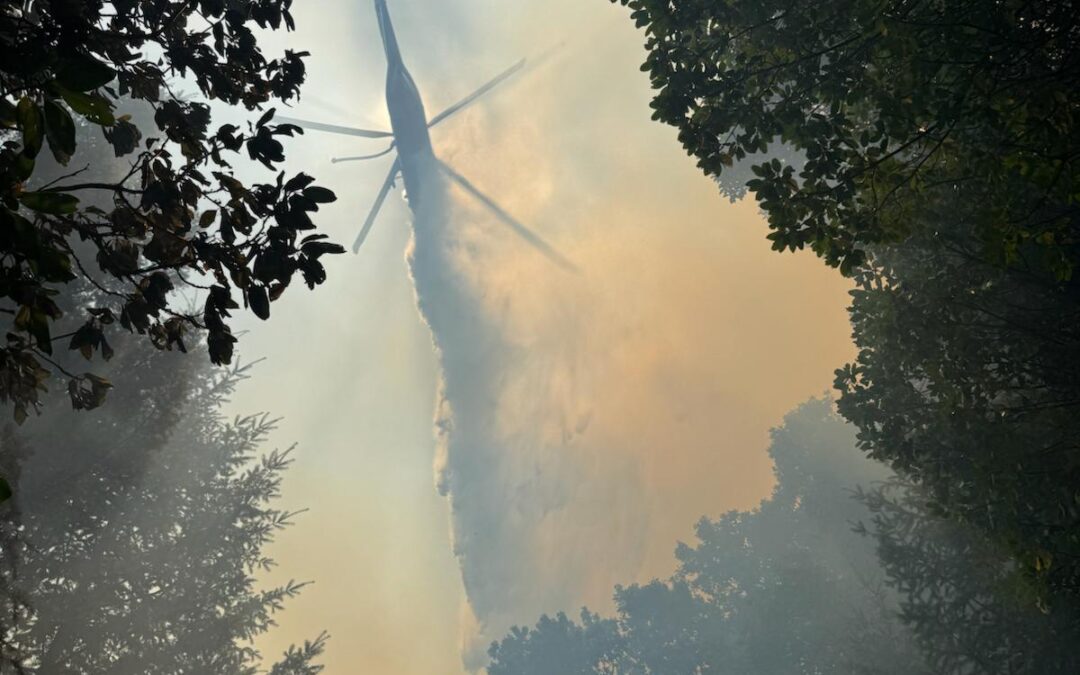
Aviation resources will continue with water drops today to cool hot spots, allowing ground crews to mop up around the fire perimeter. As a reminder, drone use near fires is both illegal and extremely dangerous to pilots working on incidents. If you fly, we can’t. All illegal drone use will be reported to law enforcement.
Due to the Board Shanty Fire south of Grants Pass, the Josephine County Sheriff’s Office and Emergency Management placed Zones JCU-436, JCU-437 and JCU-448-A under a Level 2 – Be Set to evacuate notice and a Level 1 – BE READY for JCU-448-B. Additionally, the Jackson County Sheriff’s Office and Emergency Management have placed Zone JAC-068 under a Level 1 – Be Ready evacuation notice. For the latest updates on evacuations, visit: https://protect.genasys.com.
Resources from Oregon Department of Forestry’s (ODF) Southwest Oregon District, Grants Pass Fire, Rural Metro Fire, Rogue Valley fire agencies and ODF Complex Incident Management Team 3 (CIMT-3) responded to the Board Shanty Fire Thursday, July 17. ODF CIMT 3 took command of the fire on Friday, July 18. For more fire information, visit the district’s Facebook page, @ODFSouthwest or www.swofire.com.
ODF fire regulations: https://swofire.com/public-fire-restrictions/.
BLM fire regulations: https://www.blm.gov/programs/public-safety-and-fire/fire-and-aviation/regional-info/oregon-washington/fire-restrictions.
July 19, 2025
GRANTS PASS, Ore. (July 19, 2025)—Today, crews working on the Board Shanty Fire, south of Grants Pass, established direct control line around the fire’s southeast edge. Due to steep slopes and rolling debris from overnight, the fire was mapped this afternoon at 469 acres, slightly increasing its footprint. With today’s work complete, control lines are secure around the area that saw new growth. Firefighters will continue to place hose lines around the fire, enabling crews to cool the fire’s edge.
“Things are looking promising, but there’s still a fight up there. Our focus remains on community and firefighter safety, and getting this fire off the map,” said Incident Commander Tyler McCarty. “We’re proud of the crews and all their hard work.”
Hand crews held the fire north of Shanty Creek and continued to establish a contingency line on the ridges south of Shanty Creek. High temperatures and gusty winds continue to drive fire behavior and have the potential to loft embers outside the fire. Firefighters remain vigilant in patrolling for spot fires in the area but have found none.
Aviation resources continued with water drops to cool and slow fire growth today so ground crews can fortify containment lines. As a reminder, drone use near fires is both illegal and extremely dangerous to pilots working on incidents. If you fly, we can’t. All illegal drone use will be reported to law enforcement.
Due to the Board Shanty Fire south of Grants Pass, the Josephine County Sheriff’s Office and Emergency Management placed Zones JCU-436, JCU-437 and JCU-448-A under a Level 2 – Be Set to evacuate notice and a Level 1 – BE READY for JCU-448-B. Additionally, the Jackson County Sheriff’s Office and Emergency Management have placed Zone JAC-068 under a Level 1 – Be Ready evacuation notice. For the latest updates on evacuations, visit: https://protect.genasys.com.
Resources from Oregon Department of Forestry’s (ODF) Southwest Oregon District, Grants Pass Fire, Rural Metro Fire, Rogue Valley fire agencies and ODF Complex Incident Management Team 3 (CIMT-3) responded to the Board Shanty Fire Thursday, July 17. ODF CIMT 3 took command of the fire on Friday, July 18. For more fire information, visit the district’s Facebook page, @ODFSouthwest or www.swofire.com.
A combination of hot temperatures and dry vegetation continues to increase the risk of fires starting and spreading. Help prevent the next wildfire by following all local regulations, found here: https://swofire.com/public-fire-restrictions/. If your weekend plans take you outside, please be aware of the fire risks and recreate safely: https://www.blm.gov/programs/public-safety-and-fire/fire-and-aviation/regional-info/oregon-washington/fire-restrictions.

July 19, 2025
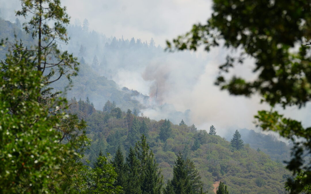
GRANTS PASS, Ore. (July 19, 2025)—Last night, incident resources maintained the direct lines on the north end of the fire and used established hose lays to begin cooling the north perimeter. On the south end, the fire escaped initial control lines yesterday and new lines were established, still holding the fire north of Shanty Creek. With perimeter established and some mop-up work beginning, the fire is estimated at 409 acres and containment is reported this morning at 4%.
High temperatures and gusty winds are anticipated again today, which will drive active fire behavior. Crews and heavy equipment on the ground will hold and improve established lines to the north, continue strengthening direct line to the south, and hold the current fire perimeter. Smoke may be visible in the area throughout the day.
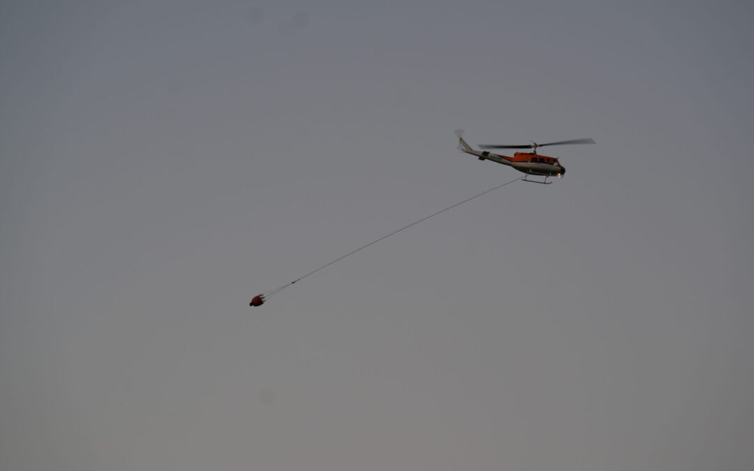
Air resources, including helicopters, air tankers and air attack planes, will again assist ground crews with water and retardant drops. Helicopters will be most used, aiding in cooling portions of the fire so ground crews can build on containment lines, holding the fire in its current footprint. As a reminder, drone use near fires is both illegal and extremely dangerous to pilots working on incidents. If you fly, we can’t. All illegal drone use will be reported to law enforcement.
Hot temperatures, low humidity and gusty wind conditions persist in the area, naturally increasing fire risk and contributing to potential fire growth; help prevent the next wildfire by following all local regulations, found here: https://swofire.com/public-fire-restrictions/. If your weekend plans take you outside, please be aware of the fire risks and recreate safely: https://www.blm.gov/programs/public-safety-and-fire/fire-and-aviation/regional-info/oregon-washington/fire-restrictions
Due to the Board Shanty Fire south of Grants Pass, the Josephine County Sheriff’s Office and Emergency Management placed Zones JCU-436, JCU-437 and JCU-448-A under a Level 2 – Be Set to evacuate notice and a Level 1 – BE READY for JCU-448-B. Additionally, the Jackson County Sheriff’s Office and Emergency Management have placed Zone JAC-068 under a Level 1 – Be Ready evacuation notice. For the latest updates on evacuations, visit: https://protect.genasys.com.
Resources from ODF Southwest Oregon District, Grants Pass Fire, Rural Metro Fire, Rogue Valley fire agencies and ODF CIMT 3 responded to the rapidly growing Board Shanty Fire around 5:00 p.m. on Thursday, July 17. ODF CIMT 3 took command of the fire in the morning on Friday, July 18.
For more fire information, visit the district’s Facebook page, @ODFSouthwest or website, www.swofire.com.
July 18, 2025
GRANTS PASS, Ore. (July 18, 2025)—Today, incident resources continued an aggressive extended attack on the 409-acre Board Shanty Fire, located south of Grants Pass. Firefighters continued direct suppression tactics amid very active fire behavior, which generated a large column and smoky conditions. Heavy smoke may continue into the evening and will likely dissipate with cooler temperatures, similar to last night.
Firefighters successfully held the fire north of Board Shanty Creek and were able to build hand and bulldozer containment lines along the majority of the fire, tying together the north, west and south sides, and even adding hose lays to the north and west ends of the fire for water access. Firefighters continue to focus on the head of the fire along the eastern side, as they attempt to put in direct and contingency lines.
Crews were greatly aided by water and retardant drops from aviation assets. Drone use near fires is both illegal and extremely dangerous to pilots working on incidents. If you fly, we can’t. All illegal drone use will be reported to law enforcement.
Fire behavior is expected to remain active tonight, and incident resources will continue an aggressive extended attack overnight as they attempt to complete containment and hold the fire within its current footprint.
Hot temperatures, low humidity and gusty wind conditions persist in the area, naturally increasing fire risk and contributing to potential fire growth; help prevent the next wildfire by following all local regulations, found here: https://swofire.com/public-fire-restrictions/. If your weekend plans take you outside, please be aware of the fire risks and recreate safely: https://www.blm.gov/programs/public-safety-and-fire/fire-and-aviation/regional-info/oregon-washington/fire-restrictions
Due to the Board Shanty Fire south of Grants Pass, the Josephine County Sheriff’s Office and Emergency Management placed Zones JCU-436, JCU-437 and JCU-448-Aunder a Level 2 – Be Set to evacuate notice and a Level 1 – BE READY for JCU-448-B. Additionally, the Jackson County Sheriff’s Office and Emergency Management have placed Zone JAC-068 under a Level 1 – Be Ready evacuation notice. For the latest updates on evacuations, visit: https://protect.genasys.com.
Resources from ODF Southwest Oregon District, Grants Pass Fire, Rural Metro Fire, Rogue Valley fire agencies and ODF CIMT 3 responded to the rapidly growing Board Shanty Fire around 5:00 p.m. on Thursday, July 17. ODF CIMT 3 took command of the fire in the morning on Friday, July 18.
For more fire information, visit the district’s Facebook page, @ODFSouthwest or website, www.swofire.com.
July 18, 2025
GRANTS PASS, Ore. (July 18, 2025)—Following an aggressive overnight attack by the Oregon Department of Forestry (ODF) Southwest Oregon District, ODF Complex Incident Management Team 3 (CIMT 3) took command of the estimated 300-acre Board Shanty Fire, located south of Grants Pass, this morning at 6:00 a.m.
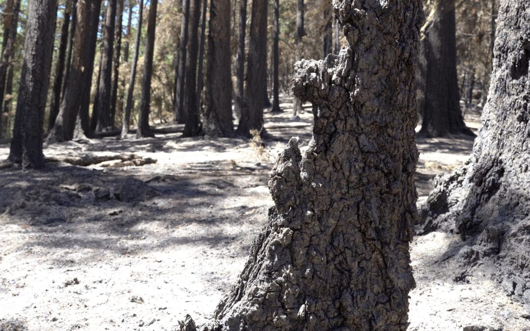
Taking advantage of cooler temperatures overnight, crews established 5,000 feet of handline along Board Shanty Road on the northeast perimeter of the fire and slowed growth at the head. Firefighters are facing very active fire behavior, including frequent spotting over the line, as well as overhead hazards, such as standing dead timber that could fall. Today, crews will continue aggressive, direct firefighting tactics as they look to connect line from the head to the heal of the fire with the assistance of aviation.
Yesterday evening, ODF Southwest Oregon District responded to the rapidly growing Board Shanty Fire around 5:00 p.m., as well as numerous engines from Grants Pass Fire, Rural Metro Fire, a contingent of engines from Rogue Valley fire agencies and resources reassigned from the Grizzly Complex.
The team will be in command of the Board Shanty Fire in addition to the 22 fully lined fires within the Grizzly Complex, which is currently at 79% containment with over half of the fires at 90% or more containment. ODF CIMT 3 was initially ordered Tuesday, July 8 to take command of 22 of the fires within the Grizzly Complex.
Hot temperatures, low humidity and gusty wind conditions persist in the area, naturally increasing fire risk and contributing to potential fire growth; help prevent the next wildfire by following all local regulations, found here: https://swofire.com/public-fire-restrictions/. If your weekend plans take you outside, please be aware of the fire risks and recreate safely: https://www.blm.gov/programs/public-safety-and-fire/fire-and-aviation/regional-info/oregon-washington/fire-restrictions
Due to the Board Shanty Fire south of Grants Pass, the Josephine County Sheriff’s Office and Emergency Management placed Zones JCU-436 and JCU-437 under a Level 2 – Be Set to evacuate notice and a Level 1 – BE READY for JCU-448. Additionally, the Jackson County Sheriff’s Office and Emergency Management have placed Zone JAC-068 under a Level 1 – Be Ready evacuation notice. For the latest updates on evacuations, visit: https://protect.genasys.com.
Aircraft will be used heavily today to help suppress the fire. Drone use near fires is both illegal and extremely dangerous to pilots working on incidents. If you fly, we can’t. All illegal drone use will be reported to law enforcement.
For more fire information, visit the district’s Facebook page, @ODFSouthwest or website, www.swofire.com.
July 16, 2025
This will be the final update on these incidents unless conditions significantly change
JACKSON & JOSEPHINE COUNTIES, Ore. (July 16, 2025)—Fire lines across the Grizzly Complex are holding strong as firefighters work to finalize containment and extinguish remaining hot spots. The overall containment across the complex reached 58%, with all fires individually at least 50% contained. Over half of the fires reached 90% or more containment and are being actively patrolled for potential flare-ups, although none have been found to date.
Tonight, overnight crews will continue using handheld infrared (IR) cameras to locate hot spots and ensure the perimeter areas are free of fire and heat. Tomorrow, continued progress is expected, with day crews aiming to complete 300 feet of mop-up into the fire perimeters, extinguishing all fire or heat throughout these areas. This progress will allow repair work to begin and enable some resources to be released from the fire line. Initial attack resources from ODF CIMT 3 remain ready to respond to any new flare-ups or fire starts in the area alongside the ODF Southwest Oregon District. Some smoke may still be visible from the center of fire perimeters.
On Monday, July 7, a thunderstorm moved into southern Oregon, bringing more than 1,300 lightning strikes to Jackson and Josephine counties. Oregon Department of Forestry (ODF) Southwest Oregon District dispatch centers were immediately flooded with calls of reported fires; by midnight, more than 50 reports of fires had been taken and recorded, and firefighters were engaged in an aggressive initial attack on numerous incidents. Resources made quick work of a number of fires, including the Pompadour Fire in the hills east of Ashland. Firefighters were able to stop its growth and fully build a line around its perimeter at 38 acres, protecting numerous homes in the area.
Due to the amount of reports, a large number of fires were called in multiple times from residents viewing the same fire in different locations; with these complexities added onto the fast paced and massive workload on ODF Southwest’s dispatchers and firefighters, 72 fires were initially reported in Jackson and Josephine counties on ODF-protected land. District staff worked around the clock on these incidents, dispatching resources to new fires, flying numerous reconnaissance flights daily and monitoring strike areas across the district to determine fire locations and status, allocating resources to the incidents where they were most needed and strategizing where the next need would be.
ODF Complex Incident Management Team 3 (CIMT 3) was ordered Tuesday afternoon and took command of 22 of the fires the following morning, with the Oregon Southwest District continuing an aggressive attack on the remaining fires in Jackson and Josephine counties, while continuing to respond to new reports of human-caused fires; since Monday’s thunderstorm, the ODF Southwest Oregon District has responded to and extinguished an additional 13 human-caused fires on top of the lighting starts, the largest being caught immediately at 12 acres.
With mapping, reconnaissance flights, detection center scans, and firefighters ground truthing all reports, the district has responded to 52 fires since last Monday. Between the work from ODF CIMT 3 and the ODF Southwest Oregon District, all fires are now 100% lined and mostly, if not entirely, mopped up. All fires were caught at 250 acres or less, with the majority in the range of 1/10 of an acre to 10 acres in size.
All of these fires were stopped due to the collective work of firefighters from across local, state and federal agencies. These partnerships between organizations in southern Oregon played a large role in the success of these incidents. ODF CIMT 3, ODF Southwest Oregon District and the Bureau of Land Management (BLM) Medford District would like to extend a thank-you to the U.S. Forest Service Rogue River-Siskiyou National Forest, CALFIRE, Ashland Fire & Rescue, Jackson County Fire District #5, Greensprings Rural Fire District, Colestin Rural Fire Protection District, Applegate Valley Fire District, Williams Fire Rescue, Grants Pass Fire Rescue, Jackson County Fire District 1, Rural Metro Fire, Illinois Valley Fire District, Lake Creek Fire District, Jackson County Fire District 3, Medford Fire Department, Jacksonville Fire Department, Jackson County Fire District 4, Prospect Rural Fire Protection District and Butte Falls Volunteer Fire and Rescue. We would also like to recognize Jackson County Sheriff’s Office, Jackson County Emergency Management, Josephine County Sheriff’s Office, Josephine County Emergency Management, Oregon Department of Transportation, Pacific Power and Light, Jackson County Roads and numerous other entities that have responded alongside us and contributed to the overall success of these fires. Additionally, thank you to the communities that we serve; your support during these incidents has been seen and greatly appreciated by all firefighters.
Slight chances of thunderstorms remain in the forecast for this evening and tomorrow, along with hot temperatures, low humidity and wind. These conditions naturally increase fire risk and contribute to fire growth; help prevent the next wildfire by following all local regulations, found here: https://swofire.com/public-fire-restrictions/. As the weekend approaches, please be aware of the fire risks and recreate safely: https://www.blm.gov/programs/public-safety-and-fire/fire-and-aviation/regional-info/oregon-washington/fire-restrictions
Level 1 – Be Ready evacuation notices remain in place for zones JAC-542, JAC-558, and Zone JAC-536. For the latest updates on evacuations, visit: https://protect.genasys.com. All lanes on Interstate 5 are now open, but firefighters are still working in the area. Please be aware and use caution when traveling near any fire zones.
Aircraft remain on standby, and drone use near fires is both illegal and extremely dangerous to pilots working on incidents. If you fly, we can’t. All illegal drone use will be reported to law enforcement.
This will be the final update on these incidents unless conditions significantly change. For more fire information, visit the district’s Facebook page, @ODFSouthwest or website, www.swofire.com.
Current status of the fires under ODF CIMT3 Incident Management:
All fires listed below are confirmed lightning-caused, are 100% lined and in various stages of mop up or repair. Crews are focusing on extinguishing hot spots along fire perimeters and may reassign resources to other fires in the region.
| Incident Status Summary |
| Fire |
Area in Acres |
% Containment |
Current Fire Status |
| Anderson Ridge |
0.1 |
90% |
100% lined, in patrol status |
| Ben Johnson Mtn |
4.8 |
85% |
100% lined, in mop up |
| Benson Gulch |
12 |
85% |
100% lined, in mop up |
| Boaz Gulch |
0.1 |
90% |
100% lined, in patrol status |
| Burnt Butte |
0.8 |
90% |
100% lined, in patrol status |
| Cedar Flat |
10.1 |
85% |
100% lined, in mop up |
| Deming Gulch |
256.2 |
50% |
100% lined, in mop up |
| Grouse Creek Rd |
11.1 |
85% |
100% lined, in mop up |
| Hinkley Gulch Rd |
0.5 |
90% |
100% lined, in patrol status |
| Holcomb Peak |
35.4 |
80% |
100% lined, in mop up |
| Jim Me Peak |
148.9 |
50% |
100% lined, in mop up |
| Lick Creek |
0.3 |
90% |
100% lined, in patrol status |
| Lick Gulch |
0.5 |
90% |
100% lined, in patrol status |
| Munger |
0.3 |
90% |
100% lined, in patrol status |
| Neil Creek Rd |
256.9 |
50% |
100% lined, in mop up |
| N Fork Deer Creek |
39.8 |
80% |
100% lined, in mop up |
| Palmer Peak |
68.6 |
50% |
100% lined, in mop up |
| Sulphur Spring |
37.3 |
50% |
100% lined, in mop up |
| Tallowbox |
1 |
90% |
100% lined, in patrol status |
| Wagner Creek Rd MM4 |
0.1 |
100% |
100% lined, in patrol status |
| Watergap Rd 16495 |
0.1 |
100% |
100% lined, in patrol status |
| Waters Gulch |
2.1 |
90% |
100% lined, in patrol status |
The following fires have been confirmed to be lightning-caused and were kept under the management of the ODF Southwest Oregon District:
| Incident Status Summary |
| Fire |
Area in Acres |
% Containment |
Current Fire Status |
| Heppsie Mountain |
100 |
85% |
100% lined, in mop up |
| Poole Hill |
12 |
90% |
100% lined, in mop up |
| Lightning Gulch |
17 |
98% |
100% lined and mopped up |
| Pompadour |
38 |
100% |
100% lined and mopped up |
| R. Fork Sardine Creek |
0.5 |
100% |
100% lined and mopped up |
| Howard Prairie |
0.5 |
100% |
100% lined and mopped up |
| Table Mountain |
0.1 |
100% |
100% lined and mopped up |
| Rain Gulch |
0.1 |
100% |
100% lined and mopped up |
| 100 Road |
0.1 |
100% |
100% lined and mopped up |
| Pickett Mountain |
1.6 |
100% |
100% lined and mopped up |
| Little Elder Creek |
0.2 |
100% |
100% lined and mopped up |
| Ladybug Gulch |
4.5 |
— |
Consumed by Jim Me Peak Fire |
| Greenview Road |
0.01 |
100% |
100% lined and mopped up |
| Leuizenger Creek |
2.27 |
100% |
100% lined and mopped up |
| Ken Rose |
0.2 |
100% |
100% lined and mopped up |
| Bear Creek |
0.75 |
100% |
100% lined and mopped up |
| Esterly Mine |
7 |
100% |
100% lined and mopped up |
July 15, 2025
JACKSON & JOSEPHINE COUNTIES, Ore. (July 15, 2025)—Despite high temperatures and gusty conditions, crews held Grizzly Complex fires within their current footprints and increased mop-up operations and total containment within the complex.
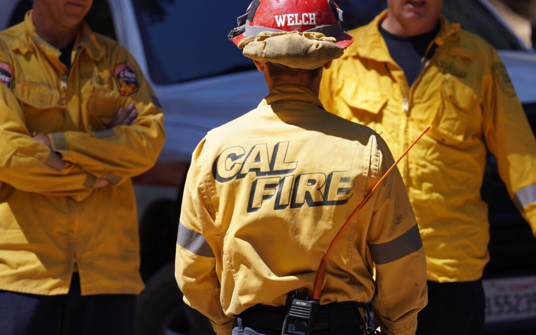
Late last night, Oregon Department of Forestry (ODF) Complex Incident Management Team 3 (CIMT 3) quickly redeployed one CAL FIRE strike team of firefighters to assist at the rapidly growing Hagelstein Fire, 14 miles north of Klamath Falls near Highway 97.
ODF CIMT 3 received a request from ODF CIMT 1 for additional resources. Both states were able to approve the redeployment mere hours after the fire started, with firefighters arriving at the fire by midnight.
“We were in a position to share resources to an emerging need in the region, without reducing our capabilities or readiness,” said Incident Commander Tyler McCarty. “We were just in that position less than a week ago, and we understand how important it is to get those resources as early as possible. We’re very appreciative to have this support and strong partnership with CAL FIRE and other cooperators. It takes a team.”
ODF CIMT 3 is in command of a group of lightning fires known as the Grizzly Complex that started on Monday, July 7. The ODF Southwest Oregon District continues suppression efforts on additional fires within the district. Resources remain available to respond to new fire starts within the complex area.
Level 1 – Be Ready evacuation notices remain in place for zones JAC-542, JAC-558, and Zone JAC-536. More information on current evacuations can be found at: https://protect.genasys.com. One lane of Interstate 5 is closed to protect firefighters between mile markers 8.5 and 10.5 on southbound lanes only. Check tripcheck.com for up-to-date traffic information.
Aircraft continues to be used throughout the Complex. As a reminder, drone use around fires is illegal, and incredibly dangerous to pilots working on incidents; if you fly, we can’t. All illegal drone use will be reported to law enforcement.
Temperatures are expected to remain at or near triple digits throughout the week, which will naturally increase fire activity and risk. While resources remain engaged on these incidents, communities can help to prevent new fires from starting by following all current fire regulations, found here: https://swofire.com/public-fire-restrictions/.
For fire local information anytime, visit the district’s Facebook page, @ODFSouthwest or website, www.swofire.com.
Current status of the fires under ODF CIMT3 Incident Management:
All Fires are 100% lined and in various stages of mop up. Crews are focusing on removing snags, strengthening lines and extinguishing hot spots along fire perimeters. Acreage on individual fires was updated due to an infrared flight last night giving more accurate area information.
| Incident Status Summary |
| Fire |
Area in Acres |
% Containment |
Current Fire Status |
| Anderson Ridge |
0.1 |
90% |
100% lined, in patrol status |
| Ben Johnson Mtn |
4.8 |
80% |
100% lined, in mop up |
| Benson Gulch |
12 |
80% |
100% lined, in mop up |
| Boaz Gulch |
0.1 |
90% |
100% lined, in patrol status |
| Burnt Butte |
0.8 |
90% |
100% lined, in patrol status |
| Cedar Flat |
10.1 |
80% |
100% lined, in mop up |
| Deming Gulch |
256.2 |
30% |
100% lined, in mop up |
| Grouse Creek Rd |
11.1 |
80% |
100% lined, in mop up |
| Hinkley Gulch Rd |
0.5 |
90% |
100% lined, in patrol status |
| Holcomb Peak |
35.4 |
75% |
100% lined, in mop up |
| Jim Me Peak |
148.9 |
30% |
100% lined, in mop up |
| Lick Creek |
0.3 |
90% |
100% lined, in patrol status |
| Lick Gulch |
0.5 |
90% |
100% lined, in patrol status |
| Munger |
0.3 |
90% |
100% lined, in patrol status |
| Neil Creek Rd |
256.9 |
30% |
100% lined, in mop up |
| N Fork Deer Creek |
39.8 |
75% |
100% lined, in mop up |
| Palmer Peak |
68.6 |
30% |
100% lined, in mop up |
| Sulphur Spring |
37.3 |
30% |
100% lined, in mop up |
| Tallowbox |
1 |
90% |
100% lined, in patrol status |
| Wagner Creek Rd MM4 |
0.1 |
90% |
100% lined, in patrol status |
| Watergap Rd 16495 |
0.1 |
90% |
100% lined, in patrol status |
| Waters Gulch |
2.1 |
80% |
100% lined, in mop up |
The following fires are managed by the ODF District:
| Incident Status Summary |
| Fire |
Area in Acres |
% Containment |
Current Fire Status |
| Heppsie Mountain |
100 |
75% |
100% lined, in mop up |
| Poole Hill |
12 |
80% |
100% lined, in mop up |
| Lightning Gulch |
17 |
95% |
100% lined, in mop up |
July 14, 2025
JACKSON & JOSEPHINE COUNTIES, Ore. (July 14, 2025)—Today crews were seeking out and cooling hot spots that were identified overnight from an infrared (IR) flight and PALM IR. Fires showed minimal fire activity along incident perimeters, allowing crews to focus on hazard tree removal and mopping up.
Many of the fires have a large number of dead trees, known as hazard trees or snags, that require extra mitigation to reduce safety risks. Today, crews completed hazard tree removal along roads within the Neil Creek Road and Jim Me Peak fires, allowing easier access for water tenders.
Oregon Department of Forestry Complex Incident Management Team 3 is in command of a group of lightning fires known as the Grizzly Complex that started on Monday, July 7. The ODF Southwest Oregon District continues suppression efforts on additional fires within the district. Resources remain available to respond to new fire starts within the complex area.
Jackson County Sheriff’s Office reduced the Level 2 – Be Set evacuation notices for zones JAC-542, JAC-543, JAC-546, JAC-558 and JAC-559 to a Level 1 – Be Ready notice. Zone JAC-536 remains at a Level 1. More information on current evacuations can be found at: https://protect.genasys.com/. One lane of Interstate 5 is closed to protect firefighters between mile markers 8.5 and 10.5 on southbound lanes only. Check tripcheck.com for up-to-date traffic information.
Aircraft continues to be used throughout the Complex. As a reminder, drone use around fires is illegal, and incredibly dangerous to pilots working on incidents; if you fly, we can’t. All illegal drone use will be reported to law enforcement.
Temperatures are expected to remain at or near triple digits this week, which will naturally increase fire activity and risk. While resources remain engaged on these lightning-caused incidents, communities can help to prevent new fires from starting by following all current fire regulations, found here: https://swofire.com/public-fire-restrictions/.
For fire local information anytime, visit the district’s Facebook page, @ODFSouthwest or website, www.swofire.com.
Current status of the fires under ODF CIMT3 Incident Management:
All Fires are 100% lined and in various stages of mop up. Crews are focusing on removing snags, strengthening lines and extinguishing hot spots along fire perimeters.
| Incident Status Summary |
| Fire |
Area in Acres |
% Containment |
Current Fire Status |
| Anderson Ridge |
0.1 |
90% |
100% lined, in patrol status |
| Ben Johnson Mtn |
3.8 |
75% |
100% lined, in mop up |
| Benson Gulch |
9.8 |
75% |
100% lined, in mop up |
| Boaz Gulch |
0.1 |
90% |
100% lined, in patrol status |
| Burnt Butte |
0.6 |
90% |
100% lined, in patrol status |
| Cedar Flat |
6.3 |
75% |
100% lined, in mop up |
| Deming Gulch |
258 |
75% |
100% lined, in mop up |
| Grouse Creek Rd |
11.1 |
75% |
100% lined, in mop up |
| Hinkley Gulch Rd |
0.5 |
90% |
100% lined, in patrol status |
| Holcomb Peak |
35.5 |
30% |
100% lined, in mop up |
| Jim Me Peak |
142.5 |
20% |
100% lined, in mop up |
| Lick Creek |
0.3 |
90% |
100% lined, in patrol status |
| Lick Gulch |
0.5 |
90% |
100% lined, in patrol status |
| Munger |
0.3 |
90% |
100% lined, in patrol status |
| Neil Creek Rd |
250.4 |
20% |
100% lined, in mop up |
| N Fork Deer Creek |
82.3 |
30% |
100% lined, in mop up |
| Palmer Peak |
76.6 |
20% |
100% lined, in mop up |
| Sulphur Spring |
38 |
20% |
100% lined, in mop up |
| Tallowbox |
1 |
90% |
100% lined, in patrol status |
| Wagner Creek Rd MM4 |
0.1 |
90% |
100% lined, in patrol status |
| Watergap Rd 16495 |
0.1 |
90% |
100% lined, in patrol status |
| Waters Gulch |
5.6 |
75% |
100% lined, in mop up |
The following fires are managed by the ODF District:
| Incident Status Summary |
| Fire |
Area in Acres |
% Containment |
Current Fire Status |
| Heppsie Mountain |
100 |
65% |
100% lined, in mop up |
| Poole Hill |
12 |
70% |
100% lined, in mop up |
| Lightning Gulch |
17 |
80% |
100% lined, in mop up |
July 14, 2025
JACKSON & JOSEPHINE COUNTIES, Ore. (July 14, 2025) — Firefighting crews continue mopping-up within fire perimeters, resulting in increased containment of fires across the Grizzly Complex.
Nightshift crews are using handheld infrared cameras to identify hot spots so that day shift can cool and extinguish them.
Personnel working on these fires are facing dry fuels and adverse weather conditions, but must mitigate a number of hazards, including difficult terrain, rolling debris, and standing dead trees, or snags. Crews continue to fall snags to allow firefighters to safely access areas of the fire. The large number of dead fir trees across the region pose a danger to firefighters and can increase the potential for fire spread.
ODF Complex Incident Management Team 3 is in command of a group of lightning fires dubbed the Grizzly Complex that started on Monday, July 7. The ODF Southwest Oregon District continues suppression efforts on additional fires within the district. Incident resources remain available to respond to new fire starts within the complex.
Level 2 – Be Set evacuation notices remain for zones JAC-542, JAC-543, JAC-546, JAC-558 and JAC-559. Zone JAC-536 remains at a Level 1 – Be Ready. More information on current evacuations can be found at: https://protect.genasys.com/. One lane of Interstate 5 is closed to protect firefighters between mile markers 8.5 and 10.5 on southbound lanes only. Visit tripcheck.com for up-to-date traffic information. If conditions change and there are any threats to homes, communities or roads, information will be provided as timely and accurately as possible.
As a reminder, drone use around fires is illegal, and incredibly dangerous to pilots working on incidents; if you fly, we can’t. All illegal drone use will be reported to law enforcement.
High temperatures, low humidity, wind, and dry fuels naturally increase fire danger. While resources remain engaged on these lightning-caused incidents, residents and visitors can help to prevent new fires from starting by following all current fire regulations, found here: https://swofire.com/public-fire-restrictions/.
For fire local information anytime, visit the district’s Facebook page, @ODFSouthwest or website, www.swofire.com.
This will be the last morning update for the incident, unless conditions change. The team will continue to provide evening updates.
Current status of the fires under ODF CIMT3 Incident Management:
All Fires are 100% lined and in various stages of mop up. Crews are focusing on removing snags, strengthening lines and extinguishing hot spots along fire perimeters.
| Incident Status Summary |
| Fire |
Area in Acres |
% Containment |
Current Fire Status |
| Anderson Ridge |
0.1 |
90% |
100% lined, in patrol status |
| Ben Johnson Mtn |
3.8 |
75% |
100% lined, in mop up |
| Benson Gulch |
9.8 |
75% |
100% lined, in mop up |
| Boaz Gulch |
0.1 |
90% |
100% lined, in patrol status |
| Burnt Butte |
0.6 |
90% |
100% lined, in patrol status |
| Cedar Flat |
6.3 |
75% |
100% lined, in mop up |
| Deming Gulch |
258 |
75% |
100% lined, in mop up |
| Gouse Creek Rd |
11.1 |
75% |
100% lined, in mop up |
| Hinkley Gulch Rd |
0.5 |
90% |
100% lined, in patrol status |
| Holcomb Peak |
35.5 |
30% |
100% lined, in mop up |
| Jim Me Peak |
142.5 |
20% |
100% lined, in mop up |
| Lick Creek |
0.3 |
90% |
100% lined, in patrol status |
| Lick Gulch |
0.5 |
90% |
100% lined, in patrol status |
| Munger |
0.3 |
90% |
100% lined, in patrol status |
| Neil Creek Rd |
250.4 |
20% |
100% lined, in mop up |
| N Fork Deer Creek |
82.3 |
30% |
100% lined, in mop up |
| Palmer Peak |
76.6 |
20% |
100% lined, in mop up |
| Sulphur Spring |
38 |
20% |
100% lined, in mop up |
| Tallowbox |
1 |
90% |
100% lined, in patrol status |
| Wagner Creek Rd MM4 |
0.1 |
90% |
100% lined, in patrol status |
| Watergap Rd 16495 |
0.1 |
90% |
100% lined, in patrol status |
| Waters Gulch |
5.6 |
75% |
100% lined, in mop up |
The following fires are managed by the ODF District:
| Incident Status Summary |
| Fire |
Area in Acres |
% Containment |
Current Fire Status |
| Heppsie Mountain |
100 |
65% |
100% lined, in mop up |
| Poole Hill |
12 |
70% |
100% lined, in mop up |
| Lightning Gulch |
17 |
80% |
100% lined, in mop up |
July 13, 2025
JACKSON & JOSEPHINE COUNTIES, Ore. (July 13, 2025) — Despite unfavorable weather conditions, steep slopes, and other challenges, firefighters continue to hold and strengthen fire lines, conduct mop-up within fire perimeters, and increase containment levels of fires across the complex.
Triple digit temperatures, low relative humidity, and winds pose a heightened risk for flaring up hot spots within the fire and generating new starts across the region. Mop-up operations work to cool the fire’s edge to create a wider perimeter to help mitigate embers from escaping the fire.
Today, aircraft delivered large water bladders to remote areas around the fire, enabling crews to extinguish hot spots in difficult-to-access locations. Helicopters also used buckets to cool remote portions of the fire. As a reminder, drone use around fires is illegal, and incredibly dangerous to pilots working on incidents; if you fly, we can’t. All illegal drone use will be reported to law enforcement.
Firefighters continue to fall snags, a common term for dead standing trees, to remove the hazard and allow firefighters to safely access additional portions of the fire.
ODF Complex Incident Management Team 3 is in command of a group of lightning fires dubbed the Grizzly Complex that started on Monday, July 7. Southwest Oregon District continues suppression efforts on additional fires within the district. Grizzly Complex resources remain available to respond to potential new fire starts within the complex.
The Jackson County Sheriff’s Office canceled the Level 1 Evacuation Notice for Zones JAC-325B and JAC-326 today due to progress on the Heppsie Mountain and Poole Hill fires. Level 2 – Be Set evacuation notices remain for zones JAC-542, JAC-543, JAC-546, JAC-558 and JAC-559. Zone JAC-536 remains at a Level 1 – Be Ready. More information on current evacuations can be found at: https://protect.genasys.com/. One lane of I-5 is closed to protect firefighters between mile markers 8.5 and 10.5 on southbound lanes only. Check tripcheck.com for up-to-date traffic information. If conditions change and there are any threats to homes, communities or roads, information will be provided as timely and accurately as possible.
High temperatures, low humidity, wind, and dry fuels naturally increase fire activity. While resources remain engaged on these lightning-caused incidents, residents and visitors can help to prevent new fires from starting by following all current fire regulations, found here: https://swofire.com/public-fire-restrictions/.
For fire local information anytime, visit the district’s Facebook page, @ODFSouthwest or website, www.swofire.com.
Current status of the fires under ODF CIMT3 Incident Management:
All fires are 100% lined and in various stages of mop up. Crews are focusing on strengthening lines while removing snags and extinguishing hot spots along fire perimeters.
| Incident Status Summary |
| Fire |
Area in Acres |
% Containment |
Current Fire Status |
| Anderson Ridge |
0.1 |
90 |
100% lined, in mop up |
| Ben Johnson Mnt |
3.8 |
20 |
100% lined, in mop up |
| Benson Gulch |
9.8 |
20 |
100% lined, in mop up |
| Boaz Gulch |
0.1 |
90 |
100% lined, in mop up |
| Burnt Butte |
0.6 |
90 |
100% lined, in mop up |
| Cedar Flat |
6.3 |
20 |
100% lined, in mop up |
| Deming Gulch |
258 |
5 |
100% lined, in mop up |
| Gouse Creek Rd |
6.2 |
20 |
100% lined, in mop up |
| Hinkley Gulch Rd |
0.5 |
90 |
100% lined, in mop up |
| Holcomb Peak |
25.6 |
10 |
100% lined, in mop up |
| Jim Me Peak |
139.3 |
5 |
100% lined, in mop up |
| Lick Creek |
0.3 |
90 |
100% lined, in mop up |
| Lick Gulch |
0.5 |
90 |
100% lined, in mop up |
| Munger |
0.8 |
90 |
100% lined, in mop up |
| Neil Creek Rd |
247.2 |
5 |
100% lined, in mop up |
| N Fork Deer Creek |
27.4 |
10 |
100% lined, in mop up |
| Palmer Peak |
76.6 |
5 |
100% lined, in mop up |
| Sulphur Spring |
37.5 |
10 |
100% lined, in mop up |
| Tallowbox |
1 |
90 |
100% lined, in mop up |
| Wagner Creek Rd MM4 |
0.1 |
90 |
100% lined, in mop up |
| Watergap Rd 16495 |
0.1 |
90 |
100% lined, in mop up |
| Waters Gulch |
5.6 |
20 |
100% lined, in mop up |
The following fires are managed by the ODF District:
| Incident Status Summary |
| Fire |
Area in Acres |
% Containment |
Current Fire Status |
| Heppsie Mountain |
100 |
40% |
100% lined, in mop up |
| Poole Hill |
12 |
55% |
100% lined, in mop up |
| Lightning Gulch |
17 |
60% |
100% lined, in mop up |
July 13, 2025
JACKSON & JOSEPHINE COUNTIES, Ore. (July 13, 2025) — High temperatures remain in the forecast with an excessive heat warning through Tuesday. Unstable conditions are predicted for this afternoon, which brings heightened fire potential and higher risk for new starts across the region. Despite unfavorable weather conditions, firefighters continue to hold and strengthen fire lines.
An infrared (IR) flight took place last night showing minimal fire activity along fire perimeters and mapped hot spots for crews to focus on today. Crews will continue to use PALM IR, a handheld infrared monitoring system, for more precise monitoring of hot spots throughout the fire.
ODF Complex Incident Management Team 3 is in command of a group of lightning fires dubbed the Grizzly Complex that started on Monday, July 7. Southwest Oregon District continues suppression efforts on additional fires within the district. The Grizzly Complex resources remain available to respond to potential new fire starts within the complex area.
Level 2 – Be Set evacuation notices remain for zones JAC-542, JAC-543, JAC-546, JAC-558 and JAC-559. Zone JAC-536 remains at a Level 1 – Be Ready. More information on current evacuations can be found at: https://protect.genasys.com/. One lane of I-5 is closed to protect firefighters between mile markers 8.5 and 10.5 on southbound lanes only. Check tripcheck.com for up-to-date traffic information.
Aircraft continues to be used throughout the day. As a reminder, drone use around fires is illegal, and incredibly dangerous to pilots working on incidents; if you fly, we can’t. All illegal drone use will be reported to law enforcement.
Due to the large number of fires, updates on smaller incidents are not being provided at this time; if conditions change and there are any threats to homes, communities or roads, information will be provided as timely and accurately as possible.
Temperatures are expected to reach triple digits this weekend, which will naturally increase fire activity. While resources remain engaged on these lightning-caused incidents, communities can help to prevent new fires from starting by following all current fire regulations, found here: https://swofire.com/public-fire-restrictions/.
For fire local information anytime, visit the district’s Facebook page, @ODFSouthwest or website, www.swofire.com.
See next page for fire acreage and containment numbers.
Current status of the fires under ODF CIMT3 Incident Management:
All Fires are 100% lined and in various stages of mop up. Crews are focusing on strengthening lines while removing snags and extinguishing hot spots along fire perimeters.
| Incident Status Summary |
| Fire |
Area in Acres |
% Containment |
Current Fire Status |
| Anderson Ridge |
0.1 |
90 |
100% lined, in mop up |
| Ben Johnson Mnt |
3.8 |
20 |
100% lined, in mop up |
| Benson Gulch |
9.8 |
20 |
100% lined, in mop up |
| Boaz Gulch |
0.1 |
90 |
100% lined, in mop up |
| Burnt Butte |
0.6 |
90 |
100% lined, in mop up |
| Cedar Flat |
6.3 |
20 |
100% lined, in mop up |
| Deming Gulch |
258 |
5 |
100% lined, in mop up |
| Gouse Creek Rd |
6.2 |
20 |
100% lined, in mop up |
| Hinkley Gulch Rd |
0.5 |
90 |
100% lined, in mop up |
| Holcomb Peak |
25.6 |
10 |
100% lined, in mop up |
| Jim Me Peak |
139.3 |
5 |
100% lined, in mop up |
| Lick Creek |
0.3 |
90 |
100% lined, in mop up |
| Lick Gulch |
0.5 |
90 |
100% lined, in mop up |
| Munger |
0.8 |
90 |
100% lined, in mop up |
| Niel Creek Rd |
247.2 |
5 |
100% lined, in mop up |
| N Fork Deer Creek |
27.4 |
10 |
100% lined, in mop up |
| Palmer Peak |
76.6 |
5 |
100% lined, in mop up |
| Sulphur Spring |
37.5 |
10 |
100% lined, in mop up |
| Tallowbox |
1 |
90 |
100% lined, in mop up |
| Wagner Creek Rd MM4 |
0.1 |
90 |
100% lined, in mop up |
| Watergap Rd 16495 |
0.1 |
90 |
100% lined, in mop up |
| Waters Gulch |
5.6 |
20 |
100% lined, in mop up |
The following fires are managed by the ODF District:
| Incident Status Summary |
| Fire |
Area in Acres |
% Containment |
Current Fire Status |
| Heppsie Mountain |
100 |
40% |
100% lined, in mop up |
| Poole Hill |
12 |
55% |
100% lined, in mop up |
| Lightning Gulch |
17 |
60% |
100% lined, in mop up |
July 12, 2025
JACKSON & JOSEPHINE COUNTIES, Ore. (July 12, 2025)—Despite high temperatures and windy conditions, firefighters held the fires within their current footprints on all incidents across Jackson and Josephine counties. Crews strengthened lines around all fires and continued mop-up operations.
Local and incident officials are urging the public to follow fire restrictions at https://www.oregon.gov/odf/fire/pages/restrictions.aspx
“We continue to see extreme heat and are facing critical fire weather,” said Justin Kelly, Bureau of Land Management Agency Administrator. “These weather conditions make fires easier to start and spread, so we’re asking the public to help us ensure that new fires don’t start—it’s the best way you can support firefighters.”
ODF Complex Incident Management Team 3 is in command of a group of lightning fires dubbed the Grizzly Complex that started on Monday, July 7. Southwest Oregon District continues suppression efforts on additional fires within the district. At this time, more than 1,600 personnel are assigned to the Grizzly Complex and are assisting with response to potential new fire starts within the complex area.
Today, the following fires remain the largest incidents under ODF CIMT3 Incident Management:
- The Neil Creek Road Fire – located west of I-5 mile marker 10 and south of Ashland, GPS mapped at 237 acres. Despite increased fire behavior, crews held fire lines with the help of helicopter water drops. Firefighters continue to strengthen lines and expand mop-up around the fire. Along the south end of the fire, crews removed hazardous standing dead trees to allow firefighters to access the southern perimeter safely. Level 2 – Be Set evacuation notices remain for zones JAC-542, JAC-543, JAC-546, JAC-558 and JAC-559. Zone JAC-536 remains at a Level 1 – Be Ready. More information on current evacuations can be found at: https://protect.genasys.com/. One lane of I-5 is closed to protect firefighters between mile markers 8.5 and 10.5 on southbound lanes only. Check tripcheck.com for up-to-date traffic information.
- The Deming Gulch Fire – located northeast of Buncom. Fire lines remain strong and the fire is currently estimated at 250 acres. Crews have completely lined the perimeter of the fire and are continuing to expand mop-up. There are currently no evacuation notices.
- The North Fork Deer Creek Fire – the 27-acre fire is located in the hills above the 8000-block of Deer Creek Road east of Selma. Mop-up operations continue on this incident. There are no current evacuation orders for this incident.
- The Jim Me Peak Fire – the 70-acre fire is located in a remote area south of Applegate. Lines remain strong; Crews have completely lined the perimeter of the fire and are continuing to expand mop-up and add more direct lines around portions of the fire to remove unburned vegetation from inside the line, strengthening it.
- The Palmer Peak Fire – the 76-acre fire is located to the southeast of the Jim Me Peak Fire. Crews have completely lined the perimeter of the fire and are continuing to expand mop-up. There are no current evacuation orders for this incident.
- The Holcomb Peak Fire – the 25-acre fire is located southwest of Williams. Crews completely lined the perimeter of the fire and are continuing to expand mop-up.
- The Sulfur Springs Fire – the 35-acre fire is located southeast of Buncom and Cinnabar Mountain. Crews have completely lined the perimeter of the fire and are continuing to expand mop-up.
- The Benson Gulch Fire, – the 9.6 acre fire is located south of Applegate Road and Button Butte, west of Buncom. Crews have completely lined the perimeter of the fire and are continuing to expand mop-up.
The following fires are managed by the ODF District:
- The Heppsie Mountain Fire – The Heppsie Mountain Fire – located south of Highway 140. Firefighters are continuing mop-up operations. Lines remain strong, and with the current status of the fire, firefighters were able to GPS map it today at 100 acres, with an additional 10 acres of mopped up spot fires. This fire is now 40% contained, which will increase as mop-up continues. A Level 1 – BE READY for a possible evacuation remains in place for: JAC-325-B Heppsie Mountain Road south of Highway 140 and the zone immediately to the south, JAC-326. More information on current evacuations issued by the Jackson County Sheriff’s Office and Emergency Management can be found here: https://protect.genasys.com/.
- The Poole Hill Fire – located south of the Heppsie Mountain Fire. Today, mop-up operations continued, putting the fire at 55% contained and holding it at 12 acres. This work will continue overnight. Evacuation notifications for the Heppsie Mountain Fire apply to this incident as well.
Most of these fires were caused by lightning strikes following thunderstorms Monday night. Other small fires are still staffed across the district. Firefighters are facing a high number of dead trees across all of these incidents. These dead trees create additional safety risks to firefighters, and in some cases have increased the time to build containment lines.
Aircraft continues to be used throughout the day. As a reminder, drone use around fires is illegal, and incredibly dangerous to pilots working on incidents; if you fly, we can’t. All illegal drone use will be reported to law enforcement.
Due to the large number of fires, updates on smaller incidents are not being provided at this time; if conditions change and there are any threats to homes, communities or roads, information will be provided as timely and accurately as possible.
Temperatures are expected to reach triple digits this weekend, which will naturally increase fire activity. While resources remain engaged on these lightning-caused incidents, communities can help to prevent new fires from starting by following all current fire regulations, found here: https://swofire.com/public-fire-restrictions/.
For fire local information anytime, visit the district’s Facebook page, @ODFSouthwest or website, www.swofire.com.
July 12, 2025
JACKSON & JOSEPHINE COUNTIES, Ore. (July 11, 2025)—Overnight, crews continued to make progress on all incidents across Jackson and Josephine counties, with control line around all fires and mop-up operations underway. Mop-up operations refer to the process of establishing water access around the fire, which includes setting pumps and miles of hose lines to extinguishing remaining hot spots along the perimeter to prevent rekindling in the hot, dry summer months.
ODF Complex Incident Management Team 3 is in command of a group of lightning fires dubbed the Grizzly Complex that started on Monday, July 7. The Neil Creek Road Fire, which was already assigned to IMT 3, was also formally assigned to the complex. Southwest Oregon District continues suppression efforts on additional fires within the district.
More than 1,600 personnel are assigned to the Grizzly Complex and are assisting with response to potential new fire starts within the complex.
“We have been aggressively fighting these fires day and night, and we’re making great progress on holding their current footprints,” said ODF CIMT 3 Incident Commander Tyler McCarty. “But this isn’t over. The temperatures are rising, and hot, windy conditions persist. We need the public’s help to keep fires from starting so we can concentrate on finishing the good work to cool these fires and keep them from restarting.”
Today, the following fires remain the largest incidents under ODF CIMT3 Incident Management:
- The Neil Creek Road Fire – located west of I-5 mile marker 10 and south of Ashland. Crews have completely lined the perimeter of the fire and are continuing to expand mop-up and add more direct lines around portions of the fire, removing unburned vegetation that could threaten the line’s strength. The fire has been GPS mapped at 237 acres. Evacuation notices: Zones JAC-542, JAC-543, JAC-546, JAC-558 and JAC-559 under a Level 2 – Be Set. Zone JAC-536 remains at a Level 1 – Be Ready. More information on current evacuations can be found at: https://protect.genasys.com/. One lane of I-5 is closed between mile markers 8.5 and 10.5 on southbound lanes only. Check tripcheck.com for up-to-date traffic information.
- The Deming Gulch Fire – located northeast of Buncom. The fire is currently estimated at 250 acres. Crews have completely lined the perimeter of the fire and are continuing to expand mop-up. There are currently no evacuation notices.
- The North Fork Deer Creek Fire – the 27-acre fire is located in the hills above the 8000-block of Deer Creek Road east of Selma. There are no current evacuation orders for this incident.
- The Jim Me Peak Fire – the 70-acre fire is located in a remote area south of Applegate. Crews have completely lined the perimeter of the fire and are continuing to expand mop-up and add more direct lines around portions of the fire to remove unburned vegetation from inside the line, strengthening it.
- The Palmer Peak Fire – the 76-acre fire is located to the southeast of the Jim Me Peak Fire. Crews have completely lined the perimeter of the fire and are continuing to expand mop-up. There are no current evacuation orders for this incident.
- The Holcomb Peak Fire – the 25-acre fire is located southwest of Williams. Crews completely lined the perimeter of the fire and are continuing to expand mop-up.
- The Sulfur Springs Fire – the 35-acre fire is located southeast of Buncom and Cinnabar Mountain. Crews have completely lined the perimeter of the fire and are continuing to expand mop-up.
- The Benson Gulch Fire, – the 9.6 acre fire is located south of Applegate Road and Button Butte, west of Buncom. Crews have completely lined the of the fire and are continuing to expand mop-up.
The following fires are managed by the ODF District:
- The Heppsie Mountain Fire – the 50-acre fire is located south of Highway 140. Firefighters worked overnight to clean up areas of the line that held pockets of unburned vegetation, strengthening those portions. The fire remains 100% lined. Resources will continue to bolster the fire line around the perimeter and continue mop-up operations. A Level 1 – BE READY for a possible evacuation remains in place for: JAC-325-B Heppsie Mountain Road south of Highway 140 and the zone immediately to the south, JAC-326. More information on current evacuations issued by the Jackson County Sheriff’s Office and Emergency Management can be found here: https://protect.genasys.com/.
- The Poole Hill Fire – located south of the Heppsie Mountain Fire. Overnight, progress continued on mopping up the fire. Today, firefighters will push forward on this work, extinguishing hotspots into the interior of the fire, ensuring it won’t flare up again. Evacuation notifications for the Heppsie Mountain Fire apply to this incident as well.
Most of these fires were caused by lightning strikes following thunderstorms Monday night. Other small fires are still staffed across the district.
Aircraft continues to be a critical asset and was used throughout the day. As a reminder, drone use around fires is illegal, and incredibly dangerous to pilots working on incidents; if you fly, we can’t. All illegal drone use will be reported to law enforcement.
Due to the large number of fires, updates on smaller incidents are not being provided at this time; if conditions change and there are any threats to homes, communities or roads, information will be provided as timely and accurately as possible.
Temperatures are expected to reach triple digits this weekend, which will naturally increase fire activity. While resources remain engaged on these lightning-caused incidents, communities can help to prevent new fires from starting by following all current fire regulations, found here: https://swofire.com/public-fire-restrictions/.
For local fire information anytime, visit the district’s Facebook page, @ODFSouthwest or website, www.swofire.com.
July 11, 2025
JACKSON & JOSEPHINE COUNTIES, Ore. (July 11, 2025)—Resources from Oregon Department of Forestry (ODF) Complex Incident Management Team 3, and district resources working on non-complex lightning fires, continued to make progress across all the fires across Jackson and Josephine counties, with most being fully lined and several moving to mop-up status.
ODF Complex Incident Management Team 3 is in command of a group of lightning fires dubbed the Grizzly Complex that started on Monday. The team is also fighting the Neil Creek Road Fire west of Interstate 5 near Ashland. ODF Southwest Oregon District continues suppression efforts on additional fires within the district.
More than 1,500 personnel are assigned to the Grizzly Complex and Neil Creek Road Fire. These crews and resources continue to provide relief to local district personnel, allowing them to continue work on other fires within the district and respond to potential new fire starts.
“We have had these fires for a little over 36 hours and the progress we have made has been aggressive and steady” said ODF CIMT 3 Deputy Incident Commander Eric Perkins. “The team resources, along with the local resources, are making incredible progress across the incidents.”
Today, the following fires remain the largest incidents under ODF CIMT3 Incident Management:
- The Neil Creek Road Fire – located west of I-5 mile marker 10 and south of Ashland. Today, crews increased the line, wrapping almost completely around the fire. Overnight, the crews will work to complete additional direct line and continue to increase mop-up operations across the whole perimeter. With updated mapping, the fire is now estimated to be closer to 200 acres. The Jackson County Sheriff’s Office and Emergency Management downgraded some evacuation notices. Zones JAC-542, JAC-543, JAC-546, JAC-558 and JAC-559 under a Level 2 – Be Set. Zone JAC-536 is now downgraded to a Level 1 – Be Ready. More information on current evacuations can be found at: https://protect.genasys.com/. One lane of I-5 is closed between mile markers 8.5 and 10.5 on southbound lanes only. Check tripcheck.com for up-to-date traffic information.
- The Deming Gulch Fire – located northeast of Buncom. The fire is currently estimated at 250 acres. Firefighters have completed hose lays and increased mop up around the fire to a depth between 10-50 feet into the perimeter, creating a stronger line around the fire. There are currently no evacuation notices on this incident.
- The North Fork Deer Creek Fire – located in the hills above the 8000-block of Deer Creek Road east of Selma. Crews continue mop-up operations and building depth to 100 feet into the interior of the fire and keeping it at 42 acres. There are no current evacuation orders for this incident.
- The Jim Me Peak Fire – located in a remote area south of Applegate. Firefighters continued to remain heavily engaged in an aggressive attack while being successful in building a hand line around most of the fire perimeter where the fire crossed lines yesterday. Overnight crews will continue to increase mop-up where they can. The fire is estimated at 70 acres.
- The Palmer Peak Fire – located to the southeast of the Jim Me Peak Fire. Line is completed around the fire and mop up operations have built lines with a 50-foot depth into the interior. The fire is currently estimated to be 90 acres.
- The Holcomb Peak Fire – located southwest of Williams. Today, firefighters continued to bolster the line, increasing mop up to depths of 50-100 feet into the interior of the fire.
- The Sulfur Springs Fire – located southeast of Buncom and Cinnabar Mountain. Crews continued to build depth to the line, adding hose lays to allow for water access across the incident. Today, they also started to build depth to the line into the interior. Mop up will continue to push forward.
- The Benson Gulch Fire, – south of Applegate Road and Button Butte, west of Buncom. This fire is fully lined at 13 acres, plumbed with hose and in mop-up operations.
The following fires are managed by the ODF District:
- The Heppsie Mountain Fire – located south of Highway 140. Firefighters continued with mop-up efforts today, making progress across the fire. No new growth today and it remains at an estimated to be 50 acres total. A Level 1 – BE READY for a possible evacuation remains in place for: JAC-325-B Heppsie Mountain Road south of Highway 140 and the zone immediately to the south, JAC-326. More information on current evacuations issued by the Jackson County Sheriff’s Office and Emergency Management can be found here: https://protect.genasys.com/.
- The Poole Hill Fire – located south of the Heppsie Mountain Fire. Firefighters were able to increase mop-up efforts 50-feet into the interior of the fire, holding it at 12 acres. This work will continue overnight. Evacuation notifications for the Heppsie Mountain Fire apply to this incident as well.
Most of these fires were caused by lightning strikes following thunderstorms Monday night. Other small fires are still staffed across the district.
Aircraft continues to be a critical asset and was used throughout the day. As a reminder, drone use around fires is illegal, and incredibly dangerous to pilots working on incidents; if you fly, we can’t. All illegal drone use will be reported to law enforcement.
Due to the large number of fires, updates on smaller incidents are not being provided at this time; if conditions change and there are any threats to homes, communities or roads, information will be provided as timely and accurately as possible.
Temperatures are expected to reach triple digits this weekend, which will naturally increase fire activity. While resources remain engaged on these lightning-caused incidents, communities can help to prevent new fires from starting by following all current fire regulations, found here: https://swofire.com/public-fire-restrictions/.
For fire local information anytime, visit the district’s Facebook page, @ODFSouthwest or website, www.swofire.com.