July 11, 2025
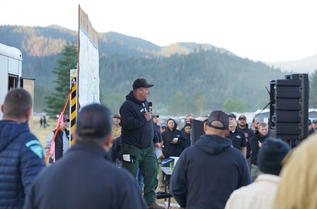
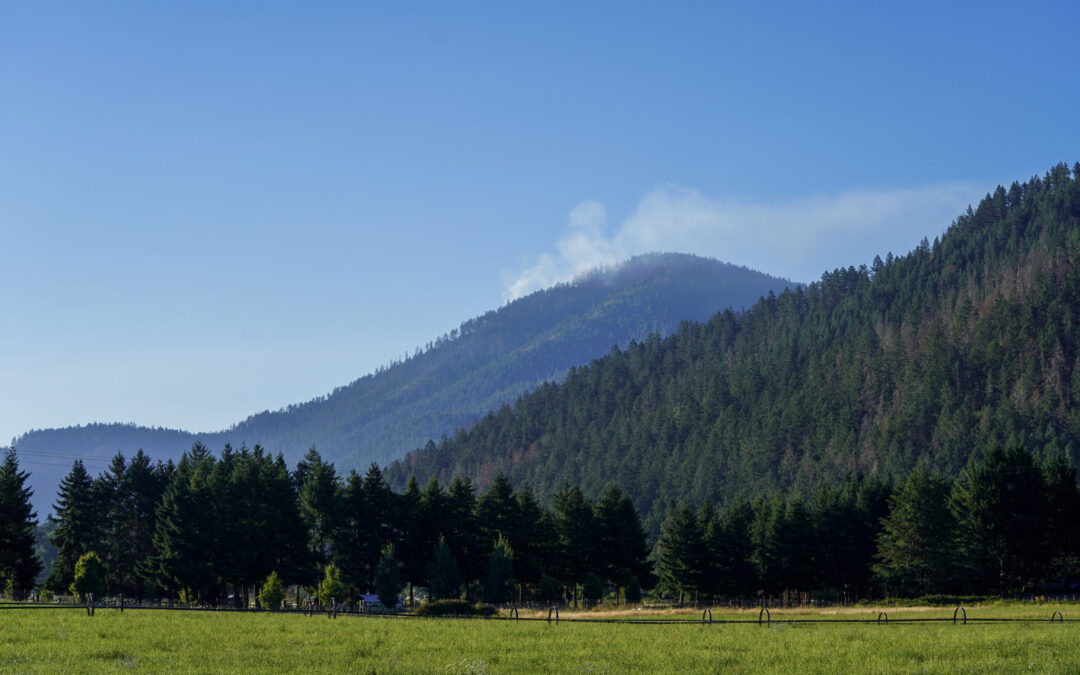
JACKSON & JOSEPHINE COUNTIES, Ore. (July 11, 2025)—Resources from Oregon Department of Forestry (ODF) Complex Incident Management Team 3, and district resources working on non-complex lightning fires, continued to make progress last night with good overnight recovery of temperatures and humidities. With temperatures increasing, today’s focus will be holding night shift’s progress and expanding on their success.
ODF Complex Incident Management Team 3 is managing a group of lightning fires dubbed the Grizzly Complex. The team is also fighting the Neil Creek Road Fire west of I-5 near Ashland. ODF Southwest Oregon District continues suppression efforts on additional fires started by lightning on Monday along with initial attack on new fire starts within the district.
More than 1,300 personnel are assigned to the Grizzly Complex and Neil Creek Road fires, with more arriving today. These additional crews and resources are providing relief to local district personnel, allowing them to continue work on other fires within the district and respond to potential new fire starts.
“The progress made on these fires overnight significantly contributes to keeping these fires small ahead of increased temperatures over the weekend,” said Tyler McCarty, ODF Team 3 Incident Commander.
Today, the following fires remain the largest incidents across the district:
- The Neil Creek Road Fire, located west of I-5 mile marker 10 and south of Ashland. Last night, crews completed additional direct line and continued mop-up operations across the whole perimeter. With updated mapping, the fire is now estimated at 200 acres. The Jackson County Sheriff’s Office and Emergency Management are maintaining evacuation notices for Zones JAC-536, JAC-542, JAC-543, JAC-546, JAC-558 and JAC-559 under a Level 2 – Be Set. More information on current evacuations can be found at: https://protect.genasys.com/. One lane of I-5 is closed between mile markers 8.5 and 10.5 on southbound lanes only. Check com for up-to-date traffic information.
- The Deming Gulch Fire, located northeast of Buncom, is currently estimated at 250 acres. Firefighters have held the fire perimeter, completed hose lays, and are working on mop up on the east end of the fire. There are currently no evacuation notices on this incident.
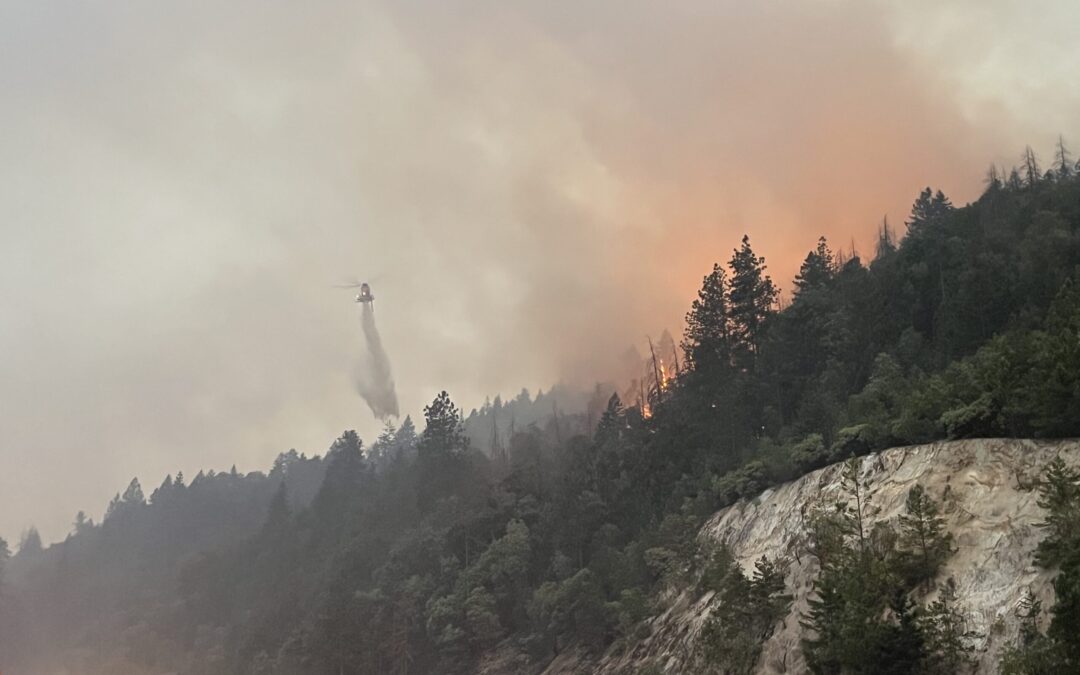
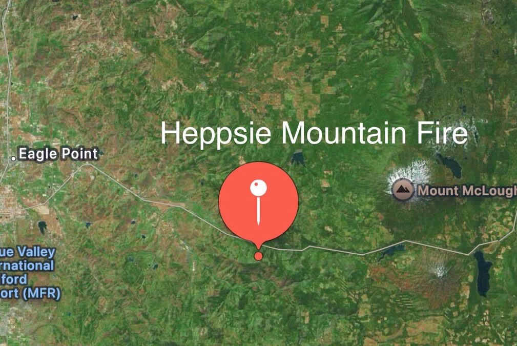
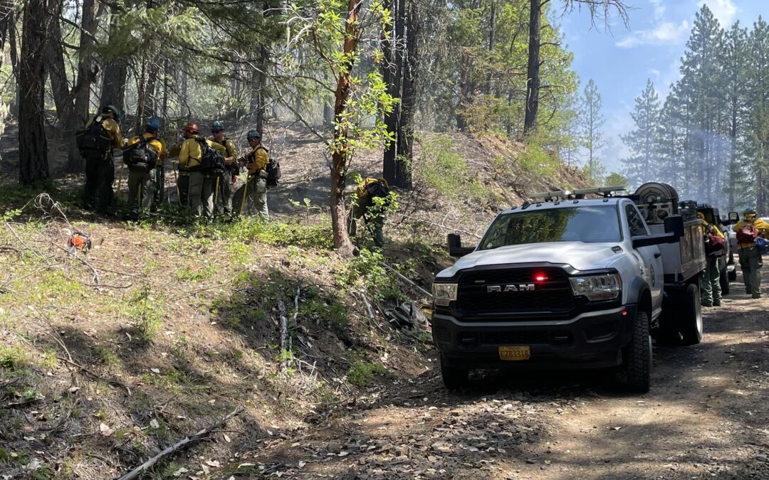
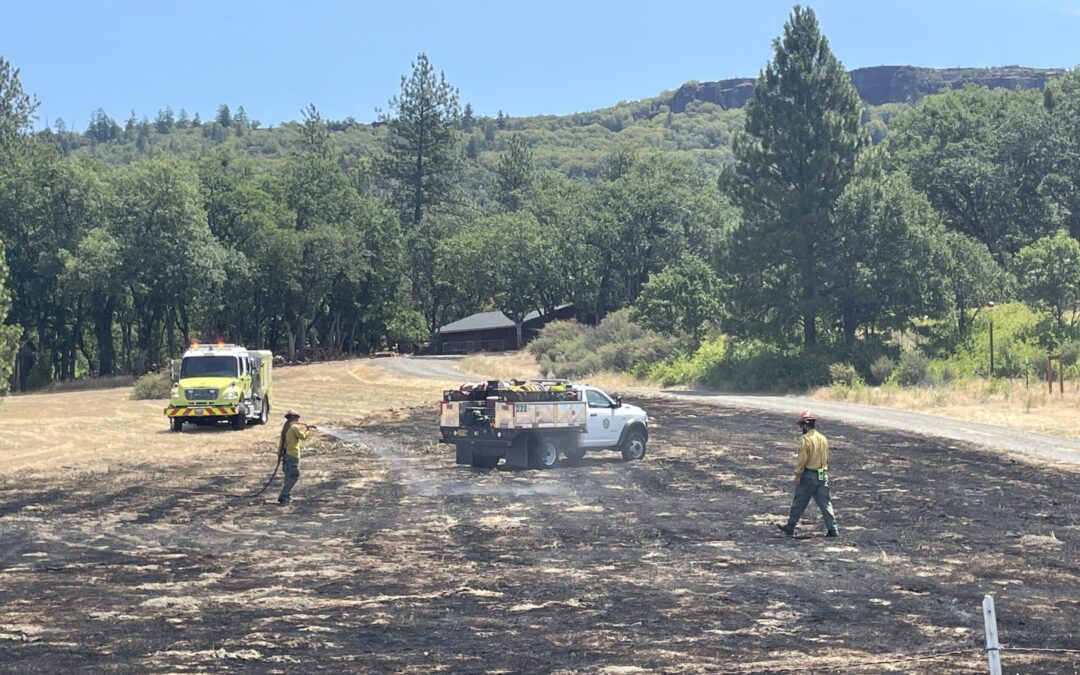
- The Heppsie Mountain Fire, located south of Highway 140. Firefighters completed 100% of the line around the Heppsie Mountain Fire and continued on mop-up. With the hot and windy conditions yesterday, firefighters found seven small spot fires around the main body of the fire. This morning, they have all been lined and plumbed with fire hose for water access. Hazard trees are also being removed. With the addition of the spot fires, it’s now estimated to be 50 acres total. The Jackson County Sheriff’s Office and Emergency Management have issued a Level 1 – BE READY for a possible evacuation from the following areas: JAC-325-B Heppsie Mountain Road south of Highway 140 and the zone immediately to the south, JAC-326. More information on current evacuations can be found here: https://protect.genasys.com/.
- The Poole Hill Fire, located south of the Heppsie Mountain Fire, was also challenged by the weather yesterday. Fire breached a small portion of the line, but firefighters were able to get around it and continue with mop-up operations. With this change, a half-acre has been added to the fire size, bringing it to 12 acres. Evacuation notifications for the Heppsie Mountain Fire apply to this incident as well.
- The North Fork Deer Creek Fire, located in the hills above the 8000-block of Deer Creek Road east of Selma. Crews continue mop-up operations, holding it at 42 acres. There are no current evacuation orders for this incident.
- The Jim Me Peak Fire, located in a remote area south of Applegate. The fire remains active and firefighters continue to remain heavily engaged in an aggressive attack. Progress was made overnight, and today’s focus on this fire is to add direct line and maintain the current perimeter as temperatures increase today. The fire is estimated at 70 acres.
- The Palmer Peak Fire, located to the southeast of the Jim Me Peak Fire. Line is completed and mop up operations continue. The fire is currently estimated to be 90 acres.
- The Holcomb Peak Fire, located southwest of Williams. Today, firefighters held the line overnight and continued to build more. Hot and windy conditions challenged crews yesterday, and resources are expecting the same today. Firefighters will remain engaged in holding the line and mopping up where possible.
- The Sulfur Springs Fire, located southeast of Buncom and Cinnabar Mountain is 100% lined, and crews are adding hose lays to allow for water access across the incident. With this addition, mop up can begin and push forward.
- The Benson Gulch Fire, south of Applegate Road and Button Butte, west of Buncom. This fire is fully lined at 13 acres, plumbed with hose and in mop-up operations.
Aircraft continues to be a critical asset and will be heavily used all day. Twenty helicopters and fixed wing aircraft will be flying today. As a reminder, drone use around fires is illegal, and incredibly dangerous to pilots working on incidents; if you fly, we can’t. All illegal drone use will be reported to law enforcement.
Most of these fires were caused by lightning strikes following thunderstorms Monday night. Other small fires are still staffed across the district. Due to the large number of fires, updates on smaller incidents are not being provided at this time; if conditions change and there are any threats to homes, communities or roads, information will be provided as timely and accurately as possible.
Yesterday, local district resources responded to multiple new reports of human-caused fires, including a 12-acre fire off of Hammel Road, north of Eagle Point. All new fires have been caught and extinguished, but they serve as a reminder of the need to prevent fires where possible. While resources remain engaged on these lightning-caused incidents, communities can help by following all current fire regulations, found here: https://swofire.com/public-fire-restrictions/.
For fire local information anytime, visit the district’s Facebook page, @ODFSouthwest or website, www.swofire.com.
July 10, 2025
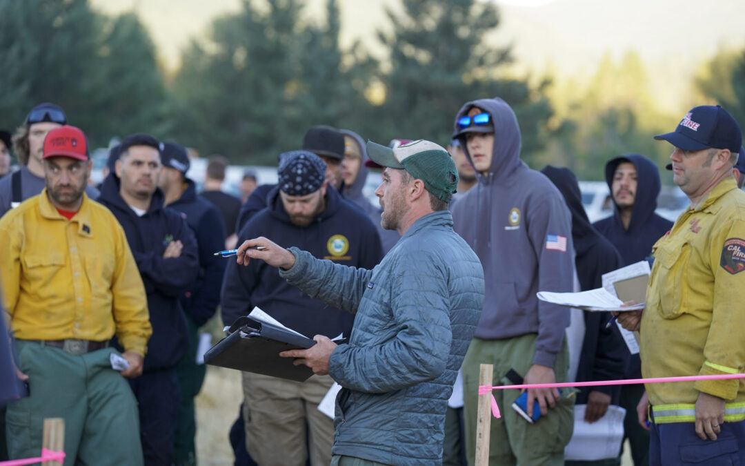
JACKSON & JOSEPHINE COUNTIES, Ore. (July 10, 2025)—Oregon Department of Forestry (ODF) Complex Incident Management Team 3 assumed command of the Grizzly Complex this morning, and the Neil Creek Road Fire that is not part of the complex. ODF Southwest Oregon District continues suppression efforts on additional fires started by lightning on Monday.
At this time, more than 1,300 personnel are assigned to the fires, with many more on the way. These additional crews and resources continue to arrive to provide relief to existing local district personnel, allowing them to continue work on other fires within the district and be ready to respond to potential new fire starts.
Significant progress was made on numerous fires managed by both district personnel and ODF Team 3 with continued aggressive, direct suppression efforts. “Increased temperatures, windy conditions and rugged terrain challenged crews today, but it was a successful day of safe firefighting,” said ODF Team 3 Incident Commander Tyler McCarty.
Today, the following fires remain the largest incidents across the district:
- The Neil Creek Road Fire, located west of I-5 mile marker 10 and south of Ashland. Today, crews completed dozer line on the south end of the fire and continued to build direct lines elsewhere around the fire’s perimeter. Crews continued mop-up operations along the north end of the fire. The fire remains estimated at 250 acres. The Jackson County Sheriff’s Office and Emergency Management are maintaining evacuation notices for Zones JAC-536, JAC-542, JAC-543, JAC-546, JAC-558 and JAC-559 under a Level 2 – Be Set. More information on current evacuations can be found at: https://protect.genasys.com/. One lane of I-5 is closed between mile markers 8.5 and 10.5 on southbound lanes only. Check tripcheck.com for up-to-date traffic information.
- The Deming Gulch Fire, located northeast of Buncom, is currently estimated at 250 acres. Firefighters continued additional line construction along the west flank and will begin adding hose lays through night shift tonight. There are currently no evacuation notices on this incident.
- The Heppsie Mountain Fire, located south of Highway 140. Firefighters completed 65% of the line around the the Heppsie Mountain Fire today, and began mop up that will continue into the night, it’s still estimated to be 40 acres in size. The Jackson County Sheriff’s Office and Emergency Management have issued a Level 1 – BE READY for a possible evacuation from the following areas: JAC-325-B Heppsie Mountain Road south of Highway 140 and the zone immediately to the south, JAC-326. More information on current evacuations can be found here: https://protect.genasys.com/.
- The Poole Hill Fire, located south of the Heppsie Mountain Fire. Firefighters continue mop up operations while maintaining lines, keeping the fire at a final size of 11.5 acres. Evacuation notifications for the Heppsie Mountain Fire apply to this incident as well.
- The North Fork Deer Creek Fire, located in the hills above the 8000-block of Deer Creek Road east of Selma. Crews continue mop up operations, holding it at 42 acres. There are no current evacuation orders for this incident.
- The Jim Me Peak Fire, located in a remote area south of Applegate. The fire remained very active today, but firefighters continue to remain heavily engaged in an aggressive attack as hot, windy conditions persist into the evening.
- The Palmer Peak Fire, located to the southeast of the Jim Me Peak Fire. Today, firefighters completed line around the fire, and mop up operations have begun. The fire is currently estimated to be 90 acres.
- The Holcomb Peak Fire, located southwest of Williams. Today, firefighters worked to hold line around the fire and build more. Hot and windy conditions challenged crews, but resources will remain engaged overnight.
Aircraft were used heavily all day, contributing to success across all fires in the district. As a reminder, drone use around fires is illegal, and incredibly dangerous to pilots working on incidents; if you fly, we can’t. All illegal drone use will be reported to law enforcement.
Most of these fires were caused by lightning strikes following thunderstorms Monday night. The fire count remains at 72 total between the two counties, with numerous fires already caught and extinguished at small sizes.
Other small fires are still staffed across the district. Due to the large number of fires, updates on smaller incidents are not being provided at this time; if conditions change and there are any threats to homes, communities or roads, information will be provided as timely and accurately as possible.
High fire danger is currently in effect on ODF-protected land in Jackson and Josephine counties; as firefighters work to extinguish these natural fire starts, help prevent new human-caused fires from sparking by following all regulations currently in place: https://swofire.com/public-fire-restrictions/.
For fire local information anytime, visit the district’s Facebook page, @ODFSouthwest or website, www.swofire.com.
July 10, 2025
JACKSON & JOSEPHINE COUNTIES, Ore. (July 10, 2025) – Oregon Department of Forestry (ODF) Complex Incident Management Team 3 assumed command of the majority of the lightning-caused fires this morning at 6:00 a.m. More firefighters, crews, and additional resources continue to arrive and will rotate out some existing local district personnel, allowing them to be ready to respond to potential new fire starts.
Capitalizing off cooler night temperatures, firefighters made great progress overnight across all fires in Jackson and Josephine counties and held the majority of fires within their current footprints, minimizing growth. Today, firefighters will continue to provide aggressive, direct suppression on fires and push forward to build lines as hot and windy conditions persist throughout the day and fire potential remains.
Today, the following fires remain the largest incidents across the district:
• The Neil Creek Road Fire, located west of I5 mile marker 10 and south of Ashland. Overnight, firefighters continued to build and hold lines around the fire. Crews built additional dozer and hand lines around the perimeter with much of the effort trying to contain the south edge of the fire along Interstate 5. Crews also began mop-up operations along the north end of the fire, still estimated to be 250 acres. The Jackson County Sheriff’s Office and Emergency Management have placed Zones JAC-536, JAC-542, JAC-543, JAC-546, JAC-558 and JAC-559 under a Level 2 – Be Set to evacuate notice. More information on current evacuations can be found here: https://protect.genasys.com/. One lane of I5 is closed between mile markers 8.5 and 10.5 on both the southbound and northbound sides. Check tripcheck.com for traffic information.
• The Deming Gulch Fire, located northeast of Buncom, is currently estimated at 250 acres. Overnight, firefighters were able to build additional line along the west flank and will continue to push forward on progress. Steep terrain with limited access is creating challenges for firefighters. There are currently no
evacuation notices on this incident.
• The Heppsie Mountain Fire, located south of Highway 140. Firefighters were able to complete the line around the entire Heppsie Mountain Fire, still estimated to be 40 acres in size. Two small spot fires were caught overnight at an acre and half an acre each, and they are both 100% lined this morning. Despite windy conditions, these were the only setbacks overnight. Today, firefighters will continue to bolster lines and mop up. The Jackson County Sheriff’s Office and Emergency Management have issued a Level 1 – BE READY for a possible evacuation from the following areas: JAC-325-B Heppsie Mountain Road south of Highway 140 and the zone immediately to the south, JAC-326. More information on current evacuations can be found here: https://protect.genasys.com/.
• The Poole Hill Fire, located south of the Heppsie Mountain Fire. Firefighters were able to hold lines overnight, keeping the fire completely lined and holding it at a final size of 11.5 acres. Mop-up operations will continue today. Evacuation notifications for the Heppsie Mountain Fire apply to this incident as well.
• The North Fork Deer Creek Fire, located in the hills above the 8000-block of Deer Creek Road east of Selma, was 100% lined overnight by fire crews, holding it at 42 acres. Firefighters will continue mop-up operations. There are no current evacuation orders for this incident.
• The Jim Me Peak Fire, located in a remote area south of Applegate. The fire remained very active overnight, but firefighters continued to hold it within its footprint at around 70 acres. Resources will continue to be engaged in an aggressive attack as hot, windy conditions persist.
• The Palmer Peak Fire, located to the southeast of the Jim Me Peak Fire. Overnight, firefighters were able to continue building line around the fire, now 90% complete. This work will continue today. The fire is currently estimated to be 90 acres.
• The Holcomb Peak Fire, located southwest of Williams. Overnight, crews were able to gain the upper hand and line 50-percent of the fire’s perimeter. Today, firefighters will work to hold this line and build more. Hot and windy conditions are expected again, and aircraft will be used where needed.
Aircraft continues to be a pivotal resource on these incidents and will be used where needed throughout the day. As a reminder, drone use around fires is illegal, and incredibly dangerous to pilots working on incidents; if you fly, we can’t. All illegal drone use will be reported to law enforcement.
The majority of these fires were caused by lightning strikes following thunderstorms Monday night. The fire count remains at 72 total between the two counties, with numerous fires already caught and extinguished at small sizes.
A number of other small fires are staffed across the district. Due to the large amount of fires, updates on smaller incidents are not being provided at this time; if conditions change and there are any threats to homes, communities or roads, information will be provided as timely and accurately as possible.
High fire danger is currently in effect on ODF-protected land in Jackson and Josephine counties; as firefighters work to extinguish these natural fire starts, help prevent new human-caused fires from sparking by following all regulations currently in place: https://swofire.com/public-fire-restrictions/.
For fire local information anytime, visit the district’s Facebook page, @ODFSouthwest or website, www.swofire.com.
July 9, 2025
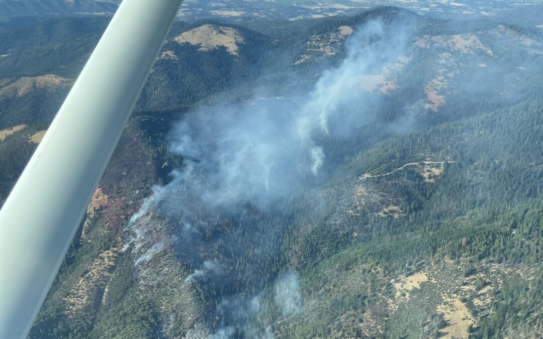
JACKSON & JOSEPHINE COUNTIES, Ore. (July 9, 2025) – Firefighters are continuing aggressive suppression action across all fires in Jackson and Josephine counties, the majority of which were caused by lightning strikes following thunderstorms Monday night. The fire count remains at 72 total between the two counties, with numerous fires already caught and extinguished at small sizes. The remaining fires are staffed with resources, and progress continues to be made across the board despite hot and windy conditions, which can naturally fuel fire growth. Oregon Department of Forestry (ODF) Complex Incident Management Team 3 was in-briefed by the local district at noon; the team is prepping to take a portion of the fires off the district’s plate as early as 6:00 a.m. tomorrow morning, freeing up local resources to be ready for potential new fire starts.
Today, the following fires remain the largest incidents across the district:
- The Neil Creek Road Fire, located west of I5 mile marker 10 and south of Ashland. Firefighters have been building and holding lines around the fire despite hot, windy conditions. With the help of additional retardant drops today, firefighters have been able to solidify line around 50% of the fire’s perimeter. Tonight, firefighters will continue to work on holding and improving existing lines and building onto them with a goal of completing as much of the perimeter as possible. The fire is still estimated to be 250 acres. The Jackson County Sheriff’s Office and Emergency Management have placed Zones JAC-536, JAC-542, JAC-543, JAC-546, JAC-558 and JAC-559 under a Level 2 – Be Set to evacuate notice. More information on current evacuations can be found here: https://protect.genasys.com/. One lane of I5 is closed between mile markers 8.5 and 10.5 on both the southbound and northbound sides. Check tripcheck.com for traffic information.
- The Deming Gulch Fire, located northeast of Buncom, is currently estimated at 250 acres. Firefighters have been able to complete line around 10% of the fire’s perimeter. Steep terrain with limited access is creating challenges for firefighters. Aircraft have been working on the incident throughout the day, providing help to firefighters on the ground. Tonight, two additional bulldozers will be working around the perimeter to continue lining the fire’s edge. There are currently no evacuation notices on this incident.
- The Heppsie Mountain Fire, located south of Highway 140, is now 65% lined and remains at 40 acres in size. Firefighters are continuing to push forward on progress despite the heat and wind. Steep slopes and falling trees continue to be hazards to firefighters on this incident. The Jackson County Sheriff’s Office and Emergency Management have issued a Level 1 – BE READY for a possible evacuation from the following areas: JAC-325-B Heppsie Mountain Road south of Highway 140 and the zone immediately to the south, JAC-326. More information on current evacuations can be found here: https://protect.genasys.com/
- The Poole Hill Fire, located south of the Heppsie Mountain Fire. Firefighters completed their line around the fire’s perimeter today, holding it at a final size of 11.5 acres. Work is continuing to bolster these lines and begin mop-up operations. Evacuation notifications for the Heppsie Mountain Fire apply to this incident as well.
- The North Fork Deer Creek Fire, located in the hills above the 8000-block of Deer Creek Road east of Selma. Firefighters are holding this fire at 42 acres, despite hot and windy conditions. Three 20-person crews, two engines and a water tender have been ordered for tonight’s shift. Resources will work on lining the fire to keep it in its current footprint. There are no current evacuation orders for this incident.
- The Jim Me Peak Fire, located in a remote area south of Applegate. This fire is estimated to be 70 acres and has slightly grown today in hot, windy conditions. Despite this, firefighters have lined 30% of the fire’s edge with a mix of hand-dug line and bulldozer line. Resources will continue to be engaged in an aggressive attack overnight.
- The Palmer Peak Fire, located to the southeast of the Jim Me Peak Fire. Currently estimated to be 90 acres, firefighters have built line around 40% of the fire today. Resources will continue this work overnight.
Numerous other fires are staffed across the district and are being kept at small sizes. Due to the large amount of fires, updates on smaller incidents are not being provided at this time; if conditions change and there are any threats to homes, communities or roads, information will be provided as timely and accurately as possible. Team 3 resources will also provide additional support to public information needs.
ODF and the Bureau of Land Management greatly appreciate the support of our communities during the aggressive firefight that has ensued since Monday evening; local firefighters and resources have been working around the clock since the first reports of smoke were taken, and the outpouring of support from southern Oregon is seen, heard and felt, providing continued motivation to the boots on the ground.
High fire danger is currently in effect on ODF-protected land in Jackson and Josephine counties; as firefighters work to extinguish these natural fire starts, help prevent new human-caused fires from sparking by following all regulations currently in place: https://swofire.com/public-fire-restrictions/.
For fire information anytime, visit our Facebook page, @ODFSouthwest or our website, www.swofire.com.
July 9, 2025
JACKSON & JOSEPHINE COUNTIES, Ore. (July 9, 2025) – The Oregon Department of Forestry (ODF) Southwest Oregon District is continuing to put up an aggressive attack on fires across Jackson and Josephine counties that were sparked by thunderstorms Monday night. In all, 72 have been identified on ODF-protected land in the two counties, and since the start of the storm, firefighters have worked nonstop to respond to all reports of fire, keeping them as small as possible with the limited resources that are currently available. This morning, Oregon Department of Forestry (ODF) Complex Incident Management Team 3 will in-brief at noon to take a portion of the fires off the district’s plate, allowing local firefighters to focus on a smaller number of lingering fires and be ready for any new reports of fire that could come in. Team 3 is expected to take command of their assigned incidents at 6:00 p.m. tonight.
Overnight, firefighters remained engaged on fires across both counties, the largest being the Neil Creek Road Fire located west of I5 and south of Ashland. It’s estimated to be 250 acres and forced the closure of one lane of I5 southbound overnight between mile markers 8.5 and 10.5. This lane closure is still currently in effect, check tripcheck.com for updates. This fire has also prompted the Jackson County Sheriff’s Office and Emergency Management to place Level 2 evacuation notices into effect for the surrounding area; all evacuation information can be found here: https://protect.genasys.com/. The second largest fire is the Deming Gulch Fire located northeast of Buncom, estimated at 200 acres this morning. No evacuation notices are currently in effect for this incident.
“We recognize how these fires are affecting our communities, and that’s why our attack on them has been so aggressive from the start,” ODF Southwest Oregon District Forester Dan Quinones said. “With the amount of lightning and limited rain that came with Monday’s storm, we knew the possibility of a large number of fires across the district was on the table, and we geared up to fight. That is a position that we have not let up on since then. Our communities can be proud of our local firefighters – they answered the call two days ago and have tirelessly continued to since then.”
This morning, the largest fires across the district include:
- The Neil Creek Road Fire, located west of I5 mile marker 10 and south of Ashland. Firefighters are estimating the fire is 250 acres and were finding and extinguishing spot fires overnight due to windy conditions. Building a line around the fire’s perimeter will continue to be the main objective today, with structural firefighters staging to protect homes and outbuildings in the nearby area. The Jackson County Sheriff’s Office and Emergency Management have placed Zones JAC-536, JAC-542, JAC-543, JAC-546, JAC-558 and JAC-559 under a Level 2 – Be Set to evacuate notice. More information on current evacuations can be found here: https://protect.genasys.com/. One lane of I5 southbound is closed between mile markers 8.5 and 10.5. Check tripcheck.com for traffic information.
- The Deming Gulch Fire, located northeast of Buncom, is currently estimated at 200 acres. Firefighters remained engaged on the fire overnight, including engines and bulldozers. Firefighters are working to line the fire and today, six 20-person crews and a bulldozer are assigned to this incident. Aircraft will also be used as needed. There are currently no evacuation notices on this incident.
- The Heppsie Mountain Fire, located south of Highway 140. The fire remains 50% lined and is considered 30% contained overall. Strong winds threatened the lines built around the fire, but resources were able to keep it in its current footprint of an estimated 40 acres overnight. One engine, five bulldozers, four sets of tree fallers, four 20-person crews and aircraft will continue to be assigned to the fire today. Steep slopes and falling trees continue to be hazards to firefighters on this incident. The Jackson County Sheriff’s Office and Emergency Management have issued a Level 1 – BE READY for a possible evacuation from the following areas: JAC-325-B Heppsie Mountain Road south of Highway 140 and the zone immediately to the south, JAC-326. More information on current evacuations can be found here: https://protect.genasys.com/
- The Poole Hill Fire, located south of the Heppsie Mountain Fire. The fire is still estimated to be between 12 – 15 acres, however firefighters continue to make progress, holding onto the 80% of line that was built through strong winds. Work will continue today with the goal of closing the perimeter if possible, however steep slopes are creating a challenge to firefighters. Evacuation notifications for the Heppsie Mountain Fire apply to this incident as well.
- The Jim Me Peak Fire, located in a remote area south of Applegate. This fire is estimated to be 40 acres and has burned into another small nearby fire named the Ladybug Gulch Fire, which was originally 4.5 acres. These two fere caused by lightning strikes located in very close proximity, which led to the fires burning into one. Resources continue to be engaged in an aggressive attack. Multiple 20-person crews, engines and bulldozers have been ordered and will continue progress on lining the fire’s edge today.
- The Palmer Peak Fire, located to the southeast of the Jim Me Peak Fire. Currently estimated to be 90 acres, firefighters are continuing an aggressive attack. Engines, a bulldozer and aircraft have been working on this incident and will continue to today.
Across all incidents, 435 personnel will be working today’s dayshift. Additional resources are continuing to be ordered as needed, however some have not readily been available due to current state and nationwide incidents. Despite these challenges, firefighters have successfully extinguished 11 fires across the district, the largest being the Pompadour Fire located east of Ashland at 38 acres. This work has been done in partnership with our local and federal partners; Collectively as a firefighting system, our continued goal is to keep all fires as small as possible and extinguish them as fast as we can.
High fire danger is currently in effect on ODF-protected land in Jackson and Josephine counties; as firefighters work to extinguish these natural fire starts, help prevent new human-caused fires from sparking by following all regulations currently in place: https://swofire.com/public-fire-restrictions/
For fire information anytime, visit our Facebook page, @ODFSouthwest or our website, www.swofire.com.
July 8, 2025
JACKSON & JOSEPHINE COUNTIES, Ore. (July 8, 2025) – Firefighters continued an aggressive initial attack on numerous fires caused by thunderstorms Monday night, making significant progress on the largest fires initially identified, but also responding to multiple new reports of fire throughout the day on Tuesday. In total across Jackson and Josephine counties, 72 fires on ODF-protected land have been confirmed by reconnaissance flights, detection cameras and firefighters.
Due to the sheer volume of incidents, the potential for additional holdover fires and predicted dry thunderstorms tonight in Jackson County, the district has ordered Oregon Department of Forestry (ODF) Complex Incident Management Team 3, which will mobilize from ODF Districts across Oregon tomorrow morning. With direction from the district, the team will take command of a portion of the fires to free up local resources, bring in additional expertise and personnel, as well as give local firefighters a short reprieve before returning to initial attack readiness.
“Our firefighters have been working around the clock to keep these fires as small as we can, but resources are becoming limited, especially with other incidents across Oregon and the country competing for the same emergency response professionals,” ODF Southwest Oregon District Forester Dan Quinones said. “Bringing in ODF IMT 3 will allow us to regain our strength locally, handing some of these fires off to firefighters who hold the same drive to take them off the map as quickly as possible. Protecting our communities and putting out fires remain our top priorities.”
Tonight, the largest fires across the district include:
- The Heppsie Mountain Fire, located south of Highway 140. Firefighters made excellent progress on this incident today, lining 50% of the perimeter. Firefighters now estimate the fire to be closer to 40 acres. Engines, bulldozers and aircraft have been assigned to the fire and continue to fight the fire aggressively. The Jackson County Sheriff’s Office and Emergency Management have issued a Level 1 – BE READY for a possible evacuation from the following areas: JAC-325-B Heppsie Mountain Road south of Highway 140 and the zone immediately to the south, JAC-326. More information on current evacuations can be found here: https://protect.genasys.com/
- The Poole Hill Fire, located south of the Heppsie Mountain Fire. Firefighters are estimating the fire has grown to 12 – 15 acres, however they have made significant progress on the incident, lining 80% of the fire’s perimeter today. Numerous resources have been ordered for this incident tonight, including two 20-person crews, a water tender and additional engines. Evacuation notifications for the Heppsie Mountain Fire apply to this incident as well.
- The Pompadour Fire, located in the hills east of Ashland off of East Nevada Street and Pompadour Drive. Firefighters caught this fire at 38 acres and have completed lining and mopping up the entire incident. The resources assigned to this fire have been dispatched to new fire reports.
- The Deming Gulch Fire, located northeast of Buncom, is currently estimated at 350 acres. Numerous resources are engaged on the fire, including engines and bulldozers. Firefighters are working to line the fire. There are currently no evacuation notices on this incident.
- The Neil Creek Road Fire, located west of I5 mile marker 10 and south of Ashland. Firefighters are holding the fire at 35 acres with several successful retardant drops this afternoon. Traffic to I5 is not being impacted by this fire. The Jackson County Sheriff’s Office and Emergency Management have placed Zone JAC-543 under Level 1 – Be Ready to evacuate notice and zones JAC-536, JAC-542 and JAC-558 under a Level 2 – Be Set to evacuate notice. More information on current evacuations can be found here: https://protect.genasys.com/
- The Jim Me Peak Fire, located in a remote area south of Applegate. This fire is estimated to be 30 acres and resources are engaged in an aggressive initial attack. Multiple 20-person crews, engines and bulldozers are being ordered to work on this fire overnight and continue progress on lining the fire’s edge.
- The Palmer Peak Fire, located to the southeast of the Jim Me Peak Fire. Currently estimated to be 20 acres, firefighters are continuing an aggressive initial attack. Engines, a bulldozer and aircraft have been working on this incident.
Numerous additional fires have been stopped at a small size and are 100% lined and mopped up this evening. All other staffed fires are estimated to be between 1/10 of an acre and 10 acres in size. Numerous reconnaissance flights have provided invaluable information throughout the day, allowing firefighters to be strategic about resources needed, helping to prioritize where the greatest needs are. The majority of these fires are located on steep slopes high in elevation where lightning naturally strikes, creating the added challenge of navigating to and accessing the fires. Aircraft has played a vital role in slowing the spread of numerous fires, allowing firefighters to gain access and begin initial attack. The ODF Southwest Oregon Detection Center has also been monitoring cameras in these strike areas today and helped to confirm smoke or fires found across the district when aircraft was unable for reconnaissance.
ODF resources are continuing to work with our federal partners at the U.S. Forest Service (USFS) Rogue River-Siskiyou National Forest and Bureau of Land Management (BLM) in response to these fires, as well as local and county structural fire departments. This teamwork is a direct reflection of the complete and coordinated fire response system in place here in southern Oregon.
High fire danger is currently in effect on ODF-protected land in Jackson and Josephine counties; as firefighters work to extinguish these natural fire starts, help prevent new human-caused fires from sparking by following all regulations currently in place: https://swofire.com/public-fire-restrictions/
For fire information anytime, visit our Facebook page, @ODFSouthwest or our website, www.swofire.com.
July 8, 2025
JACKSON & JOSEPHINE COUNTIES, Ore. (July 8, 2025) – Firefighters with the Oregon Department of Forestry (ODF) Southwest Oregon District are continuing to respond to 53 reports of smoke and fire following thunderstorms that moved through Jackson and Josephine counties Monday evening. Of the 53 reports, 17 have been found to be duplicates or not fires, resulting in 22 confirmed fires across the district and an additional 14 reports that are pending. Resources have been engaged on these 22 incidents all night, and as a result, seven are already 100% lined and mopped up, leaving 15 active and staffed. As fires are lined and mopped up, resources are continually being dispatched to pending calls.
This morning, firefighters remain engaged on three major fires, the largest being an estimated 50 acres in size. The following is a current look at incident status:
- The Heppsie Mountain Fire, located off of Highway 140 north of Lake Creek. Estimated to be 50 acres, this fire is located on steep terrain with numerous hazard trees. Overnight, large trees were falling while
- firefighters were working in the area. Resources ordered for today’s dayshift include four 20-person crews, five bulldozers, three sets of tree fallers, two water tenders and one engine, totaling 100 personnel. Additionally, two Large Air Tankers (LATs), two Type 1 helicopters and an air attack plane have also been ordered. Firefighters will focus on falling hazard trees and working to line the fire and keep it as small as possible.
- The Poole Hill Fire, located south of the Heppsie Mountain Fire across South Fork Little Butte Creek Road, is estimated to be three to five acres. Firefighters are actively engaged on this incident. Due to the proximity of the Heppsie Mountain and Poole Hill fires, the Jackson County Sheriff’s Office and Emergency Management issued a Level 1 – BE READY evacuation notice for the 11000-block of South Fork Little Butte Creek Road last night, which remains in place this morning. More information is available here: https://protect.genasys.com/. This is the only current evacuation notice in place on any fire. Additional fire reports have been made in this area; recon flights beginning at 8:00 a.m. will provide additional information to firefighters on the ground.
- The Pompadour Fire, located in the hills east of Ashland off of East Nevada Street and Pompadour Drive. Firefighters were able to line 100% of the fire’s perimeter and stop its growth at 38 acres. Overnight, resources began mop-up operations and have completed 10%. Today, four 20-person crews, two bulldozers and one engine are assigned to the fire, totaling 86 personnel. Aircraft will be ordered as needed.
All other staffed fires are estimated to be between 1/10 of an acre and six acres. This morning, two reconnaissance flights will be launching at 8:00 a.m., covering all strike areas across the district. These flights will provide better information in the daylight of current fires, and allow us to get eyes on pending reports, confirm duplicate reports and provide insight on fire status to be strategic with ordering and dispatching resources. The ODF Southwest Oregon Detection Center will also be monitoring cameras in these strike areas today and reporting any smoke or fires found across the district.
Last night, a strike team of five engines from the ODF Southern Oregon Area arrived and were dispatched to fires; this morning, another five-engine strike team is mobilizing from the ODF Northwest Oregon Area. The district has also ordered an additional two 20-person crews, seven engines, one water tender and one bulldozer to be available where needed as initial attack on these fires continues. In total, 266 personnel are assigned to these fires for today’s dayshift, and more resources will be ordered and assigned for Tuesday night where needed.
ODF resources are continuing to work with our federal partners at the U.S. Forest Service (USFS) Rogue River-Siskiyou National Forest and Bureau of Land Management (BLM) in response to these fires, as well as local and county structural fire departments. This teamwork is a direct reflection of the complete and coordinated fire response system in place here in southern Oregon.
High fire danger is currently in effect on ODF-protected land in Jackson and Josephine counties; as firefighters work to extinguish these natural fire starts, help prevent new human-caused fires from sparking by following all regulations currently in place: https://swofire.com/public-fire-restrictions/
For fire information anytime, visit our Facebook page, @ODFSouthwest or our website, www.swofire.com.
July 1, 2025
JACKSON COUNTY, Ore. (July 1, 2025) – Firefighters with the Oregon Department of Forestry (ODF) Southwest Oregon District responded to 15 reports of fire on Tuesday following thunderstorms throughout the region on Monday night. In total, ODF firefighters found and confirmed 10 fires from the 15 reported. ODF resources worked with federal partners at the U.S. Forest Service (USFS) Rogue River-Siskiyou National Forest and Bureau of Land Management (BLM) in response to these fires, and as a result, all fires are either completely extinguished or are fully lined and holding in their current footprint. This teamwork is a direct reflection of the complete and coordinated fire response system in place here in southern Oregon.
Numerous resources were used early Tuesday morning to gather data on these incidents, including drone flights, reconnaissance flights with various aircraft and ODF’s Detection Center cameras. ODF has a goal of extinguishing all fires as quickly as possible and as small as possible; between the technology and aircraft used, as well as firefighters patrolling in their areas, all fires were located quickly, and resources were dispatched immediately to each report. As a direct result of this work and aggressive initial attacks, the largest fire was caught at 12 acres.
The following is a current look at incident status, listed by size:
- East Trail Creek Road Fire, located north of Trail near the 6000-block of Highway 227. With a mix of helicopters, air tankers and ground resources, the fire was caught at 12 acres and is 100% lined. Firefighters are continuing to work on mop-up operations. Resources have been ordered for an overnight shift, including three 20-person crews, 10 engines, a water tender and a bulldozer. Aircraft is available as needed until sundown.
- Alder Creek Fire, located northwest of Prospect on private and USFS land. Holding at two acres, turned over to USFS for continued mop-up operations.
- Hibbard Creek Fire, located northwest of Prospect on private and USFS land. Holding at a half-acre, mop-up ongoing.
- Star Gulch Fire, located on remote terrain southeast of Williams. Stopped at a quarter-acre, 100% lined and mopped up.
- Beaver Dam Fire, located along Big Elk Road south of Fish Lake. Stopped at 1/10 of an acre on USFS land, 100% lined and mopped up.
- Daily Creek Fire, located on USFS land south of Fish Lake. Stopped at 1/10 of an acre. Firefighters lined 100% of the fire and mopped up 75% before handing it over to USFS resources.
- Summit Prairie Fire, located southeast of Lost Creek Lake. Caught at 1/100 of an acre, 100% lined and mopped up.
- Mule Creek Fire, located southeast of Lost Creek Lake. Caught at 1/100 of an acre, 100% lined and mopped up.
- Laurelhurst Fire, located on the southeastern shore of Lost Creek Lake. Firefighters were able to stop the fire at 1/100 of an acre, 100% lined and mopped up.
- Halls Point Fire, located northwest of Prospect on USFS land. Stopped at 1/100 of an acre, 100% lined and turned over to the Forest Service.
Firefighters responded to an additional five reports of fire, but didn’t find any smoke or fire while searching in the area. A reconnaissance flight at 3 p.m. didn’t yield any additional smoke reports over strike areas. The ODF Southwest Oregon Detection Center will continue to monitor cameras in these areas and report any smoke found. A recon flight is planned for Wednesday morning to go over the same areas and any potential new strike areas overnight.
At 12:01 a.m. on Wednesday morning, High fire danger will go into effect on ODF-protected land in Jackson and Josephine counties; as firefighters work to extinguish these natural fire starts, help prevent new human-caused fires from sparking by following all regulations currently in place: https://swofire.com/public-fire-restrictions/
For fire information anytime, visit our Facebook page, @ODFSouthwest or our website, www.swofire.com.

June 30, 2025
JACKSON & JOSEPHINE COUNTIES, Ore. (June 30, 2025) – The fire danger level on lands protected by the Oregon Department of Forestry (ODF) Southwest Oregon District will increase to “high” (yellow) and the Industrial Fire Precaution Level (IFPL) will increase to Level 2 (two) on Wednesday, July 2, 2025 at 12:01 a.m. This increase is due to consistent hot temperatures, dry vegetation and the threat of thunderstorms and unpreventable lightning-caused fire potential. This change affects 1.8 million acres of state, private, county and Bureau of Land Management lands in Jackson and Josephine counties.
The primary difference between current fire prevention restrictions and those beginning on Wednesday affects the public use of power-driven equipment, such as chainsaws, mowers, weed eaters, and more. The use of power-driven equipment, grinding, cutting of metal, and other spark-emitting equipment, such as wood splitters and generators, will be prohibited between the hours of 10 a.m. and 8 p.m. daily. This does not apply to mowing green lawns.
Other fire prevention regulations which will remain in effect, include:
- No debris burning, including piles and debris burned in burn barrels
- No fireworks on or within 1/8thof a mile of ODF-protected land. Fireworks are prohibited on all BLM land
- Exploding targets and tracer ammunition, or any bullet with a pyrotechnic charge in its base, are prohibited
- Campfires are allowed only in designated campgrounds. Portable stoves or fire pits using liquefied or bottled fuels may be used in other locations that are clear of dry vegetation at all times
- Motorized vehicles, including motorcycles and all-terrain, are allowed only on improved roads; one shovel and one gallon of water, or one 2.5 pound or larger fire extinguisher, is required while traveling
- Smoking while traveling will only be allowed in enclosed vehicles on improved roads, in boats on the water and other specifically designated locations
- Chainsaws may not be used between 10:00 a.m. and 8:00 p.m. during high fire danger. During hours outside of this time frame, chainsaws may be used but require that the operator have one shovel and one 8-oz or larger fire extinguisher at the work site. A fire watch is also required for one hour after each chainsaw use
- Cutting, grinding, and welding of metal is not allowed between 10:00 a.m. and 8:00 p.m. during high fire danger. These activities will be allowed during hours outside of this time frame only if the work site is cleared of potentially flammable vegetation and other materials, and a water supply is at the job site
- The mowing of dead or dried grass with power-driven equipment is not allowed between 10:00 a.m. and 8:00 p.m. during high fire danger, including equipment powered by gas, electricity or batteries. This restriction does not include mowing of green lawns, or equipment used for the commercial culture and harvest of agricultural crops
- Any other spark-emitting internal combustion engine-use not specifically mentioned is not allowed between 10:00 a.m. and 8:00 p.m. during high fire danger. Use of any spark-emitting internal combustion engine is allowed outside of this time frame only if the work site is cleared of potentially flammable vegetation and other materials, and a water supply is at the job site
- Any electric fence controllers must be approved by a nationally recognized testing laboratory, such as Underwriters Laboratories Inc., or be certified by the Department of Consumer and Business Services, and be installed and used in compliance with the fence controller’s instructions for fire safe operation
For industrial operations, under IFPL II (Two) – limited shutdown, which is entirely separate from all public fire restrictions, the following may operate after 8 p.m. and up until 1 p.m. daily:
- Power saws, except at loading sites
- Feller-bunchers with rotary head saws
- Cable yarding
- Blasting
- Welding, cutting, or grinding of metal
For more information about the Oregon Department of Forestry’s fire season restrictions, please call or visit the Southwest Oregon District unit office nearest to you:
- Medford Unit, 5286 Table Rock Rd., Central Point. (541) 664-3328
- Grants Pass Unit, 5375 Monument Dr., Grants Pass. (541) 474-3152
Fire season information is also available online at our Facebook page, @ODFSouthwest and our website, www.swofire.com.
June 23, 2025
CENTRAL POINT, Ore. (June 23, 2025) – Oregon Department of Forestry (ODF) firefighters are investigating following 11 roadside fires that were reported along Table Rock Road outside of Central Point, three in the morning and eight in the evening of June 23. All fires have been extinguished at small sizes with the largest being half an acre.
Just after 11 a.m., Jackson County Fire District 3 and ODF Southwest Oregon District firefighters were dispatched to a report of fire along the 13000-block of Table Rock Road near the intersection of Highway 234. Upon arrival, two additional fires were located in the area. An aggressive initial attack from both agencies resulted in all three fires being quickly extinguished, the largest at half an acre. A preliminary investigation found all three fires to likely be vehicle-related.
Around 6:30 p.m., a new fire in the same area was reported. Both agencies responded once again and found eight small fires between the 11000 and 13000 blocks of Table Rock Road. All eight fires were stopped at 1/10th of an acre or less.
Following a continued investigation, the cause of the fires has been determined to be vehicle-related and all fires remain under investigation. Investigators have ruled out chip sealing conducted by Jackson County Roads in the area as a potential cause at this time.
Vehicle-related fires are common along roadways, especially in areas with dry grass. Fire causes related to cars include faulty catalytic converters; when not maintained, sparks and metal pieces can shoot out tailpipes and ignite dry vegetation near the roadway. Another common car-related fire cause is tow chains dragging on the road. If chains aren’t properly secured, they can hit the pavement and throw sparks into dry grass. Additionally, off-roading in areas of dry vegetation or even parking a hot car over dry grass can cause a fire.
Help prevent human-caused fires this summer by keeping these common vehicle-related fire causes in mind and mitigate risks where possible: ensure your car is regularly serviced by a mechanic, check tow chains and ensure they’re secure, and park in areas clear of dry vegetation.
During fire season, ODF regulates activities that commonly cause wildfires. By following local regulations, fires can be prevented. A complete list is available here: https://swofire.com/public-fire-restrictions. For more fire information, visit our Facebook page, @ODFSouthwest or our website, www.swofire.com.
June 21, 2025
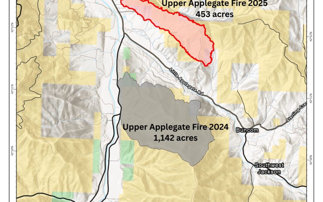
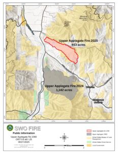
RUCH, Ore. (June 21, 2025) – Firefighters working on the Upper Applegate Fire continue to make steady strides across the incident, pushing forward progress in mop-up operations and bringing the overall incident up to 55% contained. The fire, located along the 2000-block of Upper Applegate Road on private and Bureau of Land Management (BLM) land, was caught by firefighters at 453 acres.
Cool weather conditions persisted Friday night, and a short duration of heavy rain was seen across the fire. On Saturday, temperatures remained much lower than normal, however only a light drizzle of precipitation has materialized. Overnight, resources focused on mop-up operations, reaching 100 feet into the fire’s perimeter. This work consists of searching for remaining hotspots within the fire line, which could include smoldering coals or root systems underground that are still holding heat. If left, the fire could flare up again in hot, windy conditions. As firefighters continue to make progress on this tedious work, the line that was initially built around the fire grows stronger and containment increases.
Tonight, resources assigned to the fire will scout the areas that have been mopped up with infrared (IR) technology to help locate any missed hotspots and ensure the area is completely free of fire or heat. Tomorrow, firefighters will continue with this process, pushing for 150 feet into the interior clear of hotspots. Resources on the line will be the same as Saturday’s roster of seven 20-person crews, one 10-person crew, four engines, two water tenders and one bulldozer. Four sets of fallers remain on the fire as well, removing hazard trees when needed to create a safer working environment. In total, 202 personnel are assigned to the incident.
On Saturday morning, the Jackson County Sheriff’s Office and Emergency Management cancelled all evacuation notices that were left around the fire area. Roads remain open around the fire, including Upper Applegate and Little Applegate roads, however firefighters are still working in the area. Please be aware and cautious when traveling near the fire area.
The Upper Applegate Fire of 2025 was reported at 12:30 p.m. on June 18 as a grass fire nearly a year to the day of last year’s Upper Applegate incident. Both fires are located in the same general area, with similar weather and vegetation moisture levels, however this year’s fire started roughly three hours earlier in the day. Additionally, on both days, ODF was responding to a second fire during initial attack. While there are slight nuances to the data, these events are similar in nature across the board. Despite these similarities, fire managers attribute bringing ODF initial attack firefighters on earlier, as well as hazard tree mitigation work in the area completed by the BLM this year to the success of firefighters on the ground.
“Our funding model is set for us, and it allows for a limited amount of time we can employ our seasonal firefighters. With more fires starting in June each year, we took a creative approach to our hiring practices and brought on Forest Officers a week early this year,” Dan Quinones said, ODF Southwest Oregon’s District Forester. “It’s a balance, because it dictates how long into September and October we can keep those positions staffed, and we will likely still be responding to fires at that point. But with that decision, those firefighters were through their recertifications a week early and were in their patrol areas ready to make a fast response to the Upper Applegate Fire. This is a direct reflection of our staffing needs to protect the communities we serve and the positive result of having firefighters on staff earlier.”
Along the fire’s perimeter, work completed by the BLM Ashland Field Office over the winter helped to create safer access points for firefighters on the Upper Applegate Fire. The project focused on roadside hazard tree removal along Spencer Gulch Road, which ended up being parallel with the fire’s northern flank. The results of the sale removed thousands of dead trees and the safety concerns related to them. Spencer Gulch Road has been a critical access road for firefighters and is serving as a contingency fire line. BLM’s efforts to mitigate the dead trees have resulted in safer access for firefighters and provided a contingency fire line that would have limited acres on the fire if it pushed past temporary retardant lines.
Numerous agencies responded to this fire alongside ODF and Applegate Rural Fire District initially, including the BLM and U.S. Forest Service Rogue River-Siskiyou National Forest. Structure fire agencies from across Jackson and Josephine counties created four task forces to protect homes in the area; due to their fast response, not a single home was lost in this fire. Oregon State Fire Marshal also sent two additional structural task forces from Lane and Marion counties to relieve the local resources on Friday while wildland firefighters continued their work to line the fire and bring control to the incident. ODF would also like to recognize the Jackson County Sheriff’s Office, Jackson County Emergency Management, the Redcross, the Expo, Jackson County Roads and all agencies involved that aided in the response and effort on this incident.
The cause of the fire remains under investigation. This will be the final update on this incident unless conditions significantly change. For more fire information, including current fire regulations, visit our Facebook page, @ODFSouthwest or our website, www.swofire.com.

June 20, 2025
RUCH, Ore. (June 20, 2025) – Progress on the Upper Applegate Fire continues to be made by resources working on the incident. On Friday, firefighters were able to complete the line around the fire and GPS map the perimeter on foot, determining the final fire size as 453 acres. Resources were also able to make progress on mop-up operations, increasing the completion of this work to 25% and bringing the total containment to 35% across the incident.
Cool, cloudy weather conditions were experienced across the fire on Friday, as well as some trace amount of moisture at times. Wind remained a challenge to resources, but more rain in the forecast may provide a natural helping hand to firefighters engaged in mop-up efforts. Tonight, that work will continue, with 127 personnel assigned to the overnight shift. Resources include four 20-person crews, six engines, two bulldozers and four water tenders. These numbers are slightly fewer than previous overnight shifts; as work continues and progress is made, resources will be slowly decreased in an effort to be financially responsible and match the current need on the incident.
In the wake of progress across the fire, the Jackson County Sheriff’s Office and Emergency Management has decreased all Level 2 – BE SET evacuation notices to Level 1 – BE READY and cancelled other existing Level 1 – BE READY notices. All current evacuations and evacuation maps can be found on www.rvem.org/fires. Residents can enter their address and find their evacuation zone and any related notices and information. While roads are open around the fire, including Upper Applegate and Little Applegate roads, firefighters are still working in the area. Please be aware and cautious when traveling near the fire area.
The Upper Applegate Fire, located on private and BLM land on the 2000-block of Upper Applegate Road, was first reported at 12:30 p.m. on June 18 as a grass fire. Applegate Rural Fire District and the Oregon Department of Forestry (ODF) Southwest Oregon District initially responded and found a fast-moving grassfire that was quickly growing in dry vegetation, and was pushed uphill by hot, windy conditions. Fire agencies from across Jackson and Josephine counties, including structural departments, the BLM and U.S. Forest Service Rogue River-Siskiyou National Forest, responded with an aggressive initial attack.
The cause of the fire is currently under investigation. For more fire information, including current fire regulations, visit our Facebook page, @ODFSouthwest or our website, www.swofire.com.
June 20, 2025
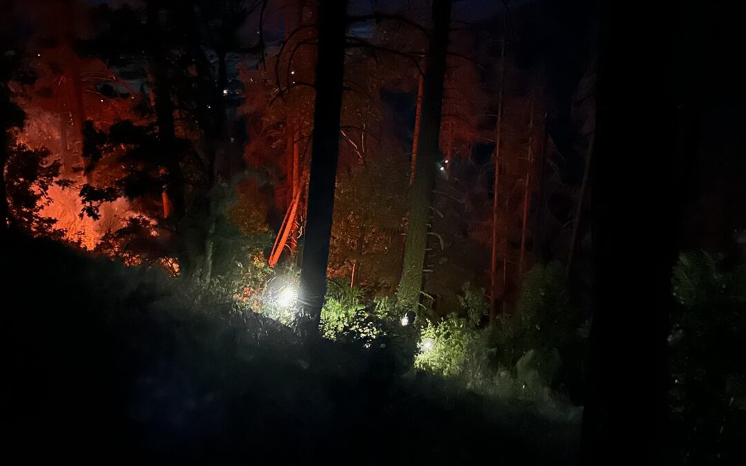
RUCH, Ore. (June 20, 2025) – Firefighters working on the Upper Applegate Fire overnight had a successful shift strengthening lines and making progress on mop-up operations, reaching the 10% mark. Resources were also able to connect hose throughout the rest of the incident, allowing for water access across the entire fire; this will greatly aid firefighters today as they continue to push forward on mopping up the fire. An infrared (IR) flight was not able to be conducted overnight, so the fire remains an estimated 470 acres.
An incoming weather system brought windy conditions to the fire Thursday night and early Friday morning. A chance of rain and thunderstorms is in the forecast today, and wind is expected to persist and even increase across the incident. Firefighters are prepared for the added challenge and are ready to respond to any new fire starts, whether lightning or human-caused.
Last night just before 7 p.m., a grass fire was reported on the 13000-block of North Applegate Road. Aircraft from the Upper Applegate Fire was immediately diverted to the new start; once on scene, the first arriving helicopter reported the fire was approximately two acres and spreading from grass into timber. ODF, Applegate Fire District and Rural Metro Fire all quickly responded with ground resources, including three engines and two crews contracted by ODF on the Upper Applegate Fire. With an aggressive initial attack and relentless water bucket drops from the Type 1 and Type 2 helicopters, firefighters able to stop the spread of the fire at just over eight acres. Resources worked on the scene all night and are continuing mop-up operations this morning.
Today, Upper Applegate Fire resources will also focus on mop up, extinguishing hotspots to create depth on the line and further progress across the incident. Tree fallers will be working again on the north portion of the incident where 5% of the fire remains unlined. As these hazardous trees are removed from the fire’s edge, the area becomes safer for firefighters to work in. More than 250 personnel are assigned to the fire today, including nine 20-person crews, one 10-person crew, seven engines, three bulldozers and five water tenders. Aircraft across the fire remains the same.
Level 2 – BE SET and Level 1 – BE READY evacuations notices remain in place by the Jackson County Sheriff’s Office and Emergency Management for homes near the fire. All current evacuations and evacuation maps can be found on www.rvem.org/fires. Residents can enter their address and find their evacuation zone and any related notices and information. Upper Applegate and Little Applegate roads are now open to all traffic, however firefighters continue to work in the area; please use caution when traveling around the fire.
The Upper Applegate Fire, located on private and BLM land on the 2000-block of Upper Applegate Road, was first reported at 12:30 p.m. on June 18 as a grass fire. Applegate Rural Fire District and the Oregon Department of Forestry (ODF) Southwest Oregon District initially responded and found a fast-moving grassfire that was quickly growing in dry vegetation, and was pushed uphill by hot, windy conditions. Fire agencies from across Jackson and Josephine counties, including structural departments, the BLM and U.S. Forest Service Rogue River-Siskiyou National Forest, responded with an aggressive initial attack.
The cause of the fire is currently under investigation. This will be the final morning update on the Upper Applegate Fire; all future updates will be once per day in the evening following shift change. For more fire information, including current fire regulations, visit our Facebook page, @ODFSouthwest or our website, www.swofire.com.
June 19, 2025
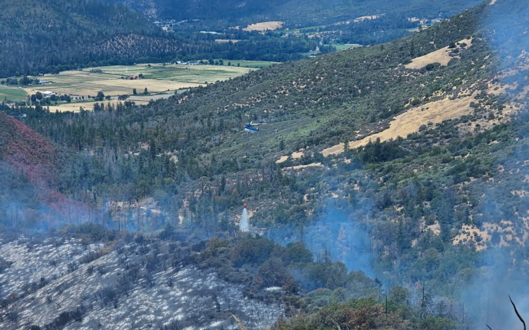
RUCH, Ore. (June 19, 2025) – Resources assigned to the Upper Applegate Fire have nearly reached their goal of lining the entire perimeter of the incident by the end of Thursday’s dayshift, completing 95% of the fire line. The portion that is remaining on the north side of the fire has a high amount of conifer mortality. Tree fallers have been removing dead trees, fire-weakened trees, and snags throughout this area, and are continuing this work to allow firefighters to complete the line safely.
Tonight, resources will also be focused on bolstering the lines created around the fire and beginning mop-up operations to add depth to the perimeter. Additionally, firefighters will be working to complete the hose construction across the incident, which will allow for water access on the fire during mop-up. A total of 224 personnel are assigned to the fire tonight, including eight 20-person crews, 10 engines, six bulldozers and seven water tenders. Aircraft have been flying throughout the day and will be used as needed until sundown.
Due to windy conditions this evening, a 1/100th of an acre spot fire crossed a line on the north side, and crews are engaged in extinguishing and mopping up the area. Resources will continue to monitor lines for any potential breaches or spot fires, as well as monitor the weather for signals of any potential changes in fire behavior.
The Jackson County Sheriff’s Office and Emergency Management have decreased all Level 3 – GO NOW evacuations to Level 2 – BE SET notices. All current evacuations and evacuation maps can be found on www.rvem.org/fires. With this change, the Redcross shelter at Jacksonville Elementary School has closed. Upper Applegate and Little Applegate roads are now open to all traffic, however firefighters remain working in the area; please use caution if traveling on this roadway.
The Upper Applegate Fire was first reported at 12:30 p.m. on June 18 as a grass fire. Applegate Rural Fire District and the Oregon Department of Forestry (ODF) Southwest Oregon District initially responded and found a fast-moving grassfire that was quickly growing in dry vegetation, and was pushed uphill by hot, windy conditions. Fire agencies from across Jackson and Josephine counties, including structural departments, the BLM and U.S. Forest Service Rogue River-Siskiyou National Forest, responded with an aggressive initial attack.
The cause of the fire is currently under investigation. For more fire information, including current fire regulations, visit our Facebook page, @ODFSouthwest or our website, www.swofire.com.
June 19, 2025
RUCH, Ore. (June 19, 2025) – Firefighters working on the Upper Applegate Fire were able to hold the fire overnight, securing a fire line around 70% of its perimeter. The fire has not grown beyond the footprint from late Wednesday afternoon. Additionally, resources were able to connect hose throughout 50% of the fire, bringing water access to the incident and allowing firefighters to hold line and extinguish hot spots easier. The fire, located on private and Bureau of Land Management (BLM) land along the 2000-block of Upper Applegate Road, is estimated to be 470 acres following an assessment from aircraft personnel. This number will fluctuate in the future as more accurate mapping allows.
Today, 204 personnel are assigned to the fire, including eight crews, seven engines, six bulldozers and three water tenders. Aircraft on the fire remains the same, including two Type 2 and three Type 1 helicopters, as well as an air attack plane. Air tankers will be ordered for retardant drops as needed. The Oregon State Fire Marshal sent two structural task forces from Lane and Marion counties to help local resources protect homes in the area.
Resources will focus on holding and improving existing lines today. The only area that remains unlined is on the north portion of the fire, where numerous hazard trees are located. Firefighters are working on mitigating those snags to create a safer working environment, as many are weakened by fire and primed to fall. An additional challenge today will be the weather; winds are predicted to reach 10 to 20 miles per hour in the afternoon with gusts of 25 miles per hour. These conditions, mixed with warm weather, may naturally increase fire activity in the afternoon. Firefighters are aware of this potential and will be watching for changes to fire conditions and responding with any needed resources.
The Jackson County Sheriff’s Office and Emergency Management have issued Level 3 – GO NOW, Level 2 – BE SET and Level 1 – BE READY evacuation notices. All current evacuations and evacuation maps can be found on www.rvem.org/fires. An evacuation shelter is currently open at Jacksonville Elementary School at 655 Hueners Lane in Jacksonville. Small pets can be taken there, and large livestock can be taken to the Expo in Central Point.
The fire was first reported at 12:30 p.m. on June 18 as a grassfire. Applegate Rural Fire District and the Oregon Department of Forestry (ODF) Southwest Oregon District initially responded and found a fast-moving grassfire that was quickly growing in the hot, windy conditions, pushed uphill by dry vegetation. Fire agencies from across Jackson and Josephine counties, including structural departments, the BLM and U.S. Forest Service Rogue River-Siskiyou National Forest, responded with an aggressive initial attack.
Upper Applegate Road remains closed to the public at this time, however residents will be let through. Firefighters remain working in the area; please use caution if traveling on this roadway and avoid the area if possible.
The cause of the fire is currently under investigation. Updates on the incident will be provided in the morning and evening, and throughout the day if a significant update is available. For more information, including current fire regulations, visit our Facebook page, @ODFSouthwest or our website, www.swofire.com.
June 18, 2025
RUCH, Ore. (June 18, 2025) – Firefighters working on the Upper Applegate Fire are holding it at an estimated 350 acres following an aggressive initial attack that has spanned numerous hours. The fire, located on private and Bureau of Land Management (BLM) land along the 2000-block of Upper Applegate Road, was first reported at 12:30 p.m. on June 18 as a grassfire. Applegate Rural Fire District and the Oregon Department of Forestry (ODF) Southwest Oregon District initially responded and found a fast-moving grassfire estimated between five and 10 acres that was quickly growing in the hot, windy conditions, pushed uphill by dry vegetation.
Numerous resources were ordered for the firefight, including additional ODF engines, crews and multiple helicopters, Large Air Tankers (LATs), a Very Large Air Tanker (VLAT) and an air attack plane. Additionally, structural task forces from fire agencies across Jackson and Josephine counties were ordered during second and third alarm calls to protect homes in the area. Resources from the BLM and U.S. Forest Service Rogue River-Siskiyou National Forest arrived on scene to assist quickly as well.
The fire continued to quickly grow in the wind, reaching an estimated 120 acres by 2:30 p.m. and nearing 200 acres by 3:30 p.m. Two Type 2 and three Type 1 helicopters made continuous water bucket drops across the fire throughout the afternoon, and four LATs and 1 VLAT were able to create a temporary fire line of retardant on the left flank of the fire, keeping winds from pushing it further north. Firefighters are engaging in those areas to build a sturdier fire line and hold the fire there. On the right flank, resources have been engaged and fire activity is minimal. The fire’s progression and most active area remains on the east side, where it’s been driven forward by the wind.
Tonight, an additional eight 20-person crews, eight engines, six bulldozers and six water tenders will be arriving to the fire to work the overnight shift. Aircraft will be operating over the fire as long as daylight allows. More resources are being ordered to staff Thursday’s dayshift, beginning at 6:00 a.m.
The Jackson County Sheriff’s Office and Emergency Management, working with firefighters to identify homes that were threatened, issued Level 3 – GO NOW, Level 2 – BE SET and Level 1 – BE READY evacuation notices. All current evacuations can be found on www.rvem.org. An evacuation shelter is currently open at Jacksonville Elementary School at 655 Hueners Lane in Jacksonville. Small pets can be taken there, and large livestock can be taken to the Expo in Central Point.
Upper Applegate Road remains closed to the public at this time, however residents will be let through. Firefighters remain working in the area; please use caution if traveling on this roadway and avoid the area if possible.
The cause of the fire is currently under investigation. Updates on the incident will be provided in the morning and evening, and throughout the day if a significant update is available. For more information, including current fire regulations, visit our Facebook page, @ODFSouthwest.

June 5, 2025
JACKSON & JOSEPHINE COUNTIES, Ore. (June 5, 2025) – Fire danger on Oregon Department of Forestry (ODF) Southwest Oregon District-protected land will increase to moderate (blue) on Saturday, June 7, 2025 at 12:01 a.m. Lands affected by this declaration include 1.8 million acres of state, private, county, city and Bureau of Land Management (BLM) forestlands in Jackson and Josephine counties. The Industrial Fire Precaution Level (IFPL) will remain at one.
Hot temperatures and windy conditions for the past couple of weeks have prompted vegetation to dry at a slightly faster rate; this, in combination with the weather conditions, have contributed to new fire starts and growth. Since the start of fire season on June 1, ODF Southwest Oregon District firefighters have responded to four fires in the span of four days, stopping all at an acre total. With temperatures predicted to reach the threshold of 100 degrees and potential thunderstorms in the forecast this weekend, fire danger will be increased to moderate and new regulations will go into effect.
Beginning Saturday at 12:01 a.m., the following new public fire restrictions will take effect:
- Open fires are prohibited, which includes campfires, charcoal fires, cooking fires and warming fires, except at locations deemed a designated campground. Portable cooking stoves or firepits using liquefied or bottled fuels are still allowed in areas clear of vegetation;
- Chainsaws may not be used between 1:00 p.m. and 8:00 p.m. during moderate fire danger. During hours outside of this time frame, chainsaws may be used but require that the operator have one shovel and one 8-oz or larger fire extinguisher at the work site. A fire watch is also required for one hour after each chainsaw use;
- Cutting, grinding and welding of metal is not allowed between 1:00 p.m. and 8:00 p.m. during moderate fire danger. These activities will be allowed during hours outside of this time frame only if the work site is cleared of potentially flammable vegetation and other materials, and a water supply is at the job site;
- The mowing of dead or dried grass with power-driven equipment is not allowed between 1:00 p.m. and 8:00 p.m. This restriction does not include mowing of green lawns, or equipment used for the commercial culture and harvest of agricultural crops;
- Motorized vehicles, including motorcycles and all-terrain vehicles, will be allowed only on improved roads free of flammable vegetation. One shovel and one gallon of water, or one 2.5 pound or larger fire extinguisher, is required while traveling.
- Possession of the following firefighting equipment is required while traveling, except on state highways, county roads and driveways: one shovel and one gallon of water or one 2½ pound or larger fire extinguisher. As noted above, all-terrain vehicles and motorcycles must be equipped with one 2½ pound or larger fire extinguisher.
- Any other spark-emitting internal combustion engine use not specifically mentioned is not allowed between 1:00 p.m. and 8:00 p.m. during moderate fire danger. Use of any spark-emitting internal combustion engine is allowed outside of this time frame only if the work site is cleared of potentially flammable vegetation and other materials and a water supply is at the job site;
Public fire restrictions currently in effect, which will remain in effect, include:
- No debris burning, including piles and debris burned in burn barrels.
- No fireworks on or within 1/8 of a mile of ODF-protected land. Fireworks not allowed on BLM-managed lands.
- Exploding targets and tracer ammunition, or any bullet with a pyrotechnic charge in its base, are prohibited.
- Smoking while traveling will only be allowed in enclosed vehicles on improved roads, in boats on the water and other specifically designated locations.
- Any electric fence controllers must be approved by a nationally recognized testing laboratory, such as Underwriters Laboratories Inc., or be certified by the Department of Consumer and Business Services and be installed and used in compliance with the fence controller’s instructions for fire safe operation.
Following fire season regulations helps to decrease the number of human-caused fires, as these activities are known to create sparks and start fires. For more information about the Oregon Department of Forestry’s Fire Season regulations, visit our Facebook page, @ODFSouthwest or our website, www.swofire.com. You can also call or visit the Southwest Oregon District unit office nearest to you:
Medford Unit, 5286 Table Rock Rd., Central Point – (541) 664-3328 Grants Pass Unit, 5375 Monument Dr., Grants Pass – (541) 474-3152

May 22, 2025
JACKSON & JOSEPHINE COUNTIES, Ore. (May 22, 2025) – The Oregon Department of Forestry (ODF) Southwest Oregon District will officially declare the start of fire season on Sunday, June 1, 2025 at 12:01 a.m. The fire danger level will be “Low” (green) and the Industrial Fire Precaution Level (IFPL) will be I (one). Lands affected by this declaration include 1.8 million acres of state, private, county, city and Bureau of Land Management (BLM) forestlands in Jackson and Josephine counties.
Consistent snow and rain across southern Oregon kept pre-season fires to a minimum until late April, when temperatures began to slowly heat up. Despite the wet spring, recent sunny and windy conditions have supported a gradual drying of vegetation. With these changes, the ODF Southwest Oregon District has responded to 12 fires for a total of 22 acres burned. As conditions continue to trend toward warmer summer-like weather, fire risk and behavior will naturally increase.
The beginning of fire season and Low fire danger brings regulations; these activities are known to cause fires and will be prohibited with the start of fire season:
- No debris burning, including piles and debris burned in burn.
- No fireworks on or within 1/8 of a mile of ODF-protected.
- Exploding targets and tracer ammunition, or any bullet with a pyrotechnic charge in its base, are prohibited.
- Campfires are allowed in designated campgrounds, and on private land with the landowner’s permission. Portable stoves using liquefied or bottled fuels may be used in areas clear of vegetation at any time.
- Smoking while traveling will only be allowed in enclosed vehicles on improved roads, in boats on the water and other specifically designated locations.
- Any electric fence controllers must be approved by a nationally recognized testing laboratory, such as Underwriters Laboratories , or be certified by the Department of Consumer and Business Services and be installed and used in compliance with the fence controller’s instructions for fire safe operation.
The start of fire season also means regulations on industrial activities. Under IFPL I (one), fire season requirements are in effect, in addition to the following:
- A Firewatch is required at this and all higher levels unless otherwise
For more information about the Oregon Department of Forestry’s Fire Season regulations, please call or visit the Southwest Oregon District unit office nearest to you:
Medford Unit, 5286 Table Rock Rd., Central Point – (541) 664-3328
Grants Pass Unit, 5375 Monument Dr., Grants Pass – (541) 474-3152
Additional information about fire season is also available online on our Facebook page, @ODFSouthwest and our X account, @swofire.
February 5, 2025
JACKSON AND JOSEPHINE COUNTIES, Ore. (February 5, 2025) – Both Medford and Grants Pass ODF offices will be closed on February 5 due to winter weather conditions. Updates concerning Thursday’s schedule will be posted when available.

February 4, 2025
JACKSON AND JOSEPHINE COUNTIES, Ore. (February 4, 2025) – Due to winter weather conditions, both our Medford and Grants Pass ODF offices will open at 10 a.m. this morning.