June 29, 2024
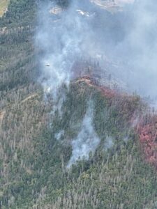
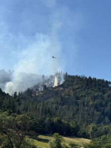
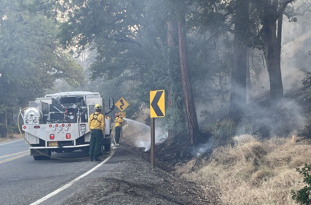
RUCH, Ore. (June 29, 2024) – Firefighters working on the Upper Applegate Fire made tremendous progress overnight completing strategic firing operations on the north portion of the fire. This strategy connected the fire’s edge with the hand line dug by firefighters, creating a solid barrier between the interior of the fire and homes further downhill. With this work finished, the fire is now 100% directly lined, meaning there are no unburned interior pockets along the perimeter that could easily allow the fire to burn over a line. It also gives firefighters a better defense, should those lines be tested by weather, which is expected today.
Weather forecasts are predicting the temperature at 85 degrees with winds ranging from 3-13 miles per hour (mph) and gusts up to 25 mph. As firefighters begin mopping up the north side of the fire today, they will be aware of this potential and ready to defend the lines. Wind may also increase smoke on the fire, which is expected. With this work overnight, the fire is now slightly expanded to 966 acres, however mop up has increased to 20%.
On the south side of the fire, mop-up operations have been progressing over the last couple of shifts; in some areas, firefighters have reached 120-feet into the interior of the fire, extinguishing hotspots as they go. This work is tedious but necessary, as it will prevent vegetation and coals with any lingering heat from igniting again in hot, windy conditions near the lines established.
Hazard trees remain a constant threat to firefighters on this incident. There are large patches of dead and dying conifer trees that have been impacting fire behavior and falling as firefighters work around them. These dead Douglas Fir trees are the result of numerous factors, including prolonged drought and hotter than average temperatures, as well as decades of fire suppression. Firefighters are aware of the falling potential and are mitigating these risks as much as possible. Rocks have also been falling down the steep slopes this fire has been burning on, and safety remains a top priority.
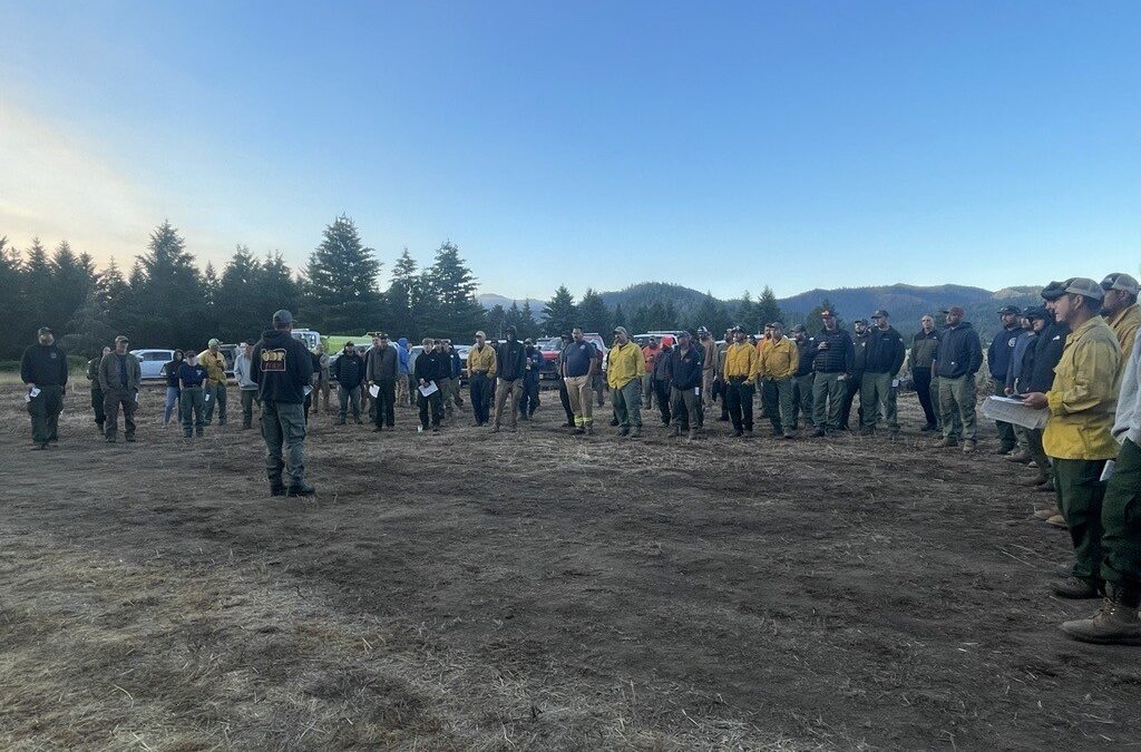
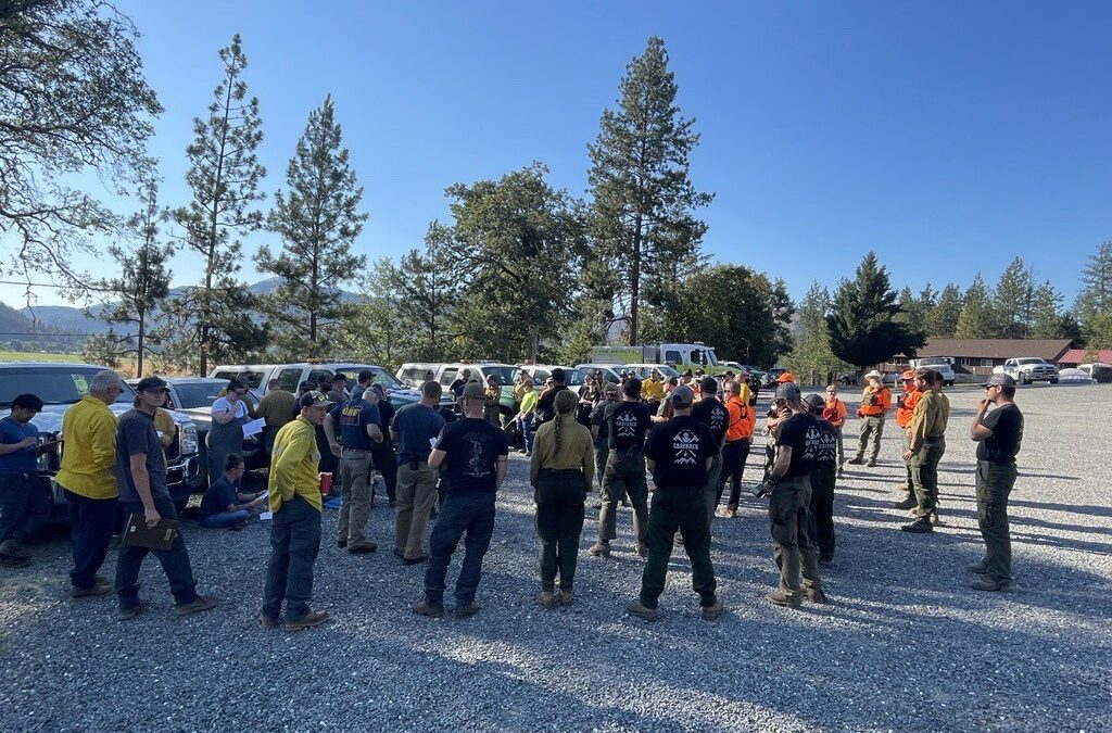
Today, more than 360 personnel are assigned to the fire, including 13 20-person crews, four engines, three bulldozers and eight water tenders. Two Type 2 and Two Type 1 helicopters remain dedicated to this incident to drop water when needed, and two Type 3 helicopters are providing full day coverage as an air attack platform to coordinate aerial work. Today, one Type 1 helicopter will be demobilized from the fire, as managers are comfortable with downsizing this fleet. As progress continues, additional resources that aren’t necessary will also be released, as overhead work to balance needs on the fire line and financial impact and responsibility. Personnel will also be hiking throughout the fire today to determine what repair work needs to be done following suppression activities.
The BLM has issued a closure order for BLM-managed lands in the fire area, including Grouse Creek Road. A map and additional information is available at https://www.blm.gov/orwafire. Little Applegate road and Applegate Lake remain open, however firefighters are working near and on the side of the road 24 hours a day. Please be aware and follow all reduced speed road signs in the area. Additionally, fire-related traffic may be impacting the Provolt area; please be aware when driving this stretch of Highway 238.
Evacuation orders remain in effect, put in place by the Jackson County Sheriff’s Office and Emergency Management. Zone JAC-434 is on a Level 1 – Be Ready notice. Zone JAC-436 remains at Level 2 – Be Set. More information about zones and locations is available at: https://protect.genasys.com/.
This fire is affecting private, BLM and U.S. Forest Service (USFS) land on the Rogue River-Siskiyou National Forest. It was first reported in the late afternoon of Thursday, June 20.
The fire danger level on the ODF Southwest Oregon District is currently moderate (blue) and regulations are in place. Please be aware of and follow all current restrictions to help reduce the risk of fires in our communities. Fire season information is also available online at our Facebook page: @ODFSouthwest and our website: www.swofire.com.

June 28, 2024
JACKSON & JOSEPHINE COUNTIES, Ore. (June 28, 2024) – The fire danger level on lands protected by the Oregon Department of Forestry Southwest Oregon District will increase to “high” (yellow) and the Industrial Fire Precaution Level (IFPL) will increase to Level 2 (two) on Monday, July 1, 2024 at 12:01 a.m. This affects 1.8 million acres of state, private, county and Bureau of Land Management lands in Jackson and Josephine counties.
The primary difference between current fire prevention restrictions and those beginning on Monday affects the public use of power-driven equipment, such as chainsaws, mowers, weed eaters, and more. The use of power-driven equipment, grinding, cutting of metal, and other spark-emitting equipment, such as wood splitters and generators, will be prohibited between the hours of 10 a.m. and 8 p.m. This does not apply to mowing green lawns.
Other fire prevention regulations which will remain in effect, include:
- No debris burning, including piles and debris burned in burn barrels
- No fireworks on or within 1/8th of a mile of ODF-protected land. Fireworks are prohibited on all BLM land
- Exploding targets and tracer ammunition, or any bullet with a pyrotechnic charge in its base, are prohibited
- Campfires are allowed only in designated campgrounds. Portable stoves or fire pits using liquefied or bottled fuels may be used in other locations that are clear of dry vegetation at all times
- Motorized vehicles, including motorcycles and all-terrain, are allowed only on improved roads; one shovel and one gallon of water, or one 2.5 pound or larger fire extinguisher, is required while traveling
- Smoking while traveling will only be allowed in enclosed vehicles on improved roads, in boats on the water and other specifically designated locations
- Chain saws may not be used between 10:00 a.m. and 8:00 p.m. during high fire danger. During hours outside of this time frame, chain saws may be used but require that the operator have one shovel and one 8-oz or larger fire extinguisher at the work site. A fire watch is also required for one hour after each chainsaw use
- Cutting, grinding, and welding of metal is not allowed between 10:00 a.m. and 8:00 p.m. during high fire danger. These activities will be allowed during hours outside of this time frame only if the work site is cleared of potentially flammable vegetation and other materials, and a water supply is at the job site
- The mowing of dead or dried grass with power-driven equipment is not allowed between 10:00 a.m. and 8:00 p.m. during high fire danger. This restriction does not include mowing of green lawns, or equipment used for the commercial culture and harvest of agricultural crops
- Any other spark-emitting internal combustion engine-use not specifically mentioned is not allowed between 10:00 a.m. and 8:00 p.m. during high fire danger. Use of any spark-emitting internal combustion engine is allowed outside of this time frame only if the work site is cleared of potentially flammable vegetation and other materials, and a water supply is at the job site
- Any electric fence controllers must be approved by a nationally recognized testing laboratory, such as Underwriters Laboratories Inc., or be certified by the Department of Consumer and Business Services, and be installed and used in compliance with the fence controller’s instructions for fire safe operation
For industrial operations, under IFPL II (Two) – limited shutdown, which is entirely separate from all public fire restrictions, the following may operate after 8 p.m. and up until 1 p.m. daily:
- Power saws, except at loading sites
- Feller-bunchers with rotary head saws
- Cable yarding
- Blasting
- Welding, cutting, or grinding of metal
For more information about the Oregon Department of Forestry’s fire season public restrictions, please call or visit the Southwest Oregon District unit office nearest to you:
- Medford Unit, 5286 Table Rock Rd., Central Point. (541) 664-3328
- Grants Pass Unit, 5375 Monument Dr., Grants Pass. (541) 474-3152
BLM fire restrictions are available here: https://www.blm.gov/programs/public-safety-and-fire/fire-and-aviation/regional-info/oregon-washington/fire-restrictions
Fire season information is also available online at our Facebook page, @ODFSouthwest and our website, www.swofire.com.
June 28, 2024
RUCH, Ore. (June 28, 2024) – Overnight, firefighters working the Upper Applegate Fire, located south of Ruch, were able to increase the direct line around the fire to 70%, leaving only 30% indirectly lined. Strategic firing operations were used in the cooler temperatures and higher relative humidity; this is helping to close the gap between the fire’s edge and the indirect line on a portion of the north end of the fire. This work has been conducted in small, manageable sections and is helping to strengthen line built, providing a much more secure buffer between the fire and homes in the area.
This morning, the fire remains 937 acres and 15% mopped up, however resources today will continue that work. The night shift was also able to walk the southern part of the fire with IR cameras where the majority of mop-up operations has been taking place, and identify hot spots that aren’t easily detected otherwise. Firefighters working day shift will be able to use these maps and images to be more thorough in their efforts today.
More than 370 personnel will be working on the fire today, including 13 20-person crews, five engines, four bulldozers, eight water tenders, 10 tree fallers and 10 medical personnel. Aircraft assigned to the fire includes two Type 1 and two Type 2 helicopters for water bucket drops, as well as a Type 3 that is being used as air attack to provide coordination from the sky. Additional aircraft will be ordered as necessary, however this fleet has been sufficient in that last couple days.
The BLM has issued a closure order for BLM-managed lands in the fire area, including Grouse Creek Road. A map and additional information is available at https://www.blm.gov/orwafire. Little Applegate road and Applegate Lake remain open, however firefighters are working near and on the side of the road 24 hours a day. Please be aware and follow all reduced speed road signs in the area. Additionally, fire-related traffic may be impacting the Provolt area; please be aware when driving this stretch of Highway 238.
Evacuation orders remain in effect, put in place by the Jackson County Sheriff’s Office and Emergency Management. Zone JAC-434 is on a Level 1 – Be Ready notice. Zone JAC-436 remains at Level 2 – Be Set. More information about zones and locations is available at: https://protect.genasys.com/.
This fire is affecting private, BLM and U.S. Forest Service (USFS) land on the Rogue River-Siskiyou National Forest. It was first reported in the late afternoon of Thursday, June 20.
The fire danger level on the ODF Southwest Oregon District is moderate (blue) and regulations are in place. Please be aware of and follow all current restrictions to help reduce the risk of fires in our communities. Fire season information is also available online at our Facebook page: @ODFSouthwest
June 27, 2024
RUCH, Ore. (June 27, 2024) – Firefighters working the Upper Applegate Fire, located south of Ruch, continue to push forward and make steady progress on the incident, increasing mop-up to 15% and solidifying more direct line today, upping that number to 65%. The fire remains 100% lined when factoring both direct and indirect line, however firefighters are pushing to create as much direct line as possible. Today, the fire was GPS mapped at 937 acres, a slight increase from this morning. That change is a result of the fire naturally progressing within those established containment lines.
Today, resources assigned to the fire were able to meet their goal of mopping up 75 feet into the interior of the fire along the southern border. This work helps to solidify the lines created and prevent the fire from reigniting in hot and windy conditions in these areas by extinguishing any lingering fire or heat from remaining vegetation and coals. Tonight, an infrared (IR) flight will be conducted, which will give firefighters the ability to see which portions of the fire are continuing to hold heat and allow them to be strategic in mop-up operations this evening and tomorrow morning.
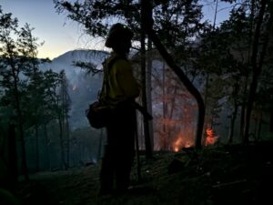
Tonight, more than 200 personnel are assigned to the fire, including seven 20-person crews, two engines, two bulldozers, and four water tenders. Aircraft will continue to fly until nightfall as needed. Strategic firing operations are planned for this evening to bolster line on the northeastern portion of the fire, which has been dangerous and challenging ground since the start of this fire. Steep terrain and falling trees have made some of these areas extremely unsafe to work in, and for that reason, indirect line was built and is now being reinforced. This will create a strong barrier between the fire and homes at the bottom of the hill.
Due to the tremendous progress on this incident, this will be the final evening update unless conditions significantly change. Beginning Friday, updates will be posted in the morning only and during the day when necessary.
Evacuation orders remain in effect, put in place by the Jackson County Sheriff’s Office and Emergency Management. Zone JAC-434 is on a Level 1 – Be Ready notice. Zone JAC-436 remains at Level 2 – Be Set. More information about zones and locations is available at: https://protect.genasys.com/.
The BLM has issued a closure order for BLM-managed lands in the fire area, including Grouse Creek Road. A map and additional information is available at https://www.blm.gov/orwafire. Additionally, fire related traffic may be impacting the Provolt area; please be aware when driving this stretch of Highway 238.
This fire is affecting private, BLM and U.S. Forest Service (USFS) land on the Rogue River-Siskiyou National Forest. It was first reported in the late afternoon of Thursday, June 20.
The fire danger level on the ODF Southwest Oregon District is moderate (blue) and regulations are in place. Please be aware of and follow all current restrictions to help reduce the risk of fires in our communities. Fire season information is also available online at our Facebook page: @ODFSouthwest
June 27, 2024
RUCH, Ore. (June 27, 2024) – Firefighters working on the Upper Applegate fire continue to make methodical progress on the incident, bolstering lines overnight and mopping up the southern portion of the fire. It remains 896 acres this morning and 55% lined. Resources have been able to mop up hotspots, vegetation that is still holding heat, 35-feet into the fire’s perimeter on the south side, bringing mop up efforts to 10% complete. Today, firefighters will push to reach 75-feet along that line.
On the northeastern side of the fire, hazard trees, or snags, remain a difficult and dangerous challenge to work around. Between the potential of trees falling and the steep ground, firefighters continue to work as safely as possible. On Tuesday, a firefighter broke a leg while working on a steep slope. The firefighter was carried out by their crew before being met by Rogue Rescue and transported to a local hospital. The hazards on this incident increase the chance of injuries, and safety is a top priority as work continues.
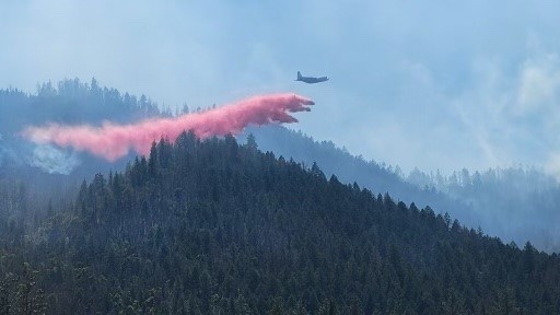
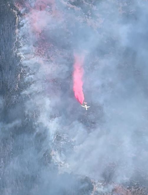
Today, more than 400 personnel are assigned to the incident, including 14 20-person crews, eight engines, four bulldozers, eight water tenders, two chippers, 10 medical personnel and numerous overhead. Aircraft assigned exclusively to the fire includes two Type 1, two Type 2 helicopters, as well as an air attack plane for coordination. Airtankers and additional aircraft will be ordered as needed.
Evacuation orders remain in effect, put in place by the Jackson County Sheriff’s Office and Emergency Management. Zone JAC-434 is on a Level 1 – Be Ready notice. Zone JAC-436 remains at Level 2 – Be Set. More information about zones and locations is available at: https://protect.genasys.com/.
The BLM has issued a closure order for BLM-managed lands in the fire area, including Grouse Creek Road. A map and additional information is available at https://www.blm.gov/orwafire. Additionally, fire related traffic may be impacting the Provolt area; please be aware when driving this stretch of Highway 238.
This fire is affecting private, BLM and U.S. Forest Service (USFS) land on the Rogue River-Siskiyou National Forest. It was first reported in the late afternoon of Thursday, June 20.
The fire danger level on the ODF Southwest Oregon District is moderate (blue) and regulations are in place. Please be aware of and follow all current restrictions to help reduce the risk of fires in our communities. Fire season information is also available online at our Facebook page: @ODFSouthwest
June 26, 2024
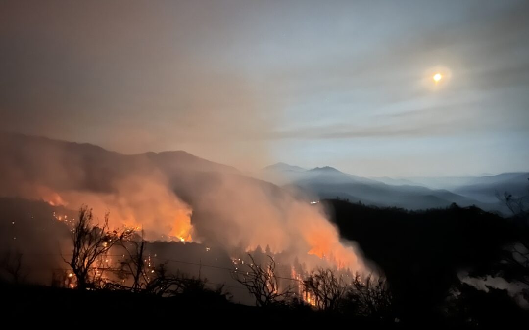
RUCH, Ore. (June 26, 2024) – Today crews faced windy weather, which was moderated by overcast skies, higher humidity, and lower temperatures. The fire remained within the containment lines and continues to burn at a low to moderate severity. The fire was mapped at 896 acres. The acreage is expected to increase in the coming days as the fire continues to burn within the established lines.
Thanks to mop up efforts on the south side of the fire, containment has increased to 55%. Because of this, Jackson County Sheriff’s Office has lowered the evacuation level for Zone JAC-434 to Level 1 – Be Ready. Zone JAC-436 remains at Level 2 – Be Set. More information about zones and locations is available at: https://protect.genasys.com/.
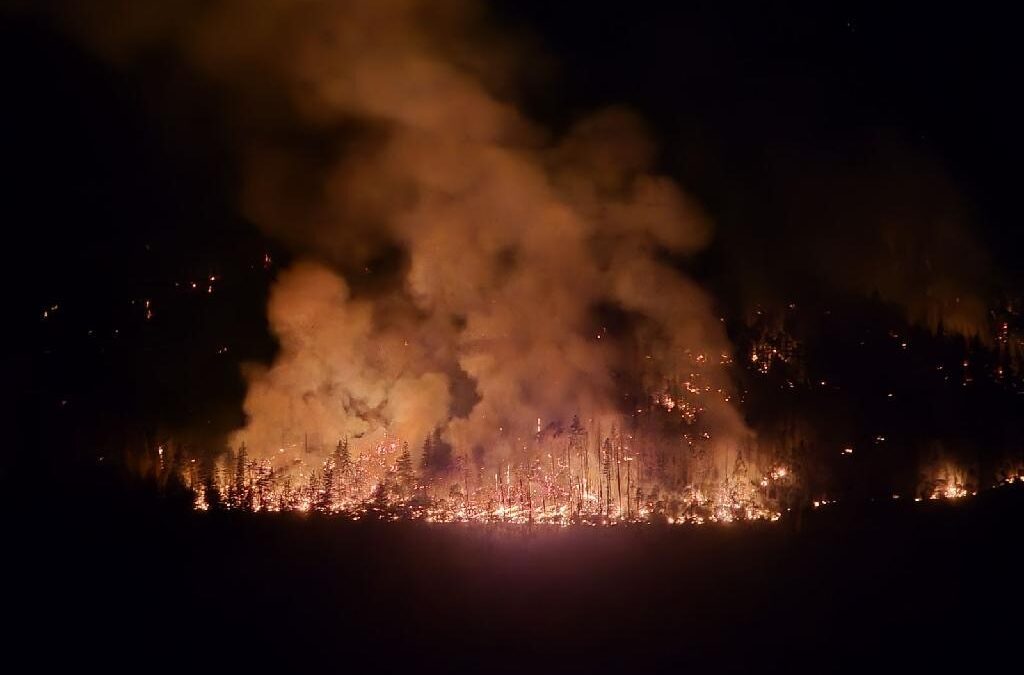
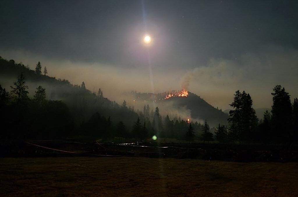
Crews continue to focus on improving the indirect lines on the north and east end of the fire, preparing for upcoming back burning operations. While backburning operations were originally planned for tonight, a shift in the wind and higher relative humidity will instead allow crews to focus on addressing the immense amount of dead and down trees on the northeastern edge of the fire. Backburning will occur in the upcoming evenings when weather is favorable for low intensity burns.
The preliminary fire investigation of the Upper Applegate Fire has found the fire was caused by mowing dry grass. The Oregon Department of Forestry will continue to investigate the fire and may potentially try to recoup firefighting costs.
The current fire danger level in ODF’s Southwest Oregon District is Moderate (blue) which prohibits the mowing of dead or dried grass with power-driven equipment between 1:00 p.m. and 8:00 p.m. This restriction does not include mowing of green lawns, or equipment used for the commercial culture and harvest of agricultural crops. With equipment use being the second leading cause of human-caused fires in Oregon, many may find it surprising that a lawn mower falls within that category. It’s important to check local fire restrictions regularly during fire season to make sure you’re not potentially bringing a fire hazard onto the landscape. By taking this small step, Oregonians can help prevent the next large wildfire.
The BLM has issued a closure order for BLM-managed lands in the fire area, including Grouse Creek Road. A map and additional information is available at https://www.blm.gov/orwafire.
This fire is affecting private, BLM and U.S. Forest Service (USFS) land on the Rogue River-Siskiyou National Forest. It was first reported in the late afternoon of Thursday, June 20. The cause of this fire is currently under investigation.
485 personnel are assigned to this incident, including 21 20-person crews, six engines, five tree fallers, four bulldozers and numerous overhead. Four helicopters of various sizes are assigned to the fire. Additional helicopters and air tankers available when needed.
The fire danger level on the ODF Southwest Oregon District is moderate (blue) and regulations are in place. Please be aware of and follow all current restrictions to help reduce the risk of fires in our communities. Fire season information is also available online at our Facebook page: @ODFSouthwest and our website: www.swofire.com.
June 26, 2024
RUCH, Ore. (June 26, 2024) – Overnight, crews were able to conduct burning operations on the eastern edge of the fire. These efforts help bring the fire edge to the indirect lines established around the fire. Mop up efforts continue along the southern portion of the fire. The fire remains at 890 acres, and additional acreage increases are expected in the coming days as burn operations continue within the containment lines.
Crews continue to prep the north side of the indirect lines for additional back burns to help bring the fire closer to containment lines. These burns will occur over the next 48 hours, during night operations when burn intensity is low. Expect to see additional fire activity at night and more smoke in the mornings.
485 personnel are assigned to this incident, including 21 20-person crews, six engines, five tree fallers, four bulldozers and numerous overhead. Four helicopters of various sizes are assigned to the fire again today, with additional helicopters and air tankers available when needed.
Level 2 – BE SET evacuation notices remain in effect by the Jackson County Sheriff’s Office and Emergency Management for Zones JAC-434 and JAC-436. More information about zones and locations is available here: https://protect.genasys.com/.
This fire is affecting private, BLM and U.S. Forest Service (USFS) land on the Rogue River-Siskiyou National Forest. It was first reported in the late afternoon of Thursday, June 20. The cause of this fire is currently under investigation.
The fire danger level on the ODF Southwest Oregon District is moderate (blue) and regulations are in place. Please be aware of and follow all current restrictions to help reduce the risk of fires in our communities. Fire season information is also available online at our Facebook page: @ODFSouthwest and our website: www.swofire.com.
June 25, 2024
Thanks to the hard work of crews, containment on the Upper Applegate Fire has reached 45%. This containment line is along the Upper Applegate Road and extends along much of the south side of the fire. In this area, crews have mopped up the fire, checking for hot spots and extinguishing any threats.
Last night’s back burn operation improved the success on the southeastern edge of the fire. As a result, less spotting occurred during the critical burn window today. The burn operation increased the fire acreage to 890 acres, all within established containment lines.
Crews continue to prep the east and north side of the indirect lines for additional back burns to help bring the fire closer to containment lines. These burns will occur over the next 48 hours, during night operations when burn intensity is low.
More than 450 personnel are assigned to this incident, including 19 20-person crews, six engines, five tree fallers, four bulldozers and numerous overhead. Four helicopters of various sizes are assigned to the fire again today, with additional helicopters and air tankers available when needed.
Level 2 – BE SET evacuation notices remain in effect by the Jackson County Sheriff’s Office and Emergency Management for Zones JAC-434 and JAC-436. More information about zones and locations is available here: https://protect.genasys.com/.
This fire is affecting private, BLM and U.S. Forest Service (USFS) land on the Rogue River-Siskiyou National Forest. It was first reported in the late afternoon of Thursday, June 20. The cause of this fire is currently under investigation
The fire danger level on the ODF Southwest Oregon District is moderate (blue) and regulations are in place. Please be aware of and follow all current restrictions to help reduce the risk of fires in our communities. Fire season information is also available online at our Facebook page: @ODFSouthwest and our website: www.swofire.com.
June 25, 2024
RUCH, Ore. (June 24, 2024) – Crews successfully conducted a firing operation overnight on the far southeastern corner of the Applegate Fire. This backburn helped bring the fire to the fire line. Today’s efforts will be focused on snagging trees along the hand line above Little Applegate Road. Mopping up of fire line continues. There are direct and indirect lines around 100% of the fire. The fire was mapped at 830 acres by an infrared flight yesterday morning. Steep slopes, hazard trees and rocks are continuing to challenge resources.
Temperatures in the 90s, with low relative humidity and increasing winds may lead to increased interior fire behavior and smoke. Fire managers anticipate that the fire will continue backing down the slopes towards containment lines.
A community meeting is scheduled for 7:00 -8:00 PM tonight, June 25, at the Ruch Elementary School, 156 Upper Applegate Road. Incident Commander Larry Kazakoff, along with agency partners, will provide an update on the fire and answer questions from the community.
More than 450 personnel are assigned to this incident, including 19 20-person crews, six engines, five tree fallers, four bulldozers and numerous overhead. Four helicopters of various sizes are assigned to the fire again today, with additional helicopters and air tankers available when needed.
Level 2 – BE SET evacuation notices remain in effect by the Jackson County Sheriff’s Office and Emergency Management for Zones JAC-434 and JAC-436. More information about zones and locations is available here: https://protect.genasys.com/.
This fire is affecting private, BLM and U.S. Forest Service (USFS) land on the Rogue River-Siskiyou National Forest. It was first reported in the late afternoon of Thursday, June 20. The cause of this fire is currently under investigation.
The fire danger level on the ODF Southwest Oregon District is moderate (blue) and regulations are in place. Please be aware of and follow all current restrictions to help reduce the risk of fires in our communities. Fire season information is also available online at our Facebook page: @ODFSouthwest and our website: www.swofire.com.
June 24, 2024
Crews continued to make progress on the Upper Applegate Fire today. Mop up was completed along the Upper Applegate Road, which will significantly reduce visible smoke from the road. Some interior islands burned out today, creating small columns of smoke. The fire remains within the containment lines. Extremely steep terrain and significant amount dead trees continue to be the biggest challenge in completing the remaining direct line around the fire.
Crews have installed hose around approximately 80% of the fire. There are direct lines around 35% of the fire, with indirect lines around the rest of the fire.
A GPS flight at 11:00 AM today mapped the Upper Applegate Fire at 830 acres. Mapped heat was consistent with where fire growth is expected, including primarily backing fire working from the top of the knob down to existing lines. The aircraft used satellite communications to update fire operations in near real time and help make informed tactical decisions. No heat was detected outside of existing fire lines.
Efforts tonight include a small burn out planned for the far southeastern corner to help connect the fire with the containment lines. Crews will continue bolstering hand and dozer line on the north side of the fire.
A community meeting is scheduled for 7:00 -8:00 PM on June 25 at the Ruch Elementary School, 156 Upper Applegate Road. Incident Commander Larry Kazakoff, along with agency partners, will provide an update on the fire and answer questions from the community.
More than 430 personnel are assigned to this incident, including 18 20-person crews, six engines, five tree fallers, four bulldozers and numerous overhead. Four helicopters of various sizes were assigned to the fire again today, with additional helicopters and air tankers available when needed. Resources remain focused on bolstering the line, especially on the eastern side of the fire, which has been difficult to work.
Level 2 – BE SET evacuation notices remain in effect by the Jackson County Sheriff’s Office and Emergency Management for Zones JAC-434 and JAC-436. More information about zones and locations is available here: https://protect.genasys.com/.
This fire is affecting private, BLM and U.S. Forest Service (USFS) land on the Rogue River-Siskiyou National Forest. It was first reported in the late afternoon of Thursday, June 20. The cause of this fire is currently under investigation.
The fire danger level on the ODF Southwest Oregon District is moderate (blue) and regulations are in place. Please be aware of and follow all current restrictions to help reduce the risk of fires in our communities. Fire season information is also available online at our Facebook page: @ODFSouthwest and our website: www.swofire.com.
June 24, 2024
RUCH, Ore. (June 24, 2024) – High overnight humidity moderated fire behavior, allowing the night shift to make significant progress plumbing the fire. Crews have now plumbed approximately 80% of the fire, including direct and indirect lines. There are direct and indirect lines around 100% of the fire. Steep slopes and falling trees and rocks are continuing to challenge resources. The fire remains GPS mapped at 756 acres. An infrared (IR) flight is scheduled for today.
Overnight, firefighters were not able to complete firing operations due to the high relative humidity. Four portable water tanks were installed in strategic locations to help address spot fires on the top of the ridge in division foxtrot. Additionally, resources also worked to mop up portions of fire.
More than 430 personnel are assigned to this incident, including 18 20-person crews, six engines, five tree fallers, four bulldozers and numerous overhead. Four helicopters of various sizes are assigned to the fire again today, with additional helicopters and air tankers available when needed. Resources remain focused on bolstering the line, especially on the eastern side of the fire, which has been difficult to work.
Level 2 – BE SET evacuation notices remain in effect by the Jackson County Sheriff’s Office and Emergency Management for Zones JAC-434 and JAC-436. More information about zones and locations is available here: https://protect.genasys.com/.
This fire is affecting private, BLM and U.S. Forest Service (USFS) land on the Rogue River-Siskiyou National Forest. It was first reported in the late afternoon of Thursday, June 20. The cause of this fire is currently under investigation.
The fire danger level on the ODF Southwest Oregon District is moderate (blue) and regulations are in place. Please be aware of and follow all current restrictions to help reduce the risk of fires in our communities. Fire season information is also available online at our Facebook page: @ODFSouthwest and our website: www.swofire.com.
June 23, 2024
RUCH, Ore. (June 23, 2024) – Lines on the Upper Applegate Fire, located south of Ruch, are now 100% complete around the perimeter, made up of both direct and indirect lines. Direct line remains at 35% tonight, as resources spent the day holding the fire in its current footprint through hot and windy conditions. Firefighters were able to walk portions of the fire today, and have GPS mapped it at 756 acres. An infrared (IR) flight is planned for tonight, which will help to solidify this data.
Firefighters were able to meet their goal today of securing water access to the southern portion of the fire. This will allow water to flow downhill and aid in efforts tonight. They also were able to bolster contingency lines. Hot, windy weather continued today, which prompted a few small spot fires near the top of a ridge. Firefighters were able to quickly knock them down and begin mopping up. Hazards continue to be the heat and wind, falling trees and rocks, and steep terrain.
Tonight, more 160 personnel are assigned are to the incident, including five 20-person crews, three engines, four bulldozers, three water tenders and numerous overhead. Aircraft will once again continue flying as needed until nightfall. Goals for the overnight shift include strengthening existing lines and continuing to mop up hotspots and the spot fires that were caught today.
Level 2 – BE SET evacuation notices remain in effect by the Jackson County Sheriff’s Office and Emergency Management for Zones JAC-434 and JAC-436. More information about zones and locations is available here: https://protect.genasys.com/.
This fire is affecting private, BLM and U.S. Forest Service (USFS) land on the Rogue River-Siskiyou National Forest. It was first reported in the late afternoon of Thursday, June 20. The cause of this fire is currently under investigation.
The fire danger level on the ODF Southwest Oregon District is moderate (blue) and regulations are in place. Please be aware of and follow all current restrictions to help reduce the risk of fires in our communities. Fire season information is also available online at our Facebook page: @ODFSouthwest
June 23, 2024
RUCH, Ore. (June 23, 2024) – Lines created by firefighters on the Upper Applegate Fire are now 95% wrapped around the entire incident, with 35% being directly at the fire’s edge. This is tremendous progress considering the terrain this fire is burning on, located just south of Ruch. Steep slopes and falling trees and rocks are continuing to challenge resources. Due to the efforts to line the fire, GPS mapping has not yet occurred on this incident; for that reason, the fire remains an estimated 500 acres.
Overnight, firefighters were able to complete strategic firing operations on the southwestern side that were first started Friday night. These efforts are the reason for the increase in direct line, and have created a much more solid barrier to protect homes in that area. Additionally, resources also worked to mop up the small portion of fire that pushed past a line in windy conditions yesterday, strengthening that area as well.
The eastern side of the fire was hiked overnight and determined that a line could not be placed directly at the fire’s edge due to large amounts of trees that are primed to fall and rocks that would hamper efforts. Today, firefighters will work on bolstering a contingency line that is slightly further back, which will now be the primary line on that portion of the fire. Applegate Valley Fire District has brought in additional resources to do structure protection, home assessments and mitigation work on properties in this area as an added protection.
More than 300 personnel are assigned to this incident today, including 13 20-person crews, four engines, five tree fallers, two bulldozers and numerous overhead. Four helicopters of various sizes are assigned to the fire again today, with additional helicopters and air tankers available when needed. Resources remain focused on completing the line, especially on the eastern side of the fire, which has been difficult to work. Another focus will be establishing water access on a high point of the southern portion of the fire by bringing in portable tanks. This will allow water to flow to various portions of the fire below and give firefighters another tool on the line.
Due to the hazards, numerous landing zones around the fire have been designated for helicopters to use, should a firefighter need to be extricated for medical attention. The safety of firefighters and the surrounding community is a top priority on this incident. The Jackson County Sheriff’s Office and Emergency Management have issued are Level 2 – BE SET evacuation notices for Zones JAC-434 and JAC-436. More information about zones and locations is available here: https://protect.genasys.com/.
This fire is affecting private, BLM and U.S. Forest Service (USFS) land on the Rogue River-Siskiyou National Forest. It was first reported in the late afternoon of Thursday, June 20. The cause of this fire is currently under investigation.
The fire danger level on the ODF Southwest Oregon District is moderate (blue) and regulations are in place. Please be aware of and follow all current restrictions to help reduce the risk of fires in our communities. Fire season information is also available online at our Facebook page: @ODFSouthwest
June 22, 2024
JACKSON COUNTY, Ore. (June 22, 2024) – Firefighters are still holding the Upper Applegate Fire at approximately 500 acres, despite hot, dry and windy conditions on Saturday. Indirect lines were built along the northeastern portion of the fire, not completely closing the loop, but adding a contingency layer in an area that’s been difficult to work in. The fire remains with 70% indirect lines and now has 20% direct line.
During the afternoon, gusty winds pushed the fire over a line on the southeastern side of the incident; with the use of retardant from multiple air tanker drops and the repositioning of a crew, firefighters were able to catch it at an estimated five acres. It’s currently re-lined and resources are working to strengthen those areas.
Due to the conditions and out of an abundance of caution, the Jackson County Sheriff’s Office and Emergency Management increased the evacuation notices. The evacuation levels for Zones JAC-434 and JAC-436 have increased to Level 2 – BE SET. More information about zones and locations is available here: https://protect.genasys.com/.
Tonight, more than 170 personnel are assigned to the fire, including five 20-person crews, three engines, three bulldozers and three water tenders. Aircraft will continue flying as needed until dark. Firefighters will be working to continue progress from the previous shift and strengthen lines where possible.
This fire is affecting private, BLM and U.S. Forest Service (USFS) land on the Rogue River-Siskiyou National Forest. It was first reported in the late afternoon of Thursday, June 20. The cause of this fire is currently under investigation.
The fire danger level on the ODF Southwest Oregon District is moderate (blue) and regulations are in place. Please be aware of and follow all current restrictions to help reduce the risk of fires in our communities. Fire season information is also available online at our Facebook page: @ODFSouthwest
June 22, 2024
JACKSON COUNTY, Ore. (June 22, 2024) – Overnight, firefighters on the Upper Applegate Fire made excellent progress, keeping the fire at an estimated 500 acres, securing lines and creating new ones. The fire, located south of Ruch, is affecting private, BLM and U.S. Forest Service (USFS) land on the Rogue River-Siskiyou National Forest. Direct line at the fire’s edge has increased overnight to 15% and indirect line remains at 70%. Today, firefighters will focus on that final 15% of unlined fire edge, located on the eastern portion of the fire. This area has been a challenge the entire duration of this incident, as it’s steep and rocky. This kind of terrain can be nearly impossible to build line on, and for that reason, firefighters have been scouting the closet location to the fire’s edge to complete the perimeter.
More than 200 personnel are assigned to the fire today, including 27 overhead, seven 20-person crews, three engines, two water tenders, three bulldozers, six tree fallers and a Rapid Extraction Mobile Support Team (REMS) to provide aid and assistance should a firefighter be injured. The terrain on this fire has posed numerous safety issues, from the steep slope to hazardous trees and rocks that have been falling. While tactics remain aggressive to corral this fire fully, the safety of those working the incident is also a top priority.
The protection of homes and the community near the fire also remains a top priority. Overnight, firefighters were able to complete strategic firing operations on the southern portion, which is near to houses across the road. The work done last night nearly connected the fire’s edge to a bulldozer line that has been in place. High relative humidity overnight made this operation a safe option, and helped to reduce fuel that could have carried fire and threatened that line. That portion is now more secure.
Weather may once again impact fire behavior today, as temperatures are predicted to be in the high 80s to low 90s with a slight wind in the afternoon. Firefighters will be watching this potential and planning accordingly. Today, a Type 1, Type 3 helicopter and two Type 2 helicopters are assigned exclusively to this incident, and air tankers will be ordered as needed, much like yesterday. Last night, an illegal drone was spotted over the fire, shutting down aircraft operations for the last hour of the day. Flying drones over fires is not only illegal, but has the potential to cause an aircraft to crash, creating an extremely dangerous situation for the pilots flying and the firefighters working below. The Jackson County Sheriff’s Office searched into the evening for the drone pilot but were unable to locate them. If you have information, please call the JCSO Tip Line at (541) 774-8333.
Level 1 “BE READY” evacuation notices issued by Jackson County Emergency Management and the Jackson County Sheriff’s Office remain in place. They are for Zone JAC-436: Little Applegate Rd, west of Upper Applegate Rd, and eastern portions of Sterling Creek Rd., Jacksonville, and Zone JAC-434: Eastside Rd south of Little Applegate Rd to north of McKee Bridge, Jacksonville. More information about zones and locations is available here: https://protect.genasys.com/
Progress on the Highway 62 continued overnight; the fire remains 75 acres, 100% lined and is now 40% mopped up. Firefighters were able to check the fire for hot spots 50 feet into its perimeter, ensuring there isn’t any heat or smoldering material that could later reignite. Today, two 20-person crews, three engines and one water tender will be working that incident, with a goal of pushing that mop up to 100 feet in. Due to the tremendous progress on this fire, this will be the final update unless conditions significantly change.
The fire danger level on the ODF Southwest Oregon District is moderate (blue) and regulations are in place. Please be aware of and follow all current restrictions to help reduce the risk of fires in our communities. Fire season information is also available online at our Facebook page: @ODFSouthwest and our website: www.swofire.com.
June 21, 2024
JACKSON COUNTY, Ore. (June 21, 2024) – Firefighters continued to make good progress on both the Highway 62 and Upper Applegate Fires during Friday’s day shift. The Upper Applegate Fire, located south of Ruch, remains an estimated 500 acres on private, BLM and U.S. Forest Service (USFS) land on the Rogue River-Siskiyou National Forest. The Highway 62 Fire, located south of Shady Cove, remains at 75 acres and 100% lined. Tonight, it’s 100% plumbed with fire hose, allowing water usage across the entire incident. It’s also 20% mopped up at this time, affecting both private and Bureau of Land Management (BLM) land. Resources tonight will be 53 personnel total, including overhead, two 20-person crews, and an engine. Resources will continue to work on mop up operations and take advantage of the naturally decreased fire behavior overnight.
Meanwhile, the Upper Applegate Fire is holding as the district’s top priority. Firefighters have been able to build indirect line around 70% of the fire and 10% direct line at the fire’s edge, however steep, rocky terrain and hazardous snag trees are creating challenges for resources and slowing down progress. Portions of these areas are affected by Conifer mortality; there are significant patches of dead Douglas fir trees. The dead trees are a result of climate change, decades of fire suppression, prolonged drought, and periods of high temperatures. Today, tree fallers were working to safely remove these trees, which will allow firefighters to work closer to the fire’s perimeter.
For Friday’s overnight shift, 47 personnel are assigned to this fire, including six 20-person crews, two engines, two water tenders and two bulldozers. Numerous aircraft remain assigned to the incident as well, and will fly as long as they are needed until the sun goes down. Today, three federal Large Air Tankers (LAT) and one Very Large Air Tanker (VLAT) were used on the fire out of the Medford Air Tanker Base (MATB) to create temporary fire lines using retardant. This largely helped to keep the fire within it’s footprint, despite hot and windy conditions today.
Tonight, resources will be focusing on creating as much direct line as possible along the eastern border, where there currently is no line or control aside from retardant perimeters. Safety remains a top priority with the potential for falling trees and rocks on the steep terrain. Structure protection will also continue on homes nearby.
Resources from across Oregon have been mobilized to this fire, including overhead members of ODF’s Incident Management Team 2. These individuals work in ODF districts across the state and dispatch to incidents where additional help is needed, allowing for surge capacity on the local district. The Oregon State Fire Marshal also deployed two strike teams this morning to the fire. Additional resources that have been working on this fire since it was first reported include BLM, USFS, Applegate Valley Fire District and firefighters and resources from agencies across Jackson and Josephine Counties.
On the Upper Applegate Fire, Level 1 “BE READY” evacuation notices were issued by Jackson County Emergency Management and the Jackson County Sheriff’s Office for Zone JAC-436: Little Applegate Rd, west of Upper Applegate Rd, and eastern portions of Sterling Creek Rd., Jacksonville, and Zone JAC-434: Eastside Rd south of Little Applegate Rd to north of McKee Bridge, Jacksonville. Both remain in place this morning. More information about zones and locations is available here: https://protect.genasys.com/
The fire danger level on the ODF Southwest Oregon District is moderate (blue) and regulations are in place. Please be aware of and follow all current restrictions to help reduce the risk of fires in our communities. Fire season information is also available online at our Facebook page: @ODFSouthwest
June 21, 2024
JACKSON COUNTY, Ore. (June 21, 2024) – Despite numerous hazards, firefighters are making good progress on two wildfires on opposite ends of Jackson County that were reported in the space of 15 minutes on Thursday afternoon. The Highway 62 Fire, located south of Shady Cove, remains at 75 acres, is 100% lined, and 60% plumbed with fire hose for water access. It’s affecting both private and Bureau of Land Management (BLM) land. The Upper Applegate Fire, located south of Ruch, is challenging firefighters more; this morning, it’s estimated to be at least 500 acres, and is burning on extremely steep terrain affecting private, BLM and U.S. Forest Service (USFS) land on the Rogue River-Siskiyou National Forest.
This morning, resources will continue to build and strengthen the lines that were dug on both flanks of the Upper Applegate Fire. Wind and terrain pushed the flames up a steep hill, creating a long and skinny fire footprint. The majority of each side is currently lined, however the most eastern portion still remains uncontrolled. Firefighters are working to gain access and put line in that area. Today, 108 personnel are assigned to this incident, including four 20-person crews, two engines, two water tenders and two bulldozers. Three helicopters are also assigned to work exclusively on this fire, including a Type 1, 2 and 3. Additional aircraft will be ordered as needed. Approximately a dozen homes were protected from this fire yesterday and overnight; structure protection will continue to be a priority as resources work today.
On the Highway 62 Fire, resources have a goal of connecting hose across the entire fire this morning, allowing water access on every portion of the incident for mop up operations. More than 100 personnel are assigned to this fire today, including four 20-person crews, four engines and two water tenders. Aircraft will likely not be needed, but will be available.
Hot temperatures, winds and low relative humidity will help to naturally fuel fire behavior today. Firefighters are aware of this potential and are planning accordingly. Both fires have hazard trees, and a few have already fallen. Resources are also challenged with steep terrain. Safety will remain a top priority on both incidents as work continues.
On the Highway 62 Fire, Level 1 “BE READY” evacuation notices were issued for Zone JAC-164: in the area of Hwy 62 and Hammel Rd, south of Shady Cove. This has been cancelled this morning.
On the Upper Applegate Fire, Level 1 “BE READY” evacuation notices were issued by Jackson County Emergency Management and the Jackson County Sheriff’s Office for Zone JAC-436: Little Applegate Rd, west of Upper Applegate Rd, and eastern portions of Sterling Creek Rd., Jacksonville, and Zone JAC-434: Eastside Rd south of Little Applegate Rd to north of McKee Bridge, Jacksonville. Both remain in place this morning. More information about zones and locations is available here: https://protect.genasys.com/
Numerous resources responded to both of these incidents, including ODF, BLM, USFS, Applegate Valley Fire District, Jackson County Fire District 4 (Shady Cove), and both the Rogue Valley Wildland Strike Team and Task Force, comprised of firefighters and resources from agencies across Jackson and Josephine Counties. This combined effort is a prime example of how fire agencies within the Rogue Valley collaborate and work together to protect our communities.
The fire danger level on the ODF Southwest Oregon District is moderate (blue) and regulations are in place. Please be aware of and follow all current restrictions to help reduce the risk of fires in our communities. Fire season information is also available online at our Facebook page: @ODFSouthwest
June 18, 2024
JACKSON & JOSEPHINE COUNTIES, Ore. (June 18, 2024) – The fire danger level on Oregon Department of Forestry Southwest Oregon District-protected lands in Jackson and Josephine counties will increase to “moderate” (blue) on Thursday, June 20, 2024 at 12:01 a.m. Please be aware that this level change means that additional fire restrictions for the public will be in effect. The Industrial Fire Precaution Level will remain at Level I (one).
These regulations impact 1.8 million acres of state, private, county, city and Bureau of Land Management lands protected by ODF’s Southwest Oregon District.
Beginning Thursday at 12:01 a.m., the following public fire restrictions will take effect:
- Open fires are prohibited, which includes campfires, charcoal fires, cooking fires and warming fires, except at locations deemed a designated campground. Portable cooking stoves or firepits using liquefied or bottled fuels are still allowed in areas clear of vegetation;
- Chainsaws may not be used between 1:00 p.m. and 8:00 p.m. during moderate fire danger. During hours outside of this time frame, chainsaws may be used but require that the operator have one shovel and one 8-oz or larger fire extinguisher at the work site. A fire watch is also required for one hour after each chainsaw use;
- Cutting, grinding and welding of metal is not allowed between 1:00 p.m. and 8:00 p.m. during moderate fire danger. These activities will be allowed during hours outside of this time frame only if the work site is cleared of potentially flammable vegetation and other materials, and a water supply is at the job site;
- The mowing of dead or dried grass with power-driven equipment is not allowed between 1:00 p.m. and 8:00 p.m. This restriction does not include mowing of green lawns, or equipment used for the commercial culture and harvest of agricultural crops;
- Motorized vehicles, including motorcycles and all-terrain vehicles, will be allowed only on improved roads free of flammable vegetation. One shovel and one gallon of water, or one 2.5 pound or larger fire extinguisher, is required while traveling.
- Possession of the following firefighting equipment is required while traveling, except on state highways, county roads and driveways: one shovel and one gallon of water or one 2½ pound or larger fire extinguisher. As noted above, all-terrain vehicles and motorcycles must be equipped with one 2½ pound or larger fire extinguisher.
- Any other spark-emitting internal combustion engine use not specifically mentioned is not allowed between 1:00 p.m. and 8:00 p.m. during moderate fire danger. Use of any spark-emitting internal combustion engine is allowed outside of this time frame only if the work site is cleared of potentially flammable vegetation and other materials and a water supply is at the job site;
Public fire restrictions currently in effect, which will remain in effect, include:
- No debris burning, including piles and debris burned in burn barrels.
- No fireworks on or within 1/8 of a mile of ODF-protected land. Fireworks not allowed on BLM-managed lands.
- Exploding targets and tracer ammunition, or any bullet with a pyrotechnic charge in its base, are prohibited.
- Smoking while traveling will only be allowed in enclosed vehicles on improved roads, in boats on the water and other specifically designated locations.
- Any electric fence controllers must be approved by a nationally recognized testing laboratory, such as Underwriters Laboratories Inc., or be certified by the Department of Consumer and Business Services and be installed and used in compliance with the fence controller’s instructions for fire safe operation.
For more information about the Oregon Department of Forestry Southwest Oregon District’s fire season public restrictions, please call or visit the Southwest Oregon District unit office nearest to you:
- Medford Unit, 5286 Table Rock Rd., Central Point. (541) 664-3328
- Grants Pass Unit, 5375 Monument Dr., Grants Pass. (541) 474-3152
Fire season information is also available online at our Facebook page: @ODFSouthwest
May 30, 2024
JACKSON & JOSEPHINE COUNTIES, Ore. (May 30, 2024) – Fire Season on lands protected by the Oregon Department of Forestry’s (ODF) Southwest Oregon District begins Saturday, June 1, 2024 at 12:01 a.m. The fire danger le
vel will be “Low” (green) and the Industrial Fire Precaution Level (IFPL) will be I (one). Lands affected by this declaration include 1.8 million acres of state, private, county, city and Bureau of Land Management (BLM) forestlands in Jackson and Josephine counties.
Spring rain, snow and cooler weather patterns allowed for a fairly fire-free spring in southern Oregon up until mid-March; since then, the ODF Southwest Oregon District has responded to 14 fires, all human-caused. These fires were stopped at just over 10 acres accumulatively. The beginning of fire season and Low fire danger brings regulations; these activities are known to cause fires and will be prohibited with the start of fire season:
- No debris burning, including piles and debris burned in burn barrels.
- No fireworks on or within 1/8 of a mile of ODF-protected land.
- Exploding targets and tracer ammunition, or any bullet with a pyrotechnic charge in its base, are prohibited.
- Campfires are allowed in designated campgrounds, and on private land with the landowner’s permission. Portable stoves using liquefied or bottled fuels may be used in areas clear of vegetation at any time.
- Smoking while traveling will only be allowed in enclosed vehicles on improved roads, in boats on the water and other specifically designated locations.
- Any electric fence controllers must be approved by a nationally recognized testing laboratory, such as Underwriters Laboratories Inc., or be certified by the Department of Consumer and Business Services and be installed and used in compliance with the fence controller’s instructions for fire safe operation.
The start of fire season also means regulations on industrial activities. Under IFPL I (one), fire season requirements are in effect, in addition to the following:
- A Firewatch is required at this and all higher levels unless otherwise waived.
For more information about the Oregon Department of Forestry’s Fire Season regulations, please call or visit the Southwest Oregon District unit office nearest to you:
Medford Unit, 5286 Table Rock Rd., Central Point – (541) 664-3328
Grants Pass Unit, 5375 Monument Dr., Grants Pass – (541) 474-3152
Additional information about fire season is also available online on our website, www.swofire.com, our Facebook page, @ODFSouthwest and our X account, @swofire.
April 4, 2024
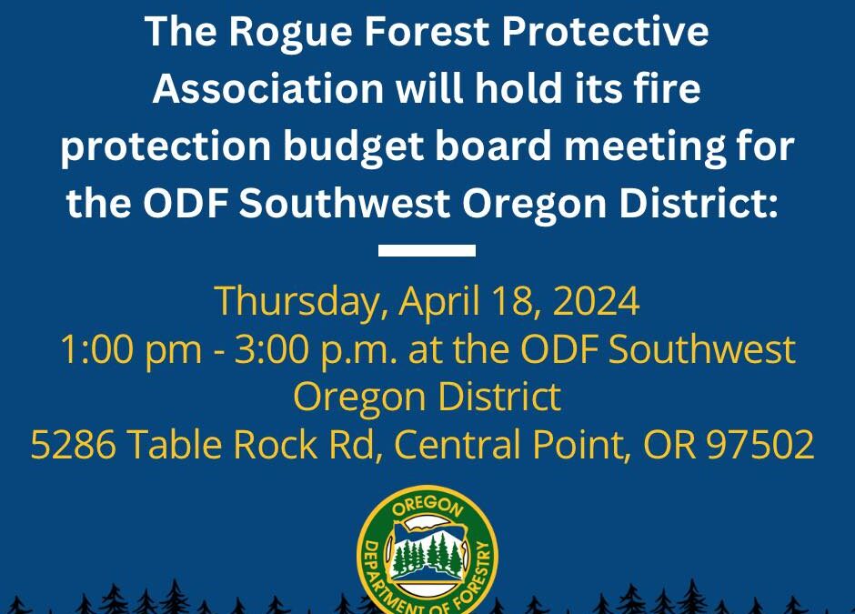
The Rogue Forest Protective Association (RFPA) will hold its spring fire protection budget meeting on Thursday, April 18, 2024 from 1:00 pm – 3:00 pm at the Oregon Department of Forestry Southwest Oregon District, 5286 Table Rock Road, Central Point, OR 97502.
A copy of the proposed budget is available at the front desk.
Agenda: 04-18-2024 RFPA BOD Agenda_DML