June 1, 2021
JACKSON & JOSEPHINE COUNTIES, Ore. (June 1, 2021) – Oregon Department of Forestry Southwest Oregon District Forester Dave Larson has accepted a new role within the agency as the Southern Oregon Area Director, effective June 1, 2021. In the interim, Grants Pass Unit Forester Tyler McCarty has been selected to serve as district forester for the 2021 fire season.
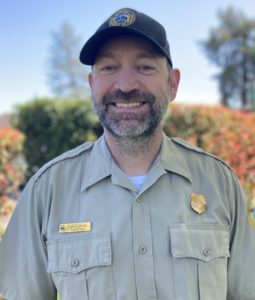
Dave Larson, Southern Oregon Area Director
Larson has spent his entire career in fire, starting at the young age of 16 on a youth hand crew with the Douglas Forest Protective Association. He spent the following 25 years working up the ranks to unit forester, before taking the position as district forester in the ODF Southwest Oregon District. Following his predecessor, Dave Lorenz’s retirement, Larson was promoted to area director; this summer will be his 32nd fire season.
“Serving the communities of the Southwest Oregon District as district forester has certainly been a highlight in my career, and I look forward to continuing to support the area in this new capacity.” Larson said. “Tyler McCarty will be a strong leader for the district this summer, and with his level of experience and dedication to the region, I know I’m leaving it in good hands.”

Tyler McCarty, SWO Interim District Forester
McCarty is a Rogue Valley native who got his start in the fire service right out of high school on the Southwest Oregon District. He spent his first 15 years at the Medford Unit office before promoting to unit forester in the Grants Pass unit.
“It’s an honor to step into this role for the district, especially as we enter this current fire season,” McCarty said. “I will remain dedicated to our firefighters and support staff as we navigate what could be a difficult season ahead of us.”
McCarty will serve as the interim district forester through fire season. A formal recruitment process to select a permanent replacement will be conducted in the fall of 2021.
May 31, 2021
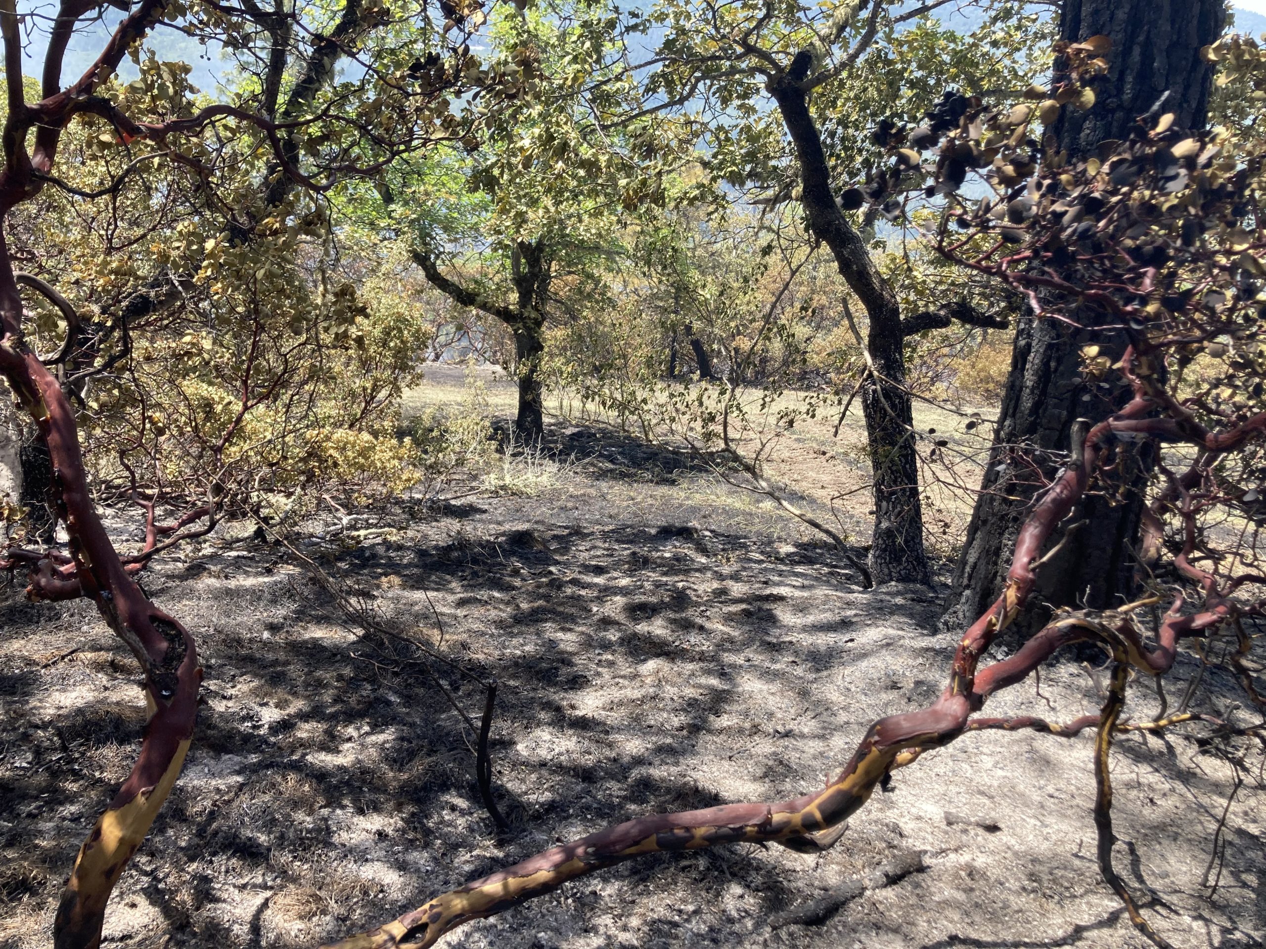
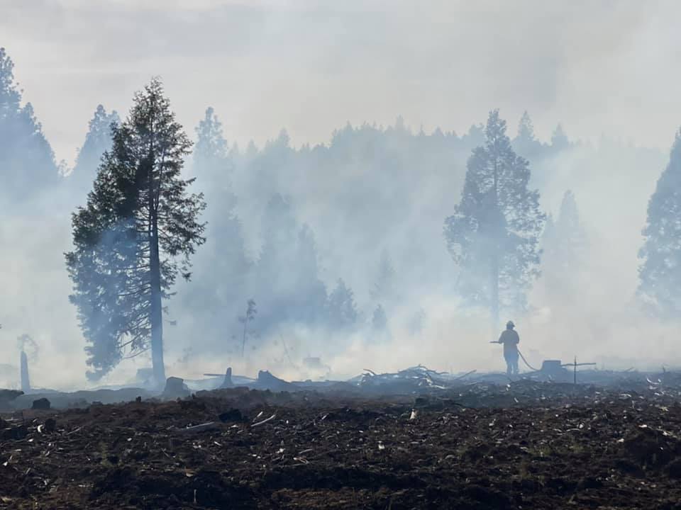
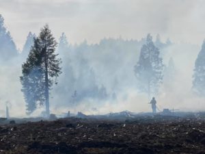
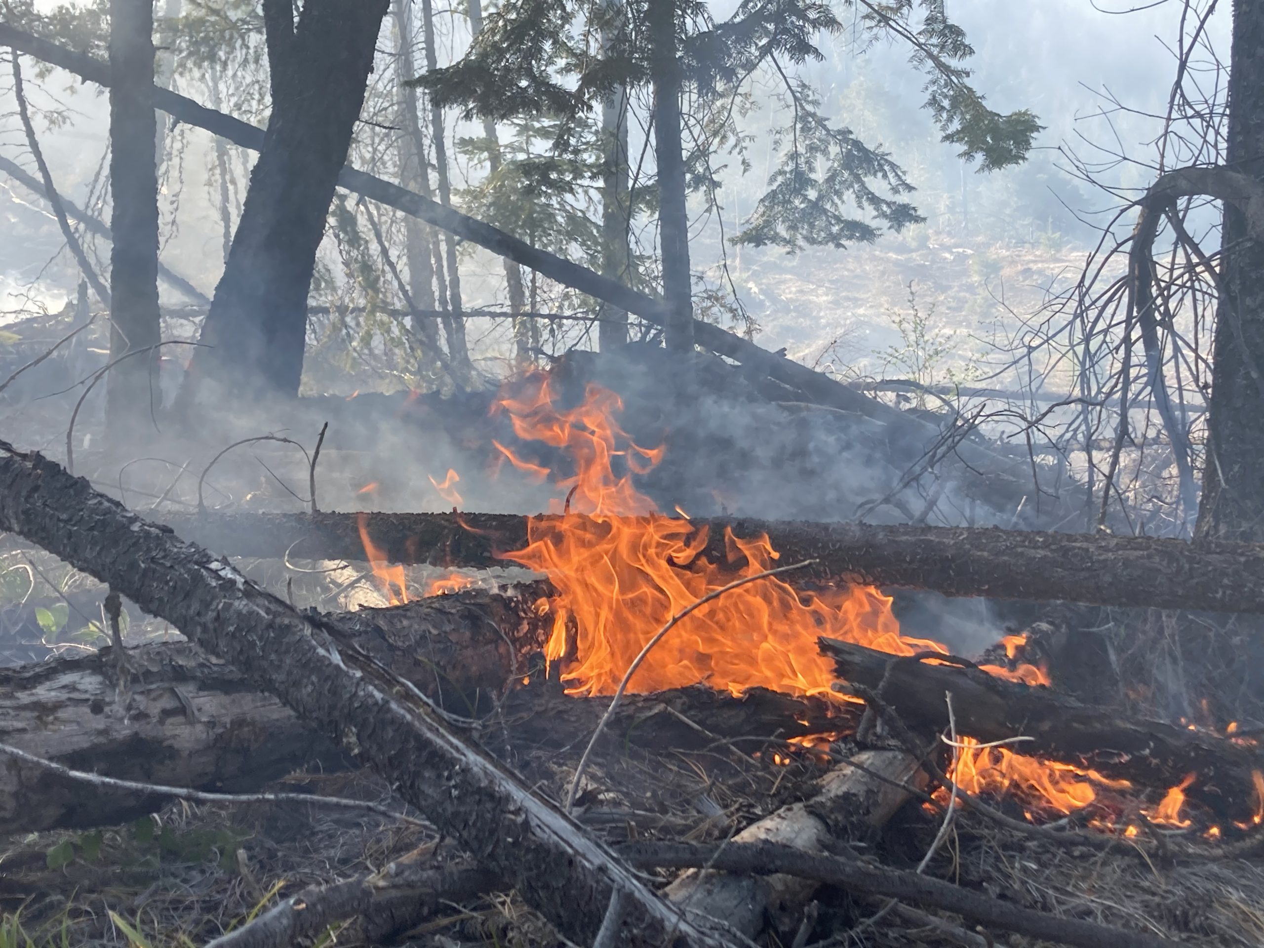
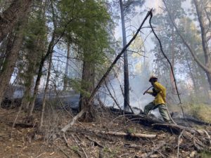
WHITE CITY, Ore. (May 31, 2021) – The East Antelope Fire, located on the 9600-block of East Antelope Road outside of White City, remains 100% lined and is now 90% mopped up. Firefighters were able to make this tremendous amount of progress during Sunday’s day shift and through the night; operations today will focus on reaching near, if not compete containment. It remains 49 acres in size, and is on private and BLM land.
An infrared drone flight was conducted Sunday evening, revealing multiple hotspots within the fire perimeter. Overnight, fire crews worked to extinguish those areas. Additional gridding will take place today, allowing firefighters to canvas the entire footprint of the fire for potential areas of concern. This evening, crews will remain on scene and do an additional infrared scan. This technology is extremely important to finalizing operations, as it detects heat in specific areas, even when indicators like smoke or embers aren’t immediately visible.
The E. Antelope Fire was initially reported on Saturday around 2:45 p.m. The road was closed to traffic with the exception of fire resources and residents; these closures have since been lifted. The Jackson County Sheriff’s Office and Jackson County Emergency Management issued level two (Be Set) evacuations orders for the immediate area; they have since been downgraded to level 1 (Be Ready). Additional evacuation information is available through the Jackson County Sheriff’s Office and Jackson County Emergency Management.
ODF Southwest Oregon District would like to thank our partner agencies who have helped on the fire lines, including the Bureau of Land Management, the U.S. Forest Service Rogue River-Siskiyou National Forest, Jackson County Fire District 3 and Lake Creek Fire. We would also like to thank the veterans who have spent their Memorial Day weekend with us, once again protecting our community; your efforts on the fire and in your military service are much appreciated.
The cause of this fire remains under investigation. Additional information relating to the cause will be released when it is safe to do so without hampering the investigation.
Fire information for Jackson and Josephine counties is always available on Facebook, @ODFSouthwest.
May 30, 2021
WHITE CITY, Ore. (May 30, 2021) — Firefighters made excellent progress overnight on the East Antelope Fire, located on the 9600-block of East Antelope road outside of White City. Through GPS mapping, the fire was found to be 49 acres. The perimeter is now 100% lined and the fire is 20% mopped up.
Overnight, firefighters were able to plumb the fire with fire hose up to 90%. This will make it easier today as resources continue to mop up.

May 29, 2021
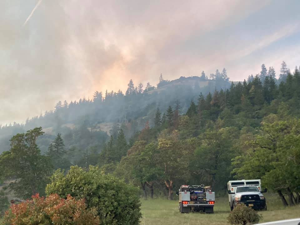
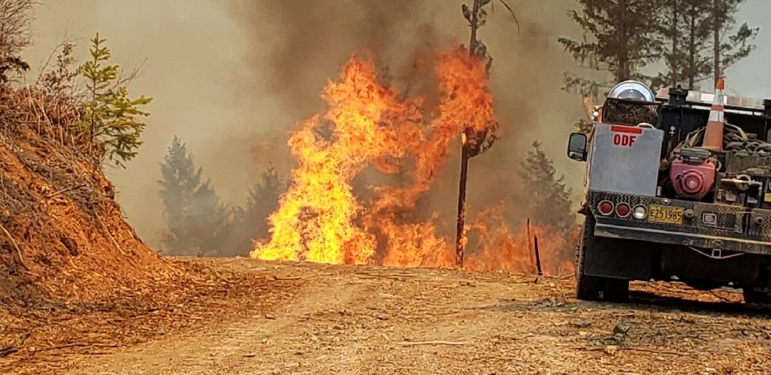
WHITE CITY, Ore. (May 29, 2021) – Oregon Department of Forestry (ODF) Southwest Oregon District firefighters are actively engaged in a wildfire in the hills above the 9600-block of East Antelope road outside of White City. The fire is estimated to be 30 acres and is currently 95% lined and 0% mopped up.
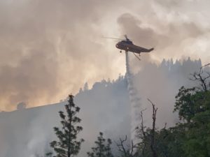
The report of smoke initially was called in around 2:45 p.m. When resources first arrived on scene, it was estimated to be 7-10 acres and growing up-slope. Engines and resources from ODF, Bureau of Land Management, Jackson County Fire District 3 and Lake Creek Fire, along with a crew, a bulldozer and a type 1 helicopter were ordered and engaged in an aggressive initial attack. Another type 1 and a type 2 helicopter were ordered, along with resources to come in for a night shift. Despite hot and windy conditions, firefighters were able to make good progress on slowing the spread of the fire within the first three hours.
Antelope road is blocked by Jackson County Roads The Jackson County Sheriff’s Office (JCSO) and Jackson County Emergency Management have issued Level 2 evacuations (Be Set) for all addresses south of the roadblock at 8465 E. Antelope Road. Initial notifications to residences were made by JCSO patrol units and Oregon State Police (OSP).
Investigators will be on scene to work on determining the cause of the fire. In the next week, the weather is continuing to warm up; temperatures are forecasted to be in the 100’s this week. Please use extreme caution, as fires can easily spread in these conditions. Fire updates are available online at www.swofire.com and Facebook, @ODFSouthwest.
May 10, 2021
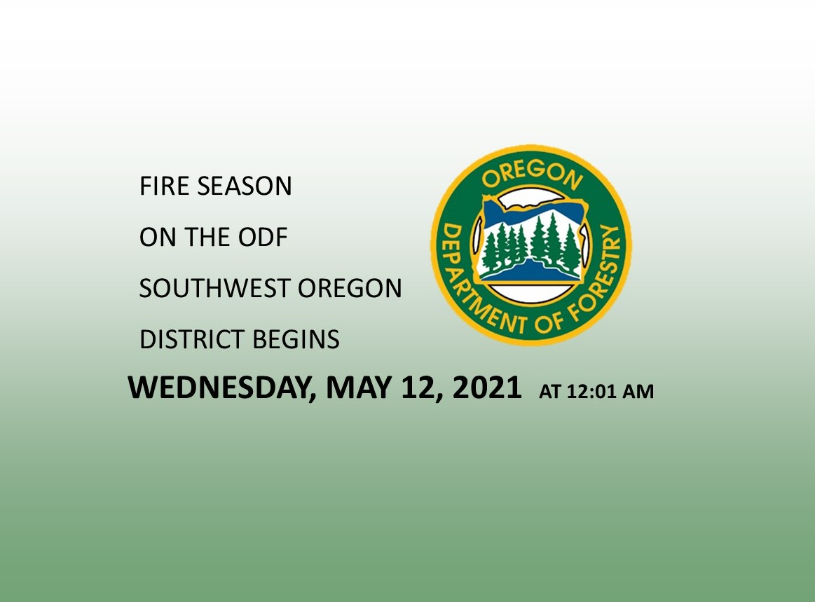
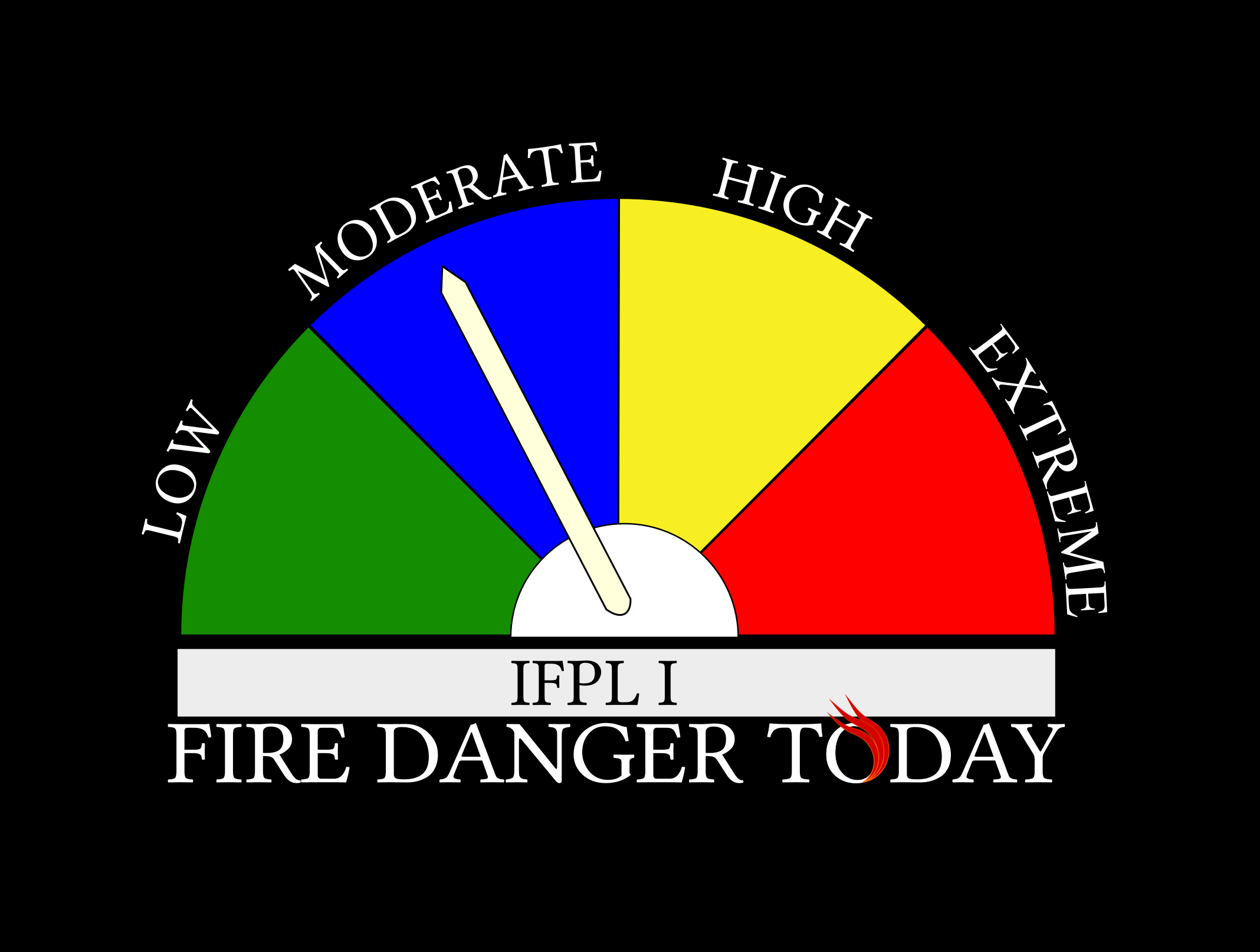
CENTRAL POINT, Ore. – Fire Season on lands protected by the Oregon Department of Forestry’s (ODF) Southwest Oregon District begins Wednesday, May 12, 2021 at 12:01 a.m. The fire danger level will be “Low” (green) and the Industrial Fire Precaution Level (IFPL) will be I (one). Lands affected by this declaration include 1.8 million acres of state, private, county, city and Bureau of Land Management (BLM) forestlands in Jackson and Josephine counties.
Since the beginning of March, the district has responded to more than 50 fires, totaling more than 100 acres; warm temperatures, windy conditions and a lack of spring rain are among the contributing factors that increased fire starts and growth. Fuels across the region are also much drier than normal, reflecting late June-like conditions in mid-May. For these reasons, fire season is being declared in Jackson and Josephine counties.
Beginning Wednesday, the burning of debris piles and the use of burn barrels for burning debris will no longer be allowed in Jackson and Josephine counties. Over the past couple of weeks, our crews have responded to multiple debris burns that have escaped; landowners are encouraged to check their previously burned piles from this spring and confirm that they have been extinguished.
In low fire danger, the following activities are prohibited:
- No debris burning, including piles and debris burned in burn barrels.
- No fireworks on or within 1/8 of a mile of forestland.
- Exploding targets and tracer ammunition, or any bullet with a pyrotechnic charge in its base, are prohibited.
- Campfires are allowed in designated campgrounds, and on private land with the landowner’s permission. Portable stoves using liquefied or bottled fuels may be used as well.
- Smoking while traveling will only be allowed in enclosed vehicles on improved roads, in boats on the water and other specifically designated locations.
- Any electric fence controllers must be approved by a nationally recognized testing laboratory, such as Underwriters Laboratories Inc., or be certified by the Department of Consumer and Business Services, and be installed and used in compliance with the fence controller’s instructions for fire safe operation.
Under IFPL I (one) – fire season requirements are in effect. In addition to the following:
- A Firewatch is required at this and all higher levels unless otherwise waived.
For more information about the Oregon Department of Forestry’s Fire Season regulations, please call or visit the Southwest Oregon District unit office nearest to you:
- Medford Unit, 5286 Table Rock Rd., Central Point – (541) 664-3328
- Grants Pass Unit, 5375 Monument Dr., Grants Pass – (541) 474-3152
Additional information about fire season is also available online on our website, www.swofire.com, our Facebook page, @ODFSouthwest and our Twitter account, @swofire.
May 10, 2021
JACKSON & JOSEPHINE COUNTIES, Ore. (April 29, 2021) – As conditions continue to support increased fire activity, Oregon Department of Forestry (ODF) Southwest Oregon District resources responded to multiple fires across the district for the second day in a row.
The first fire was reported in Josephine County just after 3 p.m.; one engine from the Grants Pass Unit initially responded to the Brimstone Road Fire located on the 600-block of Brimstone Road. Once on scene, firefighters requested additional resources. Rural Metro Fire Department and Wolf Creek Rural Fire Protection District responded alongside two ODF engines. The fire was quickly lined and contained to half an acre. The cause remains under investigation.
The Highway 62 MM 42 Fire
The second fire was dispatched shortly after the first, just before 3:15 p.m. in Jackson County. ODF engines responded to the Highway 62 MM 42 Fire, located along Highway 62 outside of Prospect. When the first unit arrived on scene, the fire was estimated to be two acres and growing in the windy conditions. Resources from Prospect Rural Fire Protection District, Jackson County Fire District 4 and the U.S. Forest Service Rogue River-Siskiyou National Forest responded, as well as additional ODF engines and a bulldozer. Within two hours, the fire was 80% lined and 10% mopped up. Firefighters will remain on scene until the fire is 100% mopped up. Road closures were never put in place on Highway 62, however traffic was forced to slow down for the safety of those working on the fire. The cause is under investigation.
The third fire was also reported in Jackson County near Greensprings Summit. The Soda Mountain Road Fire is located on the 1900-block of Soda Mountain Road off of Highway 66. One ODF engine responded, along with resources from Greensprings Rural Fire District and Jackson County Fire District 5. It’s estimated to be 1½ acres, and at the time of this release, crews are actively engaged in initial attack.
These fires come on the heels of six others that ODF firefighters and our partner structure agencies responded to on Wednesday, including:
- 2400-block of Little Applegate Road, Jackson County, 1/100th of an acre
- 100-block of Scott Drive outside of Murphy, Josephine County, 1/10th of an acre
- 2600-block of Fish Hatchery Road, Josephine County, 1/10th of an acre
- 1000-block of Red Blanket Road northeast of Prospect, Jackson County, 1/10th of an acre
- 1700-block of Cady Road southwest of Jacksonville, Jackson County, two acres
- 2100-block of Crowfoot Road east of Shady Cove, Jackson County, 1/4 of an acre
The causes of these fires remain under investigation; however, they do not appear to be connected. Fire updates are available online at www.swofire.com and Facebook, @ODFSouthwest.
May 10, 2021
JACKSON & JOSEPHINE COUNTIES, Ore. (April 28, 2021) – Oregon Department of Forestry (ODF) Southwest Oregon District firefighters were kept extremely busy on Wednesday, following six fires that broke out across both Jackson and Josephine Counties in a six-hour window. As of 7 p.m., all but one had been completely lined, and mop-up work is either completed or ongoing.

The Cady Fire
The first fire was reported in Jackson County just before 10 a.m. near the 2400-block of Little Applegate Road. It was contained to 1/100th of an acre.
The second fire was reported just before 12:30 on the 100-block of Scott Drive outside of Murphy in Josephine County. Firefighters stopped that fire at 1/10th of an acre. The third fire was also in Josephine County, on the 2600-block of Fish Hatchery Road. It was reported just before 3 p.m., and was contained to 1/10th of an acre.
The fourth fire was reported around 3:20 p.m. on the 1000-block of Red Blanket Road to the northeast of Prospect in Jackson County. It was contained at 1/10th of an acre.
The fifth fire was also in Jackson County on the 1700-block of Cady Road to the southwest of Jacksonville. It is estimated to be two acres, and is now completely lined. Mop-up operations are continuing at this time.
The final fire was reported just before 4:30 on the 2100-block of Crowfoot Road. It was contained at 1/4 of an acre.
The causes of these fires are under investigation. ODF would like to thank our partner agencies who responded alongside our engines, including Applegate Valley Fire District, Jacksonville Fire Department, Jackson County Fire District 3, Prospect Rural Fire Protection and Butte Falls Volunteer Fire & Rescue.
After a short reprieve over the weekend, the weather is continuing to warm up. Temperatures are forecasted to be in the 80’s this week; please use extreme caution, as fires can easily spread in these conditions. Fire updates are available online at www.swofire.com and Facebook, @ODFSouthwest.
May 10, 2021
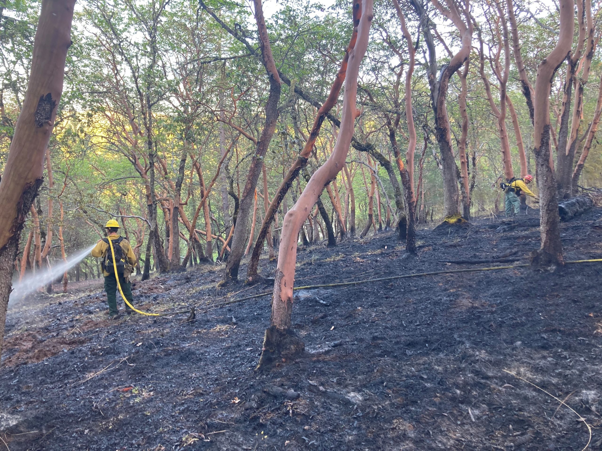
APPLEGATE LAKE, Ore. (April 23, 2021) – Firefighters assigned to the Bearwallow Ridge Fire, located west of Applegate Lake in southwest Jackson County, have lined the entire perimeter and are actively working on mop-up operations. The fire is now considered to be 30% mopped up, and following GPS mapping, the fire was found to be 32 acres.
The fire was first spotted on ODF Southwest Oregon District’s Detection Center cameras shortly before 12 p.m. on Thursday, April 22, 2021. Initially, two engines were sent to the location; upon arrival, firefighters estimated the fire to be two acres and growing on steep terrain. Within an hour and a half, it had grown to an estimated four to five acres. Additional resources were ordered, including the district’s bulldozer, and a U.S. Forest Service engine assisted as well.
By 6 p.m., the fire had grown to more than 20 acres, fueled by wind. Resources stayed on the fire overnight, and two crews comprised of 30 firefighters were brought in to work the dayshift on Friday. Resources will continue to remain in the area until the fire is 100% mopped up.
Fire updates are available online at www.swofire.com and Facebook, @ODFSouthwest.
May 10, 2021
GRANTS PASS, Ore. (April 15, 2021) – Warm and windy weather conditions are causing an increased risk of fires starting and spreading in southern Oregon. Firefighters with the Oregon Department of Forestry Southwest Oregon District (SWO) were dispatched to three separate fires in Josephine County on Wednesday, April 14, 2021 throughout the afternoon. As of Thursday morning, all three fires had been completely lined and mopped up.

The Tarter Gulch Fire
The first fire was reported just before 1 p.m. The Tarter Gulch Fire, located nine miles southeast of Cave Junction, was burning on a recently replanted timber harvest in the Tarter Gulch area. Originally reported as five acres, the fire quickly grew to an estimated 15-20 in the warm and windy conditions. Illinois Valley Fire District responded alongside ODF firefighters, and within six hours, resources had the fire completely lined. It was caught at 33 acres. The cause is currently under investigation.
The Azalea Fire, located two miles northwest of Grants Pass on Azalea Drive, was first spotted and reported by a SWO Detection Center Specialist; by viewing a camera in the area, the specialist was able to pinpoint the fire’s location and report it to Josephine County dispatch. Rural Metro Fire District and Grants Pass Fire Rescue responded before calling in ODF firefighters to assist. Despite multiple homes in the area, no evacuations were made and no structures were damaged. The Azalea fire was contained to half an acre and was determined by investigators to have started in a chicken coop.
The third fire, the Goldbrook Fire, was located in the hills two miles northeast of Grants Pass off of Granite Hill Drive. ODF, Rural Metro Fire District and Grants Pass Fire Rescue resources responded to this fire as well, and were able to contain it to 1.5 acres. The cause of this fire is currently under investigation.
In the past two weeks, ODF firefighters have responded to more than 20 fires in Jackson and Josephine counties; 13 of those were escaped debris burns on private property. Current weather conditions are predicted continue with temperatures forecasted in the 80’s this weekend; the heat, combined with a lack of rain, is increasing the risk of fires starting and spreading. Residents should be aware, and report smoke or fire immediately by calling 911.
Fire updates are available online at www.swofire.com and Facebook, @ODFSouthwest.
May 10, 2021
ROGUE RIVER, Ore., (April 7, 2021) – Fire investigators with the Oregon Department of Forestry (ODF) Southwest Oregon District have determined the cause of the Wards Creek Road Fire, located in the hills northeast of Rogue River, to be multiple debris burn piles that escaped. A citation has been issued to the responsible party.

The fire was reported just before 5:30 p.m. on Tuesday, April 6, 2021 as a grassfire that was spreading rapidly uphill from the 3700-block of Wards Creek road. Rogue River Fire District #1 was the first agency on-scene and assumed command. Firefighters initially estimated the fire to be three acres in size, involved in heavy brush and timber, and quickly spreading due to the wind. A second and third alarm were called, as the fire continued to run uphill.
ODF crews, alongside engines from Grants Pass Fire Rescue, Rural Metro Fire, Illinois Valley Fire District, Evans Valley Fire District, Medford Fire-Rescue, Jackson County Fire District 3 and Ashland Fire all responded and aggressively engaged in initial attack with Rogue River
Fire District resources. Steep terrain and heavy vegetation prevented bulldozers from being utilized on the majority of the fire, leaving the work solely to firefighters on the ground. Within three hours, resources were able to hoseline the entire perimeter of the fire and begin constructing a strong perimeter. However, winds prompted multiple spot fires in the hills above the main body of the fire, creating a challenge for crews.
Additional resources were called in to relieve the initial engines and work to contain the spot fires overnight. By early morning, the entire fire was deemed contained and mop-up work continued into Wednesday. Through GPS mapping, the fire was deemed to be just over eight acres, including spot fires. Due to direction the fire was spreading, evacuations were never ordered and no homes were threatened. Wards Creek Road was closed for a time to everyone but residents and fire personnel; that closure has since been lifted.
After examining the scene and speaking with witnesses, fire investigators determined the cause of the fire was multiple escaped debris burns that were left unattended. A citation was issued to the responsible party. This incident is not the first of its kind this week; fire agencies from across southern Oregon have responded to multiple escaped burns in the past seven days. Warmer weather, winds and a lack of rain are contributing to increased fire activity and risk. Currently, below 3,000 feet in elevation, conditions are comparable to typical late spring conditions in the Rogue Valley. Debris burning in these conditions can easily escape the control of the landowner, and additional precautions should be taken. Residents are also being urged to check extinguished burn piles, as prior burns can easily reignite in these conditions.
November 6, 2020
CENTRAL POINT, Ore. (Nov. 6, 2020) — After 190 days, fire season ends today, Friday, November 6, 2020 at 9:00 a.m. on lands protected by the Oregon Department of Forestry’s Southwest Oregon District. Lands affected by this declaration include state, private, county, city, and Bureau of Land Management forestlands in Jackson and Josephine counties totaling 1.8 million acres.
This marks the second longest fire season on record on the Southwest Oregon District, only nine days fewer than the longest recorded season from 1988. The preliminary totals for the season show ODF firefighters tackling 220 wildland fires, totaling roughly 40,494 acres. This total fire count does not even include the number of alarms firefighters responded to related to fire restriction violations, assisting our local partners, and smoke chases throughout Jackson and Josephine Counties; crews responded to more than 1,400 calls for service that did not result in fire suppression.
The season began with dry conditions on May 1, 2020, prompting an earlier start than most years. However, it wasn’t until late July that the first large fire of the season broke out on the district. The Worthington fire was first reported on July 30, burning 761 acres five miles northeast of Eagle Point. It was followed by the Grizzly Creek fire a mile north of Howard Prairie Lake; that fire was caught at 325 acres.
Up until September, these were the largest fires on the district, and less than 1,000 acres had been burned by 162 fires. September 8, 2020 presented firefighters and residents of the Rogue Valley alike with an unprecedented fire event. The Almeda, South Obenchain and Slater fires all broke out on the same day, fueled by an east wind event typically only experienced once every 20 years. The loss of lives, homes and structures will forever be remembered by fire crews.
ODF as an organization was also challenged in a different way this fire season; COVID-19 presented risks to our firefighters and general staff that created an added hurdle to an already difficult and often stressful time. Safety is always a top priority in the agency, and preventative measures were added to reduce the risk of COVID-19 in the district and at fire camps. By following CDC guidelines, including social distancing, wearing masks and sanitizing often, cases were kept at a minimum; According to the Northwest Coordinating Center, there were seven confirmed positive cases of COVID among firefighting resources assigned to Type 1 or Type 2 incidents in the Northwest Region (Oregon and Washington) this fire season. At the peak of the recent firefighting efforts, there were nearly 8,000 people assigned to fires in the region.
Despite the difficulties encountered this year, overall, 97-percent of all ODF Southwest fires were held at ten acres or less. We accredit this not only to our aggressive initial attack and well-trained team, but our countless partners throughout our region that have helped to make this season a success.
The termination of fire season removes fire prevention regulations on equipment use and the use of fire for debris burning. This applies to the public and industrial operations on forestlands. However, many structural fire agencies require permits for debris burning; please check with your local fire department to obtain any necessary permits before burning.
While fire season is over, fire prevention must continue. Please be vigilant while burning debris, making sure that a burn pile is never left unattended. Also, please use caution while using machinery that could produce a spark. Fall weather in Southern Oregon can vary greatly.
While fire season has officially come to a close, we are still here to help. Fire prevention tips and additional information is available on our Facebook page: @ODFSouthwest.
October 12, 2020
CENTRAL POINT, Ore. (Oct. 12, 2020) — A sudden shift in the weather is prompting a decrease in the fire danger level and industrial fire precaution level (IFPL) on lands protected by the Oregon Department of Forestry Southwest Oregon District. While fuels in the region have remained extremely dry into early fall, rain and cooler temperatures over weekend have made it possible to ease-off on some additional fire prevention regulations.
Effective immediately, the fire danger level will be lowered to “moderate” (blue) and the IFPL will decrease to one (1) in Jackson and Josephine counties. The following fire prevention regulations which will remain in effect, include:
- No debris burning, including piles and debris burned in burn barrels.
- Exploding targets and tracer ammunition, or any bullet with a pyrotechnic charge in its base, are prohibited.
- No fireworks on or within 1/8th of a mile of forestlands.
- Campfires are allowed only in designated campgrounds. This includes charcoal, cooking and warming fires. (Portable stoves using liquefied or bottled fuels are allowed at all times.)
- Motorized vehicles are allowed only on improved roads; one shovel and one gallon of water, or one 2.5 pound or larger fire extinguisher, is required while traveling.
- Smoking while traveling will only be allowed in enclosed vehicles on improved roads, in boats on the water and other specifically designated locations.
- Chain saws may not be used between 1:00 p.m. and 8:00 p.m. during moderate fire danger. During hours outside of this time frame, chain saws may be used but require that the operator have one shovel and one 8-oz or larger fire extinguisher at the work site. A fire watch is also required for one (1) hour after each chainsaw use.
- Cutting, grinding, and welding of metal is not allowed between 1:00 p.m. and 8:00 p.m. during moderate fire danger. These activities must be conducted in a cleared area that has a charged garden hose or one 2.5 pound or larger fire extinguisher available.
- The mowing of dead or dried grass with power-driven equipment is not allowed between 1:00 p.m. and 8:00 p.m. during moderate fire danger. This restriction does not include mowing of green lawns, or equipment used for the commercial culture and harvest of agricultural crops.
- Any other spark-emitting internal combustion engine-use not specifically mentioned is not allowed between 1:00 p.m. and 8:00 p.m. during moderate fire danger. These activities must be conducted in a cleared area that has a charged garden hose or one 2.5 pound or larger fire extinguisher available.
- Any electric fence controllers must be approved by a nationally recognized testing laboratory, such as Underwriters Laboratories Inc., or be certified by the Department of Consumer and Business Services, and be installed and used in compliance with the fence controller’s instructions for fire safe operation.
For more information about the Oregon Department of Forestry’s fire season public restrictions, please call the Southwest Oregon District unit office nearest to you:
- Medford Unit, (541) 664-3328
- Grants Pass Unit, (541) 474-3152
Fire season information is also available online at our Facebook page: @ODFSouthwest and our website: www.swofire.com.
October 9, 2020
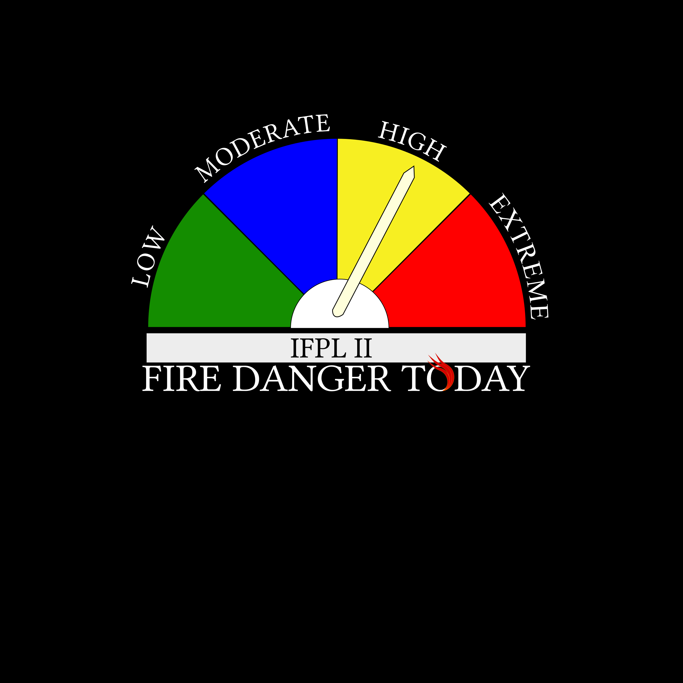
CENTRAL POINT, Ore. (Oct. 9, 2020)– A combination of cooler temperatures, higher relative humidity and the potential for rain across southwest Oregon have made it possible to ease-off on some fire prevention regulations. Effective immediately, the fire danger level on Oregon Department of Forestry-protected lands in Jackson and Josephine counties has decreased to “high” (yellow) and the Industrial Fire Precaution Level has been lowered to level two (II).
These regulations affect 1.8 million acres of state, private, county, city and Bureau of Land Management lands protected by ODF’s Southwest Oregon District.
Restrictions on the public use of chain saws, brush cutters and other power-driven or spark-emitting machinery are being slightly relaxed, allowing the use of equipment until 10:00 a.m. and after 8 p.m. Other fire prevention regulations which will remain in effect include:
- No debris burning, including piles and debris burned in burn barrels.
- Exploding targets and tracer ammunition, or any bullet with a pyrotechnic charge in its base, are prohibited.
- No fireworks on or within 1/8th of a mile of forestlands.
- Campfires are allowed only in designated campgrounds. This includes charcoal, cooking and warming fires. (Portable stoves using liquefied or bottled fuels are allowed at all times.)
- Motorized vehicles are allowed only on improved roads; one shovel and one gallon of water, or one 2.5 pound or larger fire extinguisher, is required while traveling.
- Smoking while traveling will only be allowed in enclosed vehicles on improved roads, in boats on the water and other specifically designated locations.
- Chain saws may not be used between 10:00 a.m. and 8:00 p.m. during high fire danger. During hours outside of this time frame, chain saws may be used but require that the operator have one shovel and one 8-oz or larger fire extinguisher at the work site. A fire watch is also required for one hour after each chainsaw use.
- Cutting, grinding, and welding of metal is not allowed between 10:00 a.m. and 8:00 p.m. during high fire danger. These activities will be allowed during hours outside of this time frame only if the work site is cleared of potentially flammable vegetation and other materials, and a water supply is at the job site.
- The mowing of dead or dried grass with power-driven equipment is not allowed between 10:00 a.m. and 8:00 p.m. during high fire danger. This restriction does not include mowing of green lawns, or equipment used for the commercial culture and harvest of agricultural crops.
- Any other spark-emitting internal combustion engine-use not specifically mentioned is not allowed between 10:00 a.m. and 8:00 p.m. during high fire danger. Use of any spark-emitting internal combustion engine is allowed outside of this time frame only if the work site is cleared of potentially flammable vegetation and other materials, and a water supply is at the job site.
- Any electric fence controllers must be approved by a nationally recognized testing laboratory, such as Underwriters Laboratories Inc., or be certified by the Department of Consumer and Business Services, and be installed and used in compliance with the fence controller’s instructions for fire safe operation.
For more information about the Oregon Department of Forestry’s fire season public restrictions, please call or visit the Southwest Oregon District unit office nearest to you:
- Medford Unit, (541) 664-3328
- Grants Pass Unit, (541) 474-3152
Fire season information is also available online at our Facebook page: @ODFSouthwest and our website: www.swofire.com.
October 9, 2020
CENTRAL POINT, Ore. – A combination of cooler temperatures, higher relative humidity and the potential for rain across southwest Oregon have made it possible to ease-off on some fire prevention regulations. Effective immediately, the fire danger level on Oregon Department of Forestry-protected lands in Jackson and Josephine counties has decreased to “high” (yellow) and the Industrial Fire Precaution Level has been lowered to level two (II).
These regulations affect 1.8 million acres of state, private, county, city and Bureau of Land Management lands protected by ODF’s Southwest Oregon District.
Restrictions on the public use of chain saws, brush cutters and other power-driven or spark-emitting machinery are being slightly relaxed, allowing the use of equipment until 10:00 a.m. and after 8 p.m. Other fire prevention regulations which will remain in effect include:
- No debris burning, including piles and debris burned in burn barrels.
- Exploding targets and tracer ammunition, or any bullet with a pyrotechnic charge in its base, are prohibited.
- No fireworks on or within 1/8th of a mile of forestlands.
- Campfires are allowed only in designated campgrounds. This includes charcoal, cooking and warming fires. (Portable stoves using liquefied or bottled fuels are allowed at all times.)
- Motorized vehicles are allowed only on improved roads; one shovel and one gallon of water, or one 2.5 pound or larger fire extinguisher, is required while traveling.
- Smoking while traveling will only be allowed in enclosed vehicles on improved roads, in boats on the water and other specifically designated locations.
- Chain saws may not be used between 10:00 a.m. and 8:00 p.m. during high fire danger. During hours outside of this time frame, chain saws may be used but require that the operator have one shovel and one 8-oz or larger fire extinguisher at the work site. A fire watch is also required for one hour after each chainsaw use.
- Cutting, grinding, and welding of metal is not allowed between 10:00 a.m. and 8:00 p.m. during high fire danger. These activities will be allowed during hours outside of this time frame only if the work site is cleared of potentially flammable vegetation and other materials, and a water supply is at the job site.
- The mowing of dead or dried grass with power-driven equipment is not allowed between 10:00 a.m. and 8:00 p.m. during high fire danger. This restriction does not include mowing of green lawns, or equipment used for the commercial culture and harvest of agricultural crops.
- Any other spark-emitting internal combustion engine-use not specifically mentioned is not allowed between 10:00 a.m. and 8:00 p.m. during high fire danger. Use of any spark-emitting internal combustion engine is allowed outside of this time frame only if the work site is cleared of potentially flammable vegetation and other materials, and a water supply is at the job site.
- Any electric fence controllers must be approved by a nationally recognized testing laboratory, such as Underwriters Laboratories Inc., or be certified by the Department of Consumer and Business Services, and be installed and used in compliance with the fence controller’s instructions for fire safe operation.
For more information about the Oregon Department of Forestry’s fire season public restrictions, please call or visit the Southwest Oregon District unit office nearest to you:
- Medford Unit, (541) 664-3328
- Grants Pass Unit, (541) 474-3152
Fire season information is also available online at our Facebook page: @ODFSouthwest.
October 8, 2020
Archie Creek Fire
Email: 2020.archiecreek@firenet.gov
Phone: 971-334-7674 (7am-8pm)
Facebook: https://www.facebook.com/Archie-Creek-Fire-Information-120244459815292/
InciWeb: https://inciweb.nwcg.gov/incident/7176/
Size: 131,542 acres
Containment: 94%
Location: Steamboat Springs on Hwy 138E to Glide, Oregon
Cause: Under investigation
Holiday Farm Fire
Email: holidayfarmfireinfo@gmail.com
Fire Information: 541-357-9729 (7am-10pm)
Lane County Non-Emergency Call Center: 541-682-3977 (7am-10pm)
Linn County Non-Emergency Call Center: 541-812-2260
Facebook: https://www.facebook.com/HolidayFarmFire/
Inciweb: https://inciweb.nwcg.gov/incident/7170/
Size: 173,393 acres
Containment: 82%
Location: Lane County, Along Highway 126 west of McKenzie Bridge to Vida, Oregon
Cause: Under investigation
Slater Fire
Email: Slaterfirenorth.information@gmail.com
Fire Information: 530-324-2528 (8am-8pm)
Media Information: 541-249-5117 (8am-8pm)
Facebook: https://www.facebook.com/SlaterAndDevilFireInformation
Inciweb: https://inciweb.nwcg.gov/incident/7173/
Size: 44,597 acres in Oregon
Containment: 67%
Location: Near Happy Camp, California, crossed into Josephine County, Oregon
Cause: Under investigation
Thielsen Fire
Email: 2020.Thielsen@firenet.gov
Phone: 541-625-0687
Facebook: https://www.facebook.com/Thielsen-Fire-105822491271712
InciWeb: https://inciweb.nwcg.gov/incident/7195/
Size: 9,975 acres
Containment: 71%
Location: 5 miles north of Crater Lake National Park and within 1 mile of Diamond Lake Resort
Cause: Under investigation
October 7, 2020
More information: http://www.lanecounty.org/mckenziefire (Holiday Farm Fire) and https://wildfire.oregon.gov/cleanup
Cleanup & Debris Management
Lane County and its state and federal partners encourage residents who are cleaning up burnt structures to WAIT.
Property owners can OPT IN for hazardous waste removal services and debris removal services at no cost to them (insurance may be billed if applicable).FEMA and the State of Oregon have reached an agreement that will allow property owners to opt in to have Environmental Protection Agency crews remove household hazardous waste from fire-affected properties at no cost to the property owner.Insurance advocates are available from 8-5pm M-F at 888-877-4894 (toll-free). Advocates should be available to answer insurance and financial questions.
https://dfr.oregon.gov/Pages/index.aspxLane County’s McKenzie Bridge transfer station can accept normal garbage and recycling, including spoiled food. It cannot accept ash or bulk debris from burnt structures. Oregon DEQ presumes ash from burnt structures to contain asbestos if the structure was built before 2004. Landfills and transfer stations in Oregon are prohibited from accepting bulk deliveries of presumed asbestos-containing material. Contact Lane Regional Air Protection Agency for information about asbestos: 541-736-1056.
October 7, 2020
More information: https://jacksoncountyor.org/emergency/News/News-Information/category/help-for-wildfire-victims/jackson-county-phoenix-and-talent-recommend-residents-to-not-clean-your-property-damaged-by-fire and https://wildfire.oregon.gov/cleanup
View Jackson County Fire Damage Dashboard map.
The state has formed a Debris Management Taskforce and is currently working with local governments to develop strategies to complete the massive cleanup. Though this process takes time, there are significant benefits to individual property owners. Getting the whole burn scar area cleaned up systematically will help maintain property values, avoid blight, and ensure compliance with state and federal laws.
If you want government to lead and help pay for removal of hazardous waste and debris from your property, you must complete a Right Of Entry form to grant permission for the removal to occur. There are several ways you may fill out the form to participate:
Online at www.jacksoncounty.org/ROE, or download and complete the Widfire ROE form of your choice (see Documents to Download below) and mail or bring the form to this address:
Development Services
ROE Form Enclosed
10 South Oakdale Ave., Room 100
Medford, OR 97501
Or, you can email a scan or photo of the signed form to ColemaRK@jacksoncounty.org.
You can call the Right of Entry Processing Center help line at: 1-682-800-5737 if you have any questions regarding this program or filling out the form. If you choose not to participate in the program we would ask that you let us know that by checking the “I wish not to participate” box, signing and sending back so we do not bother you again on this. Forms need to be returned by October 16, 2020.
October 7, 2020
More information: https://www.co.douglas.or.us/recovery/recovery.asp
For residents affected by the recent wildfires in Douglas County, there is a program in place to assist you with the removal of household hazardous waste at no cost to you. But, you must to act by October 15, 2020 in order to participate.
Simply, fill out the Right-of-Entry Permit Form as soon as possible to grant state contractors access to your property.
The link below will take you to a webpage that is being managed by a consultant for the state of Oregon that is managing household hazardous waste removal.
Click Here for the Right of Entry Form:
If you do not wish to take part in the free wildfire household hazardous waste removal program, we ask that you still complete the form, but select ‘NO’, I do not wish to participate in the program. This will help us to track those that have been contacted.
September 20, 2020
Acreage: 32,671
Containment: 55%
Cause: Under investigation
Current situation: Areas inside the immediate burn area remain at a Level 3 evacuation with restricted entry. Areas outside of the immediate burn area previously at a Level 3, are reduced to a Level 2. See the Jackson County Emergency Management and Sheriff’s office website. The town of Butte Falls is open for residents to return, however drivers using Butte Falls Highway will need to show proof of residence at the Oregon National Guard check point. Please drive with caution as personnel and equipment will still be working on the Butte Falls Highway and adjacent areas. Residents may return to their homes in the areas east of Salt Creek Road and north of Hwy 140, including the Salt Creek and Wasson Canyon drainage areas.
Visible flames and smoke will persist within the fire perimeter until a season-ending rain or snow event. Only call 911 if flames are actively spreading and life or property are threatened. Please provide a specific address or location for firefighters to respond.
Moderate fire behavior today will allow resources to continue mop up inside the perimeter up to 300 feet in some locations. Fire suppression repair work continues. Crews on contained portions of the fire are removing hose lays, cleaning up dozer lines, repairing fencing and completing other suppression repair. With increased containment and consistent work on the fire, resources assigned to the fire will decrease. Resources will return home for a much needed rest or be reassigned to other incidents. As resources are released, an important step in that process is to have fire vehicles’ undercarriage washed to reduce the possible spread of noxious weeds.
Evacuations: Areas inside the immediate burn area remain at Level 3 with restricted entry, and areas outside the immediate burn area have been reduced to Level 2. Please view the following web pages for the most current evacuation maps:
Jackson County Emergency Management-
https://jacksoncountyor.org/emergency/News/News-Information/jackson-county-evacuations-north-county- update-obenchain-fire-1
Jackson County Sheriff’s Office https://jacksoncountyor.org/sheriff
The life and safety of the public and all wildland fire responders is always the number one priority for all fire agencies. To keep firefighters and communities healthy and safe, all firefighters are asked to follow recommendations from the Centers for Disease Control and Prevention to reduce the spread of illness. This also includes limited entry into the incident command post and base camp. Please see the websites below or contact the Jackson County Emergency Management Office at (541) 776-7338 for further fire information.
EXTREME fire danger still exists in the Rogue Valley. All fuels are at critically dry levels. An innocent spark could escalate out of control. One less spark, one less wildfire. There is no season-ending precipitation event in the forecast.
Shelter Location: The evacuation shelter is located at the Jackson County Expo Center, 1 Penninger Rd. in Central Point, Oregon where care and services are available such as food, medical care, bathrooms and showers.
Weather: Temperatures today continue to be warmer and drier during the day, with no precipitation over the fire. Temperatures 80-84 degrees with a relative humidity of 20-25%. Light winds today, E to NE to 7 mph.
Resources-924: 1-type 1 hand crew, 1-type 2 initial attack crew, 27-type 2 crews, 2- light helicopters, 3- medium helicopters, 3- heavy helicopters, 44-engines, 18-dozers, 26-water tenders and 5-skidgens.
Temporary Flight Restrictions: For the safety of the firefighters and aircraft fighting the South Obenchain fire, a temporary flight restriction has been placed over the fire area. Please consult the Notice to Airman for specifics. If you fly, we can’t. The entire air operation must be shut down until the air space is reported clear.
Donations: People wishing to donate to help individuals and families that have been displaced by fires can visit the local Access website for additional information. https://www.accesshelps.org/
Closure: The Bureau of Land Management Medford District has temporarily closed many areas of public lands to support fire suppression efforts and to prevent new starts. Maps of the closure areas are available on the Bureau of Land Management’s website: http://www.blm.gov/programs/public-safety-and-fire/fire-and- aviation/regional-info/oregon-washington/fire-restrictions
September 19, 2020
Acreage: 32,833
Containment: 45%
Cause: Under investigation
The life and safety of the public and all wildland fire responders is always the number one priority for all fire agencies. To keep firefighters and communities healthy and safe, all firefighters are asked to follow recommendations from the Centers for Disease Control and Prevention to reduce the spread of illness. This also includes limited entry into the incident command post and base camp. Please see the websites below or contact the Jackson County Emergency Management Office at (541) 776-7338 for further fire information.
EXTREME fire danger still exists in the Rogue Valley. All fuels are at critically dry levels. An innocent spark could escalate out of control. There is no season ending precipitation event in the forecast.
Current situation: Most areas involved in the South Obenchain Fire are open for residents to return. This includes the City of Butte Falls and Butte Falls Highway. However, those drivers using Butte Falls Highway will need to show proof of residents at the Oregon National Guard check point. The following areas remain at Level 3 “Go”. (See attached map). Those area include:
· Those areas around the immediate fire perimeter, and;
· Those areas north of Oregon 140 between Salt Creek Road east to BLM Road 36-2E-26.”
https://jacksoncountyor.org/emergency/News/News-Information/jackson-county-evacuations-north-county-update-obenchain-fire-1
Residents need to be aware that firefighting personnel and equipment will still be working on the Butte Falls Highway and adjacent areas. Please drive with caution.
Please be aware visible flames and smoke will persist within the fire permitter until a season ending rain or snow event. Only call 911 if flames are actively spreading and life or property are threatened. Please provide a specific address or location for firefighters to respond.
The cold front produced only a trace of sprinkles of rain over the fire. This amount of rain is not much to impact the fire weather, but the front did push smoke out of the area. With the increased visibility, air resources were up and flying over the area providing air support as needed. Firefighters will continue mopping up into the fire permitter up to 300 feet in areas where it is conducive. Fire suppression repair work continues today within the fire area, cleaning up dozer lines, pulling water bars and other work to prevent erosion damage during rainfall and winter events. The cooler weather is favorable, creating moderate fire conditions in all divisions of the fire helping firefighters in mop up and repair efforts.
Friday night, the Oregon Department of Forestry provided an unmanned aircraft (drone) with infrared capabilities that flew over the southwest portion of the fire collecting data on the location of heat. A map with those locations will be provided to firefighters daily to assist them in mopping up the hotspots.
The Billy Graham Rapid Response team has trauma trained chaplains who are trained to provide emotional and spiritual care for the community and first responders. For assistance call 423-470-2200 or email www.billygraham.org/rrt. The team is located at the New Life Church Nazarene in Central Point, Oregon.
Fire Information: (541) 776-7338
E-mail: SouthObenchainFire@gmail.com
Wildfire Information Center: https://southwestoregonwildfireinformation.blogspot.com/
Facebook: https://www.facebook.com/SouthObenchainFire
Inciweb: https://inciweb.nwcg.gov/incident/7185
Air Quality: http://oregonsmoke.blogspot.com/
Evacuations: Evacuation orders are in place to protect the public and the firefighters that are working to control the fire. Please adhere to the evacuation level issued for your area. Please view the Jackson County Emergency Management web page for the most current map.
South Obenchain Fire
https://jacksoncountyor.org/emergency/News/News-Information/jackson-county-evacuations-north-county-update-obenchain-fire-1
Jackson County Sheriff Department
https://jacksoncountyor.org/sheriff
Shelter Location: The evacuation shelter is located at the Jackson County Expo Center, 1 Penninger Rd. in Central Point, Oregon where care and services are available such as food, medical care, bathrooms and showers.
Weather: Partly cloudy with clearing in the afternoon with expected patchy smoke. Temperatures 75-80 degrees in the valleys and 68-73 in higher elevations. Relative humidity of 30-40% with light and variable winds in the morning turning up slope at 5mph in the afternoon. West to northwest winds 6 mph with gusts to 15 mph on west to east oriented drainages. On ridges expect gusty to 15 mph in the afternoon.
Resources-934: 1-type 1 hand crew, 1-type 2 initial attack crew, 28-type 2 crews, 3- light helicopters, 3-medium helicopters, 3- heavy helicopters, 45-engines, 19-dozers, 28-water tenders and 6-skidgens.
Temporary Flight Restrictions: For the safety of the firefighters and aircraft fighting the South Obenchain fire, a temporary flight restriction has been placed over the fire area. Please consult the Notice to Airman for specifics. If you fly, we can’t. The entire air operation must be shut down until the air space is reported clear.
Donations: People wishing to donate to help individuals and families that have been displaced by fires can visit the local Access website for additional information. https://www.accesshelps.org/
Closure: The Bureau of Land Management has closed public lands in and near the South Obenchain Fire to all forms of public access. In addition, the Medford District has temporarily closed all Bureau of Land Management-administered public lands in and near Cascade Siskiyou National Monument, as well as south of Grants Pass, Interstate 5, and U.S. Route 199 to the border of the Rogue River-Siskiyou National Forest.
To View Closure Order and map:https://www.blm.gov/programs/public-safety-and-fire/fire-and-aviation/regional-info/oregon-washington/fire-restrictions or call 541-618-2340 for more information about the closure.