
There is a community meeting planned for Sunday, July 19, 2026, at 2:00 p.m. to provide a brief operational update on the fire:
In Person: Shady Cove School Gym, 100 Cleveland St, Shady Cove, OR 97539
Stream online via: Facebook.com/ODFSouthwest
Firefighters Prepare for Critical Weather on East Evans Creek Fire
SAMS VALLEY, Ore. – Firefighters made steady progress across the main body of the East Evans Creek Fire today, continuing to strengthen containment lines, support structure protection, and prepare for hotter, drier weather expected through the weekend. Aircraft use was limited for much of the day as a persistent inversion delayed flying conditions until late afternoon.
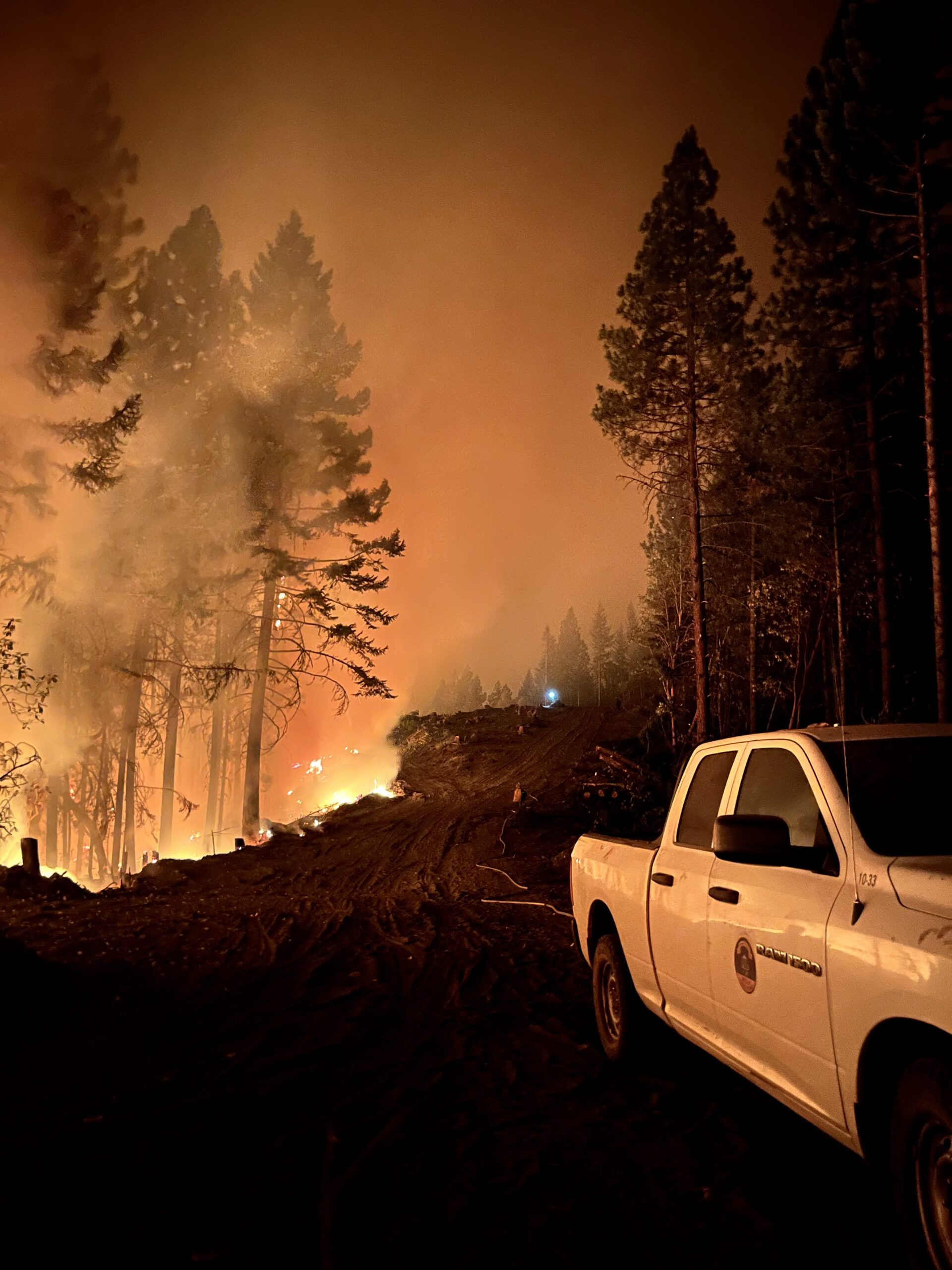
The Board Mountain spot fire continues to present operational challenges. Steep terrain and gusty afternoon winds along the southern portion of the fire have required coordinated suppression efforts from ground crews, heavy equipment, and aircraft when conditions allow. Although the fire challenged established lines on the southern edge, it was quickly attacked by firefighters already in position. Crews remain actively engaged in a firefight this evening as strong northwest winds have increased fire activity. Aircraft, dozers, and hand crews worked together to slow fire spread and reinforce suppression efforts.
On the spot fire located northwest of Hull Mountain, firefighters have made progress on fireline, despite challenging terrain. Crews are working to cool and hold the spot fire within its current footprint. High-capacity pumping capabilities provided by structural engines were necessary to support extensive hose lays.
On the Canyon Creek spot fire, firefighters have completed line construction around the perimeter and are using plumbed hose line to support suppression efforts where possible. While line has been established around the entire spot fire, the eastern edge remains active, and significant work continues to strengthen, secure, and hold those lines.
Firefighters in the western and northwestern portions of the main fire have adjusted sections of line to utilize existing road systems and are conducting tactical firing operations to strategically remove unburned fuels adjacent to firelines, where necessary. Firing operations strengthen fireline by methodically reducing vegetation that could otherwise ignite and contribute to unpredictable fire spread.
On the northern perimeter of the main fire, lines have remained secure through several operational periods with no significant control issues. Along the eastern and southern edge of the main fire, crews are continuing mop-up operations along the fire edge, working up to 25 feet inside the fire perimeter to locate and cool hidden hot spots.
Structural resources remain engaged throughout the fire area. Around homes previously encroached on by fire on the eastern and southern edge, firefighters continue to focus on locating and extinguishing lingering heat near structures. Crews are expanding structure preparation, improving defensible space, completing additional structure assessments, and refining structure protection plans, should fire conditions change.
Tonight, more than 500 personnel—including wildland firefighters, structural protection resources, and heavy equipment operators—will continue working through the night on the fire. Overnight operations will focus on strengthening and reinforcing containment lines, improving access where needed, and positioning personnel and equipment to respond to flare-ups.
Fire activity across Oregon continues to challenge firefighting resources statewide. Through strong interagency coordination, personnel, equipment, and aircraft are strategically shared to support communities and provide the most effective response possible. This evening, a helicopter assigned to the incident provided initial attack support to a nearby fire, highlighting the collaborative effort underway across Oregon’s firefighting community. As fire conditions remain dynamic, agencies continue to work together to prioritize resources, support one another, and maintain the strongest possible response across the state.
Evacuations: There are evacuations in place in both Jackson and Douglas counties, issued by both counties’ Sheriff’s Offices and Emergency Management. Up-to-date evacuations are available here: https://readyjacksonco.com/Emergency/emergency-information-hub-east-evans-creek-road-fire
Find your evacuation zone here: https://tinyurl.com/EastEvansCreekFireEvacMap
Road/Land Closures: The Tiller-Trail Highway is closed at the county border in Jackson County to Highway 62. Traffic is closed to the public on East Evans Creek Road at Meadows Road. The BLM has issued a road closure for West Fork Evans Creek Road and Rock Creek Road. Please avoid the fire area to allow firefighters and heavy equipment to operate safely. Road closure information is available on https://tripcheck.com/
A closure order for BLM-administered lands near the East Evans Creek Fire is in place. Public entry, including hunting, hiking, and camping, is prohibited. More information about the closure, including a map, is available online at www.blm.gov/orwafire.
Smoke Impacts: Smoke from the East Evans Creek Fire may settle into valleys and other low-lying areas, reducing visibility and impacting air quality in nearby communities. Smoke conditions can change throughout the day as winds shift. Individuals sensitive to smoke should take appropriate precautions. For current air quality information and smoke forecasts, visit: https://fire.airnow.gov/.
Temporary Flight Restriction (TFR): A “TFR” is in place for the fire area daily (24 hours) until further notice. Complete information is available at https://tfr.faa.gov/tfr3/?page=detail_6_4915
Flying a drone near or around a wildfire is illegal and compromises the safety of both pilots and firefighters and interferes with firefighting efforts.
Cause: The fire started on Friday, July 10th at 2:41 p.m. after a car crashed into a power pole, sparking dry vegetation in the area. The Jackson County Sheriff’s Office is currently investigating the cause of the crash.